The opening of the Illinois & Michigan Canal in 1848 made Chicago and northern Illinois the key hub of mid-America. Chicago grew into a major metropolis, agricultural and industrial innovations abounded, and Illinois soon became the most populous inland American state, all attributable to the 96-mile canal that linked the Great Lakes to the Illinois and Mississippi rivers. By connecting those waterways, the canal made possible a vast all-water route that linked a growing nation. Its significance was recognized in 1984 when President Reagan, native son of Illinois, signed a bill that established the region as the first National Heritage Area.
Inspired by the vast, untouched prairies
Long before Bridgeport looked the way it does now, Native Americans walked the area trails formed by the large, migrating herds of bison that made pathways through the oceans of tall-grass prairies and . . . — — Map (db m244240) HM
[Panel 1:]
Welcome
Origins
Welcome to the place where water connections transformed Chicago from a tiny trading post into a national crossroads. The Illinois and Michigan Canal began here, and so does Chicago’s story.
Water . . . — — Map (db m257619) HM
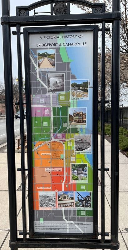
Entrepreneurs in Historic Canaryville
The primary catalyst for the establishment of Canaryville was the opening of the Union Stock Yards and the organization of the Union Stock Yard & Transit Company in 1865. Two young entrepreneurs arrived . . . — — Map (db m244233) HM
Water Marks mosaic sculptures celebrate something few people know. Chicago owes its greatness to a canal built over 150 years ago.
Generations of French fur traders and American travelers―nation builders―dreamed of . . . — — Map (db m81423) HM
Chicago (Chicagou in the Algonquin tongue) was named for the wild onions that grew in abundance on the river banks.
1673 Guided by Indians, Pere Jacque Marquette, a Jesuit Missionary and Louis Jolliet an explorer, arrive at the portage to . . . — — Map (db m289643) HM
1836-48 Jolliet's dream to cut through the portage and thus, create a way to the Gulf via the Mississippi was finally realized with the completion of the Illinois and Michigan Canal. Many were hired to hand-dig the 60' wide and 6' deep canal. . . . — — Map (db m289649) HM
This site preserves the west end of the old Chicago Portage which linked the Illinois River with Lake Michigan.
Early Explorers
In 1673 French explorer Louis Jolliet and missionary Father Jacques Marquette were returning to . . . — — Map (db m254805) HM
[West-facing sign:]
A moment of discovery
Robert Betz and Floyd Swink have collaborated for decades to save and restore the remnants of Illinois' once vast prairies. It all began here in 1959 when Swink, a leading authority on prairie plants, . . . — — Map (db m262324) HM
Santa Fe Prairie Nature Preserve has been formally dedicated as a sanctuary for native plants and animals. It is maintained in its natural condition so that present and future generations can see the Illinois landscape as it appeared in the past. . . . — — Map (db m262227) HM
Santa Fe Prairie Nature Preserve has been formally dedicated as a sanctuary for native plants and animals. It is maintained in its natural condition so that present and future generations can see the Illinois landscape as it appeared in the past. . . . — — Map (db m262236) HM
[West-facing sign:]
Railroads & Prairies?
Many of our surviving prairie remnants are located along railroad tracks, because railroads limited development along their right-of-ways.
The Burlington Northern and Santa Fe Railway Co., whose . . . — — Map (db m262323) HM
A rare prairie in an industrial park?
Don't let the surroundings fool you. The Santa Fe Prairie is one of Illinois' finest prairie remnants. Pairies once covered roughly half of Illinois, but today only a few scattered sites remain.
Explore . . . — — Map (db m262231) HM
In 1861, broken pieces of quarry stone were donated and transported from nearby Brown's Quarry on flat sleds with log runners pulled by horses. These stones became the structure of this New England-style church conceived by the pioneer families of . . . — — Map (db m295613) HM
You are standing on a Continental Divide. Water falling on this line separates and runs to the west and to the east. To the west the water flows to the Des Plaines River in River Forest, on to the Illinois and Mississippi Rivers and to the Gulf of . . . — — Map (db m230260) HM
You are standing on a Continental Divide. Water falling on this line separates and runs to the west and to the east. To the west the water flows to the Des Plaines River in River Forest, on to the Illinois and Mississippi rivers and to the Gulf . . . — — Map (db m237480) HM
You are standing on a Continental Divide. Water falling on this line separates and runs to the west and to the east. To the west the water flows to the Des Plaines River in River Forest, on to the Illinois and Mississippi Rivers and to the Gulf . . . — — Map (db m237481) HM
You are standing on a Continental Divide. Water falling on this line separates and runs to the west and to the east. To the west the water flows to the Des Plaines River in River Forest, on to the Illinois and Mississippi Rivers and to the Gulf . . . — — Map (db m237482) HM
You are standing on a Continental Divide. Water falling on this line separates and runs to the west and to the east. To the west the water flows to the Des Plaines River in River Forest, on to the Illinois and Mississippi Rivers and to the Gulf of . . . — — Map (db m241781) HM
A century ago, this quiet trail was part of the bustling, 96-mile I&M Canal that connected the Illinois River with Lake Michigan.
Teams of mules and horses pulled passenger and freight barges along the towpath on the north side of the canal. . . . — — Map (db m266862) HM
In 1935, Camp #612 was built on the hill above Archer Avenue, just west of Willow Springs Road. The first group of men to arrive, after being processed at Fort Sheridan, constructed the camp site and built a path down to Archer Avenue. Remnants of . . . — — Map (db m295878) HM
Look left. Look right. You are standing on the northern border of the Indian Boundary Line, a 20-by-70-mile strip of land that stretched from Lake Michigan southwest to the Illinois River near present-day Ottawa, Illinois.
The line was part . . . — — Map (db m246237) HM
Illinois played a significant role in the Underground Railroad. A large number of the slaves who came to Illinois escaped from Kentucky and Tennessee with the majority fleeing from Missouri. Although most Underground Railroad passengers reached . . . — — Map (db m308060) HM
In 1859, Jim Gray, a slave who escaped from Missouri, was apprehended in Illinois by slave hunters. Gray was taken to Ottawa for a hearing before Justice John Dean Caton of the Illinois Supreme Court's northern division.
On October 19, with a . . . — — Map (db m201759) HM
On this site stood the Third LaSalle County Courthouse. Actually the second courthouse to be erected at this location, the Third LaSalle County Courthouse was completed in the latter part of 1841. It was a two-story brick structure, with imposing . . . — — Map (db m65303) HM
Abraham Lincoln won his elected office, a seat in the Illinois House of Representatives in 1834. That same year Joseph Duncan of Jacksonville was elected Governor of Illinois. Before you stands the home of Joseph Duncan, which became the . . . — — Map (db m241999) HM
George Kiser, an African-American, moved to Joliet from Missouri in the early 1900s. A laborer at the Joliet Iron Works, he worked in noisy, hot and dangerous conditions. The mill employed workers from all over the world - migrants from the south . . . — — Map (db m158086) HM
James McKee's mill and dam operated here from 1834 until the Illinois & Michigan Canal was built in 1848. The locktender's house was on an island between the canal and the river. Stores on both sides sold food and drink to passengers as boats went . . . — — Map (db m157167) HM
Exceptional in its historical detail and social conscience, this mural honors the canal and quarry workers who literally helped build the 'City of Stone' in the 19th century. Depicting the lives, struggles, and families of the men who moved earth, . . . — — Map (db m304204) HM
(left panel:)
A people palace
In the 1920s, the six Rubens brothers began plans for the Rialto Theatre. It was to be a "Palace for the people." Joliet was at the peak of its industrial might when the theater opened in 1926. A . . . — — Map (db m157510) HM
In 1837 the town of Lockport was laid out by the Illinois and Michigan Canal commissioners and a residence-office was built. The first floor of the permanent structure was completed in 1837, and became headquarters for construction and . . . — — Map (db m94016) HM
One of the first locks built on the I & M Canal, Lock 1 was operating at the turn of the century when this photograph was taken. All the limestone for the lock was quarried locally, as well as the hydraulic cement used for mortar.
Locks act . . . — — Map (db m136028) HM
To take advantage of the natural slope of the valley towards the Des Plaines River, the Hydraulic Basin was constructed on the westside of the I & M Canal. The 260-foot by 370-foot basin, begun in 1848, gave Lockport the greatest water power . . . — — Map (db m136025) HM
Built in the 1850s, shortly after the opening of the I & M Canal, the Norton Building contained a grain warehouse and a grocery for farmers and citizens of Lockport, and a canal supplies store for boat crews. It also served as a crew dormitory. . . . — — Map (db m136016) HM
(front:)
Route 66, the Mother Road, is an American icon that symbolizes romance and freedom of the open road. Born in 1926, Route 66 was one of the first numbered U.S. highways, journeying 2,500 miles from Chicago to Los Angeles. Today, . . . — — Map (db m159131) HM