After filtering for Nova Scotia, 26 entries match your criteria.
French and Indian War Topic
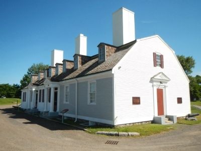
By Barry Swackhamer, June 17, 2014
Capture of Port Royal Marker
| 1 ► Nova Scotia, Annapolis County, Annapolis Royal — Captures of Port Royal — 1654 (&) 1710 — |
| Near St. George Street close to St. Anthony Street, on the left when traveling west. | |||
| 2 ► Nova Scotia, Annapolis County, Annapolis Royal — Daniel Auger de Subercase — |
| Near St. George Street at St. Anthony Street, on the left when traveling east. | |||
| 3 ► Nova Scotia, Annapolis County, Annapolis Royal — Duvivier Attack — L’attaque de Duvivier — |
| Near St. George Street close to St. Anthony Street, on the left when traveling west. | |||
| 4 ► Nova Scotia, Annapolis County, Annapolis Royal — Fort Anne, a Bastioned Fort — Le Fort Anne, fort à bastions — |
| Near St. George Street close to St. Anthony Street, on the left when traveling west. | |||
| 5 ► Nova Scotia, Annapolis County, Annapolis Royal — Glebe Lands — Historic Lower Saint George Street — |
| On St. George Street close to Church Street, on the right when traveling north. | |||
| 6 ► Nova Scotia, Annapolis County, Annapolis Royal — Jean Paul Mascarene — c. 1694-1760 — |
| Near St. George Street close to St. Anthony Street, on the left when traveling west. | |||
| 7 ► Nova Scotia, Annapolis County, Annapolis Royal — Samuel Vetch — |
| Near St. George Street close to St. Anthony Street, on the left when traveling west. | |||
| 8 ► Nova Scotia, Cape Breton Region, Louisbourg — First Lighthouse Tower — |
| Near Havenside Road, on the left when traveling east. | |||
| 9 ► Nova Scotia, Cape Breton Region, Louisbourg — Fortress of Louisbourg — La forteresse de Louisbourg — |
| Near Kennington Cove Road. | |||
| 10 ► Nova Scotia, Cape Breton Region, Louisbourg — French Garrison at Louisbourg — |
| Near Havenside Road, on the left when traveling east. | |||
| 11 ► Nova Scotia, Cape Breton Region, Louisbourg — French Naval Guns — |
| On Main Street close to Huntington Avenue, on the left when traveling east. | |||
| 12 ► Nova Scotia, Cape Breton Region, Louisbourg — Lighthouse Point — La pointe du phare — |
| On Havenside Road, on the right when traveling east. | |||
| 13 ► Nova Scotia, Cape Breton Region, Louisbourg — The Lobster Fishery — Le pêche du homard — |
| On Havenside Road, on the left when traveling east. | |||
| 14 ► Nova Scotia, Cape Breton Region, Louisbourg — The Siege Landing — Débarquement des assiégeants — |
| On Kennington Cove Road, on the left when traveling west. | |||
| 15 ► Nova Scotia, Cape Breton Region, Louisbourg — Wolfe’s Landing — Le débarquement de Wolfe — |
| Near Kennington Cove Road. | |||
| 16 ► Nova Scotia, Cumberland County, Fort Lawrence — Beaubassin — |
| 17 ► Nova Scotia, Cumberland County, Fort Lawrence — Beaubassin 1672-1750 — |
| 18 ► Nova Scotia, Guysborough County, Larrys River — 6 — The Great Upheaval 1755-1763 — Le grand dérangement — |
| On Marine Drive (Nova Scotia Route 316) at Ballfield Loop on Marine Drive. | |||
| 19 ► Nova Scotia, Guysborough County, Larrys River — 7 — The Scattering of a People — La dispersion d’un peuple — |
| On Marine Drive (Nova Scotia Route 316) at Ballfield Loop, on the right when traveling west on Marine Drive. | |||
| 20 ► Nova Scotia, Halifax Region, Halifax — The Grand Dérangement — Georges Island - Halifax / Île Georges - Halifax — |
| Near Lower Water Street close to Morris Street. | |||
| 21 ► Nova Scotia, Kings County, Grand Pré — Memorial Church/L'église-souvenir — |
| Near Grand Pré Road. | |||
| 22 ► Nova Scotia, Kings County, Grand Pré — The Expulsion of the Acadians — La déportation des Acadiens — (1755-1762) — |
| Near Grand-Pré Road close to Old Post Road, on the left when traveling north. | |||
| 23 ► Nova Scotia, Kings County, Horton Landing — New England Planters/Les planters de la Nouvelle-Angeleterre — |
| Near Wharf Road. | |||
| 24 ► Nova Scotia, Kings County, Horton Landing — The Tragedy of the Deportation/La tragédie de la Déportation — |
| Near Wharf Road. | |||
| 25 ► Nova Scotia, Kings County, Hortonville — Horton Landing Cross — |
| Near Wharf Road. | |||
| 26 ► Nova Scotia, Lunenburg County, Lunenburg — Merligueche — |
| On Linden Avenue at Bluenose Drive, on the left when traveling west on Linden Avenue. | |||