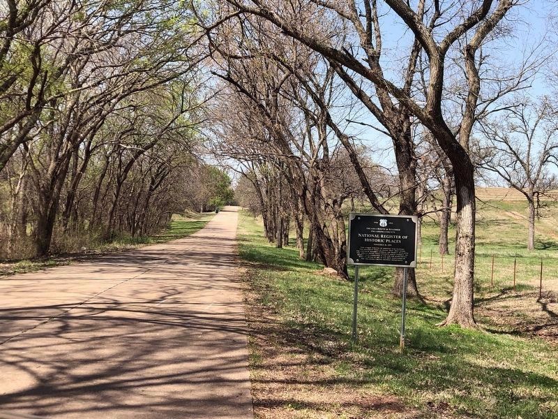
National Register of
Historic Places
November 30, 1999
This unique stretch of original US 66 features two different types of paving that meet where the concrete roadbed (Federal Aid Project 137-G) joins the asphalt paving with concrete . . . — — Map (db m272970) HM
1901 – Citizens Bank replaced the Bank of Edmond
1914 – Citizens State Bank merged with Farmer's State Bank
1914-1969 – Citizens National Bank
This building was placed on the
National Register of
Historic Places
March 1980
. . . — — Map (db m273077) HM
One of the first Oklahoma Official Centennial Projects was the preservation of Oklahoma Territory's first public schoolhouse, located in Edmond. It was originally built with funds raised by the Ladies School Aid Society under the leadership of Mrs. . . . — — Map (db m171168) HM
Charles Gasham "Gristmill" Jones was the mayor of Oklahoma City when the franchise was awarded for interurban and trolly service within Oklahoma City and Oklahoma County. Jones later built railroads to connect to the inner-city passenger and freight . . . — — Map (db m287665) HM
The James D. Couch Municipal Building was named after the City of Oklahoma City's
longest-serving City Manager, Jim Couch, who retired in 2019. Mr. Couch served the
City of Oklahoma City from 1989 to 2019 and was named City Manager in 2000. . . . — — Map (db m274085) HM
Listed in the National Register of Historic Places by the
United States Department of the Interior
Constructed in 1925 and 1928 (eastern portion), the Harbour-Longmire Building housed the second-largest furniture store in the country at one . . . — — Map (db m274083) HM
On December 4, 1928, the Oklahoma City No. 1 blew in, opening Oklahoma's most productive oil and gas field, sixth largest in the nation.
Drilled by the Indian Territory Illuminating Oil Company, a subsidiary of Cities Service Oil Company, and . . . — — Map (db m279924) HM
The Chickasaw Nation's jurisdictional territory includes 7,648 square miles of south-central Oklahoma and encompasses all or parts of 13 Oklahoma counties. Chickasaw citizens live in all 50 states and in many countries throughout the world. . . . — — Map (db m284911) HM
This location marks the southeast corner of Council Grove, a three-and-one-half square mile section rich in history. The land was heavily wooded, creating an ideal meeting place for the Muscogee (Creek), Kiowa, and Comanche nations with shady areas . . . — — Map (db m284901) HM
Although Kingfisher, Blaine, and other western Oklahoma counties were enjoying an excellent agriculture economy, in the late 1940's, access to telecommunications had not kept pace for most rural residents. Because the population was not centered in . . . — — Map (db m284645) HM
Always short on revenue, the City eventually acquired its own building by evicting a saloon.
The Mayor and City Council of Oklahoma City first met on May 3, 1889 in the law office of councilman Ledru Guthrie on the south side of Main . . . — — Map (db m141902) HM
A slate of candidates supported by the Seminole Town and Improvement Company, including the temporary mayor William Couch, was elected at the polls on Wednesday, May 1.
At the mass meeting on April 27, after the compromise survey was . . . — — Map (db m142027) HM
Oklahoma City and Guthrie, a dozen other towns, and thousands of farms were settled in a day.
The Run of '89 gave birth to Oklahoma City, which today is the state's capital and largest city. It also marked the beginning of Guthrie, where the . . . — — Map (db m141980) HM
The history of the Johnston County Courthouse dates back to the beginning of Oklahoma statehood, November 16, 1907 when counties were formed. One of the 77 Oklahoma counties formed, Johnston County, needed a place to operate governmental business. . . . — — Map (db m184348) HM
Although the Norman townsite was settled during the Land Run on April 22, 1889, Cleveland County did not exist for another year, and almost wasn't named Cleveland County. In fact, if not for the efforts of Norman's early citizens and civic . . . — — Map (db m121630) HM
With a margin of only 14 votes, Beale claimed a mandate to overturn seven months of Seminole-dominated city rule. Within a month the city was in chaos and city governance was shut down by federal authorities.
Dr. A. J. Beale, the leader . . . — — Map (db m142036) HM
Founder of the first Oklahoma City hospital
for Blacks, “the Utopia”. He served as medical
examiner for Oklahoma County, rose to the
position of Chief of Staff of the South Ward
of University Hospital and was the founder
of the Medical, Dental . . . — — Map (db m280395) HM
After building a flour mill in 1889, C.G. Jones emerged as an energetic businessman and civic leader, serving in the territorial legislature and as mayor of Oklahoma City.
Charles G. Jones moved to Oklahoma City from rural Illinois in the . . . — — Map (db m284906) HM
Gower Memorial Cemetery
National Register of Historic Places
December 17, 1991
Founders: John & Ophelia Gower,
donated “Gower Cemetery” from homestead land
November, 1889
November 20, 1896 earliest burial
Gower . . . — — Map (db m272974) HM
Pawhuska, Oklahoma county seat of Osage County
was named for well known Osage Chief
Pa-Hus-Ka whose name means White Hair
The Post Office was established May 4, 1876
A community who embraces with pride the
reflections of our past and . . . — — Map (db m55651) HM
Thin black lines indicate changes in relevance. Between each pair of lines entries are ordered geographically but all have the same relevance.
* Inflectional forms of words are their plurals, singulars, and possessives as well as gramatical tenses and similar variations.