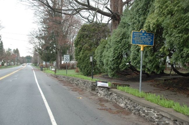
On Museum Lane, on the right when traveling south.
Erected 1830 by Hugh White
who helped develop Cohoes
Power and Industry; R. R.
Builder; Congressman; Brother
of Canvass White, C. E.,
Builder of Erie Canal
— — Map (db m11532) HM
Near South Broadway Ave. (New York State Route 9), on the right when traveling south.
The Lincoln Bathhouse was established in 1915, converted from the abandoned Natural Carbonic Gas Company Plant. Although this bathhouse accommodated large numbers of patrons, it could not keep up with the demand, so construction of the Washington . . . — — Map (db m48323) HM
Near 2nd Avenue (New York State Route 32) at 16th Street, on the right.
Peter J. Dalessandro
Congressional Medal of Honor
Technical Sergeant, US Army, Company E. 39th Infantry, 9th Infantry Division Sergeant DAlessandro was born May 19, 1918.
Entered service at: Watervliet, N.Y.
Presented the Congressional . . . — — Map (db m246299) HM
According to historians, the Mohicans occupied this strategic crossing for millennia, using the intersecting waterways for trade and sustenance. The Hudson-Champlain corridor forms a near-continuous water passage, extending from New York City to . . . — — Map (db m246393) HM
Martin Harris one of the three witnesses to the divine authenticity of the Book of Mormon
Born Eastown, Saratoga County, New York May 18 1783.
Died Clarkston, Cache County, Utah July 10, 1875. — — Map (db m278595) HM
On Washington Avenue (County Hwy D), on the right when traveling east.
Salmon Child, born on September 19, 1765, in Woodstock, Connecticut, enlisted as a private in the Revolutionary War at the age of 16. Child participated in several "alarms" against the British while serving in Colonel Holtham Dunham's Company of . . . — — Map (db m269158) HM
On Delaware Avenue, on the left when traveling north.
Peebles Island State Park is located in the city of Cohoes (Albany County) and the village of Waterford (Saratoga County). Surrounded by the third and fourth branches of the Mohawk River, this 191-acre park includes Polrump, Goat, and Peebles . . . — — Map (db m115377) HM
On Maple Avenue 0.2 miles south of Division Street, on the right when traveling south. Reported missing.
The Church of Jesus Christ of Latter-Day Saints was founded in this area, and Martin Harris was a leading figure in its early history. He helped publish the Book of Mormon. Martin Harris was born 18 May 1783 in Easttown, Saratoga County New York. ln . . . — — Map (db m284351) HM
Near Pearl Street, on the right when traveling west.
A native of Saratoga County, New York, Henry Millard moved to Missouri with his family while still a child. As a young man he moved to Natchez, Mississippi, where in 1826 he married Mary Warren Beaumont. While living in Natchez they became the . . . — — Map (db m190760) HM
On Glen Street near Bacon Street, on the right when traveling east.
In 1860, Zopher and Catherine DeLong moved to Glens Falls from the Saratoga County town of Day where Zopher had been a farmer, lumberman and proprietor of a general store. They purchased this Glen Street property, with its simple wooden house built . . . — — Map (db m147865) HM
On Charlton Road 0.2 miles east of Valentine Road, on the right when traveling east.
Joseph LaRue, 1731-1810,
acquired 200 acres here
in 1776. Attorney and farmer,
served as a county justice
of the peace, 1792-1802. — — Map (db m244618) HM
On Broadway at Caroline Street, on the right when traveling north on Broadway.
One month after the Battle of Gettysburg on August 3, 1863, thoroughbred horse races were formally run in Saratoga Springs for the first time. The organizer of this four-day meet was John Morrissey. Over 5,000 people showed up to watch the races. . . . — — Map (db m216513) HM
On Washington Street at Fenwick Street, on the right on Washington Street.
Birthplace
Major-Gen Abner Doubleday
Ballston Spa June 26 1819
Founder of Baseball 1839
A Civil War Hero at Battle
of Gettysburg 1863
— — Map (db m65261) HM
On Kingsley Road, on the left when traveling north.
Joseph died 1804 and Abigail
died 1791 local innkeepers
and unfortunate parents of
Joseph, convicted traitor
& spy who was hung in 1782 — — Map (db m128976) HM
Early 1800's H.R. Rowland established saw & grist mill. Area later included limestone quarry, Kiln, stone & plaster mills, farms, homes, and district school — — Map (db m131599) HM
Near North Washington Street (New York State Route 385) 0.2 miles north of Union Street.
A paddler's dream became reality in 2001 when Governor George E. Pataki announced funding for the Hudson River Greenway Water Trail stretching from Battery Park in the Village of Waterford, Saratoga County, to Battery Park in Manhattan.
Water . . . — — Map (db m182885) HM
Near New York State Route 30 0.1 miles north of Mine Kill Road, on the right when traveling north.
History of the Long Path
During the 1930s, a plan was developed by Vincent J. Schaefer of the Mohawk Valley Hiking Club and others to connect the southern New York hiking trails with the Adirondack hiking trail system. This proposed trail . . . — — Map (db m179658) HM
On Broad Street (U.S. 4) at First Street on Broad Street.
Map of Village Historic Sites
Early Water Ford was a fording place or crossing place where the Mohawk River slowed to narrow streams around small islands. Settled in 1622 by Dutch fur traders and trappers. It was a base for trade with the . . . — — Map (db m148605) HM
On Tennantville Road, on the right when traveling north.
Soldier - Patriot and One of
the Last Revolutionary
War Pensioners in the U.S.
Samuel Downing 1761 - 1867
Grave Site
Stone Arabia and Saratoga SAR
— — Map (db m129395) HM
Fire Tower
Erected of wood in 1916
Steel tower erected in 1920
Cabin built to house ranger
Closed 1990, restored and
staffed summers from 1996 — — Map (db m9257) HM
On School Street at Main Street, on the right when traveling west on School Street.
Come to Lake Luzerne, just eleven miles south of Lake George Village.
Here, the Hudson River squeezes into a narrow gorge, tumbling over the dramatic Rockwell Falls. Water from the Great Sacandaga Reservoir joins the
river in a flurry of white . . . — — Map (db m150210) HM
On Main Street (County Route 77) at Ski Bowl Road, on the right when traveling north on Main Street.
Side One
Johnsburg
Rivers, Rails, Teddy, Treasures and Trails
Johnsburg lies at the heart of the
Adirondacks, where the rails came
to an end over a century ago. Teddy
Roosevelt rode through the wilderness to catch a train when . . . — — Map (db m147364) HM
On Harrisburg Road at Lanfear Road, on the right when traveling north on Harrisburg Road.
“The "Biggest Little Town” in NY State has more than thirty thousand acres of Forest Preserve waiting for hikers, hunters and campers. Fresh mountain streams feed into Stony Creek and the Hudson River, where native brook trout seek out . . . — — Map (db m150209) HM
On Trout Pond Road north of Maintenance Road, on the left when traveling north.
This cemetery is the resting place for at least two dozen early settlers to the falls area. It is believed that the burials, or at least the stones, were moved here from another location in the park. A number of graves are unmarked. In the 1950s, . . . — — Map (db m167908) HM
Thin black lines indicate changes in relevance. Between each pair of lines entries are ordered geographically but all have the same relevance.
* Inflectional forms of words are their plurals, singulars, and possessives as well as gramatical tenses and similar variations.