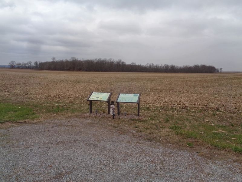
On Illinois Route 3 0.3 miles south of Rodee Road, on the right when traveling south.
In December of 2009, the lush wetland at the heart of Lover's Pond Nature Preserve was renamed in honor of James "Gene" Korando, a lifelong resident of this area and avid outdoorsman.
Humble Beginnings
"Gene" Korando was born May 26, . . . — — Map (db m161856) HM
On East South Street (County Route 6) east of Weed Street, on the left when traveling west.
Lumi Bekteshi had never baked a pie before she began managing the Palms Grill Café on Route 66 in Atlanta in the spring of 2009. Three months later, she earned two first-place Blue Ribbons at the Illinois State Fair for her peach and apple . . . — — Map (db m311781) HM
On Southwest Arch Street west of Southeast Vine Street, on the right when traveling west.
In the 20th century, road travel became the predominant means of going from point a to point b. With the increase of cars on the road, “attention getters,” items attracting the attention of passengers and drivers with the intended result being to . . . — — Map (db m312093) HM
On West Main Street east of North Combs Avenue, on the left when traveling east.
Collinsville, Illinois is home to the World's Largest Catsup Bottle, located at 800 South Morrison Avenue.
The giant bottle is 70 feet tall and 25 feet wide, perched atop 100-foot-tall steel legs.
The Brooks Catsup Bottle was built in . . . — — Map (db m305715) HM
On West Main Street east of North Combs Avenue, on the left when traveling east.
Collinsville, Illinois is proud to be the Horseradish Capital of the World, producing roughly 60% of the global supply.
Horseradish has been grown in Collinsville since the 1800s when German immigrants brought the farming practice to the . . . — — Map (db m305993) HM
On Pine Street at North Walnut Street, on the right when traveling east on Pine Street.
(front:)
Route 66, the Mother Road, is an American icon that symbolizes romance and freedom of the open road. Born in 1926, Route 66 was one of the first numbered U.S. highways, journeying 2,500 miles from Chicago to Los Angeles. Today, . . . — — Map (db m316253) HM
On State Street (Illinois Route 150) west of Old Plank Road, on the right when traveling north.
Segar's hard working chef debuted on May 24, 1931. He owns and operates the Rough House Café. Since the diner serves hamburgers, Wimpy frequents the beanery in constant search of a free meal and his famous plea "I'll gladly pay you Tuesday for a . . . — — Map (db m161716) HM
On South 6th Street (Business Interstate 55) 0.4 miles south of East Linton Avenue, on the right when traveling south.
Enjoy the "original" deep fried hot dog on a stick. Ed Waldmire invented the Cozy Dog while stationed in Amarillo, Texas, during World War II. Originally called "crusty cur," the battered hot dogs were a hit with the GIs at the airfield. In 1950, . . . — — Map (db m312091) HM
On East Capitol Avenue at 6th Street, on the right when traveling west on East Capitol Avenue.
Home of the Original Signature Horseshoe Sandwich
created in 1928 at the Leland Hotel by Chef Joe Schweska.
The name "horseshoe" was derived from the shape of the cut of ham used in the original sandwich. The French fries represent the . . . — — Map (db m267465) HM
On North Chicago Street (Illinois Route 53) at Ohio Street, on the right when traveling south on North Chicago Street.
On this site and in this building, erected ca. 1895, the world's first Dairy Queen store opened on June 22, 1940.
Soft serve ice cream was unknown before its inception in Kankakee, Illinois in 1938 by John Fremont "Grandpa" McCullough . . . — — Map (db m157062) HM
On Zollman Road 0.4 miles east of Sunday Drive, on the left when traveling east.
Born and raised here on his family farm, entrepreneur Harland Sanders entered the restaurant business in the 1930s, serving food at his Corbin, Kentucky service station. By 1952, Sanders developed his patented method of cooking chicken and . . . — — Map (db m312060) HM
On County Route 56 at Indiana Route 1, on the right when traveling west on County Route 56.
Ralph and Anne Sechler established Sechler’s Pickles (first named St. Joe Valley) on their homestead here in the 1920s. Despite the Great Depression, they grew the business, selling many varieties of pickles to local restaurants and building a . . . — — Map (db m315721) HM
On West Main Street (U.S. 40) west of West Street, on the right when traveling east.
A waitress named Marge. A red vinyl stool at the counter. The pie case and the bottomless cup of coffee. Diners were America's first fast-food restaurants.
As automobile traffic increased on the National Road in the 1920s, diners sprang up . . . — — Map (db m233274) HM
Near Cfp Canyon Road north of Clifty Hollow Road, on the right when traveling east.
The Clifty Inn has undergone many changes, but the lovely site overlooking the Ohio River remains the same.
In 1924, the two-story Clifty Inn opened at this location. The Madison Courier reported, "The vistas are superb and the panoramas not . . . — — Map (db m312179) HM
On Illinois Street north of West Georgia Street, on the right when traveling north.
St. Elmo
Steak House
has been placed on the
National Register
of Historic Place
by the United States
Department of the Interior
— — Map (db m316248) HM
On Lincolnway at Lafayette Street, on the right when traveling east on Lincolnway.
In the 1960s, the founders and partners of Chester, Inc., Charlie Bowman and Orville Redenbacher, developed and produced hybrid popcorn seed under the name Red Bow Popcorn (Red for Redenbacher and Bow for Bowman).
As one of the largest . . . — — Map (db m315735) HM
On Ferry Street at Franklin Street, on the right when traveling south on Ferry Street.
As soon as immigrant James Dufour saw the area now known as Vevay in the Northwest Territory, he knew it would be an ideal place for his vineyards. The gentle hills were terraced like those in his native district of Vevay, Switzerland, and he named . . . — — Map (db m315849) HM
On South River Road at South Newman Road, on the right when traveling east on South River Road.
Cooking in an oven similar to this one was an all day activity. To begin, a fire was built in the oven and allowed to burn for several hours. While the oven was heating, bread dough was mixed, kneaded and set aside to rise. When the inside bricks of . . . — — Map (db m314738) HM
On South River Road at South Newman Road, on the right when traveling east on South River Road.
The herb garden was an essential part of 18th century life. The plants were traditionally used in cooking, in medicinal ways and for coloring and dyeing other materials. — — Map (db m314739) HM
On South 3rd Street at East Voorhees Street, on the left when traveling south on South 3rd Street. Reported missing.
World-famous trademark created in 1915 on this site at Root Glass Company, by Chapman J. Root, T. Clyde Edwards, Earl R. Dean, and Alexander Samuelson. Bottle design selected in national competition. — — Map (db m8888) HM
On North Des Moines Street (Fox Avenue) (County Highway M43) just north of Market Street (330th Street) (State Highway 175), on the left when traveling north.
Cracker Jack 1918 to 1963 August Petersmeyer specialized in popcorn from 1889-1918 — — Map (db m315732) HM
On Lincoln Highway west of U.S. 65, on the right when traveling west.
Food service at Reed/Niland Corner began in the mid-1920s with a lunch stand selling sandwiches and cold drinks to motorists during the summer months. Built next to a small gas station located about one hundred yards east of this point, the lunch . . . — — Map (db m316064) HM
On East Wall Street at National Avenue, on the left when traveling west on East Wall Street.
Fort Scott was a dairy town and had 3 working dairies. Borden's canned and powdered milk was produced, boxed and shipped by rail to locations all over the United States. In the 1950's Batten Meadow Gold bought milk, bottled it, and delivered door . . . — — Map (db m312760) HM
On U.S. 69 0.7 miles south of Atkinson Road, on the right when traveling south.
H.R. Browns Grocery was one of the last neighborhood grocery stores in Pittsburg, Kansas. By 1912, there were seventy-nine retail grocery stores in Pittsburg. Their strength was in their relative convenience for their customers. Regular customers . . . — — Map (db m312174) HM
On U.S. 24 east of 3rd Street, on the right when traveling east.
Cuisine Good Food, Great TraditionGood food and small cafes have long been a tradition in Nicodemus, although most businesses are now gone. Ernestine’s Bar-B-Q is the last restaurant in town. The legendary Ernestine VanDuvall’s . . . — — Map (db m312227) HM
On Innovation Boulevard, on the right when traveling north.
This museum highlighting the history of the world-famous Pizza Hut chain of restaurants sits on Wichita State University's Innovation Campus. The structure is the original Pizza Hut store and was relocated to the WSU campus and dedicated in 1986, . . . — — Map (db m316180) HM
On Perimeter Road 0.1 miles east of Harvard Avenue, on the right when traveling east.
Two former WSU students, Dan and Frank Carney, borrowed $600 to open this first Pizza Hut. Their corporation grew to become the world's largest pizza chain and was sold to PepsiCo in 1977 for $300,000,000.
The building was moved to this site to . . . — — Map (db m316181) HM
On Augusta chatham Road (Kentucky Route 19) north of Mary Ingles Highway ( Route 8), on the left when traveling south.
During the 1870s, leading wine-producing county of US, furnishing over 30,000 gallons annually, half the entire national production. Germans, finding soil here similar to that in France and Spain, brought grape cultivation and wine production to . . . — — Map (db m315853) HM
Near Riverboat Row, on the right when traveling north.
James Smith brewed an English style beer in Newport as early as 1798. In the 1840s and 1850s German immigrants introduced the new style lager. Although several breweries operated in Newport after the Civil War, the one established by George . . . — — Map (db m174788) HM
Near East Main Street (U.S. 60) at Midland Avenue (U.S. 60), on the right when traveling west.
One of Lexington's most distinguished native citizens also emerged as one of America's top Thoroughbred breeders and owners. W. T. Young developed the stately Overbrook Farm, stocked it with high quality bloodstock and began breeding, racing, . . . — — Map (db m315782) HM
On East Main Street (U.S. 421) at Esplanade, on the left when traveling west on East Main Street.
Oldest continuous LGBTQ gathering place in Kentucky, and among the oldest in the U.S. LGBTQ patrons discreetly congregated here as early as 1939. In 1963 The Gilded Cage bar opened, run by gay men John Hill and Estel Wilson. Patrons enjoyed same . . . — — Map (db m179398) HM
On Dixie Hwy (U.S. 25) at Rose Avenue, on the right when traveling south on Dixie Hwy.
1964 Jack Massey and John Y. Brown buy Kentucky Fried Chicken corporation from Colonel Sanders.
1969 KFC Corporation purchases the Colonel’s restaurant in Corbin and converts it into a Kentucky Fried Chicken Restaurant.
1973 . . . — — Map (db m312065) HM
On Dixie Highway (U.S. 25) south of Colonel Sanders Street, on the right when traveling south.
Birth of a Legend. Kentucky's Most Famous Citizen. Colonel Harland Sanders began the part of his life that brought him fame in a small gasoline service station on the opposite side of this highway. Born on September 9, 1890, . . . — — Map (db m312057) HM
On William Whitley Road, on the left when traveling east.
The races at Sportsman’s Hill began at dawn and were followed by an elaborate breakfast which was prepared in the yard of the house and served out of doors to all the guests. A tradition that continues today at the Kentucky Derby with “The . . . — — Map (db m311785) HM
On U.S. 79 north of Dawson Street, on the right when traveling north.
AKA pot liquor. Broth made from boiling greens and pork fat. Fed South's hungry by early 1850s. In 1935, Senator Huey Long praised its value. — — Map (db m220563) HM
On Lafitte Avenue at Hagan Avenue on Lafitte Avenue.
Original depression-era Poor Boy sandwiches, made like way back when. If you're looking for a bite of history, look no further.
Streetcar Poor Boy
The first Poor Boy ever made by the Martin Brothers to feed the striking streetcar . . . — — Map (db m315243) HM
Near Hagan Avenue at Toulouse Street, on the right when traveling north.
Original depression-era Poor Boy sandwiches, made like way back when. If you're looking for a bite of history, look no further.
Streetcar Poor Boy
The first Poor Boy ever made by the Martin Brothers to feed the striking streetcar . . . — — Map (db m315307) HM
On Iberville Street west of Chartres Street, on the right when traveling east.
At this site on June 24, 1973, an arsonist set fire to the UpStairs Lounge, a gay bar located on the second floor. Thirty-two people perished, and the fire remains the deadliest in New Orleans history. The arsonist was never arrested, the city’s . . . — — Map (db m276720) HM
At the height of Prohibition, deep in the curving, muddy waters of the swamp was the secret meeting place known by moonshiners simply as the Whiskey Tree. With no roads to reach it and far from the grasp of any officials, you can vividly imagine . . . — — Map (db m296864) HM
Near Searsport Avenue (U.S. 1), on the right when traveling west.
Originally a cigar making factory, the building shown became Perry's Tropical Nut House when owner Irving Perry started selling pecans in 1926. The business flourished as automobile traffic along Route 1 grew and it soon became . . . — — Map (db m315729) HM
Near Taylor Avenue (Maryland Route 435) south of Rowe Boulevard ( Route 70), on the right when traveling north.
Herbs have been used for many centuries to provide seasoning for food. Taste or rub a leaf and smell it to see if you can identify the plant. — — Map (db m315521) HM
On West Lexington Street at North Paca Street, on the left when traveling west on West Lexington Street.
In 1886 at the age of 19, John W. Faidley went into business with fish dealer Peter B. Smith, opening as Smith & Faidley—now known simply as Faidley's. Faidley's granddaughter, Nancy Devine, and her husband, Bill, continue to operate what is the . . . — — Map (db m313662) HM
Near Russell Street north of West Lee Street, on the left when traveling north.
Fuku is a spicy fried chicken spot from Chef David Chang. We opened our doors in New York's East Village in 2015 and have since expanded to multiple restaurants and ballparks. We deliver high quality, crave-able food and aim to serve up different . . . — — Map (db m312063) HM
On North East Street at East Church Street, on the right when traveling north on North East Street.
Larry J. Lebherz and his brothers incorporated The Everedy Company here in 1923 during the height of the prohibition era. The operation began with the production of bottle cappers and later would be known for its stainless steel pots and pans, . . . — — Map (db m104045) HM
The device in front of you is the actual water pump used by Jefferson residents to draw water from the town well. During the 1800's and until 1960, residents obtained water from the well located in the center of town. The well offered tremendous . . . — — Map (db m311801) HM
Near Hyattstown Mill Road 0.2 miles east of Frederick Road ( Route 355), on the right when traveling east.
In operation since 1798, Hyattstown Mill was known for its “fine stone-ground white and yellow cornmeal." Destroyed by fire in 1918, the new mill was quickly rebuilt on the old foundation and remained a crucial local business until the mid-1930s. . . . — — Map (db m311909) HM
On Georgia Avenue (U.S. 29) at Ripley Street when traveling south on Georgia Avenue.
"Buy 'em by the Bag," the motto urged. For more than half a century, hamburger-hungry customers came to Maryland's first Little Tavern to do just that.
Harry F. Duncan founded Little Tavern Shops, Inc., which specialized in 5¢ little . . . — — Map (db m75468) HM
On Caleb Jones Road east of Smith Island Road, on the left when traveling north.
Smith Island has its own region-specific traditional cuisine. The most famous dish is a locally produced cake known as Smith Island cake. Traditionally, the cake consists of eight to ten layers of cake with frosting between each layer and . . . — — Map (db m286175) HM
Near Point Lookout Road (Maryland Route 5) east of St. Michaels Manor Way, on the right when traveling east.
…Upon the whole, prison life was very monotonous. It was such and unhealthy camp that the prisoners considered that they had a better chance for their lives fighting in the army.
The food, while good was very scant. Breakfast consisted of . . . — — Map (db m312019) HM
On Somerville Avenue at Beech Street, on the right when traveling east on Somerville Avenue.
A Handful, A Pinch and a Dash of Perfection. 1911. Minnie Simpson Turner perfects the recipe for lemon pie filling. In a time when cooking skills passed from mother to daughter and recipes called for a "handful of flour" and "pinch of salt," . . . — — Map (db m315780) HM
On School Street at Province Street, on the right when traveling east on School Street.
One of Boston’s luxury hotels, opened by innovative hosteller Harvey Parker, the Parker House has been operating on this site since 1856. Parker introduced the European Plan, started the practice of scrod, the fresh white fish catch of the day. . . . — — Map (db m311794) HM
The rank and financial status of Ft. Warren residents determined the quality of meal they ate. Rations for Union soldiers consisted of fresh beef with potatoes three times a week, salt beef, pork or ham three times a week, and baked beans on . . . — — Map (db m313674) HM
On Hanover Street at Lathrop Place, on the right when traveling north on Hanover Street.
Giovanni DeCunto's "Medusa" reimagines one of Italy's most enduring symbols. Long viewed as a guardian spirit, Medusa embodies the strength and protection that has defined Sicilian culture for centuries.
In this piece, DeCunto connects that . . . — — Map (db m316318) HM
On Hanover Street north of Parmenter Street, on the right when traveling north.
A living monument to American history, the North End had many revolutionaries walk its streets. Today, many walk its streets to support local traditions, taste its delicious food, and to carve their place in history, proving that legacies are . . . — — Map (db m316316) HM
On Delta Avenue east of 9th Street, on the right when traveling east.
One of the most popular stores in Gladstone that operated for almost 55 years was Rouman's Candy Kitchen.
Brothers Leo and Jim Rouman immigrated from Katavothra Greece to Gladstone in 1903. They came from a family of eleven children and . . . — — Map (db m315731) HM
On Jefferson Avenue at Revere Street, on the right when traveling north on Jefferson Avenue.
St Clair Shores was home to a classic
speakeasy on the shores of Lake St. Clair.
Blossom Heath, now a event center, was
notorious for illegal drinking and gambling
during Prohibition and the Great Depression.
Hoteller Matthew Kramer . . . — — Map (db m313071) HM
On Jefferson Avenue at Revere Street, on the right when traveling north on Jefferson Avenue.
The Prohibition era of the 1920s and
1930s was a turbulent and colorful time
in St. Clair Shores. The Volstead Act,
prohibiting the sale and consumption of
alcohol, went into effect in 1920. However,
the state of Michigan had passed . . . — — Map (db m313072) HM
Near Orion Road at Gallagher Road, on the left when traveling north.
The History of Goodison - It All Started with the Mill
The Paint Creek Cider Mill's history shares a story of settlement, spanning the 19th, 20th, and 21st centuries. Always the economic and social hub of Goodison, the buildings on this . . . — — Map (db m315311) HM
Why the big guy?
The Green Giant Statue is a symbol of the long standing association of the City of Blue Earth with the Green Giant company. Peas and corn are still grown and canned here today.
How long has he been standing there? . . . — — Map (db m316179) HM
On 1st Street S. west of 5th Avenue S., on the right.
In 1972, the Mississippi riverfront was considered "the backside of the city." Minneapolis' riverfront was an industrial area containing abandoned mills, a sand and gravel storage area, and an active railyard. The ruins of the Bassett Sawmill . . . — — Map (db m314274) HM
On Marshall Street Northeast (County Road 23) at 13th Avenue Northeast, on the right when traveling north on Marshall Street Northeast.
"I am now ready to supply the citizens of the Territory with Ale and Beer, which will be found equal—yes, superior—to what is brought from below. I am now demonstrating that malt liquors of the very best quality can be manufactured in . . . — — Map (db m313837) HM
On Keller Avenue at Jenkins Lane, on the right when traveling north on Keller Avenue.
Barq's root beer was created by Edward C. Barq, Sr. in 1898 and produced on this site until 1936, when the operation moved to Lameuse Street. A Mississippi Gulf Coast favorite, the number of franchise bottlers grew to over two hundred by 1950. . . . — — Map (db m68425) HM
On Levee Street south of Grove Street, on the left when traveling north.
In May 1908, Leo C. Koestler opened Koestler's Bakery on Washington at Belmont Street. The first ovens were coal fired and "Mello-Toast Bread" was delivered to households by a horse-drawn dray.
In about 1918, Leo became the first in the state . . . — — Map (db m312021) HM
On South Mount Auburn Road south of Bloomfield Road.
Test your record-setting knowledge
Q1: How many hours did it take to fill the cup?
A: It took just under 3 hours to fill starting at 6am on August 20, 2017.
Q2: How many people worked to fill the cup?
A: Eight people worked to . . . — — Map (db m307393) HM
On South National Avenue at East St. Louis Street, on the right when traveling south on South National Avenue.
One of the few remaining "old style" designs for this chain of drive-in restaurants, opened in 1962. It still features curb service, steak burgers and hand-dipped milkshakes. — — Map (db m316245) HM
On West College Street west of South New Avenue, on the right when traveling west.
Red's Giant Hamburg was a business on the west end of Route 66 in Springfield, Missouri, which is believed to have been the world's first drive-through restaurant.
The business's name was supposed to be "Red's Giant Hamburger," but owner . . . — — Map (db m170766) HM
On Main Street at West Armour Boulevard, on the right when traveling north on Main Street.
12 East Armour Boulevard was the original headquarters of Interstate Bakeries Corporation (IBC), now Hostess Brands, Inc. Hostess Brands owns Hostess and Dolly Madison snack cakes and Wonder, Nature's Pride and Butternut breads. — — Map (db m313669) HM
On West Main Street (Old U.S. 66) east of Washington Street, on the left when traveling west.
Supertam on 66, known for their collection of over 2500 items celebrating the Man of Steel, was opened in 2006 by Larry Tamminen. When he retired in 2021, the Briley family took over the ice cream shop and continues its all-American tradition. . . . — — Map (db m311744) HM
On Elm Street at 1st Street, on the right when traveling south on Elm Street.
On July 7, 1928, Chillicothe baker Frank Bench and inventor Otto Rohwedder secured Chillicothe Missouri's Slice of History. On this day their bread slicing machine produced the first loaves of sliced bread and made them available on the shelves . . . — — Map (db m311897) HM
On Washington Street (U.S. 65) at Webster Street, on the right when traveling north on Washington Street.
Chillicothe's slice of history arrived in 1928 when inventor Otto Rohwedder and Chillicothe baker Frank Bench produced the first loaves of sliced bread. Their invention set into motion the timeless comparison of ingenuity and innovation to "The . . . — — Map (db m311899) HM
Next time you open up a cool Eskimo Pie or a creamy Valomilk candy, you’ll appreciate them even more if you consider the colorful history behind these sweet treats. Eskimo Pies gained fame thanks to candy man Russell Stover, who partnered with . . . — — Map (db m311784) HM
Near Market Street at South 18th Street. Reported missing.
Ice cream cones gained wide-spread popularity after they were introduced at the 1904 World's Fair, though they were invented years prior. — — Map (db m311778) HM
Near Shaw Boulevard west of Tower Grove Avenue, on the left when traveling west.
What do you know about the sassafras tree? The sweet and aromatic roots and leaves have been used by humans for hundreds of years to soothe sore throats and other aches. In the early 1900s, sassafras was made into a drink called sarsaparilla. . . . — — Map (db m315240) HM
Near Shaw Boulevard west of Tower Grove Avenue, on the left when traveling west.
The grove of sassafras trees around Henry Shaw's house gave it the name Tower Grove House. They probably represent the only trees on the grounds that predate the Garden's founding. Sassafras has been used for tea and to flavor root beer, candies, . . . — — Map (db m315241) HM
On Chippewa Street (State Highway 366) 0.2 miles east of Prather Avenue, on the right when traveling east.
Ted Drewes Frozen Custard has been located on Route 66 since 1941 and has been a St. Louis landmark since 1929. Many travelers have stopped to enjoy the world-famous "Concretes."
Recognized by Hampton Hotels Save-A-Landmark program as a . . . — — Map (db m147690) HM
On 3rd Street at Market Street, on the right when traveling north on 3rd Street.
Aka knaeflies, local specialty believed to be brought here by German immigrants, mid-1800s. Stiff batter of liver, flour, eggs & herbs, shaped & boiled. — — Map (db m300784) HM
Near 40th Avenue South near 13th Street South, on the left when traveling west.
Bustling with activity, the Lewis and Clark Expedition made its home here for weeks. Clark chose the site on June 18, 1805, and the expedition based here unit July 13, when Lewis, Sacagawea and her baby became the last to leave. Here, the Corps . . . — — Map (db m314328) HM
On East Park Avenue (State Highway 1) near Cedar Street, on the right when traveling east.
Anaconda Copper Mining Company carpenter Daniel R. Beck built this small brick building in 1896. He lived in one half and rented out the other half. Beck was an early resident of Anaconda, arriving in 1883 when it was still a hodgepodge of shacks . . . — — Map (db m312020) HM
Near Yellowstone Road 1.2 miles west of Montana Route 24.
The ponderosa pine is well known for the excellent quality of lumber it provides. Older trees have yellowish bark, which smells like vanilla, while young trees have dark, almost black bark, prompting the name "black jack."
Indians ate the seeds . . . — — Map (db m312364) HM
On Montana Avenue (Business Interstate 90) near North 22nd Street, on the left when traveling east.
The Purity Bread Company, based in Minneapolis, was among the first corporate wholesale bakeries to introduce packaged, sliced white bread to Billings. One Purity Bread advertisement boasted, "The well-bred run for gladness' sake to get this loaf . . . — — Map (db m311898) HM
On East Fremont Street 0.1 miles east of East Charleston Boulevard, on the right when traveling east.
Opened around 1931 by Mrs. Mattie "Jimmy" Jones, the Green Shack restaurant was a town landmark at this site. The restaurant opened in a Union Pacific Railroad barracks building that was moved here; in 1934 additions were made to the structure. . . . — — Map (db m312062) HM
On Mill Street at P Street, on the right when traveling east on Mill Street.
The earliest known breweries in Virginia City were the Nevada Brewery and the Virginia Brewery both founded between 1860 and 1861. The Nevada Brewery House on this site was not only the first, but the last to cease operations, closing its doors . . . — — Map (db m313840) HM
On Mast Street (New Hampshire Route 114) at High Street ( Route 13), on the left when traveling south on Mast Street.
A Goffstown tradition since the 1930s, the popcorn stand was introduced to the town by Louis Prince, who originally operated the cart from the corner of South Mast Street and Wallace Road. In 1944, the popcorn stand was taken over by "Popcorn . . . — — Map (db m315733) HM
On East 9th Street at Boardwalk, on the right when traveling west on East 9th Street.
Shriver's Salt Water Taffy & Fudge is the oldest business on the boardwalk in Ocean City, N.J. In 1898 William Shriver founded Shriver's as a restaurant, candy & ice cream store. In 1959 Shriver's was purchased by four brothers who owned a chain . . . — — Map (db m315726) HM
Pizza for the Mack family is a way of life. When Anthony Mackrone, "Tony Mack", took his Trenton, New Jersey tomato pie to the Wildwood boardwalk to open Mack's Pizza in 1953, he took his wife Lena and four children, Duke, Joe, Kitty and Vincent . . . — — Map (db m278292) HM
On Raritan Road near Terrill Road, on the right when traveling south.
British General Cornwallis stopped to ask for bread during the battle of Short Hills, June 26, 1777, and was marked by Betty Frazee’s famous statement “I give you this in fear, not in love.” — — Map (db m311915) HM
Near U.S. 60 just west of Mud Pie Lane, on the right when traveling west.
Due to the strategic location of our town, folks have always found it a pleasant place to stop, rest, and refresh…
The first merchant in town had such a demand for home made pies and they were of such quality that they became justly famous… . . . — — Map (db m311780) HM
On Old Santa Fe Trail south of East De Vargas Street, on the right when traveling south.
Santa Fe's oldest and best known restaurant.
Established in 1944 by Rosalea Murphy. The Pink Adobe is regarded as Santa Fe's own national treasure. The "Pink" is located in the historic Barrio de Analco, one of the oldest areas of Santa Fe and . . . — — Map (db m184949) HM
On Heritage Lane 0.2 miles west of Airline Drive, on the right when traveling west.
This orchard was planted and tended by Shakers who now rest in the nearby cemetery. It shows up on an 1838 map of the Church Family, one of four Shaker villages established within a mile. Apples were an important food in the Shakers' diet. Apples . . . — — Map (db m311795) HM
Near Edgewood Place at Washington Park Road, on the right when traveling north.
This section of the park, just south of the original playground, was a destination for park visitors seeking refreshment. An elaborate octagonal pavilion housed a drinking fountain that catered to thirsty children from the adjacent playground. . . . — — Map (db m315937) HM
Near Old Niskayuna Road 1 mile south of Route 155 (Route 155).
In the 19th century, farm families preserved most meats by "smoking." The raw meats (like hams) were suspended above a slow-burning wood fire to flavor and "cure" the meat. Salted meats were smoked at temperatures high enough to dry them of . . . — — Map (db m310886) HM
Near River Avenue north of East 161st Street, on the right when traveling south.
In commemoration of the 50th anniversary of the events at New York City's Stonewall Inn, which sparked the modern LGBTQ movement.
This plaque serves to honor the struggle for equality and is a reminder of the richness we gain by nurturing . . . — — Map (db m253952) HM
393 entries matched your criteria. Entries 101 through 200 are listed above. ⊲ Previous 100 — Next 100 ⊳