By Scott J. Payne, April 23, 2016
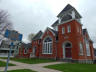
Early Church In Greene Marker
| On South Chenango Street. |
| On New York State Route 12. |
| On North Chenango Street, on the right. |
| On County Route 36 north of Marble Road, on the right when traveling north. |
| On County Route 5 at County Route 2, on the left when traveling west on County Route 5. |
| On New York State Route 8. |
| On New York State Route 8 at White Stone Road on State Route 8. |
| Near East Park Place at North Broad Street, on the right when traveling north. |
| On New York State Route 80, on the left when traveling east. |
| On Main Street, on the right when traveling east. |
| On New York State Route 26, 0.1 miles east of Pitcher Hill Road, on the left when traveling south. |
| On Route 26, 0.1 miles east of Pitcher Hill Road, on the right when traveling south. |
| On New York State Route 8, on the left when traveling north. |
| On County Route 21 at Cole Road, on the left when traveling west on County Route 21. |
| On Union Road (County Route 39) at Brown Road, on the right when traveling north on Union Road. |
| On Mace Chasm Road (County Route 71) 0.2 miles south of New York State Route 373, on the right when traveling south. |
| On Lake Shore Road north of Point Au Roche Road, on the right when traveling south. |
| On New York State Route 22B south of Mason Street, on the left when traveling south. |
| On New York State Route 22B, 0.3 miles north of Irish Settlement Road (County Route 32), on the right when traveling south. |
| On Hallock Hill Road, on the right when traveling east. |
| On Trinity Place west of City Hall Place (U.S. 9), on the right when traveling west. |
| On Champlain Street (U.S. 11) 0.1 miles west of Lake Street, on the right when traveling west. |
| On Pleasant Street (New York State Route 22B) at Norrisville Road (County Route 33), on the right when traveling south on Pleasant Street. |
| On U.S. 9 (New York State Route 9) north of Champlain Drive, on the right when traveling north. |
| On New York State Route 295, 1 mile west of New York State Route 22, on the right when traveling west. |
| On New York State Route 9H at Old Lane, on the left when traveling south on State Route 9H. |
| On U.S. 9, 0.1 miles north of Commons Road (County Route 6), on the left when traveling north. |
| On U.S. 9, 0.1 miles north of Commons Road (County Route 6), on the left when traveling north. |
| On New York State Route 9G, on the right when traveling north. |
| On Main Street (County Route 8) west of Viewmont Road, on the right when traveling east. |
| On Cakeout Turnpike (County Route 21) east of Schoolhouse Road, on the left when traveling east. |
| On Cemetery Road at Ghent-Mellenville Road (County Route 9), on the left when traveling east on Cemetery Road. |
| On Harlemville Road at Wolf Hill Road, on the right when traveling south on Harlemville Road. |
| On Hudson Street (New York State Route 21) at Silvester Street, on the right when traveling north on Hudson Street. |
| On Broad Street (New York State Route 9) at Church Street, on the right when traveling north on Broad Street. |
| On Wire Road at Half Circle Road, on the right on Wire Road. |
| On Wire Road at County Route 10, on the left when traveling south on Wire Road. |
| On Church Street east of Old Post Road, on the left when traveling east. |
| On County Route 19 at County Route 8, on the left when traveling south on County Route 19. |
| On County Route 7, 0.2 miles east of MacNeil Road, on the right when traveling west. |
| On South Street at New York State Route 203, on the left when traveling north on South Street. |
| On South Street at New York State Route 203, on the left when traveling north on South Street. |
| On South Street at New York State Route 203, on the left when traveling north on South Street. |
| On Church Street at High Street, on the right when traveling north on Church Street. |
| On Church Street at Luther Street, on the left when traveling north on Church Street. |
| On East Keeney Road (County Route 156) 0.9 miles north of Main Street (New York State Route 13), on the left when traveling north. |
| On Main Street (U.S. 11) south of Central Park Place, on the right when traveling south. |
| On South Main Street (U.S. 11) at Albany Street, on the right when traveling north on South Main Street. |
| On Main Street (New York State Route 221) west of Cortland Street/Broome Street (U.S. 11), on the right when traveling west. |
| On Spring Street south of Clinton Street, on the right when traveling south. |
| On Currie Road at U.S. 11, on the left when traveling west on Currie Road. |
| On Otisco Valley Road at Steger Road (County Route 108A), on the right when traveling south on Otisco Valley Road. |
| On Otisco Valley Road (County Route 103) at Wright Road, on the left when traveling south on Otisco Valley Road. |
| On Preble Road (County Route 108B) 0.1 miles east of New York State Route 281, on the left when traveling east. |
| On Taylor Valley Road (County Route 600) 0.9 miles east of Hawley Woods Road (County Route 159A), on the left when traveling west. |
| On New York State Route 26 at Town Line Road, on the left when traveling north on State Route 26. |
| On Church Street, on the right when traveling west. |
| On New York State Route 10 at Church Street, on the right when traveling south on State Route 10. |
| On New York State Route 19, on the left when traveling south. |
| On Elk Creek Road, 0.1 miles south of Meridale-Davenport Center Road (County Route 10), on the left when traveling south. |
| On Main Street (New York State Route 97) west of Pennsylvania Avenue, on the right when traveling west. |
| On Maple Avenue at Pine Street, on the right when traveling east on Maple Avenue. |
| On New York State Route 30 north of Lake Street, on the right when traveling south. |
| On Main Street (New York State Route 30) at Lake Street, on the right when traveling south on Main Street. |
| On Main Street (New York State Route 30) at Spruce Street, on the right when traveling south on Main Street. |
| On Grand Street west of Main Street, on the left when traveling west. |
| On Gardiner Place, on the left when traveling west. |
| On Main Street at Churchill Street, on the right when traveling east on Main Street. |
| On Salt Point Turnpike (New York State Route 115) at Firehouse lane, on the left when traveling north on Salt Point Turnpike. |
| On Salt Point Turnpike (New York State Route 115) north of Firehouse Lane, on the left when traveling north. |
| On Main Street (New York State Route 52), on the right when traveling west. |
| On New York State Route 52 at Old Main Street, on the right when traveling east on State Route 52. |
| On Holmes Road (County Route 30) 0.2 miles west of Route 292, on the left when traveling west. |
| On Beekman Road (County Route 9), on the left when traveling east. |
| On Albany Post Road (U.S. 9) at East Market Street, on the right when traveling north on Albany Post Road. |
| On Albany Post Road (U.S. 9) at East Market Street, on the right when traveling north on Albany Post Road. |
| On Albany Post Road (U.S. 9) 0.1 miles north of Circle Drive, on the right when traveling north. |
| On Freedom Plains Road (New York State Route 55) at Stringham Road, on the right when traveling east on Freedom Plains Road. |
| On Milan Hollow Road (County Route 15) 0.1 miles north of Pink Lane, on the right when traveling north. |
| On Franklin Avenue at Millbrook Hollow Lane, on the right when traveling east on Franklin Avenue. |
| On Maple Avenue at Merrit Avenue, on the right when traveling north on Maple Avenue. |
| On New York State Route 343 at Church Street, on the right when traveling west on State Route 343. |
| On North Avenue at St Joseph Drive, on the left when traveling north on North Avenue. |
| On Rudd Pond Road near Merwin Road, on the right when traveling south. |
| On Old Quaker Hill Road (County Route 66) 0.1 miles north of Kirby Hill Road, on the right when traveling north. |
| On Church Road, 0.2 miles south of Quaker Hill Road, on the right when traveling south. |
| On Dutcher Avenue at Henry Street, on the left when traveling north on Dutcher Avenue. |
| On Meeting House Road at Quaker Hill Road (County Route 66), on the left when traveling east on Meeting House Road. |
| On Meeting House Road at Quaker Hill Road (County Route 66), on the right when traveling east on Meeting House Road. |
| On Strever Farm Road, 0.4 miles north of New York State Route 82, on the right when traveling north. |
| On New York State Route 199, on the right when traveling west. |
| On Vassar Street at Mill Street, on the left when traveling north on Vassar Street. |
1168 entries matched your criteria. Entries 101 through 200 are listed above.
⊲ Previous 100 —
Next 100 ⊳