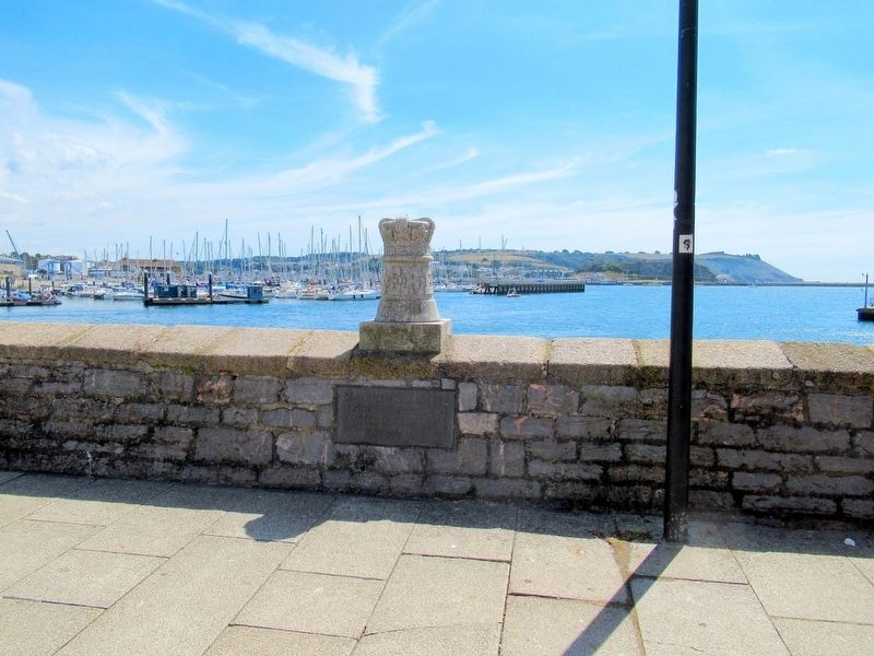
By Michael Herrick, August 4, 2018
Royal Visit Marker
| Near Commercial Road at The Barbican, on the right when traveling north. |
| On Osborne Place at Citadel Road, on the left when traveling south on Osborne Place. |
| Near Commercial Road at The Barbican, on the right when traveling north. |
| Near Queen Street at Wickham Street, on the left when traveling north. |
| Near Queen Street at Wickham Street, on the left when traveling north. |
| Near Route B2154 close to Clock Street, on the left when traveling north. |
| Near Queen Street at Wickham Street, on the left when traveling north. |
| Near Route B2154 at Clock Street, on the left when traveling north. |
| Near Route B2154 at Park Road, on the left when traveling north. |
| Near Anglesea Road (England Route A3) at Bishop Crispin Way, on the right when traveling north. |
| Near Queen Street at Wickham Street, on the left when traveling north. |
| Near Queen Street (Route B2154) at Wickham Street, on the left when traveling north. |
| Near Queen Street at Wickham Street, on the left when traveling north. |
| Near Queen Street at Wickham Street, on the left when traveling north. |
| Near Queen Street at Wickham Street, on the left when traveling north. |
| Near England Route B2154 at Park Road, on the left when traveling north. |
| Near Queen Street at Wickham Street, on the left when traveling north. |
| On Clarence Esplanade at Serpentine Road, on the left when traveling north on Clarence Esplanade. |
| Near Anglesea Road (England Route A3) at Bishop Crispin Way, on the right when traveling north. |
| Near Queen Street at Wickham Street, on the left when traveling north. |
| Near Anglesea Road (England Route A3) at Bishop Crispin Way, on the right when traveling north. |
| Near Anglesea Road (England Route A3) at Bishop Crispin Way, on the right when traveling north. |
| Near Anglesea Road (England Route A3) at Bishop Crispin Way, on the right when traveling north. |
| Near England Route B2154 at Park Road, on the left when traveling north. |
| Near England Route B2154 at Park Road, on the left when traveling north. |
| Near Anglesea Road (England Route A3) at Bishop Crispin Way, on the right when traveling north. |
| Near Queen Street at Wickham Street, on the left when traveling north. |
| On Clarence Esplanade at Pier Road, on the left when traveling north on Clarence Esplanade. |
| On England Route B2154 at St Georges Square, on the right when traveling north on State Route B2154. |
| On Route B2154 at St Georges Square, on the right on Route B2154. |
| On England Route B2154 at St Georges Square, on the right when traveling north on State Route B2154. |
| Near Queen Street at Wickham Street, on the left when traveling north. |
| Near Route B2154 at Clock Street, on the left when traveling north. |
| Near Route B2154 at Park Road, on the left when traveling north. |
| Near England Route B2154 at Park Road, on the left. |
| Near Queen Street at Wickham Street, on the left when traveling north. |
| Near Route B2154 close to Park Road, on the left when traveling north. |
| On Clarence Esplanade at Serpentine Road, on the right when traveling north on Clarence Esplanade. |
| On Clarence Esplanade at Serpentine Road, on the right when traveling north on Clarence Esplanade. |
| On Clarence Esplanade at Serpentine Road, on the right when traveling north on Clarence Esplanade. |
| On Clarence Esplanade at Serpentine Road, on the right when traveling north on Clarence Esplanade. |
| Near Route B2154 at Clock Street, on the left when traveling north. |
| Near Grand Parade at Penny Street, on the right when traveling south. |
| Near Queen Street (Route B2154) at Wickham Street, on the left when traveling north. |
| Near Queen Street at Wickham Street, on the left when traveling north. |
| Near Queen Street at Wickham Street, on the left when traveling north. |
| Near Queen Street close to Wickham Street, on the left when traveling north. |
| Near Route B2154 at Clock Street, on the left when traveling north. |
| On Queen Street (England Route B2154) at Clock Street, on the left when traveling north on Queen Street. |
| Near Clarence Esplanade at Serpentine Road, on the right when traveling north. |
| Near Queen Street at Wickham Street, on the left when traveling north. |
| Near Queen Street at Wickham Street, on the left when traveling north. |
| Near Route B2154 at Clock Street, on the left when traveling north. |
| On Riverbank at Hampton Court Way, on the left when traveling south on Riverbank. |
| On Quayside at Sandhill, on the left when traveling east on Quayside. |
| On Quayside close to Sandhill, on the left when traveling east. |
| On Quayside at Lombard Street, on the left when traveling east on Quayside. |
| Near Front Street at Pier Road, on the right when traveling east. |
| On Waterside, on the left when traveling west. |
161 entries matched your criteria. Entries 101 through 161 are listed above.
⊲ Previous 100
