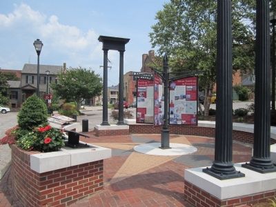
The Petersburg area has an extraordinarily rich African-American heritage. In 1625, most of the Africans in Virginia were servants at Flowerdew Hundred, nearby in Prince George County. In the 18th century, tens of thousands of newly enslaved . . . — — Map (db m57366) HM
Prince George County. Area 294 Square Miles. Formed in 1702 from Charles City, and named for Prince George of Denmark, husband of Queen Anne. The battles of the crater, 1864, and Fort Steadman, 1865, took place in this county. . . . — — Map (db m18920) HM
Prince George County. Area 294 Square Miles. Formed in 1702 from Charles City, and named for Prince George of Denmark, husband of Queen Anne. The battles of the crater, 1864, and Fort Steadman, 1865, took place in this county. . . . — — Map (db m18111) HM
Richard Bland (1710-1776), statesman and son of Richard and Elizabeth Randolph Bland of Jordan's Point, represented Prince George County in the House of Burgesses from 1742 to 1776. Between the 1750s and 1774, Bland played a leading role through . . . — — Map (db m18748) HM
Beginning in the late 1880's, this region of Prince George County along the Norfolk & Western Railway became the center of the first largest settlement of Czech and Slovak immigrants in Virginia. Originally known as Wells Station, then . . . — — Map (db m91748) HM
Prominent places in the colonial landscape Accotink Village: The town of Accotink was started as a 17th century meeting place. During the colonial period a gristmill and racetrack were located here. Pohick Church: Truro Parish was . . . — — Map (db m35118) HM
Virginia’s highway system took shape during the 1920s as automobile ownership expanded rapidly. State Route 52 was established in 1928 to connect Suffolk with Prince George County. In 1933, this road became part of the new U.S. 460 from Roanoke to . . . — — Map (db m103868) HM
Resistance to slavery took many forms – some more extreme and more cruel than others. In November 1834, house slave Judah, a 14 year-old, girl confessed to fatally poisoning three of Dr. Bayne’s children and attempting to set fire to Salubria, his . . . — — Map (db m117030) HM
The Petersburg Area. Throughout this area you will find attractions for the entire family, from museum houses and gardens to a zoo, from fine dining to camping, from Civil War Trails and battlefields to white-water kayaking.
Charles . . . — — Map (db m57322) HM
The Virginia General Assembly established Brunswick County in 1720 to encourage English settlement between the fall line and French outposts west of the Blue Ridge Mountains. Until 1732, when Brunswick’s court was constituted, residents attended . . . — — Map (db m180055) HM
The Petersburg Area. Throughout this area you will find attractions for the entire family, from museum houses and gardens to a zoo, from fine dining to camping, from Civil War Trails and battlefields to white-water . . . — — Map (db m310320) HM
Frederick County. Named for Frederick 5th and last Lord Baltimore. Erected out of Prince George’s County in 1748. It then included Montgomery County and all of Maryland west to the West Virginia boundary.
Washington County. The first . . . — — Map (db m41770) HM
Bird's Eye View of Alexandria, 1863
Ships that docked at Alexandria's bustling wharves carried tobacco all over the world and brought fine goods from Europe for wealthy Maryland planters.
Addison Family at National Harbor . . . — — Map (db m144024) HM
Arlington County in 1921
This 1921 aerial photograph shows the immediate surroundings and transportation networks of both the streetcar line and roads from Clarendon from Ballston. The Washington-Virginia Railway, successor to the Washington, . . . — — Map (db m145151) HM
Charles City County, named for King Charles I, was one of Virginia's eight original shires formed by 1634. It encompassed land south of the James River until 1702, when Prince George County was established. The courthouse was completed here in 1757. . . . — — Map (db m175947) HM
Just to the south stood Catalpa, where John Strode Barbour was born on 29 Dec. 1820. In 1849, he was appointed the state’s representative on the board of directors of the Orange and Alexandria Railroad. The board elected him president in 1851 and he . . . — — Map (db m288424) HM
African American Medal of Honor Recipients Memorial
The Medal of Honor takes its place in our country as the highest award for military valor. The honor, awarded by the President in the name of Congress, may only be accorded an . . . — — Map (db m173924) HM WM
Historic Sites Allegedly Connected to the Underground Railroad
Caleb Bentley and his son Richard Bentley owned and occupied Historic Bloomfield from the early 1800s until 1914. The Bentleys were Quaker farmers, entrepreneurs, and active . . . — — Map (db m188243) HM
Thomas Henry Ball was born in Northumberland County, Virginia, in 1819, the son of The Rev. David Thomas and Hannah Henry (Gaskins) Ball. Following in his father's footsteps, Ball became a Methodist minister. While serving his first congregation in . . . — — Map (db m129692) HM
The Berry Years
Prosperous planter Zachariah Berry owned thousands of acres in Prince George's County before purchasing Oxon Hill Manor from the Addison Family in 1810. Little is known about his activity on the estate–indeed, it . . . — — Map (db m127693) HM
1. Oxon Cove Farm & Oxon Hill Farm
Explore farm life and how it's changed over time by visiting the outbuildings and animal pens of a working farm, taking a wagon ride, and by participating in hands-on activities and living history . . . — — Map (db m202578) HM
At Hobkirk’s Hill the American army numbered between 1,200 and 1,500 men. Col. Otho Holland Williams’s brigade held the left of the line. It consisted of two Maryland Continental regiments commanded by Col. John Gunby and Lt. Col. Benjamin Ford, . . . — — Map (db m48268) HM
8000 — B.C. Indian occupancy.
1613 Sir Thomas Dale establishes area as “Bermuda Cittie.”
1619 — Name changes to Charles City Point.
1621 — Rev. Patrick Copeland plans to build free public school, financed by the East India Company.
1622 — . . . — — Map (db m19605) HM
As the summer of 1864 ended with Union Gen. U.S. Grant’s army still laying siege to Petersburg, Southern sources learned of a large herd of cattle being held at nearby Coggin’s Point on the James River. The cattle were grazing at “Beechwood,” the . . . — — Map (db m14773) HM
Wayland Seminary opened in Foggy Bottom just after the Civil War to train formerly enslaved people and others as “preachers and teachers for the South” and as missionaries to evangelize Africa. In 1875 it moved here, later merging . . . — — Map (db m130745) HM
William Sidney Pittman was born in Montgomery Alabama in 1875 to a laundress and an unknown father. At the age of seventeen, he began studying at Tuskegee Institute located in Tuskegee Alabama. He later attended Drexel Institute, Philadelphia . . . — — Map (db m143017) HM
In 1790, Prince George's County, along with the Commonwealth of Virginia, relinquished most of the land for the ten-mile square that would become Washington, D.C., the new Nation's Capital. George Washington chose a site on the Potomac and . . . — — Map (db m202683) HM
Only Black Slavery Was Legal in Maryland Maryland institutionalized the enslavement of Africans at the same time they were being shipped to this section of the Potomac Valley from St. Mary’s City, Port Tobacco, and Virginia. Indians and Whites . . . — — Map (db m75283) HM
Jordan's Parish
Charles City Co. 1657
Westover Parish 1688-1720
Now in Martin's Brandon Parish
Prince George County
Virginia
Episcopal-exterior original — — Map (db m301740) HM
In June 1864, Gen. U.S. Grant began to confine Gen. Robert E. Lee’s Army of Northern Virginia within the Richmond and Petersburg defenses. The South Side R.R., connecting Petersburg and Lynchburg, and the Richmond and Danville R.R. supplied Lee’s . . . — — Map (db m14771) HM
More than any other person, John W. Greene is credited with the success and enduring legacy of Columbia Air Center. Greene was a pioneering aviator, airplane mechanic and teacher. He managed Columbia Air Center from 1941 to 1954.
Greene was . . . — — Map (db m183960) HM
Education for the children was an important concern for the community. In 1910, there were 100 children living in the community, but no school. The first school opened in 1909 in a frame house on 59th Avenue with Carrie Griffin as the first . . . — — Map (db m302888) HM
Home of the Digges Family
(descendants of Edward Digges,
governor of Virginia, 1652–1668)
The most intimate friend of
George and Martha Washington
in Prince George’s County,
where they visited many times. . . . — — Map (db m3663) HM
“It was indeed a day and night of horrors, the fleet … lay directly before our house.”
Mary DeButts, writing to her sister Millicent on March 18, 1815.
From this farm, Mary DeButts saw a small fleet on the Potomac . . . — — Map (db m48959) HM
When Maryland's governor ordered the chapel door locked in 1704 and the legislature passed the Act to Prevent the Growth of Popery, a new chapter in religion began in the colony. Catholics were barred from holding office and voting, were . . . — — Map (db m190032) HM
To those who made the Supreme Sacrifice in the services of their country in World Wars I and II from Prince George County, Virginia
World War I
White
Timothy B. Gogle • Roy Ellis • Harvey F. D. Tatum
Colored
James Wooden . . . — — Map (db m149577) WM
"I knew him when he was drafted for the war, and I knew him when he came back ... He had a soldier's clothes on when he came back, with a gun, canteen, knap sack and blanket."-- Lloyd Mudd, testifying to U.S. Pension officials about . . . — — Map (db m112866) HM
A Plantation Society
Settlers to the New World came in search of gold, but what they found was a rugged landscape whose humbler natural resources would prove to be the greatest source of wealth. Timber, furs, and metal ores that had . . . — — Map (db m229194) HM
On this site stood the Wilson family homestead, which was built in the early 1900s after an earlier family home was destroyed by fire. It was the home of Georgianna Cornelia Wallis and Joseph Percy Wilson, the grandparents of the last generation of . . . — — Map (db m202764) HM
Born in Pennsylvania about 1736. Served in Virginia Provincial Forces against Indians. Vestryman of the Parish-Church Warden. Chairman County Court. Major Orange County Militia. Member North Carolina Assembly, 1760-1768. Instrumental in establishing . . . — — Map (db m286315) HM
Welcome to Government Island. This 17-acre historic site is an early American quarry originally named Brent’s Island or Wiggington’s Island. As early as 1694, stone was quarried from this site for use as architectural trim in Colonial America. . . . — — Map (db m39550) HM
Thin black lines indicate changes in relevance. Between each pair of lines entries are ordered geographically but all have the same relevance.
* Inflectional forms of words are their plurals, singulars, and possessives as well as gramatical tenses and similar variations.