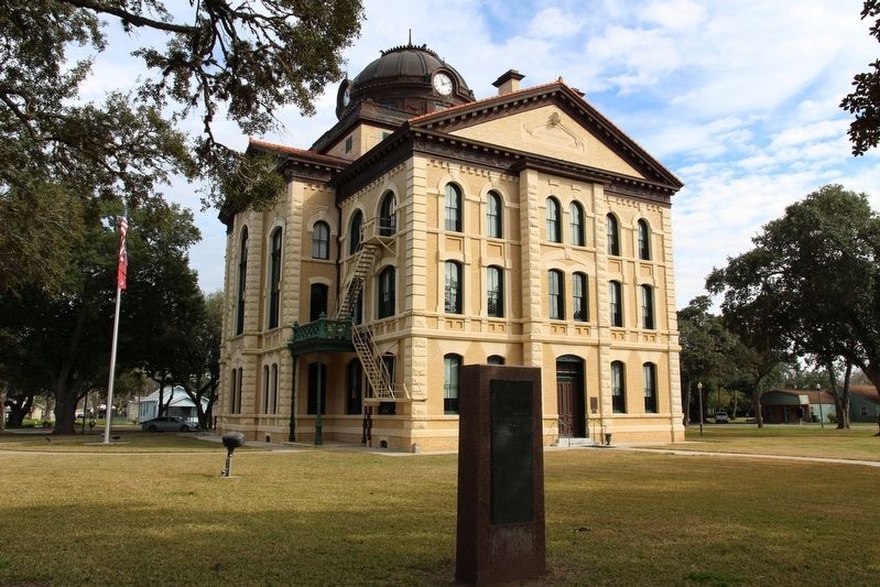
On Milam Street (State Highway 52 Spur), on the right when traveling north.
Site of projected capitol of
Stephen F. Austin's colony, 1823.
First settlement at this point shown on
Stephen F. Austin's map of 1835 as Montezuma.
The municipality of Colorado was created by the
provisional government of Texas . . . — — Map (db m130393) HM
On McElroy Lane 1 mile north of San Felipe Road (County Highway 31), on the right when traveling north.
Pioneer, farmer, soldier, and county official Mike Muckleroy was born in Franklin County, Tennessee, and came to Texas in 1840. An early and long-time resident of Colorado County, he came to be affectionately known throughout the area as "Uncle . . . — — Map (db m176234) HM
On Business State Highway 71 at Robson, on the right when traveling north on State Highway 71Business .
Robert Robson (1804-1878), one of many Scotsmen seeking fortune in North America, came to the Texas Republic in 1839. On land he owned at this site, he built a concrete "castle," using native lime and gravel. It had running water, pumped from the . . . — — Map (db m28325) HM
Near Live Oak Street (Farm to Market Road 1457) at Main Street.
Bernard Scherrer left his native Switzerland at the age of 22 for extended travels before reaching Texas in 1833. After serving in Burleson's Regiment during the Texas Revolution, he received a land grant in Colorado County, but settled in Biegel . . . — — Map (db m201940) HM
On Bowie Street at Preston Street, on the left when traveling north on Bowie Street.
District Clerk for 38 years in Colorado County. Born in Illinois. Educated as a teacher, came to Texas (1899) in that profession. Moved to Columbus (1904) and became clerk in 1908. This house that he and his wife Emma (Buescher) built in 1914 . . . — — Map (db m176276) HM
On Brunes Mill Road at Dungens Mill Road, on the right when traveling south on Brunes Mill Road.
Napoleon B. Breeding purchased this land from the Republic of Texas in May 1837, soon after Colorado County organized. German immigrants were among the early settlers of Frelsburg and this area, which was later called Brushy Community. John . . . — — Map (db m301165) HM
Near Landa Park Drive at Monument Drive, on the right when traveling north.
Panel 1
The first German settlements in Texas were Industry in Austin County, founded by Friedrich Ernst in 1831, Biegel in Fayette County, founded by Joseph Biegel in 1832, Cat Spring in Austin County, founded by the von Roeder, Kleberg, . . . — — Map (db m210312) HM
On Bay Street North at 14th Avenue North, on the right when traveling north on Bay Street North.
Virginia native William Jefferson Jones received his license to practice law at age 19. He was an associate of Mirabeau B. Lamar, future president of the Republic of Texas, in a Georgia newspaper enterprise. Urged by Lamar to move to Texas, Jones . . . — — Map (db m50275) HM
On Milam Street (State Highway 52) at Houston Street, on the right when traveling south on Milam Street.
Pioneers Asa and Rebecca Townsend came to the Republic of Texas in February 1838 and were granted 640 acres in Colorado County. Their son, James Light Townsend (1845-1894) and his second wife, Margaret Alice Cummins, made their first home on a . . . — — Map (db m178970) HM
On Walnut Street (U.S. 90), on the right when traveling east.
William L. Menefee, born ca. 1796 in Knox County, Tennessee, served in the Tennessee Militia in the War of 1812. He studied law and was admitted to the bar sometime prior to 1824 when he moved to Alabama. In 1830 he and his wife Agnes (Sutherland) . . . — — Map (db m130391) HM
On Farm to Market Road 155 at Anton Salas Loop, on the left when traveling north on Road 155.
(obverse)
First ferry in present-day Fayette County. Established about 1824 at the crossing of the La Bahia Road by Jesse Burnam. After the Army of the Republic of Texas crossed on March 19, 1836, the ferry was destroyed by order of General . . . — — Map (db m53220) HM
On West FM 1161 Road (Farm to Market Road 1161) 0.4 miles east of Farm to Market Road 102, on the right when traveling east.
A crossroads for trade and travel in the earliest years of Anglo settlement in Texas, Egypt is considered the oldest remaining community in Wharton County. In 1826, Eli Mercer established a home and ferry crossing on the east bank of the Colorado . . . — — Map (db m308402) HM
On East Bolling Highway (Farm to Market Road 1301) east of Junior College Boulevard, on the left when traveling east.
Included in a land grant awarded in 1824 to Martin Allen, one of Stephen F. Austin's "Old Three Hundred" colonists, this property has had a long and varied history. In the 1840s Allen's heirs sold most of his land to Albert Clinton Horton, Wharton . . . — — Map (db m96304) HM
On Bowie Street north of Washington Street, on the left when traveling north.
Texas struggle for independence from Mexico peaked with the fall of the Alamo in March 1836. As the Mexican Army swept across Texas, Sam Houston ordered the evacuation of colonists. He ordered the burning of cabins and buildings to avoid giving aid . . . — — Map (db m244144) HM
On County Road 356B 0.1 miles north of County Road 357, on the left when traveling north.
On June 25, 1886, H.J. Strunk, a resident of Colorado County, Texas, sold five acres of land for use as a school and cemetery to the Shinerville School community, originally named for area landowner H.B. Shiner. Residents funded, built and staffed . . . — — Map (db m291820) HM
On Washington Street at Travis Street, on the right when traveling west on Washington Street.
Born in South Carolina, Asa Townsend was reared in Georgia, where he married Rebecca Harper (1805-1857). They moved from Florida to Colorado County in 1838 with their large family. An active civic leader, Townsend served on the committee to adopt . . . — — Map (db m243020) HM
On State Highway 118 2.9 miles south of Farm to Market Road 170, on the right when traveling south.
Everett Ewing Townsend, called the "father of the Big Bend National Park," was instrumental in initiating, promoting and finally bringing into reality the idea of a public park along the Big Bend of Texas' Rio Grande.
Townsend was born on . . . — — Map (db m218918) HM
On Walnut Street (U.S. 90) at Travis Street, on the left when traveling west on Walnut Street.
Following the American Civil War and emancipation of slaves in 1865, it
was not until 1871 that African Americans in Texas were able to
uniformly register to vote, following the ratification of the 15th
Amendment to the U.S. Constitution. . . . — — Map (db m314163) HM
On Milam Street at 3rd Avenue, on the left when traveling north on Milam Street.
Virginia native Friench Simpson (1848-1923) came to Colorado County in the 1860s. A farmer, banker, Columbus mayor, state senator, and poet, Simpson had this home built for his family in 1882. After 1916, it became the home of Dr. C.A. Williamson . . . — — Map (db m176540) HM
On Farm to Market Road 102 0.5 miles south of Carter Walker Lane, on the left when traveling south.
The Sugar Industry, which began in Texas before the Civil War (1861-65), was revived in the late 1800s by cheaper refining methods. One of the leading sugar producers in Colorado County was William Dunovant. In 1898 he and several men from Eagle . . . — — Map (db m292029) HM
On Arthur Street at Burford Street, on the right when traveling south on Arthur Street.
Founded in 1901, the town of Garwood is located on land once occupied by Preston Gilbert, one of Stephen F. Austin's "Old 300" colonists, who acquired the acreage in 1827. In 1896, Marcus Hervy Townsend, Thomas A. Hill, and William Thomas Burford . . . — — Map (db m192871) HM
On Alleyton Road (County Road 268) 0.1 miles west of Farm to Market Road 102, on the right when traveling east.
Alleyton was settled by brothers Rawson, Abraham, John and Thomas Alley ca. 1822; William Alley joined his brothers in 1824. William donated a portion of his property in 1859 for right of way for the Buffalo Bayou, Brazos and Colorado Railway, and . . . — — Map (db m143993) HM
On Montezuma Street at Cardinal Lane when traveling west on Montezuma Street.
John Toliver deeded a tract of land to Columbus Lodge No. 51 Independent Order of Odd Fellows. In July 1871 for use as a cemetery among the first to be interred here were victims of the 1873 yellow fever epidemic. Including George W. Smith . . . — — Map (db m156705) HM
On Milam Street (State Highway 52) at Wallace Street, on the right when traveling south on Milam Street.
Jesse H. Johnson, born in Clarksburg, West Virginia, came to Texas in 1868 and settled here in Columbus, Colorado County. In May 1869 he was appointed Sheriff of Colorado County, a position he held until the end of that year. Johnson became a part . . . — — Map (db m178962) HM
South Carolina native Dillard Cooper came to Texas in Jan. 1836 with Capt. John Shackelford's Red Rovers, landing at Copano Bay and joining Col. James Fannin's command. Following the Texians' defeat at the Battle of Coleto Creek on March 20, the . . . — — Map (db m238502) HM
Near Locust Street at Main Street (Business U.S. 82).
During the 4 years, 4 months after secession, Texas sent 18 lawmakers to the Confederate capitols. Her delegates to the Provisional Congress, Feb. 1861 to Feb. 1862, were John R. Gregg, Freestone County; John Hemphill, Travis County; Wm. B. . . . — — Map (db m96899) HM
On Wallace Street at Milam Street (State Highway 52 Spur), on the right when traveling west on Wallace Street.
Home begun 1856, with slave labor, by Chas. Wm. Tait, military surgeon, surveyor; Texas Legislator, planter. After Civil War duty in 4th Texas Cavalry, finished home. Cottonwood siding. Handmolded brick in the four chimneys and basement. . . . — — Map (db m178953) HM
On Spring Street at Milam Street, on the right when traveling west on Spring Street.
Formed in 1836 and organized in 1837, Colorado County is one of the original counties of the Republic of Texas. In December 1836, the First Congress of the Republic elected Robert M. Williamson judge of the Third Judicial District, automatically . . . — — Map (db m179375) HM
On Milam Street at 3rd Avenue, on the right when traveling north on Milam Street.
An 1860s frontier cottage of cypress and pine, with locally made bricks in foundations.
At first owned by James Hodges; bought 1875 by James H. Simpson, county's first banker; then sold in 1896 to Charles J.G. Leesemann, 1904-08 Colorado . . . — — Map (db m176544) HM
On Farm to Market Road 1291 0.1 miles west of McElroy Lane, on the right when traveling west.
In 1857, community founder and German native, Capt. Wilhelm Frels, donated 3.9 acres at this site for the establishment of a Lutheran Church and cemetery. Members of the Frels, Becker and Fehrenkamp families, as well as other early settlers, are . . . — — Map (db m176230) HM
On Old Nada Road at County Highway 115, on the right when traveling north on Old Nada Road.
Located on land once included in Stephen F. Austin's colony, the community of Nada was first settled in the 1880s by German and Czech immigrants. John William Schoellmann brought his family here from nearby Frelsburg in 1881. He built the area's . . . — — Map (db m192880) HM
On State Highway 71 at County Highway 115, on the right when traveling north on State Highway 71.
The post office in Nada was established in 1894 when William J. Engbrock, Jr., was appointed the first postmaster. The post office was located in the general store owned by his father, William Engbrock, Sr., until 1898.
Subsequent locations of . . . — — Map (db m192876) HM
On Farm to Market Road 532 at Silver Street, on the right when traveling south on Highway 532.
Originally known as Prairie Point, a town was platted at this site in 1856 by A.C. Hereford. A native of Virginia, Hereford was a veteran of the Mexican War who had arrived in this area in the early 1850s.
Located on part of the original James . . . — — Map (db m206223) HM
On Farm to Market Road 532 at Silver Street, on the right when traveling south on Highway 532.
Founded in 1882, the Oakland Normal School provided professional training for black school teachers for three decades. G.R. Townsend served as first principal, but for most of the school's existence it was directed by Robert L. Smith, a respected . . . — — Map (db m206222) HM
On County Route 3000, on the right when traveling north.
German natives who settled originally in Colorado County came here in 1879 looking for better land. Pleased with the soil and location, they brought their families and immediately purchased 100 acres for a church and school. The earliest Mass was . . . — — Map (db m125272) HM
On Bohlman Avenue at Black Street, on the right when traveling south on Bohlman Avenue.
This log cabin erected at Industry, Austin Co. Texas in 1835 by Jacob Wolters. Moved to Wolters Park in Schulenburg, Texas, by the Wolters-Herder Family Ass'n. in August 1941. Dedicated on June 14, 1942 to the memory of past generations, to the . . . — — Map (db m163213) HM
Thin black lines indicate changes in relevance. Between each pair of lines entries are ordered geographically but all have the same relevance.
* Inflectional forms of words are their plurals, singulars, and possessives as well as gramatical tenses and similar variations.