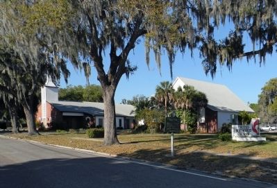
On 15th Street East at 4th Avenue East, on the right when traveling north on 15th Street East.
Marker Front: Manatee County was created by legislative action signed January 9, 1855, from Hillsborough, St. Lucie, and Monroe Counties. Five years later, in 1860, Josiah Gates and Mary, his wife, deeded to Manatee County a parcel of land . . . — — Map (db m72425) HM
Near Manatee Avenue West (Florida Route 64) at 12th Street West, on the left when traveling west.
Chips Shore (1941-2015) was the Manatee County Clerk of Circuit Court and Comptroller for 38 years (1977-2015). He was very proud to be a native of Manatee County, Florida and loved the outdoor environment that makes our community unique. He knew . . . — — Map (db m217044) HM
On Rye Wilderness Road 1 mile east of North Rye Road, on the left when traveling east.
Rye was once a thriving settlement along the Manatee River named after Erasmus Rye, who moved to the area in the mid-1840s from Hanover County, Virginia. In 1861, Erasmus married Mary Lucebia Williams, whose family owned the largest homestead in . . . — — Map (db m214570) HM
On East Oak Street at Brevard Avenue (U.S. 17), on the left when traveling east on East Oak Street.
Named after the great Spanish conquistador and Florida explorer Hernando De Soto, the county was created out of Manatee County in 1887. The area's original inhabitants were Caloosa Indians. In early Florida history the region was the scene of . . . — — Map (db m72534) HM
On North Bay Boulevard 0.3 miles north of Pine Avenue, on the right when traveling north.
In May 1894, Anna Maria Island's first modern-day pioneer -- George Emerson Bean -- took up a homestead, signed by President Wm. McKinley, that embraced the island's entire north point. Other daring settlers, such as Samuel C. Cobb and John R. . . . — — Map (db m72419) HM
Near 3rd Avenue Northwest at 43rd Street Northwest, on the right when traveling west.
Adams Cemetery, once known as the Fogartyville Colored Cemetery, began in 1896 when William H. and Eliza Atzeroth Forgarty donated four acres of land to the community for use as a public cemetery. The cemetery’s earliest marker is the final resting . . . — — Map (db m100900) HM
On 14th Street East at 2nd Avenue East on 14th Street East.
Here flowed a spring which had been used by Indians and was found by Manatee's first white settler, Josiah Gates, who settled nearby in January 1842. It served Branch Fort, when the early settlers camped nearby for protection from the Seminole raid . . . — — Map (db m72422) HM
On 25th Street West at 2nd Avenue West, on the left when traveling east on 25th Street West.
Palmetto’s historic Memphis neighborhood was originally plotted in 1904 by Robert F. Willis who sold lots to “a number of very desirable people” who built homes in what he named the “Town of Memphis” after his hometown in . . . — — Map (db m100898) HM
On 10th Avenue West at Riverside Drive, on the right when traveling south on 10th Avenue West.
(side 1)
S.S. Lamb came here with his family from Mississippi in a covered wagon and barouche and purchased this property on February 3, 1868. Lamb laid out and named Palmetto. The Lamb home, which stood about 100 yards west of here, was . . . — — Map (db m100922) HM
Near 17th Street West 0.2 miles west of 57th Terrace West, on the left when traveling west.
A Living Record of the Past
Exploring the temple mound and shell middens at Emerson Point is a fascinating excursion into Manatee County's past — even before the time of recorded history! Once home to thriving communities of American . . . — — Map (db m277652) HM
In 1866, three brothers, John, Bartholomew, and Bill Fogarty, settled in Manatee County and established a ship building and coastal trading schooner base on the shore of the Manatee River. In the years before automobiles and railroads, Manatee . . . — — Map (db m43104) HM
Near Manatee Avenue East (State Road 64) at 14th Street East.
The Manatee Village Historical Park was created as a gift to the people of Manatee County by the Historical Commission and the HOME Committee in remembrance of our Nation's Two Hundredth Birthday in the year 1976. Two historical buildings, Manatee . . . — — Map (db m43100) HM
Near Desoto Memorial Highway (75th Street NW) 0.2 miles north of 24th Avenue NW.
The Hernando de Soto Catholic Memorial, also known as the Holy Eucharist Monument, and the Memorial Cross, just across the bridge from here, are owned by the Catholic Diocese of Venice, Florida. The base stone of this monument was quarried and cut . . . — — Map (db m125790) HM
Near Manatee Avenue, on the right when traveling west.
Florida's endemic species are plants and animals found nowhere else in the world. One example is the endangered Florida goldenaster whose range consists of five Florida counties: Pinellas, Hillsborough, Manatee, Hardee, and Highlands Counties. . . . — — Map (db m275612) HM
Side 1:
The Naval stores industry, as the name implies, was once the backbone of every nations navy. The wood, tar, caulk, and other materials derived from the pine tree were needed to build, repair and waterproof wooden ships. America . . . — — Map (db m131054) HM
Manatee County's first Courthouse was built in 1859-1860, and is the oldest remaining building constructed as a county courthouse in the State of Florida. It was built on the original Courthouse Square at 15th Street East and Fourth Avenue, two . . . — — Map (db m43101) HM
Near 119th Street W. south of Cortez Road W. ( Highway 684), on the left when traveling south.
Settlers from North Carolina arrived in this area in the late 1800s and began to create a waterfront community. Two families, the Brattons and the Burtons, played important roles in the development of Cortez. The Bratton family built a dock so . . . — — Map (db m307950) HM
On Forest Creek Trail just north of Hidden Forest Loop, on the right when traveling south.
William Iredell Turner was born in Richmond, Virgina and grew up in Alachua County, Florida, where he spent his early adulthood as a cattle rancher. He became a major with the Florida Volunteers in the Second Seminole War (1835-1842). He later . . . — — Map (db m200001) HM
On 119th Street W. south of Cortez Road W. ( Highway 684), on the left when traveling south.
This 1912 Cortez Rural Graded Schoolhouse originally housed three classrooms for grades 1-8. A 1933 Public Works Project addition turned the middle classroom into an auditorium, identifiable by its pitched roof in contrast to the flat . . . — — Map (db m305504) HM
On Manasota Key Road at Manasota Beach Road, on the right when traveling south on Manasota Key Road.
After the Civil War, many Georgians moved their families to Southern Florida. Joseph Daniel "Jody" Anderson, born in Georgia in 1867, was a child when his father moved to the Tampa/Sara Sota area. In 1884, Joseph became the head of the Anderson . . . — — Map (db m156335) HM
Near 119th Street W south of Cortez Road W. ( Highway 684), on the left when traveling south.
Roseatte [sic] Spoonbill
Blue Heron
Yesterday in Cortez
County Uses Dragline To Fight Mosquitoes
Manatee County Anti-Mosquito Control District's specially designed dragline is shown . . . — — Map (db m313622) HM
On 15th Street East north of 2nd Avenue East, on the right when traveling north.
Marker Front: Located a few yards from this spot near the banks of the Manatee River is the site of the log home of Josiah Gates. Gates was the first Anglo-American settler in the entire Manatee area which at that time extended southward . . . — — Map (db m72426) HM
Near Desoto Memorial Highway (75th Street NW) at 24th Avenue NW, on the right when traveling north.
Riverview Pointe and De Soto National Memorial are part of the Shaw's Point Archeological District. This thirty-five-acre archeological district is on the National Register of Historic Places and preserves a large prehistoric coastal village site . . . — — Map (db m125370) HM
Near 119th Street W. at Cortez Road W. ( Highway 684), on the left when traveling south.
Cortez and nearby communities were settled by people who relied on boats. They caught fish from the sea to eat and sell. Their supplies, mail, and visitors arrived on sailboats and steamboats. They also established boatyards to build, repair, . . . — — Map (db m298719) HM
Near 10th Avenue West at 6th Street West, on the right when traveling south.
The Cottage Museum, a typical 1900 family home, has been refurbished with the help of families who lived there. Josephine Harrison and the members of the Heritage Doll Club were actively involved in establishing the Cottage Museum.
The . . . — — Map (db m146782) HM
On Interstate 275 2.4 miles north of Terra Ceia, on the right when traveling north.
De Soto National Memorial in Manatee County preserves a pivotal moment in American history: the 1539 landing of Spanish conquistador Hernando de Soto and his 600-man expedition, the first large-scale European incursion into the Southeast. The . . . — — Map (db m305508) HM
Near Manatee Avenue East (State Road 64) at 14th Street East.
A prime example of the “Cracker Gothic” style, this home was built in 1912 by the Will Stephens family. It is an excellent representation of a Florida rural frame house during the period between the 1870's and World War I. This third . . . — — Map (db m43106) HM
On 17th Street West 0.2 miles east of 57th Terrace West, on the left when traveling west.
800? - AD 1500:
Occupation by Amerindian peoples, possibly Timucans, builders of the temple mound and village middens. Throughout their time here, Amerindians used the natural resources of their environment under a complex spiritual and . . . — — Map (db m277695) HM
On 12th Street 0.1 miles east of North Tamiami Trail (U.S. 41), on the right when traveling east.
In 1882 this "handsome residence" was under construction for Alfred and Mary Bidwell on land Mary purchased from the State of Florida for one dollar an acre. Before construction the Bidwell's apparently occupied the detached kitchen-dining room . . . — — Map (db m97086) HM
On Riverview Boulevard 0.1 miles east of 59th Street West, on the left when traveling east.
Marker Front:
In 1868, firearms manufacturer James Warner moved his family from Springfield, Massachusetts, to Manatee County, where he hoped to regain his health. He built a home on the shore of the Manatee River about half a mile east . . . — — Map (db m72427) HM
On Manatee Avenue East at 9th Street East, on the right when traveling west on Manatee Avenue East.
Side A The Town of Manatee was officially chartered on June 19, 1903. This intersection of Central Street (present day 9th Street East) and Manatee Avenue became the heart of the town’s business district after the arrival of the Florida West . . . — — Map (db m32409) HM
On 17th Street West 0.2 miles east of 57th Terrace West, on the left when traveling west.
When is an apple a cactus? When the plant in question is the aboriginal prickly-apple, Harrisia aboriginum. This cactus was first described by John Kunkel Small in 1920 from a sample he discovered on Terra Ceia Island in northern Manatee . . . — — Map (db m277677) HM
On Honore Avenue just south of Sawgrass Road, on the right when traveling north.
(Side 1)
Fruitville Elementary School, the largest elementary school in Sarasota County in 1989, began as a converted corn crib in the late 1880's. Charles L. Reaves, a pioneer of the Fruitville area with his wife Martha Tatum of Tatum . . . — — Map (db m150432) HM
On Fruitville Road (Florida Route 780) at Bearded Oaks Drive, on the right when traveling west on Fruitville Road.
Lynching in America. Racial terror lynchings between 1865 and 1950 claimed the lives of at least 6,500 Black people and terrorized millions more. Racial hierarchy persisted after the Civil War and Emancipation, resulting in . . . — — Map (db m246801) HM
On 12th Street West at 3rd Avenue West, on the right when traveling south on 12th Street West.
(side 1)
In April of 1915, twenty-two year old Robert M. Beall opened a simple dry goods store on this block of Old Main Street. Pricing nothing over a dollar, he named it the Dollar Limit. Beall invested his money in merchandise so when . . . — — Map (db m100947) HM
On 17th Street East at 3rd Avenue East, on the right when traveling north on 17th Street East.
(side 1)
Edmund Lee Family Graveyard and the Lonesome Grave
According to local history, members of the Lee family are buried here. Rev. Edmund Lee, a Presbyterian Minister, his wife Electa, and their daughter Sarah, came to the . . . — — Map (db m112518) HM
On 119th Street West at 45th Avenue West, on the left when traveling south on 119th Street West.
(side 1)
The 1890 Bratton Store
In the 1890s, William C. Bratton built the first commercial building at Hunter's Point, the original name of the area eventually to be called Cortez. The building served as post office, general store . . . — — Map (db m112519) HM
On 46th Avenue West at 123rd Street Court West, on the left when traveling west on 46th Avenue West.
(Side 1)
Origin of the name CORTEZ cannot be proved but is thought to have begun with the inhabitants of a Spanish fishing "rancho" in this vicinity. The area was known as "Hunter's Point" to local residents until the 1880's. This is borne . . . — — Map (db m102971) HM
On 17th Street East at 3rd Avenue East, on the right when traveling east on 17th Street East.
(side 1)
Lincoln Memorial High School was established in 1949 and served as the only public high school in Manatee County to allow colored children to attend until it closed in 1969 in order to complete the desegregation of Manatee County's . . . — — Map (db m102467) HM
Near 17th Street West 0.2 miles west of 57th Terrace West, on the left when traveling west.
In 1866, after release from a Union prison, Major Robert Stewart Griffith homesteaded here, building a small wooden house and planting banana and citrus trees. In 1869, two years after his marriage to Anna Webb of Spanish Point in Osprey, their . . . — — Map (db m277581) HM
On Manatee Avenue West (State Road 64) just west of 11th Street West, on the left when traveling west.
(side 1)
In 1892, John Crews Pelot deeded this 200 x 400 square foot parcel of land to Manatee County for the sum of $200.00. The land was cleared at a cost of $62.50, and a new courthouse, the first in "Braidentown" and the county's third . . . — — Map (db m100948) HM
On 15th Street West at 4th Avenue West, on the right when traveling north on 15th Street West.
(Side 1)
This Carnegie Library was built in 1918 with funds from the Carnegie Corporation. It is one of the 1,946 Carnegie Libraries built in the United States under the direction of Andrew Carnegie, a Scottish immigrant who rose from . . . — — Map (db m81714) HM
On 6th Street West at 16th Avenue West, on the left when traveling west on 6th Street West.
Side 1
The Tresca home was established in 1946 at this location by Major Wm. Warren and Annie H. Tresca. They met in Oklahoma where Warren was recovering from serious injuries suffered while serving in France during WWII and Annie was serving in . . . — — Map (db m200403) HM
On Main Street east of South Washington Boulevard (U.S. 301), on the right when traveling east.
Side 1
On July 1, 1921, Sarasota County came into existence. Interest in breaking away from Manatee County had led to a series of public meetings the previous summer. Lack of good roads, inadequate representation in Tallahassee, and . . . — — Map (db m146106) HM
On McIntosh Road at Proctor Road, on the right when traveling south on McIntosh Road.
Side 1
In 1915, Bee Ridge, then part of Manatee County, supported a train station, post office, hotel, general store, and school. A second wave of settlers who moved into Bee Ridge desired a church in their community. In January, 1917, the . . . — — Map (db m135978) HM
Thin black lines indicate changes in relevance. Between each pair of lines entries are ordered geographically but all have the same relevance.
* Inflectional forms of words are their plurals, singulars, and possessives as well as gramatical tenses and similar variations.