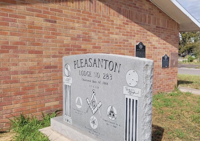
On North Main Street at Virginia Street, on the left when traveling north on North Main Street.
Peter Tumlinson was 19 years old when his family moved to Texas in 1821. During an 1823 skirmish with Waco Indians, his father, John Jackson Tumlinson, became the first Texas Ranger to die in the line of duty. Peter followed his father into the . . . — — Map (db m260099) HM
On Verdi Road 1 mile west of Farm to Market Road 3006, on the right when traveling west.
Brite Cemetery has served citizens of Atascosa County since the 1850s. It was formally set aside when Thomas Ransdele Brite passed away in 1859, though the earliest marked burial is that of his infant son, Dan (d. 1854). Thomas Brite was born in . . . — — Map (db m56588) HM
On Verdi Road 1 mile west of Farm to Market Road 3006.
Born in Williamson County, Tennessee, in 1827, Robert E. Neill migrated with his family to what is now Caldwell County, Texas, at the age of four. At age nine, while grinding corn meal for the Texas Army, he suffered a crushing injury that crippled . . . — — Map (db m260132) HM
On Saint Francis Avenue north of Campbell Blvd, on the right when traveling north.
Atascosa County was created from Bexar County in 1856 by the Sixth Legislature of Texas. The town was named after John Campbell who came to Texas from Ireland as a boy with his parents. John Campbell first came to Atascosa County around 1857 and . . . — — Map (db m261711) HM
On Oak Street (State Highway 97) 0.2 miles east of Jourdanton Avenue, on the right when traveling east.
R. R. "Railroad" Smith (1880-1944) was born in Gonzales County to Alexander Frohock and Mary McGill (Mathews) Smith. Around 1907, Smith moved to Atascosa County where he opened up a law practice and entered into the newspaper business with a cousin. . . . — — Map (db m56668) HM
On North Main Street at West Goodwin Street, on the left when traveling south on North Main Street.
Named for early Texas settler John Pleasants, by John Bowen (d.1867), San Antonio's first Anglo-American postmaster. Bowen, assisted financially by associate Henry L. Radaz, in Sept. 1858 founded this town at the juncture of Atascosa River and . . . — — Map (db m56599) HM
On Verdi Road 1 mile west of Farm to Market Road 3006.
Thomas Ransdell Brite was born in 1824 in Callaway County, Missouri. His family moved to Bastrop County when he was 16. In 1842, when Mexican armies invaded Texas, Thomas volunteered to serve in the Vasquez, Woll and Somervell campaigns in the . . . — — Map (db m260134) HM
On 2nd Street (U.S. 281) at Settlers Xing, on the left when traveling north on 2nd Street.
Although Poteet is well known for growing strawberries, farmers have enjoyed much success with harvesting peanuts as well. The first peanuts were grown in Atascosa County in the early 1900s. Harvesting was a hand-picked operation until the 1930s, . . . — — Map (db m291015) HM
On Main Street at Live Oak Street, on the right when traveling south on Main Street.
A pioneer in settling of southwest Texas. Born in South Carolina; married Mary Jane Mason. Moved in 1840's to Alabama, then to Mississippi. With wife and 6 children came in 1855 by ox-wagon and horse-drawn hack to Texas. After a year in Lockhart, . . . — — Map (db m152036) HM
T.H. Zanderson and city namesake Jourdan Campbell bought the 40,000-acre Toby Ranch in 1907 and laid out the town of Jourdanton. The original plat included two blocks designated for use as a cemetery. The Artesian Belt Railroad built through the . . . — — Map (db m56665) HM
On Farm to Market Road 3175, on the right when traveling west.
First public cemetery in this community, which was famous in early days for its outstanding school, aggressive businesses, and newspaper, the Benton City "Era." Site was given by James M. Jones, farmer-livestock raiser and leading citizen, whose . . . — — Map (db m56587) HM
On E Gates Valley Road at Mangum Road, on the right when traveling east on E Gates Valley Road.
William Norwood (W.N.) Gates (1818-1903) was born in Madison County, Tennessee, and served in the Army of the Republic of Texas, participating in the Seige of Bexar in 1835. In 1854, he settled in what was then Bexar County, near present-day Poteet . . . — — Map (db m294024) HM
On Farm to Market Road 1333 at Curvier Road, on the left when traveling south on Route 1333.
This land had once been allocated in the 1700s as a ranch for Mission San Jose in San Antonio (20 mi. N), but in the 1820s was left unsettled. In 1828 prominent San Antonio resident Jose Antonio Navarro (1795-1871) beseeched the Governor of the . . . — — Map (db m111187) HM
On North Bryant Street north of Sutton Street, on the left when traveling north.
In 1914, Reverend N.H. Doggett, an evangelist for the Western Texas Presbytery, brought his traveling tent to Pleasanton. On March 29, 1914, the Presbyterian Church in Pleasanton was established, the first in the county. Services were held once a . . . — — Map (db m291010) HM
On Casarez Road 0.3 miles north of Crane Road, on the right when traveling south.
Between 1850 and 1860, Manuel, Enrique, and Francisco Esparza brought their families to settle in what is now Atascosa County. The brothers, along with their sister and mother, were within the walls of the Alamo when it fell to the Mexicans in March . . . — — Map (db m56608) HM
Atascosa County was created from Bexar County in 1856. The first county seat was at Navatasco, on land donated by Jose Antonio Navarro, and the county's first courthouse was a log cabin. The county seat was moved to Pleasanton in 1858, and a frame . . . — — Map (db m56584) HM
On State Highway 97, on the right when traveling north.
Jourdan Campbell (1867-1938) and his family moved to Atascosa County by 1870; his father John Campbell founded Campbellton. Jourdan married Alice Louise Marr in 1897 and the couple had eight children. Jourdan became County Commissioner in the 1890s, . . . — — Map (db m130161) HM
On Oak Street (State Highway 97) 0.3 miles east of Jourdanton Avenue, on the right when traveling east.
St. John Evangelical Lutheran Church has served this area of Atascosa County since 1918. Around that time, the now-dispersed farming settlement of Dobrowolski was growing, and the mostly Lutheran population needed a place of worship. At first, the . . . — — Map (db m56670) HM
On County Road 304 0.5 miles east of Farm to Market Road 2146.
Amphion traces its beginning to the establishment of Atascosa County's first courthouse which is believed to have been constructed near this site at the county seat of Navatasco in 1857. Amphion, thought to have been named after a figure in Greek . . . — — Map (db m56582) HM
On North Leonard Avenue (Farm to Market Road 468) at Medina Street, on the left when traveling east on North Leonard Avenue.
Land for this cemetery was first given by Joseph Cotulla, the town's founding father. The earliest marked grave is dated 1882. Numerous graves bear the date 1886. When smallpox struck La Salle County, many community leaders, including Joseph . . . — — Map (db m202902) HM
Medina Lake was constructed in 1912 as an irrigation reservoir. Its 26-mile gravity-flow canal system delivers water to 34,000 acres of farmland via earthen canals. Wooden trestles and flumes, like the one in the photo below, used to carry water . . . — — Map (db m193086) HM
On Zanderson Avenue (State Highway 16) at Plum Street, on the left when traveling north on Zanderson Avenue.
From a tiny school to an official, recognized single campus concept, the Jourdanton Independent School District has remained dedicated to education and community. In the early 20th century, county schools such as the Hilburn School northwest of . . . — — Map (db m180815) HM
On Farm to Market Road 1784 at Verdi Road, on the right when traveling north on Route 1784.
By 1855, settlers primarily from Alabama, Arkansas, Georgia, Mississippi, Missouri and Tennessee, as well as some of Spanish origin, were making their homes in this area and calling themselves Lucas Community because of their proximity to Lucas . . . — — Map (db m56611) HM
On State Highway 97, on the right when traveling north.
As transportation increased through Atascosa County with the creation of major highways, the number of vehicular accidents and fatalities increased. In 1952, thirteen fatalities and many serious injuries were reported as the "bloodiest year" in . . . — — Map (db m130163) HM
On Frio Street at North Main Street, on the right when traveling east on Frio Street.
In 1882 Joseph Cotulla, founder of the town, gave land for the Baptist Church building. About 1883 or 1884 a missionary, the Rev. W.D. Johnson, organized this fellowship. The congregation worshiped in the Methodist sanctuary until a frame building . . . — — Map (db m202911) HM
Thin black lines indicate changes in relevance. Between each pair of lines entries are ordered geographically but all have the same relevance.
* Inflectional forms of words are their plurals, singulars, and possessives as well as gramatical tenses and similar variations.