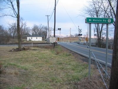
On Flowing Springs Road (County Route 17) at County Route 17/2, on the right on Flowing Springs Road.
Within these grounds is the home of General William Darke (1736-1801), who served as officer in American Revolution and in St. Clair's 1791 expedition against Miami Indians in Ohio. He served as delegate to the Virginia Convention called 1788 to . . . — — Map (db m5347) HM
On John Mosby Highway (U.S. 17/50) at Gun Barrel Lane (County Route 644), on the right when traveling west on John Mosby Highway.
Clark County. Area 171 Square Miles. Formed in 1836 from Frederick and added to from Warren. Named for George Rogers Clark, conqueror of the Northwest. Lord Fairfax and General Daniel Morgan, Revolutionary hero, lived in this . . . — — Map (db m3483) HM
On Front Royal Pike (U.S. 522) at Lord Fairfax Highway (U.S. 340), on the right when traveling south on Front Royal Pike.
Clark County. Area 171 Square Miles. Formed in 1836 from Frederick and added to from Warren. Named for George Rogers Clark, conqueror of the Northwest. Lord Fairfax and General Daniel Morgan, Revolutionary hero, lived in this . . . — — Map (db m3481) HM
On Bishop Meade Road (Virginia Route 255) at Lord Fairfax Highway (U.S. 340), on the left when traveling north on Bishop Meade Road. Reported missing.
Lord Fairfax worshipped here in the “Old Chapel” of colonial Frederick Parish, established 1738. This stone building dates from 1790 and witnessed the early ministry (1810–1885) of Bishop Meade. Governor Edmund Randolph and Col. Nathaniel Burwell . . . — — Map (db m1852) HM
On Bishop Meade Road (Virginia Route 255) at Lord Fairfax Highway (U.S. 340), on the right when traveling south on Bishop Meade Road.
The Virginia General Assembly established Frederick Parish in 1738, and a log sanctuary was built here ca. 1747. A stone church, later known as Old Chapel, replaced the log building ca. 1793. The Rev. William Meade served the congregation for . . . — — Map (db m314118) HM
On Amherst Street at North Stewart Street on Amherst Street.
In 1802 General Morgan died in this home built by George F. Norton in 1786. The house has been carefully nurtured over the centuries by the Boyd, Sherrard, Massie, Smith, Gaunt and Schember families. — — Map (db m2650) HM
On East Lane at East Boscawan Street, on the right when traveling north on East Lane.
To the Glory of God and in Memory of Lutheran Pioneers. Erected by members and friends of Grace Evangelical Lutheran Church Winchester, Va. 1938. These walls are the sacred ruins of the first Lutheran Church erected in Winchester - "Die teutsche . . . — — Map (db m26857) HM
On North East Lane at East Piccadilly Street, on the right when traveling north on North East Lane.
Fought everywhere, was beaten nowhere.
Major General Daniel Morgan Response Letter to Congress, c. 1798
The Epitaph on Daniel Morgan's original grave marker at this site: Major General Daniel Morgan
On July 6th, 1802 in the 67th year of . . . — — Map (db m4740) HM
On Lord Fairfax Parkway (U.S. 340), on the right when traveling south.
West Virginia. (Jefferson County). “The Mountain State”—western part of the Commonwealth of Virginia until June 20, 1863. Settled by the Germans and Scotch-Irish. It became a line of defense between the English and French . . . — — Map (db m1783) HM
On East Main Street (Virginia Route 7B) 0.1 miles west of Page Street, on the right when traveling west.
Clarke County is proud to be home to two historic driving tours. They include all four of our historically designated towns and villages. Combined with the National Register Historic Districts of which they are part, they make up over 38 percent . . . — — Map (db m157718) HM
On Maple Street / North Frederick Pike (U.S. 522) at Autumn View Lane, on the right when traveling west on Maple Street / North Frederick Pike.
Thomas Fairfax (1693-1781), sixth Baron Fairfax of Cameron, was the proprietor of the Northern Neck Proprietary, a vast landholding that lay between the Rappahannock and the Potomac Rivers, and extended to the Blue Ridge. Born in England, he came . . . — — Map (db m2299) HM
On Berryville Pike / Harry Byrd Highway (Virginia Route 7), on the right when traveling east.
Clark County. Area 171 Square Miles. — Formed in 1836 from Frederick and added to from Warren. Named for George Rogers Clark, conqueror of the Northwest. Lord Fairfax and General Daniel Morgan, Revolutionary Hero, lived in this . . . — — Map (db m156734) HM
On East Main Street (Virginia Route 7B) 0.1 miles west of Page Street, on the right when traveling west.
Initially known as "Battletown" for the Saturday night brawls that took place at the local inns, the town of Berryville was officially chartered in 1798 and named for Benjamin Berry, a local businessman. The new town became the county seat when . . . — — Map (db m157717) HM
On East Main Street (Virginia Route 7B) 0.1 miles west of Page Street, on the right when traveling west.
The short story of "Our Land is Our Legacy" begins with Virginia's Tidewater planters migrating to the northern Shenandoah Valley to take advantage of the fertile lands and abundant water. What we now know as Clarke County was primarily colonized . . . — — Map (db m157715) HM
On Greenwood Road at Senseny Road, on the right when traveling north on Greenwood Road.
Public education began in Frederick County during the last decades of the 19th century. This marks the beginning of the public education system, as mandated by the Underwood Constitution. During the period the school district included three . . . — — Map (db m274605) HM
Near Jones Road (Virginia Route 621) 0.6 miles south of Cedar Creek Grade ( Route 622), on the right when traveling north.
The stone wall here was originally between waist and shoulder-high. It was a farm fence, made of stones picked up from the farm fields full of lime stone outcroppings common to the Shenandoah Valley. The wall ran east-west to the top of a long . . . — — Map (db m185113) HM
On Barlow Bend Road 0.2 miles north of Madison Road (Route 33), on the left when traveling north.
First church building of record in Clarke County.
Erected here in 1810 by John French of Virginia,
who organized Methodist congregation here 1811.
Combined with Gainestown Church 1897. — — Map (db m101575) HM
Author of History of The Valley of Virginia
1st Edition Printed in Winchester 1833
Born Frederick County now Clarke County
He is buried here in the Bowman Graveyard
Harmony Hall — — Map (db m36723) HM
On State Highway 5 1 mile south of State Route 25, on the right when traveling south.
Front:
This Greek Revival style brick structure is known as the Hope Family Grave Shelter. Constructed in 1853, it is listed on the National Register of Historical places. The unusual splayed eaves and vaulted or “compass” . . . — — Map (db m47621) HM
On Stonewall Jackson Highway (U.S. 522) at Lord Fairfax Parkway (U.S. 340) on Stonewall Jackson Highway.
Early in the 19th century, three important roads crossed here: Nineveh Turnpike leading to Front Royal, Winchester Turnpike leading to the north, and Newton Turnpike connecting Stephens City and the Shenandoah River via the Winchester and Berrys . . . — — Map (db m253517) HM
Walter Lawson was born in Clarke County, Virginia, in January 1862 to Thomas and Susan (Clarke) Lawson.
Walter Lawson, also known as “Walker,” was a private in the 25th Infantry Regiment in the Indian Wars from 1886 – 1891 in Montana. This . . . — — Map (db m293752) HM
Thin black lines indicate changes in relevance. Between each pair of lines entries are ordered geographically but all have the same relevance.
* Inflectional forms of words are their plurals, singulars, and possessives as well as gramatical tenses and similar variations.