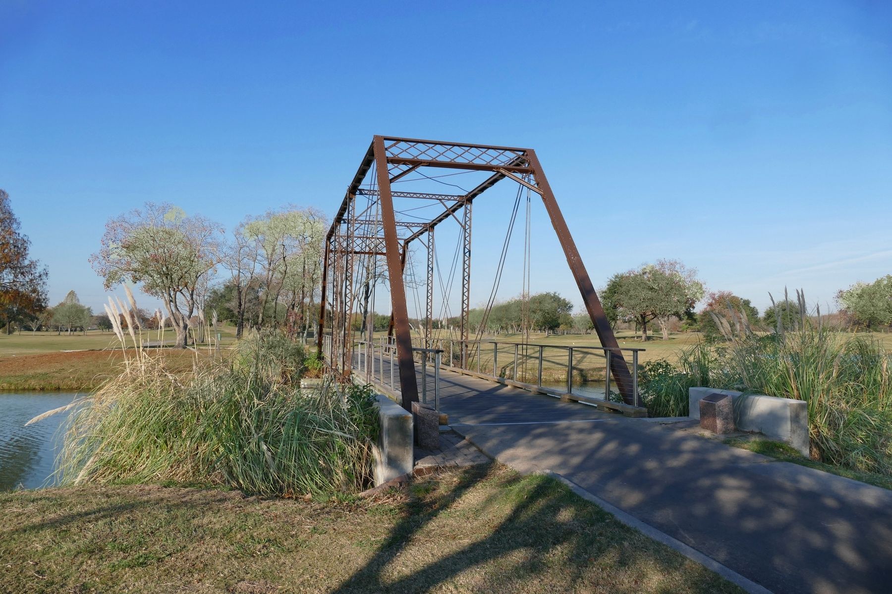
Near Georgia Avenue north of West X Street, on the left when traveling north.
A pin connected truss bridge characteristic of the popular style that once dotted rural Texas, this bridge is the last one in Texas built by the Clinton Bridge and Iron Company of Iowa. Originally opened in 1891 on the Leon River in Coryell County . . . — — Map (db m143302) HM
On Farm to Market Road 2210 at County Road 3706, on the left when traveling west on Road 2210.
A native of Tennessee, Samuel G. Evetts came to Texas in the 1830s. In December 1835 he was wounded at the Siege of Bexar. He later lived in Austin and Coryell counties and received land grants in those counties as well as in the counties of . . . — — Map (db m309555) HM
Near Farm to Market Road 183 0.7 miles south of U.S. 84, on the left when traveling south.
John Raney Bertrand was born in Brazoria County, the son of French immigrants who came to Texas before the Texas Revolution. He was a partner in a mercantile business in Washington County for several years before leaving to join the Confederate Army . . . — — Map (db m217408) HM
One of many patented truss designs developed by American inventors and engineers in the mid- to late-19th century, this 87-foot lenticular truss bridge represents an unusual truss type in the United States. The lenticular design features a curved . . . — — Map (db m29256) HM
Noted Coryell County pioneer and pastor Jesse Graham was born in North Carolina. He moved with family to Tennessee and then to Alabama where he married Martha Jane Fanning and became a primitive Baptist minister. By 1850, the Grahams, who would have . . . — — Map (db m217500) HM
On County Highway 3112 0.2 miles north of Bosque County Road, on the right when traveling north.
In 1857, R.G. Grant of Coryell County built a wooden mill at this site, using the waters of the Bosque River to power his operation. Two years later, the property transferred to J.H. Stinnett, and the mill building was used as a commissary and . . . — — Map (db m233818) HM
On West Leon Street 0.1 miles east of Old Georgetown Road, on the right when traveling east.
The route once known as the Old Georgetown Road was in existence by 1854 and crossed the Leon River here. A ferry operated at this crossing as early as 1854 and was owned by R.G. Grant, a local entrepreneur and land developer.
The Bowstring . . . — — Map (db m69907) HM
On College Avenue at Mooney Avenue, on the right when traveling west on College Avenue.
This church traces its history to 1893 when a revival was held in Oglesby. The official founding date of this congregation is September 1896. J.M.B. Gresham was elected as the first pastor of the church, which held services once or twice monthly . . . — — Map (db m217505) HM
On College Avenue at Webster Street, on the left when traveling west on College Avenue.
This congregation was organized in 1891 as the Methodist Episcopal Church, South, and boasted 56 members in its first year. The Rev. J. David Crockett served as its first pastor. A church structure built in 1891 was destroyed by a tornado in 1893. A . . . — — Map (db m217507) HM
Near North Main Street (County Road 2268) south of Rock Creek Drive, on the left when traveling north.
A pedestrian safety project by
the Texas Department of Transportation
Lenticular truss-Patented 1878
Designer: William O. Douglass
Manufacturer: East Berlin Iron Bridge Company, East Berlin, Connecticut
Constructed in 1889 across Cowhouse . . . — — Map (db m198746) HM
Near North Rice Street (U.S. 281) at East Francis Marion.
Born in Larkinsville, Ala.; came to Coryell County, Tex., 1857, and Hamilton, 1860. Taught school here. Acquired much land; traded 200 cattle for C.C. Bumgartner's store and hotel. Helped found and direct Hamilton College, 1884-89. He was one of . . . — — Map (db m177604) HM
On West Central Avenue west of South 9th Street, on the right when traveling west.
Surveyed in 1850 by Army engineers, this was the first wagon road to penetrate this area. Point of origin was San Antonio, site of U.S. Army District Headquarters after annexation of Texas in 1846.
This segment of road extended from Fort . . . — — Map (db m308381) HM
On County Line Road (Farm to Market Road 3231) 3.5 miles south of State Highway 43, on the right when traveling south.
Members of the Scots-Irish Grant clan sailed from the British Isles to the new world early in the 1600's bound for Colonial Virginia and Maryland.
Matthew Matthias Grant was born in Virginia where he grew to adulthood and married Caroline . . . — — Map (db m268554) HM
On West Jefferson Street at S Commerce Alley, on the left when traveling west on West Jefferson Street.
George Washington Boyd
Captain Boyd was born Sept. 12, 1859, in Coryell County, Texas. He was the son of James and Elizabeth Boyd.
He came to what was later Old Greer County in 1876 with buffalo hunters as a skinner. Two years later he . . . — — Map (db m290623) HM
On East Main Street (U.S. 84) at South 7th Street, on the left when traveling west on East Main Street.
An outstanding example of Second Empire Victorian style, often seen in Texas Courthouse design. Erected in 1897 on land donated by early settler R.G. Grant. Architect for this third Coryell County Courthouse was W.C. Dodson; builder, Tom Lovell. . . . — — Map (db m238633) HM
On Texas 36 Business (State Highway 36) at East Main Street (U.S. 84), on the left when traveling south on Texas 36 Business.
Built in 1910 and used until the mid 1970's, "The Depot" became the hub of commerce for Coryell County. When the route was abandoned and the building was to be torn down, the citizens of Gatesville responded. Through the Chamber of Commerce, a major . . . — — Map (db m217498) HM
On East Main Street (U.S. 84) at South 10th Street, on the left when traveling west on East Main Street.
Organized in 1856 with fewer than a dozen members, this congregation has been a part of Gatesville history for more than a century. The first meeting of the congregation was held in the Coryell County Courthouse, and early worship services were . . . — — Map (db m217497) HM
On Farm to Market Road 183 at Pearl Road, on the left when traveling west on Highway 183.
This church was organized in 1884 under the guidance of the Rev. E. Berry, a pioneer area missionary and preacher. Originally located in the Bee House community (4 Mi. W), it was first known as the Bee House Missionary Baptist Church. Early worship . . . — — Map (db m217377) HM
On Farm to Market Road 183 at County Highway 183, on the right when traveling west on Highway 183.
Originally named for Swayback Mountain, the community served by this cemetery was named Wayback through a clerical error in 1884. The name was changed to Pearl in 1890 for the young cousin of postmaster E.P. Davenport.
In the early 1890s Pearl . . . — — Map (db m217403) HM
On Farm to Market Road 183 at Pearl Road, on the right when traveling west on Highway 183.
Worship services were first held in the Bee House community about 1878, then in the first Pearl schoolhouse on Cowhouse Creek. This church was organized in October 1895. The members bought three acres of land, built a sanctuary, and added to it in . . . — — Map (db m217385) HM
On Farm to Market Road 183 at County Highway 153, on the left when traveling west on Highway 183.
A group of Methodists gathered in the home of the Rev. John Wesley Shook (1846-1921) in the winter of 1875-76 to organize a congregation. Early worship services were held in the Hope Schoolhouse.
In 1890 landowner Charley Karnes (1854-1933) . . . — — Map (db m217389) HM
On Farm to Market Road 183 at County Highway 139, on the left when traveling west on Highway 183.
Evolved from a log cabin with puncheon floor and with split log benches to a modern plant with a gymnasium. Furnished its fair share of educated citizens.
In early days, a one or two teacher school. First trustees were J.H. Harrison, V.C. . . . — — Map (db m217397) HM
On South Graham Avenue (County Highway 108) at West College Street, on the left when traveling north on South Graham Avenue.
Founded in 1854 and named for early settler and land donor John M. Stephen, the town of Stephenville became county seat when Erath County was created in 1856. The first county courthouse, a wood frame structure built in 1856, was destroyed by fire . . . — — Map (db m186526) HM
On West 6th Street at South Jackson Avenue, on the left when traveling west on West 6th Street.
This congregation traces its origin to the establishment in 1858 of the Onion Creek Baptist Church (10 miles SW at present-day Eagle Springs, Coryell County). Members of the Onion Creek congregation later organized the Comanche Springs Baptist . . . — — Map (db m217512) HM
Near U.S. 281 at E. Brooks Drive, on the right when traveling north.
The town of Evant traces its history to an earlier settlement in this area. Langford Cove, founded in 1855 by Asa Langford (1820-1907), was located adjacent to and partly within the south boundary of the present town of Evant. A United States post . . . — — Map (db m89695) HM
On State Highway 36 at 18th Street (Local Road 18), on the left when traveling south on State Highway 36.
On January 15, 1942, the U.S. Army established a tank destroyer tactical and firing center near Killeen covering more than 100 square miles. Camp Hood (later Fort Hood) would be used to train fifty battalions of about 1,000 men each for World War . . . — — Map (db m295022) HM
On N IH 35 Service Rd 0.1 miles south of County Route 312, on the right when traveling north.
Settled primarily by settlers from Texas and the southern states, Corn Hill was one of the earliest communities in Williamson County. John E. King, county judge from 1858 to 1860, named it for the home he built on a hill and nearby cornfield in . . . — — Map (db m304400) HM
Thin black lines indicate changes in relevance. Between each pair of lines entries are ordered geographically but all have the same relevance.
* Inflectional forms of words are their plurals, singulars, and possessives as well as gramatical tenses and similar variations.