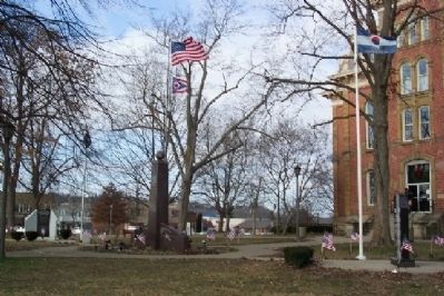
United States of America
Congressional Medal of Honor Recipients
State of Ohio, Coshocton County
Civil War
Elson, James M. Sergeant Mississippi 1863 — — Map (db m14716) HM
On Brown Street near 3rd Street, on the left when traveling east.
The last barn painter for the Bloch Brothers Tobacco Company of Wheeling, West Virginia, Harley Warrick painted thousands of barns with the familiar Mail Pouch Tobacco logo over his 48-year career. Mail Pouch transcended advertising to become a . . . — — Map (db m205139) HM
In 1764, Colonel Henry Bouquet established the site of what is now Coshocton. In 1811, the county was founded and the town incorporated as the county seat. The Coshocton County Courthouse, the third on this site, was built between 1873 and 1875 by . . . — — Map (db m298) HM
On Ohio Route 83, on the left when traveling north.
1764. Lt.Col. Henry Bouquet with 1500 British regulars and American Militia penetrated the Ohio wilderness to crush Chief Pontiac’s Indian conspiracy.
Here at the forks of the Muskingum River during October and November, Bouquet subdued the . . . — — Map (db m3286) HM
On Main Street (U.S. 36) at Plum Street, on the right when traveling west on Main Street.
Served in the Continental Army under the command of General Washington. Appointed as Accountant of the War Department by Washington and served under Presidents Adams, Jefferson and Madison. For his services in the Continental Army, received a land . . . — — Map (db m227846) HM
On County Road 495 at State Route 16, on the right when traveling west on County Road 495.
Side A:
The acknowledged host of the Underground Railroad in Coshocton County was Prior Foster, a well respected African American who lodged fugitive slaves in his shanty at Harbaugh Corner. He fed, sheltered, and clothed them and then . . . — — Map (db m36227) HM
On Chestnut Street east of North 3rd Street ( Route 541), on the right when traveling east.
Coshocton County lies in the great bituminous coal field. In 1820 early pioneers removed layers of soil and removed coal near the surface, chiefly for home use to light and heat their homes.
1833 - Hardscrabble Mine east of town was the . . . — — Map (db m205929) HM
On Chestnut Street just east of North 3rd Street ( Route 541), on the right when traveling east.
Coshocton County lies in the great bituminous coal field. In 1820 early pioneers removed layers of soil and removed coal near the surface, chiefly for home use to light and heat their homes.
1833 - Hardscrabble Mine east of town was the . . . — — Map (db m205931) HM
William Green, President of the American Federation of Labor from 1924 until his death, 1852, began his amazing and strenuous climb to the top run of labor's ladder at age 16, in the Morgan Run Coal Mines in Coshocton County.
Born in Coshocton . . . — — Map (db m299) HM
On North Whitewoman Street at Hill Street, on the left when traveling north on North Whitewoman Street.
Whitewoman Street is named after a woman named Mary Harris, Mary Harris and her family were the first identifiable persons to live in the Coshocton county area, arriving there about 1745. They were Mohawks from Kahnawake, near Montreal, the . . . — — Map (db m206156) HM
On Township Road. (Local Route 171) at County Route 10 on Township Road..
Dr. Lower was born May 6, 1867 and reared on a farm near Chili, Ohio, Crawford Twp. He attended Chili School and graduated from Western Reserve University Medical School in 1891. Dr. Lower performed the first leg amputation in 1898. In 1900 he . . . — — Map (db m69144) HM
On Maple Street at Wills Creek Avenue, on the right when traveling east on Maple Street.
George Washington Crile was born in 1864 at Chili, in Crawford Township, Coshocton County. Before embarking on his notable medical career, he graduated from Northwestern Ohio Normal School (now Ohio Northern University) at Ada, teaching for two . . . — — Map (db m15178) HM
This cemetery, established in 1810, is the final resting place of many of the founders of Plainfield and Linton Township. Besides the early date of its founding, it is notable for the number of armed forces veterans interred here, who represent . . . — — Map (db m15275) HM
On Main Street (U.S. 36) at Bridge street ( Route 60), on the left when traveling west on Main Street.
In 1800, President John Adams granted 4,000 acres in the Walhonding Valley to William Simmons for his service to the United States of America as a Colonel during the Revolution, and for being one of five men appointed by President George Washington . . . — — Map (db m157850) HM
On Long Street (U.S. 33), on the right when traveling east.
William Green Labor Leader
A native of Coshocton County, William Green (1870-1932) began his working life as a coal miner at age 16 and rose rapidly in the leadership of the United Mine Workers of America. Twice elected to the Ohio Senate, . . . — — Map (db m12970) HM
On Ohio Route 621 just south of Local Road 188, on the left when traveling south.
Agricultural development and cultivation on steep lands led to severe
soil erosion in the nation in the 1920s and 1930s. In response, the
United States Department of Agriculture established the Soil Conservation
Service SCS) in 1935. The SCS . . . — — Map (db m225376) HM
This memorial is dedicated to those who served, those who died, and those still missing.
Erected by Coshocton County Vietnam Veterans of America Chapter 159 with the support of the citizens of Coshocton County
Killed in Action
Michael S. . . . — — Map (db m14718) WM
On Ohio Route 83 north of U.S. 36, on the right when traveling north.
A humble American with vision and appreciation of historical values of the area, and their future potential to this community, settled in Coshocton County in the year of 1900.
The former owner of this ground, Mr. Scarr bought acres along . . . — — Map (db m293125) HM
On Chestnut Street just east of North 3rd Street ( Route 541), on the right when traveling east.
This memorial is dedicated to honor and remember all of the coal miners, their families, and everyone involved in the coal mining industry of Coshocton County, Ohio
In Remembrance of all the coal miners who lost their lives while working in . . . — — Map (db m205933) HM
On Main Street west of South 5th Street, on the right when traveling east.
In a review of the life record of Edgar O. Selby it will be noted that every business enterprise with which he has become connected has been crowned with success, and while he has promoted his individual interests he has contributed in . . . — — Map (db m209617) HM
On North Whitewoman Street (County Road 495) north of Hydraulic Street, on the right when traveling north.
The lock your at is for the Wallooding Canal a 25 mile feeder canal off the Ohio-Erie that runs from Cleveland to Portsmouth 305 miles.
The captain and his wife lived on their boat she being the cook there was a "Hoagie" maintained the . . . — — Map (db m206161) HM
On Main Street just west of South 5th Street, on the right when traveling east.
Coshocton was too small to rate a mail train stop.
Mid 1860's-non-stop mail trains began service to small towns using canvas bags and mail cranes. The practice declined along with passenger rail travel in the 1940's.
Dan Moody was a . . . — — Map (db m209385) HM
On South 2nd Street, on the right when traveling east.
The Rodrick Bridge was designed by Squire Whipple,
a civil engineer known as the 'Father of Iron Bridge
building in America', in 1841 and built in 1872 by his
nephew, James W. Shipman. The bridge is one of only
three bridges of its kind in the . . . — — Map (db m205978) HM
Thin black lines indicate changes in relevance. Between each pair of lines entries are ordered geographically but all have the same relevance.
* Inflectional forms of words are their plurals, singulars, and possessives as well as gramatical tenses and similar variations.