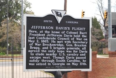
On North Main Street (State Highway 71) at Greenville Street (State Highway 20) on North Main Street.
Burt-Stark House When Jefferson Davis, President of the Confederacy, left Richmond after its fall in April 1865, he traveled south, trying to reach and rally the remnants of his army. On May 2, he spent the night at the home of Col. Armistead . . . — — Map (db m10564) HM
On Main Street at Greenville Street, in the median on Main Street.
This tablet was placed here to commemorate the last meeting of the Confederate States Cabinet which was held in the Burt House near by directly in front of this stone.
The following cabinet members were present:
Jefferson Davis, President . . . — — Map (db m73949) HM
On 3rd Street at Main Street, on the left when traveling north on 3rd Street.
Benjamin Logan built Logan's Fort at St. Asaphs, mile to west, 1776. Kentucky County, Virginia, formed 1776. First land court, St. Asaphs 1779. Kentucky made into Lincoln, Jefferson, Fayette counties, 1780. In 1785 part of Lincoln taken for Madison . . . — — Map (db m105390) HM
On Maysville Road (U.S. 68) at Main Park Road, on the left when traveling north on Maysville Road.
On Aug. 19, 1782, between this hill-top and Licking River a bloody battle was fought by Kentucky pioneers against a superior force of Indians and British-Canadians. — — Map (db m136359) HM
On Elm Tree Lane at East Third Street, on the right when traveling south on Elm Tree Lane.
Kentucky Clinic North was established by the University of Kentucky in 1996 to provide primary care in a medically underserved area of downtown Lexington The community-oriented clinic operated at a site on Third Street until this facility opened in . . . — — Map (db m169746) HM
Near Wilkinson Boulevard (U.S. 421) north of West Plaza Connector Road (U.S. 127), on the right when traveling south.
Frankfort takes its name-many people believe-from an episode that took place near here during the frontier era. A group of explorers camping near the mouth of Benson Creek was attacked by Indians. One member of the group, Stephen Frank, was killed. . . . — — Map (db m62266) HM
On Newtown Pike (Kentucky Route 922) 1 mile north of Iron Works Pike ( Route 1973), on the right when traveling north.
Pharmacist, physician, chemist, teacher and author. Born in England, 1805, he came to Lexington in 1832. Dr. Peter was associated with Transylvania Univ. more than 50 yrs.; elected to chair of chemistry and pharmacy and Dean of Medical School. . . . — — Map (db m165195) HM
On Kentucky Route 1 at Laurel Road, on the left when traveling north on Kentucky Route 1.
The first white child born of American parents west of the Allegheny Mountains—Mrs. Lucy Virgin Downs—was a resident of Oldtown, Greenup County, from 1807 until her death in 1847. She was the daughter of Jeremiah and Lucy Virgin, born . . . — — Map (db m126330) HM
On Clifton Avenue 0.5 miles west of Cheek Street, on the left when traveling west.
Kentucky did not support Lincoln in the 1860 and 1864 presidential elections. Many Kentuckians disagreed with Lincoln's policy of prohibiting the expansion of slavery into future U. S. territories and states. Some Kentuckians correctly feared 1860, . . . — — Map (db m162504) HM
Born in Kentucky. Circuit Clerk of Fayette County 1826-56. Adjutant General 1834-39. First talented artist of Illinois. Portrait painter of state officers and legislators. Commissioned by General Assembly to copy portraits of Washington and . . . — — Map (db m42381) HM
On Manchester Street at Saint Charles Street, on the left when traveling north on Manchester Street.
Starks S. Cockrill (1795-1862), son of Christopher and Susanna (Starks) Cockrill, was born in Loudon County, Virginia. After their father died, Starks and several brothers moved to Fayette County, Kentucky. He enlisted in the Kentucky militia and . . . — — Map (db m301218) HM
Near Danville Road Loop 2 0.4 miles south of Fitch Road.
Defending Camp Nelson
Designed to hold the middle of Camp Nelson's northern line, Fort Jackson is 280 feet deep and 300 feet wide with breastworks ten feet high. It is a lunette — a four-sided, unenclosed fort. It is one of . . . — — Map (db m171681) HM
On Ghent-Eagle Station Road south of Dividing Ridge Road ( Route 2984), on the left when traveling south.
Home and family cemetery of Lewis
Sanders, 1781-1861. House built
1819, on land wife inherited from
Col. George Nicholas, key drafter
of Kentucky Constitution and the first
state Attorney General. Sanders
organized first Kentucky fair on . . . — — Map (db m136122) HM
On Coronado Ridge 0.1 miles south of Sprinters Trail, on the right when traveling south.
This spring 900 feet to the west was discovered in 1775 by Joseph Lindsay who was killed at the Battle of Blue Licks. Spring and surrounding 2,000 acres were later surveyed for Evan Shelby, father of the first governor of Kentucky. The house on . . . — — Map (db m170027) HM
On U.S. 27 at Hutchison Station Road ( Route 1939), on the right when traveling north on U.S. 27.
Hopewell, one of the oldest Presbyterian churches in Bourbon County, has held worship services since 1785. The first congregation included Dutch settlers. It was recognized by the Transylvania Presbytery in 1787. Original church was located near . . . — — Map (db m218204) HM
On West 4th Street at Poplar Street, on the right when traveling east on West 4th Street.
Dr. Clay E. Simpson, Sr., native of Notasulga, Alabama and his wife Mary E. Simpson, native of Fayette County, Kentucky, served the Owensboro community for many years. As a Family Physician, Dr. Simpson made numerous house calls and delivered . . . — — Map (db m160137) HM
On Old Frankfort Pike (Route 1681) at Alexandria Drive, on the right when traveling east on Old Frankfort Pike.
The early explorers and surveyors recognized unusually good soil
by its appearance, physical qualities and vegetation
- even if they didn't comprehend the geology beneath.
This 2,400 square mile area -
the Inner Bluegrass region of . . . — — Map (db m194469) HM
On East Main Street at South Martin Luther King Boulevard, on the left when traveling west on East Main Street.
On July 8, 1999, Fayette County outlawed discrimination based on sexual orientation or gender identity in housing, employment, and public accommodations. This groundbreaking, county-wide ordinance was the first in Kentucky to provide these . . . — — Map (db m136945) HM
On West Short Street at North Upper Street on West Short Street.
Slavery in Fayette Co.
On the N.E. corner of the Fayette County Courthouse lawn stood the whipping post established in 1847 to punish slaves for such offenses as being on the streets after 7 p.m. Fayette Co. was one of the largest slave-holding . . . — — Map (db m16411) HM
On Deweese Street south of Elm Tree Lane, on the left when traveling south.
Mammoth Insurance Co.
Founded 1915 in Louisville, Mammoth Life and Accident Ins. Co. opened district office at 149 Deweese. It offered employment opportunities and fair rates to African American
community. At its peak, Mammoth had 750 . . . — — Map (db m169744) HM
On West 3rd Street west of North Mill Street, on the right when traveling west.
Col. Robert Patterson (1753-1827)
A large landholder, Patterson took part in founding Lexington, Cincinnati and Dayton. Chose site of Lexington, helped erect fort, April 1779, and laid off town; on Board of Trustees for many years. He . . . — — Map (db m61080) HM
To the Glory of Patriotism
In memory of
Abraham Davenport
and his wife
Mary Simms.
Their seven sons were
soldiers of the
American Revolution
———————
Stephen, Abraham, John,
Marmaduke, . . . — — Map (db m103512) WM
On Kentucky Route 1 just north of Route 1496, on the left when traveling south.
In 1873, line was extended from
Grayson to Willard. Located here
were a turntable, water tower,
railroad scales, & engine house.
Near-by, the Lick Branch & Lost
Creek spurs, as well as EK coal
mines and coal camp existed. In
1892, an angry . . . — — Map (db m145353) HM
On Farm to Market Road 2571 at Young School House Road (County Road 280), on the right when traveling west on Road 2571.
Maryland native Stephen Scallorn (1787-1887) lived in Kentucky and Tennessee, where he practiced medicine and was active in the Primitive Baptist Church, before moving to Texas. He was attracted to the Republic by the favorable accounts of his . . . — — Map (db m160302) HM
On State Highway 159 0.3 miles north of Darden Loop, on the right when traveling north.
Breeding Family Cemetery
(300 yards northwest, across the highway)
David and Sarah Davis Breeding came to Texas from Kentucky and settled here in 1833 with sons John, Richard L., Napoleon B., Fidelio S., and Benjamin W.; John, . . . — — Map (db m84667) HM
On North Main Street (Business U.S. 27) at West Maple Street, on the right when traveling south on North Main Street.
Jessamine County
Formed from Fayette County, 1798.
Named by Col. John Price, one of
Representatives in Legislature,
who stated he named it for flower
which flourishes in region and for
Jessamine Creek. A moving legend
tells that the . . . — — Map (db m169945) HM
On Chester Street north of Walker Street, on the left when traveling north.
The land currently known as Arlington originally belonged to the Chickasaw Indians. In 1818, a Treaty with the Chickasaw ceded this land, along with other land in West Tennessee, to the United States. On November 24, 1819, Shelby County was . . . — — Map (db m179116) HM
On North Main Street at East Poplar Avenue (Tennessee Route 57), on the right when traveling north on North Main Street.
The Original Town Site of Collierville/Colliersville
In this area and to the east, lies the original town site of Collierville. The lands that were destined to become Collierville traveled through many periods of history before a village . . . — — Map (db m149071) HM
The Birdman of West Virginia
When thinking of the early aviation history of the United States, many times we think of Dayton or Kitty Hawk. However, the town of Ansted also holds a very special place in the story, as it was the birthplace of . . . — — Map (db m173335) HM
On Princeton Avenue (U.S. 19) at Tony Wagner Avenue, on the right when traveling east on Princeton Avenue.
Points of Interest ~
Ansted* – Visit the Ansted Heritage Museum, Hawks Nest State Park, or take a hike on the Ansted Rail Trail.
Ashland – Locally made crafts may be purchased at the restored Ashland Company . . . — — Map (db m304941) HM
On North Main Street south of First Street, on the left when traveling south.
Colonel William R. Morrison
One of Waterloo's most renowned and distinguished citizens was Colonel William R. Morrison, to whom the city owes its library.
The library building at the corner of Library and Park Streets was Colonel . . . — — Map (db m219967) HM
Near North Main Street (Business U.S. 27) north of Wardlaw Street East, on the right when traveling north.
Named for John Brown
Gordon, a Confederate
general, Georgia governor
and U.S. Senator, this
school stands, as a silent
monument to the citizens
whose legacies made
La Fayette a historically rich
community. Originally
named “Chattooga . . . — — Map (db m142951) HM
Thin black lines indicate changes in relevance. Between each pair of lines entries are ordered geographically but all have the same relevance.
* Inflectional forms of words are their plurals, singulars, and possessives as well as gramatical tenses and similar variations.