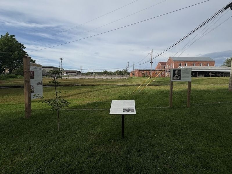
Near Railroad Avenue west of Depot St, on the left when traveling east.
(1) E.L. Hampton, a railroad station agent at Tracy City picked up the pieces at the coal and coke operation left by Tennessee Coal and Iron Company (TCI) and formed in 1905 Tennessee Consolidated Coal Company. In that same year the Mountain Goat . . . — — Map (db m277079) HM
Near Northcutt Cove Road 1.6 miles west of West Smartt Road, on the right when traveling north.
The Northcutts Cove Chapel is the oldest standing meetinghouse of The Church of Jesus Christ of Latter-day Saints (the Mormons) in the Southeastern United States. The building was constructed and paid for by local members, friends, and . . . — — Map (db m150455) HM
Lilian Wyckoff Johnson viewed agricultural cooperatives as a means for farmers to achieve economic freedom. In 1915 she moved to Grundy County with a dream of establishing a cooperative which would lead to independence and sustainability for local . . . — — Map (db m277080) HM
Near Railroad Avenue (U.S. 41) south of Depot Street, on the right when traveling south.
(front)
The Civil War on the Plateau
Confederate sympathizers in occupied Middle Tennessee were thrilled when they heard in July 2, 1862 that Nathan Bedford Forrest, with 1,400 men, had surprised the Federal garrison in . . . — — Map (db m277073) HM
Near Railroad Avenue west of Depot St, on the left when traveling east.
(1) E.L. Hampton was born March 1, 1861 on a plantation near Winchester, Tennessee. His father was a banker and farmer. When he reached high school age he moved to Decherd with family and friends. He attended school and worked at night.
He began . . . — — Map (db m277078) HM
Near Railroad Avenue west of Depot St, on the left when traveling east.
John Moffat was born in Glasgow, Scotland. His father was a successful businessman, a partner in the manufacturing firm of Moffat and Swan. In an economic downturn the elder Moffat immigrated to Canada with his wife and two sons. Moffat's father, . . . — — Map (db m277089) HM
Few men have the satisfaction of knowing they have made a contribution in their lifetime that will last through the ages and touch the lives of millions.
Men of the CCC know that feeling well. The Civilian Conservation Corps was launched April . . . — — Map (db m276701) HM
Near Colyar Street west of Depot St, on the left when traveling east.
(1) Tennessee Coal and Railroad Company (TCR) was reorganized in 1882 as Tennessee Coal, Iron and Railroad Company (TCIR) after John H. Inman and Associates of New York acquired a 2/3rd interest. Einar Oswald Nathurst was made Superintendent. He was . . . — — Map (db m277176) HM
On Swiss Colony Cemetery Road 0.2 miles east of 20th Ave N, on the right when traveling east.
Leaving Switzerland for a Better Life
In the mid-1800s, the Anton Stoker and his family were among
many Swiss emigrants who were looking for a better future.
Switzerland was among several European countries suffering
from famine, failed . . . — — Map (db m308491) HM
On Laurel Street, on the right when traveling north.
The Great Depression of the 1930s was particularly hard on Grundy County. According to John M. Glen in Highlander No Ordinary School 60 percent of the county's population in June 1935 were on some form of government relief.
The Works . . . — — Map (db m277414) HM
Near Railroad Avenue west of Depot St, on the left when traveling east.
Arthur St. Clair Colyar played a major role in the raising of Tracy City like a phoenix from the ashes of the Civil War to an industrial giant of the late 19th century. Born In Washington County near Jonesboro, he migrated at age of nine with his . . . — — Map (db m277155) HM
A vision for good
As Company 1475's Camp Superintendent, Tracy City native Herman E. Baggenstoss had a vision for what the company could do. Even in its early days, while the company was located in Palmer, Herman knew there were bigger . . . — — Map (db m276805) HM
On Cumberland Street at Spring Street, on the right when traveling north on Cumberland Street.
A Distinguished Home for a Distinguished Gentleman
This was the home of Levi Vernon Woodlee, an important political figure in Grundy County. Woodlee served in the Tennessee General Assembly as a Representative between 1897 and 1899 and as a . . . — — Map (db m297616) HM
On Laurel Street at Main Street (Scenic U.S. 41), on the right when traveling north on Laurel Street.
Before 1794, there were no permanent residents on the plateau. Cherokee and other Native American tribe members visited the plateau from time to time with hunting parties. This state of the plateau changed after the Major James Orr led militia . . . — — Map (db m277346) HM
On Dubose Street (Tennessee Route 56) north of Dixie Lee Avenue (U.S. 64), on the right when traveling north.
Monteagle is an important crossroads in the southern Cumberland Mountains, where roads and railroads crisscross rugged, scenic terrain. In the summer of 1862, Union and Confederate forces raced for advantage among these transportation corridors. . . . — — Map (db m167629) HM
On Railroad Avenue at Depot St, on the right when traveling east on Railroad Avenue.
Soon after the Civil War, the nearly-bankrupt Tennessee Coal and Railroad Company ("TC&R") was acquired by entrepreneur Arthur St. Clair Colyar. Tracy City was created as a company town, named after company financier Samuel F. Tracy. Impressive . . . — — Map (db m277068) HM
On Tracy Road (U.S. 41) at Justus Street, on the left when traveling north on Tracy Road.
In 1932, Myles Horton and Don West founded Highlander Folk School, located ½ mile north of this site. It quickly became one of the few schools in the South committed to the cause of organized labor, economic justice. and an end to racial . . . — — Map (db m150471) HM
Dams, Lakes, Trails, Towers, Walls, Wires, Roads…
It was not uncommon for CCC companies to pick up and move, they were mandated to relocate wherever their work required, and by 1935, Company 1475's principal assignment was in the southern . . . — — Map (db m277179) HM
Near Railroad Avenue west of Depot St, on the left when traveling east.
This flower garden, the centerpiece of the annex to the Grundy County Historical Society Heritage Center outdoor exhibit area, is dedicated to the memory of William "Bill" L. Beard. A member of the Board of Directors from 2014 to his death on March . . . — — Map (db m277154) HM
On 10th Street south of 3rd St, on the left when traveling south.
An Eclectic Home with a "Do It Yourself" Owner
The Frank White House is listed on the National Register of Historic Places. This two story brick house was apparently built by White circa 1890 and was reportedly used as both a residence and . . . — — Map (db m277580) HM
On Hillsboro Highway (U.S. 41) at Tyree Cove Road, on the right when traveling south on Hillsboro Highway.
Coffee County
Established 1836; named in honor of
Major General John Coffee
soldier, surveyor, and close friend of Andrew Jackson. Tennessee troops under his command took a decisive part in the New Orleans Campaign, December 23, 1814 to . . . — — Map (db m150467) HM
On Main Street (Tennessee Route 56) at Spring Street, on the right when traveling north on Main Street.
Altamont was established in 1848 as the Grundy County seat thanks to the efforts of Gen. Adrian Northcutt, a local farmer who served for ten years in the Tennessee legislature. The first county courthouse was in Northcutt’s original home, a small . . . — — Map (db m297614) HM
On Laurel Street at Depot Street, on the right when traveling north on Laurel Street.
was located on this site. The denomination was formed in 1810 following revival of the Christian gospel in the second wave of the Great Awakening. Settlers from Scotland and Ireland of Scott descent were mainly followers of John Calvin as embodied . . . — — Map (db m277329) HM
On Laurel Street, on the right when traveling north.
In 1939 and prior thereto the Warren Memorial Cumberland Presbyterian Church of Tracy City building on this site was used by the Works Progress Administration (WPA) for its relief programs in Grundy County. On February 10 a small group of unemployed . . . — — Map (db m277415) HM
On Tennessee 108 0.2 miles west of S 20th Ave, on the right when traveling east.
In the mid-1800s, Switzerland was one of several
European countries suffering from famine, failed crops and
overcrowding. Captain Eugen Plumacher, the commissioner
of emigration to the United States, and Peter Staub, a Swiss
emigrant living in . . . — — Map (db m308492) HM
On Main Street, on the right when traveling north.
Palmer, originally known as Tate's Village, was incorporated
in 1925 and renamed in honor of Clarence William Palmer
(1850-1919), who owned much of the land upon which the
town was established.
The area thrived during the early 20th Century . . . — — Map (db m308490) HM
On Laurel Street at Main Street (Scenic U.S. 41), on the right when traveling north on Laurel Street.
"In the years to come, Grundy County will be remembered for one reason: that Leonard Tate lived here and wrote his poetry." These words of County Judge J.L. Rollins proclaim the significance of the Poet Laureate of Grundy County.
Leonard Tate . . . — — Map (db m277409) HM
Near Laurel Street at Main Street (Scenic U.S. 41), on the right when traveling north.
We are mountain people.
We are a boorish set, they tell us
Hard-bitten, coarse of feature and of speech,
Shallow and brawling as the mountain streams,
With morale friable as our sandstone
All my life I have wanted to tell them:
That we . . . — — Map (db m277350) HM
Born in the depths of the Great Depression
...the Civilian Conservation Corps, or "CCC," was a public work relief program that operated from 1933 to 1942 throughout the United States. The CCC was designed to provide jobs for young men and . . . — — Map (db m276726) HM
On Depot Street at Laurel St, on the right when traveling east on Depot Street.
The Marugg Company was founded by Christian Marugg in the early 1870s in what is now Grueti-Laager. Seeing the need for a variety of farming tools, he started imparting tool components from Switzerland and Germany. These parts didn't come with . . . — — Map (db m277435) HM
Thin black lines indicate changes in relevance. Between each pair of lines entries are ordered geographically but all have the same relevance.
* Inflectional forms of words are their plurals, singulars, and possessives as well as gramatical tenses and similar variations.