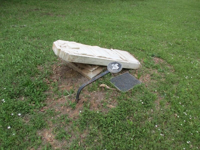
Near East Pease Street 0.2 miles west of Texas Highway 19. Reported damaged.
Maryland native John Lawrence Hall lived in New Orleans before coming to Texas in 1831. Hall served in the Texas Army (1835-36), Republic of Texas Army (1841), and in the Mexican War (1846). He added to the land grants he received for military . . . — — Map (db m219485) HM
Member of Nacogdoches Volunteers 2nd Regiment, Texas Volunteers Battle of San Jacinto
Early Texas Ranger Commanding Officer, Fort Houston Houston County Rangers Battle of the Neches July 16 - 17, 1839
Texas Ranger. Mounted Rifleman . . . — — Map (db m212224) WM
Near East Pease Avenue 0.2 miles Texas Highway 19. Reported damaged.
New York native George G. Alford, an officer in the War of 1812, came to Texas from Missouri in 1836. During the Texas Revolution he served as Gen. Sam Houston's Quartermaster General. Captured by Mexican forces after the war while on a supply trip . . . — — Map (db m219478) HM
Arkansas native John Silas Edens (b. December 15, 1820) arrived in present-day Houston County, Texas, in 1831. He served in the Republic of Texas Army in 1836 then joined the Texas Rangers and participated in several Indian campaigns in 1841. He . . . — — Map (db m212114) HM
On Hackberry Street (Cemetery Rd) south of Lowe Street, on the left when traveling east.
A native of North Carolina, John Swanson Yarbrough came to Texas in 1832 and settled in what is now Houston County in east Texas. A veteran of the Texas War for Independence, Yarbrough participated in the 1835 Siege of Bexar and in the decisive . . . — — Map (db m291007) HM
A native of Tennessee who settled in East Texas in the 1820s, James English fought in the siege of Bexar (1835) and served as comissioner for the Shelby County Militia during the Texas Revolution. English received a land grant in Houston County for . . . — — Map (db m286848) HM
Near North Adkisson Street 0.1 miles north of Sand Bank Road.
Georgia native Manaen T. Smith arrived in present Shelby County, Texas in 1822. He became active in civic affairs, and served in the Texas Army from October 1835 to January 1836. He was a participant in the Siege of Bexar in December 1835. He . . . — — Map (db m171550) HM
Near East Pease Street 0.2 miles west of Texas Highway 19.
New York-born John Titus Smith moved to Texas from Georgia in 1849. He settled on a cotton plantation at McKenzie's Bend on the Trinity River and operated the steamboat "Ida Reese". Smith served as Chief Justice (County Judge) of Houston County, . . . — — Map (db m219488) HM
On West Main Street (Farm to Market Road 230) at South Maple Street, on the left when traveling west on West Main Street.
On September 28, 1881, the Trinity & Sabine Railway Co. was chartered as a logging tram connecting with the International & Great Northern (I&GN) Railroad. The line was intended to run east to the Sabine River but only extended as far as Colmesneil. . . . — — Map (db m206840) HM
On Highway 287 (State Highway 19) at Farm to Market Road 2160, on the left when traveling north on Highway 287.
A pioneer area landowner and farmer, John Wortham (1804-67) was a petitioner for the creation of Houston County in 1837. He later served as captain of an independent Ranger company, as major in the Republic of Texas Army and as quartermaster of the . . . — — Map (db m207027) HM
On Farm to Market Road 2663 0.2 miles east of U.S. 287, on the right when traveling east.
Early community called Oldham, near Bethel Church and school, was renamed Starks' Switch when International & Great Northern Railroad in 1872 laid sidetrack to serve Starks' sawmill (2 Mi. W).
Latexo post office opened in 1907, after the . . . — — Map (db m207030) HM
On Farm to Market Road 861 0.2 miles north of County Road 103, on the left when traveling north.
A Soldier in the Army of Texas, 1836
Born in Indiana July 26, 1816 Died November 24, 1849
His Wife Laura Jordon Bennett
Born August 28, 1830 Died December 24, 1925 — — Map (db m245833) WM
On East Goliad Avenue (State Highway 7) at South 8th Street on East Goliad Avenue.
A Baptist Church, led by pioneer James T. Heflin, was meeting in Crockett as early as 1846. A second Baptist congregation was formally organized in 1850. Named Mt. Zion Baptist Church of Crockett, the congregation built a sanctuary on El Camino . . . — — Map (db m206967) HM
On East Goliad Avenue at South 7th Street, on the right when traveling east on East Goliad Avenue.
City's first congregation and one of oldest in Texas. Formed 1839 with Henderson Palmer as pastor. Noted minister Littleton Fowler was presiding elder at organization. Methodists shared a structure with Crockett's other denominations until erecting . . . — — Map (db m206926) HM
On East Houston Avenue (State Highway 21) 0.1 miles east of South 7th Street, on the right when traveling east.
This church was established in 1854 by an act of the East Texas Presbytery. The Rev. W.C. Dunlap was organizer of the congregation and served as its pastor for two years. Members met in a Baptist church until the completion of their first building . . . — — Map (db m207022) HM
On South 2nd Street at East Fannin Avenue, on the right when traveling south on South 2nd Street.
A small group from Bethel Missionary Baptist Church in Crockett withdrew in 1884 to create their own congregation. The St. Paul Missionary Baptist Church was organized under the leadership of the Reverend Raefield Cotton and six deacons. The group . . . — — Map (db m206923) HM
On East Goliad Avenue 0.1 miles west of South 4th Street, on the left when traveling west.
Crockett merchant William Monroe Patton (1855-1915) built this commercial structure about 1903. It was the fourth of six buildings he constructed on what became known as the Patton Block and is the only one that retains its original Mesker Bros. . . . — — Map (db m206924) HM
On East Goliad Avenue (State Highway 7) at South 6th Street, on the right when traveling east on East Goliad Avenue.
Alabama native William Elbert "Buck" Mayes (1836-1915) came to this area in 1856. After serving in the Civil War, he returned to Houston County and became a successful businessman with interests in banking, real estate, construction and retail . . . — — Map (db m206925) HM
On Highway 287 (State Highway 19) at Farm to Market Road 2663, on the right when traveling north on Highway 287.
The community of Stark Switch, originally known as Oldham, was the home of protestant worship for early settlers from the mid-19th century. Stark Switch Baptist Church of Christ was organized on July 19, 1900, with 27 charter members. The Louisiana . . . — — Map (db m207028) HM
On Farm to Market Road 2022 0.5 miles south of State Road 294, on the right when traveling south.
Racial tensions in America in the early 20th century were sometimes punctuated by violent outbursts. One such occasion began near Slocum and Denson Springs and spread across a wide area near the Anderson-Houston county line. Beginning on the morning . . . — — Map (db m286937) HM
Born west of Crockett. A noted musician. Houston County district clerk, 1918-22. A barber by trade. In boyhood, studied violin. At 16, began teaching; at 20, opened Tunstall Music House. Traveled East Texas 50 years with band that included his ten . . . — — Map (db m245592) HM
On East Pease Avenue 0.2 miles west of Texas Highway 19.
In original townsite of Crockett. Opened soon after Houston County was created and the county seat founded in 1837. Burials include early Texas heroes and statesmen; a friend visited by David Crockett on way to the Alamo; a grandnephew of U.S. . . . — — Map (db m219476) HM
Near East Pease Avenue 0.2 miles Texas Highway 19.
John Edward Nite, born in North Carolina, married Lucy Stepp, a native of Georgia, in 1826. Although robbed of $1800 in gold enroute to Texas from Tennessee in 1835, they were able to secure 1,506 acres of land along the Trinity River in Houston . . . — — Map (db m219479) HM
Near East Pease Street 0.2 miles west of Texas Highway 19.
A soldier in the Army of Texas, 1836 Chief Justice of Houston County, 1841 Born in Tennessee Feb. 1, 1788 Died Nov. 24, 1848 His wife Elizabeth (Stone) Gossett Born in Tennessee Sept. 1, 1789 Died July 6, 1849 — — Map (db m219482) HM
Near E. Pease St. 0.2 miles west of Texas Highway 19.
Alabama native William Elbert "Buck" Mayes, son of the Rev. Isaac C. Mayes and Lucinda Fuller, came to Texas in 1856. He married Sarah (Dickerson) Clark in 1858. After serving in the Civil War Mayes returned to Houston County and became a successful . . . — — Map (db m219493) HM
A native of Louisiana, Joseph Randolph Yarbrough served in the Texas War for Independence from Mexico and was assigned to guard the camp opposite Harrisburg during the Battle of San Jacinto. He and his father, John Swanson Yarbrough, signed the . . . — — Map (db m161208) HM
On Highway 19 3 miles north of Highway 1280, on the right when traveling north.
The Houston County Coal and Manufacturing Company was formed in 1900 for the purpose of mining lignite. Near this site, a slope mine was opened and a company town named Wooters was established. Company founders were A. H. Wooters, D. A. Nunn, G. . . . — — Map (db m155413) HM
On Park Road 70, on the left when traveling south.
Micam Main of Illinois was granted a league of land by the Mexican government in 1835. One of the area's first brickmakers, Samuel M. Warden, died while working on Main's estate on Christmas Eve in 1847. He was interred on this site. According to . . . — — Map (db m128982) HM
On Van Bibber Road 0.1 miles east of North Main Street, on the left when traveling east.
Rev. Denman was born in Gumlock Creek, Franklin Co., Georgia on May 8, 1803 and moved to Cherokee County, Texas with his first wife, Elizabeth Randle (1805-1861), in 1849. There he established a large plantation and ran a general store with the help . . . — — Map (db m203301) HM
Near East Pease Street 0.2 miles west of Texas Highway 19.
Author - "History of Houston County, Texas" Armistead Albert Aldrich (April 10, 1858 -- Aug. 22, 1945) Born in Crockett, son of Oliver Cromwell and Eliza (Masters) Aldrich. Educated at University of Virginia, he was admitted to the bar in 1883. . . . — — Map (db m219490) HM
On South 4th Street (U.S. 287) at East Goliad Avenue (Texas Highway 7), on the left when traveling south on South 4th Street.
In early 1938, the Houston County commissioners court, with County Judge B. F. Bradley presiding, began making plans for construction of the county's fifth courthouse. Built in 1939 with funds from the Federal Public Works Administration, the . . . — — Map (db m121245) HM
On East Goliad Avenue (State Highway 21) at Rail Row, on the left when traveling east on East Goliad Avenue.
This log cabin was constructed on the Jeremiah Strode league (12 mi. E). It is believed to have been built in the 1850s by B.R. Wallace (1800-73), Strode's son-in law and a Texas legislator, or by Wallace's cousin W. W. Wallace (b. 1821). Later . . . — — Map (db m156957) HM
On State Highway 7 near County Road 4700, on the right when traveling west.
Kentuckian James Henry Hager (1822-1879) and his wife Naoma (Clark) came to Texas in the 1840s. Hager, a farmer and cabinet maker, opened a blacksmith shop and mill in Houston County. The Nacogdoches-to-Navasota stage and mail road . . . — — Map (db m29566) HM
Near County Road 1680 north of Farm to Market Road 227, on the right.
John and Lucinda (Nugent) Sheridan left North Carolina in the mid-1820s and became two of Houston County's first permanent settlers. John (Apr. 5, 1796 – May 10, 1837), a former Texas Ranger, was killed by Indians in what is now Anderson County. . . . — — Map (db m245643) HM
On County Road 1675 east of Farm to Market Road 227, on the left when traveling east.
This church served the freed slaves of the Percilla, Augusta and Glover communities. A small wood-framed church was built in 1880 and served as the church building until 1906. This first location on Percilla Road also served as the Elliott Springs . . . — — Map (db m245616) HM
On Commerce Street (State Highway 19) at Houston Street (Farm to Market Road 1280), on the right when traveling north on Commerce Street.
Founded by Houston & Great Northern Railroad investors as line was built through grant of Cyrus Lovelady, near communities of Nevil's Prairie, Pennington, and Weldon. Post office opened on Nov. 8, 1872. Town soon had livery stables, stores, . . . — — Map (db m206905) HM
On Refuge Cemetery Road 0.2 miles north of Farm to Market Road 227 when traveling north.
Reuben (1805-1859) and Sarah Parker (1807-1852) Brown came from Illinois to settle here in 1833. Their oldest son, John (1837-1921), lived his entire life within a mile of Old Fort Brown, his birthplace. In 1865, when John deeded two acres to . . . — — Map (db m245653) HM
On Kitty Hawk Road 0.2 miles east of Pat Booker Road (Farm to Market Road 218).
Early Anglo settlers to Texas, the John Edens family arrived in Houston County in 1831. John's son Banister Edens, along with his wife Mary Walker Edens and their family, moved to Bexar County in 1855. By 1856 Banister Edens had acquired 350 acres . . . — — Map (db m197208) HM
On West Tyler Street at North Prairieville Street, on the right when traveling east on West Tyler Street.
Thomas Murchison was born in Tennessee and grew up in Marshall, Mississippi before moving with his parents to Houston County, Texas around 1848. Murchison moved to Athens around 1855 and worked in a general store. Around 1858, Murchison began his . . . — — Map (db m232805) HM
On U.S. 287 0.7 miles west of Farm to Market Road 358, on the right when traveling north.
In 1857 Albert Holley (b. 1828), his mother and two brothers, migrated to Houston County from Alabama. While the others journeyed to Texas by boat, he brought the family's supplies overland by wagon with 137 slaves. By 1860 he and his wife Julia . . . — — Map (db m128926) HM
On South 4th Street (U.S. 287) at East Houston Avenue (Texas Highway 21), on the left when traveling south on South 4th Street.
On June 12, 1837, President Sam Houston authorized the formation of Houston County, the first newly created county in the Republic of Texas. Andrew W. Gossett (1812-1890) donated land, which included this square, for the townsite. He and his father, . . . — — Map (db m121246) HM
On State Highway 7, on the left when traveling west.
A symbol of Black America's pride in education, plus crusade of Julius Rosenwald (1862-1932), a Chicagoan who in 1913 began to fund school buildings for Negroes. By 1920, when this one-teacher structure was built at Ratcliff (4 miles east), . . . — — Map (db m201868) HM
On U.S. 287 east of Sumpter Cemetery Road, on the right when traveling west.
The legislature of the State of Texas created Trinity County out of Houston County in 1850. A group of seven commissioners was appointed to locate and survey a site for the seat of government. The town of Sumpter was founded in this area, near the . . . — — Map (db m286925) HM
On North Mallard Street (State Highway 19) at East Poplar Street, on the right when traveling south on North Mallard Street.
Created March 24, 1846,
from Houston County
Organized July 13, 1846 with
Palestine as the county seat
Named in honor of
Kenneth Lewis Anderson
Vice-President of the
Republic of Texas
1844-45 — — Map (db m128942) HM
Thin black lines indicate changes in relevance. Between each pair of lines entries are ordered geographically but all have the same relevance.
* Inflectional forms of words are their plurals, singulars, and possessives as well as gramatical tenses and similar variations.