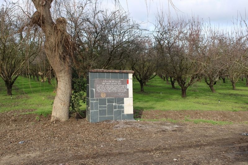
On West Service Road at Jennings Road, on the right when traveling west on West Service Road.
The Town of Adamsville was located approximately ½ mile west of this location. Founded in 1849 and named after Dr. David Adams, Adamsville became the county seat of the newly formed Stanislaus County on June 10, 1854. County government remained here . . . — — Map (db m213851) HM
On Roberts Ferry Road 0.2 miles south of Yosemite Boulevard (California Highway 132).
[A short walk starting on the eastern side of the Roberts Ferry Covered Bridge; walking south, crossing over to the western side and returning north. Interpretive markers are placed along both sides covering the timeline from the first people who . . . — — Map (db m42617) HM
On Flota Road west of Yosemite Boulevard (California Highway 132), on the left when traveling west.
This building, circa 1875, replaced the Branch District School that was built of rough lumber in 1855. Typical of the era, it is one room with handmade furnishings, porch and bell tower. A native of Iowa, C. C. Wright came here and began teaching in . . . — — Map (db m42562) HM
On South Manthey Rd, on the right when traveling west.
First known sail launch to ascend San Joaquin River from San Francisco landed here autumn 1846. Carried 20 Mormon pioneers who founded New Hope agricultural project on the Stanislaus. Yoke of oxen and span of mules driven from Marsh’s Landing . . . — — Map (db m143445) HM
In the late 1850’s David Loche built Knights Ferry’s first flour mill. It was destroyed by the flood of 1862, and a second new mill was built here by David Tulloch.
A dam upstream diverted water to a water wheel which turned the millstones. . . . — — Map (db m12928) HM
On California Route 108 at milepost 0, 15 miles west of U.S. 395, on the left when traveling east.
Oldest of the Trans-Sierra Emigrant Trails to California is spectacular Sonora Pass crossed by Highway 108, second highest (9,626 feet) of all the highway crossings of the range. The Bartleson-Bidwell Party, with mules, horses and oxen, made the . . . — — Map (db m57989) HM
On West Main Street east of South Acacia Avenue, on the right when traveling east.
Approximately six miles west, 20 Mormon pioneers from ship Brooklyn founded first known agricultural colony in San Joaquin Valley. Planting first wheat; also crops they irrigated by the pole and bucket method. Erected three log houses, operated . . . — — Map (db m143447) HM
On Sonora Road 0.2 miles north of Kennedy Road, on the right when traveling north.
The establishment of Estanislao Chapter 58 occurred on June 21, 1958. The inaugural meeting took place at the historic Tulloch Flour Mill in Knights Ferry under the direction of Noble Grand Humbug W.S. 'Walt' Hargrove. There were forty-eight . . . — — Map (db m178005) HM
On Yosemite Boulevard (California Route 132), on the right when traveling east.
This is one of the oldest continuously occupied buildings in LaGrange. In 1857, Lodge #65 of the Independent Order of Odd Fellows of California was formed.
The Odd Fellows purchased the two story jail from the County in 1862 and it was used for . . . — — Map (db m94798) HM
On K Street at 10th Street, on the right when traveling east on K Street.
Welcome to Modesto, the Stanislaus County seat, and 16th largest City in the State. We may be big, but we still have that small- town charm and friendly people. The community appreciates the past and the many people who pioneered this unique area. . . . — — Map (db m227169) HM
On 10th Street at G Street, on the right when traveling north on 10th Street.
Agriculture is the food you eat, the clothes you wear and even the house you live in! Deeply rooted in heritage, tradition and commerce, agriculture in Stanislaus County feeds the world. Each year, more than 100 different crops are harvested from . . . — — Map (db m225304) HM
On 10th Street north of J Street, on the right when traveling north.
Modesto sprang into existence in October 1870 as a created town on the Central Pacific Railroad line, snaking down the California's Central Valley.
Because the people of the area recognized the advantages of the railroad's year-round, reliable . . . — — Map (db m227081) HM
On Plaza Circle near South Salado Avenue when traveling north.
Marker One:
Roll of Honor
In memory of the men of Patterson Township, Stanislaus County, who gave their lives in the service of their country
World War II
Norman Allport • Joe Borges • Raymond Brown • Leonard Corbin • Frank Cox . . . — — Map (db m208235) WM
On Third Street, on the right when traveling north.
It was here on the Sacramento River that William Knight settled in 1843. This natural landing place was to become an important landing and shipping point in this area.
It wasn't until 1853 four years after Knights death that the townsite was . . . — — Map (db m84133) HM
Thin black lines indicate changes in relevance. Between each pair of lines entries are ordered geographically but all have the same relevance.
* Inflectional forms of words are their plurals, singulars, and possessives as well as gramatical tenses and similar variations.