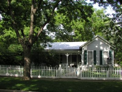
Born April 4, 1877 in La Vernia (Wilson County), Harry Graves attended Southwestern University in Georgetown and later served three terms as city attorney. As Williamson County attorney, he aided the prosecution in a landmark trial against the Ku . . . — — Map (db m42431) HM
On 3rd Street north of D Street, on the right when traveling north.
Created February 13, 1860
Organized August 6, 1860
Named in honor of
James Charles Wilson
1816 – 1861
Member of the Mier Expedition
District Clerk of Brazoria County, 1844
Senator from Matagorda County
Floresville, . . . — — Map (db m117636) HM
On Business State Highway 78, on the right when traveling north.
Born in Wilson County, Tennessee, George Washington Smith came to Texas in 1834 with his wife Elizabeth Briggs. He fought in the Texas War for Independence (1835-36) as a private in Capt. Clendennin’s Company 1st Regiment Artillery. In the Mexican . . . — — Map (db m163227) HM
Near Paloma Drive at 3rd Street (Loop State Highway 181).
A fearless, colorful, cultured man whose honesty and diplomacy often prevented bloodshed. An 1890's Wilson County Deputy Sheriff. In Frontier Battalion, Texas Rangers. Sheriff, Wilson County, 1902-1917. At request of Texas Adjutant-General, he . . . — — Map (db m192189) HM
On U.S. 87 0.1 miles east of Bluebonnet Drive, on the right when traveling west.
Following the Civil War, two brothers, both Union veterans, moved from Zanesville, Ohio to Texas. Isaac Suttles (c. 1840-1884), who wed Mary Ann McBride in 1866, appears in the 1870 census for Seguin, where he worked at Wilson Potteries. Records . . . — — Map (db m167774) HM
Dr. John Sutherland (1792-1867), a native of Danville, Virginia, came to Texas in 1835. While helping the Texians prepare to defend the Alamo against the Mexican army in 1836, he suffered an accident with his horse, rendering him unable to fight. . . . — — Map (db m211544) HM
Near Piedmont Avenue 0.3 miles east of Pleasant Valley Avenue.
Born near Little Cedar Lick, Wilson County, Tennessee. Lived in Mississippi, where he learned surveying. Joined Republic of Texas Army in May, 1836, and served 3 years in ranger/spy companies. Gained fame as an Indian fighter while surveyor for . . . — — Map (db m55204) HM
In 1818, after studying law for six months under Judge James Trimble, Sam Houston passed the Bar to practice law. He came to Wilson County to practice law. Mr. Frederick Golladay befriended Mr. Houston and furnished him a small log cabin for an . . . — — Map (db m248696) HM
On Farm to Market Road 539 at East 3rd Street, on the left when traveling north on Highway 539.
Pattillo “Pat” Higgins was born in 1910 in Houston to Pattillo “Bud” Higgins, Sr. and Annie Jahn Higgins. Bud owned oil properties in Chambers and Bexar Counties and, in 1925, began to purchase land in Sutherland Springs. . . . — — Map (db m167547) HM
On Green Avenue at 10th Street, on the right when traveling west on Green Avenue.
Founded 1910 by William Green, son of a family who settled in South Texas more than a century ago. The townsite was part of four leagues of Wilson County school lands bought 1906 by Green and Associates.
Green later bought out his associates, . . . — — Map (db m110537) HM
On South Live Oak Street at East Wallace Street, on the left when traveling north on South Live Oak Street.
Born to Hamilton and Mary (Pedigo) Neal in the Fairview community in Wilson County, Edgar T. Neal (1869-1946) was a famed San Saba lawman. Early in his adult life, he followed his father and cultivated a close connection with the Masonic fraternity. . . . — — Map (db m263544) HM
An important landmark in downtown Floresville, this building dates to the earliest years of the 20th century. Although records have not been found to pinpoint the exact date of construction, it was built sometime between 1902 and 1907. A 1909 . . . — — Map (db m130343) HM
On West Nueva Street east of South Main Avenue, on the right when traveling west.
Born in San Antonio; descendant of Frenchman who settled in Mexico before 1714. Always a civic leader, helped found first public school in San Antonio, 1812.
Went (1821) with Juan M. Veramendi to escort Austin Colony leaders to Bexar, and . . . — — Map (db m118112) HM
On South River Street at East Nolte Street, on the right when traveling south on South River Street.
"I embraced the cause of Texas at the report of the first cannon which foretold her liberty, filled an honorable situation in the ranks of the conquerors of San Jacinto, and was a member of the Legislative body of the Republic."
Personal . . . — — Map (db m232405) HM WM
On North Harborth Avenue (U.S. 281) south of East Alexander Street, on the right when traveling south.
Educator, soldier, politician, and businessman, Jessy Franklin Gray was born in Wilson County on December 5, 1895. Passing the state teacher's exam at 17, he taught in Oakville and became school superintendent. Resigning when the United States . . . — — Map (db m155398) HM
On Farm to Market Road 400 1.1 miles south of Wellhausen Rd, on the right when traveling south.
Located south of the townsite of Wilson, Green Memorial Park
Cemetery was established as part of the farming community of
Wilson. In 1906, William Green and his associates from Shiner,
Texas, purchased land and a short time later Green and . . . — — Map (db m174142) HM
On King William Street south of Beauregard Street, on the right when traveling north.
Alfred Giles is remembered as a major architect who designed many edifices throughout Texas in the late 19th and early 20th centuries.
Born in 1853 in Hillingdon, Middlesex County, England, Giles spent his early days as an architect's . . . — — Map (db m118800) HM
Flores Rancho emerged out of lands assigned to Mission Espada and Rancho de las Cabras in the early 1700s. Prior to its current name, the land owned by the mission was called Chayopines, named for the Native Americans who once occupied the area. . . . — — Map (db m207395) HM
On 3rd Street north of D Street, on the right when traveling north.
Constructed in 1884, this courthouse replaced one built soon after Floresville was chosen Wilson County seat in 1871. Designed by noted San Antonio architect Alfred Giles, this Italianate structure was constructed of bricks made in a local . . . — — Map (db m118723) HM
Beall Cemetery, located in the Young Perry Alsbury Survey, began as a family burial ground on the farm of early settlers Erasmus (Erastus) and Elizabeth Brinkley Beall, parents of six sons and four daughters. The Beall family migrated to Texas . . . — — Map (db m205671) HM
On Farm to Market Road 539 at Polly Lane, on the right when traveling north on Highway 539.
The oil discovery in this field in 1955 was the most extensive and significant in the area. It was preceded, however, by several earlier strikes. Maple C. Hughes, a wealthy rice farmer from Louisiana, drilled the Austin Chalk formation on property . . . — — Map (db m167560) HM
On Farm to Market Road 1681 at County Highway 438, on the right when traveling east on Highway 1681.
The community of Nockenut began in 1857, when a number of German and Polish immigrants settled in this area. Originally located in Guadalupe County, it became part of Wilson County after a boundary change in 1869. A post office opened in 1858, and . . . — — Map (db m207564) HM
On 4th Street (Old Hwy 87) at 14th Street, on the left when traveling west on 4th Street (Old Hwy 87).
Outstanding early-day Southwest Texas Health Spa. Had 27 flavors of mineral water, from over 100 hot and cold springs. (Indians used curative waters here before white settlement.) Resort was founded in 1848 by Dr. John Sutherland (1792-1867), who . . . — — Map (db m167490) HM
On B Street near 4th Street, on the right when traveling west.
This congregation was established by The Rev. John Washburn, who came to Texas from Illinois in 1877. He moved to Floresville to become superintendent of the Floresville Academy in May 1878. According to tradition, about 20 charter members . . . — — Map (db m130342) HM
On Chihuahua Street at Bluebonnet Drive, on the left when traveling west on Chihuahua Street.
Established about 1846 or 1847 by Claiborne Rector, who built a stage stop and blacksmith shop here to serve travelers on the Chihuahua Road, a major trail in early Texas. Main Street today follows route of the old road. Settlement was called . . . — — Map (db m167673) HM
On C Street east of 3rd Street, on the right when traveling east.
Founding officer, Co. D, Texas Rangers.
Had uncles, brother, sons in Rangers and Border Patrol.
Wilson County deputy sheriff, 1896-1900; sheriff, 1902-1917.
While in office reared his family in the jailer's quarters.
Always was armed. . . . — — Map (db m118698) HM
On 3rd Street north of D Street, on the right when traveling north.
The Flores de Abrego family came to the New World from northern Spain before the time of the American Revolution. During the 18th century, members of this family brought their cattle northward and established ranches along the San Antonio River. . . . — — Map (db m118697) HM
Thin black lines indicate changes in relevance. Between each pair of lines entries are ordered geographically but all have the same relevance.
* Inflectional forms of words are their plurals, singulars, and possessives as well as gramatical tenses and similar variations.