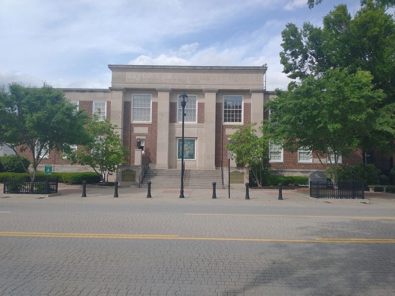
On East Main Street east of North Market Street, on the right when traveling west.
Philip Gatch • 1751-1834 • Minister & Common Pleas Judge Milford
William Lytle • 1770-1831 • Surveyor • Williamsburg
Thomas Morris • 1776-1844 • U.S. Senator & Abolitionist • Bethel
Ulysses S. Grant • 1822-1885 • 18th U.S. . . . — — Map (db m199332) HM
On Clermontville-Laurel Road 0.1 miles east of Ohio River Scenic Parkway (U.S. 52).
The first place of higher learning in Clermont County. A woman’s dream, a man’s covenant with God.
Built in the valley below by Rev. Daniel Parker’s family. Graduated 1500 students of many professions.
First Principal—James, their son, . . . — — Map (db m204649) HM
On East Main Street just east of North Market Street, on the right when traveling west.
The stained glass window is a gift to the citizens of Clermont County from the Clermont County Ohio Bicentennial Celebration Committee. It is a project of legacy, a preservation of history and a commitment to education. Surrounding the geographic . . . — — Map (db m200019) HM
On Ohio Route 133 0.2 miles south of Edenton-Pleasant Plain Road ( Route 727), on the left when traveling north. Reported missing.
The stone monument in the adjacent field commemorates the Bullskin trace, an old Indian trail used by Daniel Boone to escape the Shawnee Indians in 1778. Used by soldiers of General Anthony Wayne’s Army in 1793. It was made the Xenia State road in . . . — — Map (db m207762) HM
In 1803. Reverend John Collins and his family settled in Clermont County to farm, and one year later donated the land for this Methodist church and cemetery. This church became part of a network of other churches in the area nicknamed the "Collins . . . — — Map (db m227930) HM
Near West Riverside Drive north of West Winbourne Avenue, on the left when traveling north.
Before you is the McAlpine Dam, one of a coordinated system of 20 locks and dams on the Ohio River operated by the U.S. Army Corps of Engineers.
The Dam: Maintaining River Depth
Prior to construction of locks and dams, the river . . . — — Map (db m291787) HM
On County Park Road 0.3 miles east of Green Street, on the right when traveling south.
Since its creation, the Ohio River has always changed. Its seasonal floods and dry spells make the Ohio
River both feared and respected.
In 1888, the U.S. snag boat E.A. Woodruff removed 1225 snags,
127 large rocks, 46 new wrecks and 13 . . . — — Map (db m166891) HM
On Clough Pike at Hunley Road, on the right when traveling east on Clough Pike.
The land along Clough Pile was predominately farmland until the 1950s. A photograph from the late 1890s of the Wolfe family farm shows the buildings and fields along a narrow dusty Clough Pike. Today the rebuilt farm house is an office building . . . — — Map (db m169927) HM
On Ohio Route 133 0.2 miles south of Edenton-Pleasant Plain Road ( Route 727), on the left when traveling north.
Used by Boone to escape in 1778, by General Wayne in Indian Campaign, 1793. Made state road, 1807. Used for ammunition train, 1812. Underground Railroad prior 1861 — — Map (db m204973) HM
On Oakland Rd (Ohio Route 48), on the right when traveling east. Reported missing.
Col. Thomas Paxton (1739-1813) served with General
George Washington at Valley Forge in 1777 and with
General Anthony Wayne at the Battle of Fallen Timbers
in 1794. This was the last major fight against the
Indians before Ohio became a state in . . . — — Map (db m99423) HM
This is the stepping stone
from Revolutionary War veteran Adam Fisher’s log cabin.
After the war he and his family came to Kentucky and then
about 1799 moved across the Ohio River to settle between
Little Indian Creek and what is now route 743 . . . — — Map (db m95614) HM
Homestead of Major General William Lytle, known as the
“Father of Clermont County” for his many contributions
to the formation and settlement of the county. A surveyor
by profession, Lytle surveyed and acquired many acres of
land in Clermont. He . . . — — Map (db m95611) HM
On Beech Rd at Little Miami Scenic Trail, on the left when traveling east on Beech Rd.
Chartered in 1836, the Little Miami Railroad reached
Milford in 1841 and Loveland in 1844. It was the first
railroad in Clermont County. John Kugler supplied
the ties for much of the 6.15 miles of track in Clermont
County. In 1860 . . . — — Map (db m99472) HM
On Broadway Street at 2nd Street, on the right when traveling west on Broadway Street.
1861 — 1865
In memory of
the veterans of Moscow, Clermont County, Ohio,
who served in the Civil War.
Ackley, James • Armacost, Elijah • Bayless, Alonzo • Benjamin, James A. • Brown, Marion • Camery, Morris • Clark, Benjamin F. • . . . — — Map (db m204530) WM
On Ohio River Scenic Byway (U.S. 52) at Coffee Street, on the left when traveling east on Ohio River Scenic Byway.
Clermont County
Bicentennial Marker
Neville – 1812
The town is situated in the
first survey, No, 388, made in
the Virginia Military District of
Ohio. Nov. 13, 1787, John Obannon
surveyed a tract of 1,400
acres for Col. John . . . — — Map (db m99890) HM
Thin black lines indicate changes in relevance. Between each pair of lines entries are ordered geographically but all have the same relevance.
* Inflectional forms of words are their plurals, singulars, and possessives as well as gramatical tenses and similar variations.