On Main Street (Business U.S. 29) 0.2 miles north of West Hurt Road (County Road 924), on the left when traveling north.
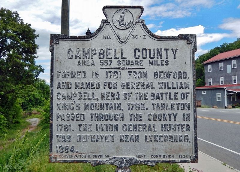
Pittsylvania County Area 1,015 Square Miles. Formed in 1766 from Halifax, and named for William Pitt, Earl of Chatham, British Statesman. This is the largest county of Virginia. The home of Claude A. Swanson, Governor of . . . — — Map (db m247285) HM
On Sutherlin Avenue south of Main Street (Virginia Route 293), on the left when traveling north.
The Town of Chatham has served as the seat of Pittsylvania County government since 1777. It is rich in history with architecturally significant pre-Revolution, Federal, Victorian and post-Victorian houses. Brochures for self-guided walking . . . — — Map (db m171909) HM
Near Court Place at Whittle Street, on the right when traveling south.
Tobacco farming and the curing of tobacco dominated Pittsylvania County's economy from its chartering in 1707 until the 1980's. Local farmers planted thousands of acres of Virginia's world famous and coveted bright leaf tobacco. Barns such as this . . . — — Map (db m299621) HM
On South Main Street (Business U.S. 29) at Franklin Place, on the right when traveling south on South Main Street.
Here stands Morea, the home of Lt. Col. Rawley W. Martin (1835-1912), a physician who served with Pittsylvania County soldiers during the Civil War in the 53d Virginia Infantry Regiment of Brig. Gen. Lewis A. Armistead's brigade. At Gettysburg, Pa., . . . — — Map (db m66057) HM
Welcome to Wayside Park, a 50 acre natural area featuring Sycamore Creek, mature forests, open fields, historic structures, and wonderful park amenities.
Wayside Park was built by the Civilian Conservation Corps (CCC) in 1935 as a recreation . . . — — Map (db m299542) HM
Welcome to Wayside Park, a 50 acre natural area featuring Sycamore Creek, mature forests, open fields, historic structures, and wonderful park amenities.
Wayside Park was built by the Civilian Conservation Corps (CCC) in 1935 as a recreation . . . — — Map (db m299543) HM
Welcome to Wayside Park, a 50 acre natural area featuring Sycamore Creek, mature forests, open fields, historic structures, and wonderful park amenities.
Wayside Park was built by the Civilian Conservation Corps (CCC) in 1935 as a recreation . . . — — Map (db m299544) HM
On North Broad Street (Virginia Route 62) at River Bend Road ( Route 1527), on the left when traveling west on North Broad Street.
Pittsylvania County. Area 1,015 square miles. Formed in 1766 from Halifax and named for William Pitt, Earl of Chatham, British statesman. This is the largest county in Virginia. The home of Claude A. Swanson, Governor of . . . — — Map (db m300118) HM
Henry County. Located in the foothills of southern Virginia, Henry County is named for Patrick Henry (1736-1799), Revolutionary leader and governor of the Commonwealth of Virginia. Henry lived in the county from 1779 to 1784. The General . . . — — Map (db m58373) HM
On Main Street (Business U.S. 21) at Court Place, on the right when traveling north on Main Street.
Here in March 1879, a federal marshal arrested James Coles, Pittsylvania County judge, on charges that he had violated the Civil Rights Act of 1875 by refusing to seat Black men on juries. Coles and the Commonwealth of Virginia petitioned the U.S. . . . — — Map (db m246666) HM
On River Park Drive 0.5 miles west of Danville Expressway (U.S. 29), on the left when traveling west.
This memorial wall honors the veterans of Danville and Pittsylvania County, Virginia, who gave their lives in the defense of our nation in all of is conflicts from the American Revolutionary War to its current engagements. The names inscribed on its . . . — — Map (db m266782) WM
Near Letcher Lane (Virginia Route 749) 0.5 miles west of Ararat Highway ( Route 773), on the left when traveling west.
William Letcher, the maternal great-grandfather of James Ewell Brown Stuart, was born about 1750 near Petersburg, Virginia. He was the second son of Giles Letcher of Goochland County, who was born in Ireland, and his wife, Hannah Hughes, who was of . . . — — Map (db m162905) HM
On Virginia Route 26 at County Route 677, on the right when traveling south on Virginia Route 26.
On 8 Apr. 1865, Gen. Robert E. Lee and his Army of Northern Virginia, retreating from Petersburg toward Pittsylvania County, reached the hills to the northeast. Gen. Ulysses S. Grant and his Federal army, pursuing Lee to the south, blocked him here. . . . — — Map (db m10224) HM
Near Letcher Lane (Virginia Route 749) at Ararat Highway ( Route 773), on the left when traveling west.
After the murder of William Letcher in 1780, the history of the fifteen-hundred-acre farm that would become the birthplace and boyhood home of James Ewell Brown Stuart is complex, in some instances vague and uncertain. Shortly after her husband's . . . — — Map (db m267763) HM
On U.S. 29 0.4 miles north of Main Street (Business U.S. 29), on the right when traveling south.
A native of Pittsylvania County, Claude Augustus Swanson (1862-1939), practiced law in Chatham until he won election to Congress in 1892. He served seven terms in the House of Representatives (1893-1906); was governor of Virginia (1906-1910) and . . . — — Map (db m55732) HM
On South Main Street (Business U.S. 220) near Old Furnace Road, on the right when traveling south.
Here stands the furnace and ironmaster’s house of the Washington Iron Works, Franklin County’s first industry. Originally established in 1773 by Col. John Donelson, father-in-law of President Andrew Jackson, the iron plantation was acquired in 1779 . . . — — Map (db m65983) HM
Near Avoca Lane west of Main Street (Business U.S. 29), on the right when traveling west.
Exhibited here is a reproduction "hogshead." A hogshead was a large barrel, usually made from oak and used by plantation owners in Maryland, Virginia, and North Carolina to store and transport tobacco to distant markets. When standing, hogshead . . . — — Map (db m299525) HM
On Pleasant Shade Drive (U.S. 58) west of Carter Road ( Route 649), on the right when traveling west.
Mecklenburg Electric Cooperative was chartered March 11, 1938, by a group of Mecklenburg County residents. The first office was located in Boydton, Virginia. The group's stated purpose was: "To advance the position of agriculture, to enrich the life . . . — — Map (db m48290) HM
On Sago Road 0.5 miles north of Callands Road ( Route 57), on the right when traveling north.
You are facing what is believed to be the original courthouse of Pittsylvania County. Here, on January 26, 1775, county residents gathered to elect a Committee of Inspection (later redesignated Committee of Safety)— a momentous step toward . . . — — Map (db m299876) HM
Near South Main Street at Pruden Street, on the left when traveling north.
In 1767 the Virginia House of Burgesses divided Halifax County to create Pittsylvania County. They named it for William Pitt, First Earl of Chatham, who earned the gratitude of the colonists for his defense of America before Parliament in 1765. The . . . — — Map (db m251495) HM
On Vaden Drive (Virginia Route 40) 0.1 miles west of Fitzgerald Street, on the right when traveling west.
Mecklenburg Electric Cooperative was charted March 1, 1938, by a group of Mecklenburg County residents. The first office was located in Boynton, Virginia, The group's state purpose was "To advance the position of agriculture to enrich the life of . . . — — Map (db m165420) HM
On U.S. 29 0.2 miles south of Tight Squeeze Road, on the right when traveling north.
One mile east stands Belle Grove, the home of Whitmell Pugh Tunstall (1810-1854). Educated at Danville Academy and the University of North Carolina, Tunstall was admitted to the bar in 1832. He served in the House of Delegates (1836-1841; 1845-1848) . . . — — Map (db m55730) HM
On West Main Street (Virginia Route 293) south of Blackwell Drive, on the right when traveling south.
Dating from the mid-1890’s, this asymmetrical Queen Anne-style dwelling was built for Waverly P. Cousins and his wife, the former Mary Herndon.
Lured from Chesterfield County, Virginia, in 1880, Mr. Cousins prospered in Danville’s . . . — — Map (db m270743) HM
On Koger Mill Road at Abram Penn Highway ( Route 626), on the left when traveling west on Koger Mill Road.
Just south of here is the site of Poplar Grove, home and burial place of Abram Penn, Revolutionary-era leader. Penn commanded a company during Dunmore's War against the Shawnee in 1774. The next year he was elected to the Pittsylvania County . . . — — Map (db m304868) HM
On Depot Street at South Main Street, on the right when traveling west on Depot Street.
I rejoice that America has resisted.
William Pitt, 1st Earl of Chatham
July 14, 1766
William Pitt, 1st Earl of Chatham, delivers a stunning speech to the British Parliament denouncing the 1765 Stamp Act . . . — — Map (db m294738) HM
On South Main Street at Pruden Street, on the left when traveling north on South Main Street.
Last unchanged street of the original town of Competition (1807-1852) Dedicated as a historical landmark by Chatham First, Inc., Pittsylvania Historical Society and the Town of Chatham December 6, 2008 — — Map (db m251486) HM
On Ford Road (County Route 908) 1.7 miles north of Yorkshire Road (County Route 777), on the right when traveling west.
Appalachian Power Company constructed Smith Mountain and Leesville Dams on the Roanoke River between 1960 and 1963 to generate hydroelectric energy, Between the dams, the river rose to form 3,400-acre Leesville Lake. West of Smith Mountain Dam, . . . — — Map (db m104452) HM
On this site, stood the outbuilding that served as the kitchen for the Stuart family. As was the custom in those days kitchens were housed in buildings separate from the main dwelling for protection against a fire that might erupt as a result of . . . — — Map (db m99842) HM
Dedicated to
the men and women of
Pittsylvania County, Virginia
who have served
their country in the
armed forces of
the United States — — Map (db m299562) WM
On Ringgold Depot Road at Ringgold Church Road, on the left when traveling west on Ringgold Depot Road.
The route of the Richmond and Danville Railroad began as a long-delayed dream for Whitmell P. Tunstall, a Pittsylvania County native. This attorney first proposed the construction of this line in 1838. It took almost a decade before Tunstall . . . — — Map (db m311312) HM
On Kerns Church Road 0.1 miles south of Kerns Mill Road, on the left when traveling north. Reported damaged.
The route of the Richmond and Danville Railroad began as a long-delayed dream for Whitmell P. Tunstall, a Pittsylvania County native. This attorney first proposed the construction of this line in 1838. It took almost a decade before Tunstall . . . — — Map (db m311316) HM
On 1st Avenue North 0.1 miles north of Broadway (U.S. 70), on the right when traveling north.
In appreciation of
the services of
Colonel John Donelson
Born in Delaware, 1718.
Died in Kentucky 1786.
Distinguished in early life in Virginia as a civil, industrial and military leader.
Member of the House of Burgesses, iron . . . — — Map (db m59376) HM
Near Craghead Street east of Bridge Street, on the left when traveling east.
By the outbreak of the Civil War, the Virginia General Assembly had chartered only eight railroads totaling 638 miles. The North, in contrast, had developed an immense network of railroads and canals. This transportation network reached into the . . . — — Map (db m66009) HM
Near Court Place at Whittle Street. Reported unreadable.
Beneath this bridge is the upper Cherrystone Spring. At the base of this hill is the lower Cherrystone Spring, the site of the Cherrystone, Meeting House community. In 1777 the new Virginia General Assembly divided Pittsylvania County to form Henry, . . . — — Map (db m299877) HM
On Whitmell School Road (County Route 750) at Sunset Drive (County Route 703), on the left when traveling south on Whitmell School Road.
Founded in 1878 as a two- room school and
named for state senator Whitmell P. Tunstall,
in 1918 the Whitmell Farm-Life School became
the first rural consolidated school in
Pittsylvania County. Sarah Archie Swanson
Beverley, who between 1916 and . . . — — Map (db m104455) HM
Thin black lines indicate changes in relevance. Between each pair of lines entries are ordered geographically but all have the same relevance.
* Inflectional forms of words are their plurals, singulars, and possessives as well as gramatical tenses and similar variations.