By James Hulse, November 9, 2022
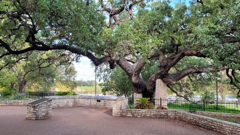
A view of the Founder's Oak and Marker
RANKED BY RELEVANCE
| Near Landa Park Drive (California Blvd) at Monument Drive. |
| On Peace Avenue at Dittlinger Street, on the left when traveling south on Peace Avenue. |
| On Landa Park Drive at Monument Drive, on the left when traveling north on Landa Park Drive. |
| On Business Interstate 35 north of State Highway 46, on the right when traveling south. |
| On Spring Branch Road (County Highway 71) 1.3 miles west of U.S. 281, on the right when traveling west. |
| On Rittimann Road near Spring Branch Road, on the right when traveling north. |
| On Schroeder Road 0.2 miles west of Ernst Parkway (Farm to Market Road 109), on the left when traveling west. |
| On La Bahia Loop at Soledad Lane, on the left when traveling west on La Bahia Loop. |
| On East San Antonio Street at North Seguin Avenue, on the right when traveling west on East San Antonio Street. |
| On Farm to Market Road 1102 at Malone Street, on the right when traveling east on Road 1102. |
| On Comal Avenue at Lindheimer Avenue, on the right when traveling west on Comal Avenue. |
| On West Mill Street at North Academy Avenue, on the right when traveling south on West Mill Street. |
| On Navasota Street at East 14th Street, on the right when traveling north on Navasota Street. |
| On Church Road 0.1 miles south of State Highway 119, on the right when traveling south. |
| On East Evans Road 0.1 miles east of Nacogdoches Road, on the right when traveling east. |
| On River Road 0.4 miles north of Hueco Springs Loop Road, on the right when traveling north. |
| On Rock Street 0.1 miles east of River Road, on the right when traveling east. |
| On Faust Street Bridge (pedestrian and cyclists only) east of Sanger Avenue, on the right when traveling east. |
| Near Landa Park Drive at Monument Drive, on the right when traveling north. |
| Near Landa Park Drive at Monument Drive, on the right when traveling north. |
| On South Seguin Avenue (State Highway 46), on the right when traveling north. |
| Near Lakeside Pass (County Highway 358) 0.7 miles east of Farm to Market Road 725, on the left when traveling east. |
| On Farm to Market Road 484 at Fischer Store Road, on the left when traveling east on Highway 484. |
| On Common Street at S East Avenue, on the right when traveling west on Common Street. |
| On Business Interstate 35 0.3 miles north of State Highway 46, on the left when traveling north. |
| On Oak Drive at Emerald Forest, on the right when traveling south on Oak Drive. |
| On River Drive West 0.1 miles west of South Austin Street (State Highway 123), on the left when traveling west. |
| On Peace Avenue at E. Dittlinger St, on the left when traveling north on Peace Avenue. |
| On Luckenbach Loop Road at Farm to Market Road 1376, on the right when traveling south on Luckenbach Loop Road. |
| On W. Parsonage Street at N. West Street, on the right when traveling west on W. Parsonage Street. |
Thin black lines indicate changes in relevance. Between each pair of lines entries are ordered geographically but all have the same relevance.* Inflectional forms of words are their plurals, singulars, and possessives as well as gramatical tenses and similar variations.
Nov. 12, 2026
