By Tim Carr, September 6, 2009
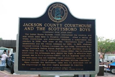
Jackson County Courthouse And The Scottsboro Boys Marker Reverse Side
RANKED BY RELEVANCE
| On E Peachtree Street, on the right when traveling west. |
| On County Road 326 at County Road 99, on the right when traveling east on County Road 326. |
| On County Road 90 0.1 miles east of Alabama Route 73, on the right when traveling east. |
| On U.S. 72 at Kentucky Ave. on U.S. 72. |
| Near Veterans Drive (Alabama Route 35) north of Lee Highway (U.S. 72), on the right when traveling north. |
| On County Route 21 1 mile east of Route 79, on the right when traveling east. |
| On Bellefonte Road (County Road 33) 0.8 miles east of Lee Highway/John T Reid Parkway (U.S. 72), on the left when traveling east. |
| On Old Highway 431 north of Cherry Tree Rd (County Road 28), on the left when traveling south. |
| On South Scott Street north of East Charlotte Avenue, on the left when traveling north. |
| On McCurdy Avenue North (State Highway 75) at Main Street (State Highway 35), on the right when traveling south on McCurdy Avenue North. |
| On Old Pearsall Road (Farm to Market Road 2536) 0.2 miles east of Edwards Road, on the right when traveling west. |
| On Ferry Street Northeast south of Cain Street Northeast, on the right when traveling south. |
| On Lee Street (County Route 66) at Hickory Drive, on the left when traveling west on Lee Street. |
| On Nashville Highway (Alternate U.S. 31) 0.1 miles north of Warner Road, on the right when traveling north. |
| On Lone Star Parkway (Farm to Market Road 2854) at State Highway 105, on the right when traveling west on Lone Star Parkway. |
| Near Alabama Route 42 0.2 miles north of Route 36, on the right when traveling north. |
| On John T Reid Parkway (U.S. 72) at Church Street, on the right when traveling south on John T Reid Parkway. |
| On South Jackson Street (U.S. 41A) at West Volney Street, on the right when traveling south on South Jackson Street. |
| Near Veterans Drive (Alabama Route 35) north of Lee Highway (U.S. 72), on the right when traveling north. |
| On Ikard Road 0.3 miles north of Nebo Road, in the median. |
| On Banks Street (State Highway 97) at Alabama Street (State Highway 97), on the right when traveling east on Banks Street. |
| On North Cedar Avenue (Tennessee Route 27) south of Old Jasper Road, on the right when traveling south. |
| On West Main Street (Business U.S. 59), on the right when traveling east. |
| On Riverfront Parkway, on the left when traveling east. |
| On Section Line Road at Railroad Street, on the right when traveling east on Section Line Road. |
| On W. Houston St. at N. Flores St., on the right when traveling west on W. Houston St.. |
| On Walnut Street (U.S. 90), on the right when traveling east. |
| On Heroes Drive west of Jefferson Dr. |
| Near West Main Street (Illinois Route 13) east of Glenview Drive. |
| Near Beach Boulevard 0.3 miles west of Hague Street. |
| On South Main Street (Farm to Market Road 2268) at College Hill Drive, on the right when traveling north on South Main Street. |
| On Heroes Drive west of Jefferson Dr. |
| Near Florida Route 2 1 mile east of Timberlake Road, on the right when traveling east. |
Thin black lines indicate changes in relevance. Between each pair of lines entries are ordered geographically but all have the same relevance.* Inflectional forms of words are their plurals, singulars, and possessives as well as gramatical tenses and similar variations.
Nov. 12, 2026
