14 entries match your criteria.
Related Historical Markers
Battle of Trevilian Station Virtual Tour by Markers.
By Devry Becker Jones (CC0), April 3, 2021
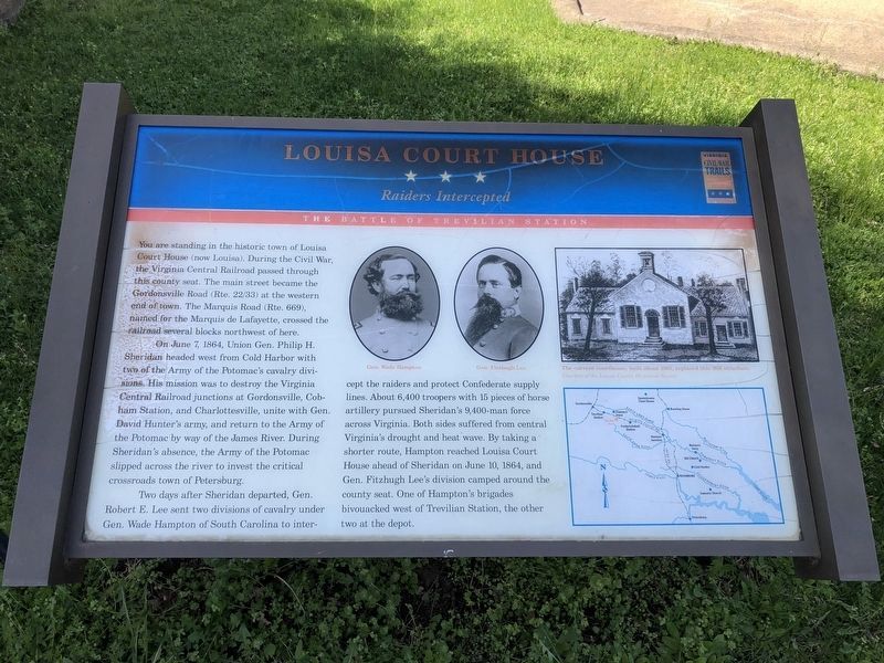
Louisa Court House Marker
SHOWN IN SOURCE-SPECIFIED ORDER
| On West Main Street (U.S. 33) at Elm Avenue, on the right when traveling east on West Main Street. |
| On Ellisville Drive (County Route 669), on the right when traveling south. |
| On Ellisville Drive (County Route 669) at Oakland Road (County Route 613), on the right when traveling north on Ellisville Drive. |
| On Oakland Road (County Route 613), on the right when traveling north. |
| On Oakland Road (County Route 613), on the right when traveling north. |
| On Louisa Road (U.S. 33) at Danne Road (County Route 682), on the right when traveling west on Louisa Road. |
| On Louisa Road (U.S. 33) at Danne Road (County Route 682), on the right when traveling west on Louisa Road. |
| On Louisa Road (U.S. 33) at Danne Road (Route 682), on the right when traveling west on Louisa Road. |
| On Louisa Road (U.S. 33) at Trevilians Square, on the right when traveling east on Louisa Road. |
| On Louisa Road (U.S. 33) at Trevilians Square, on the right when traveling east on Louisa Road. |
| On South Spotswood Trail (U.S. 33) 1.4 miles north of Louisa Road (Virginia Route 22), on the right when traveling west. |
| On Spotswood Trail (U.S. 33) at Dunkum Store Road (County Route 636), on the right when traveling west on Spotswood Trail. |
| On West Street (County Route 666), on the right when traveling west. |
| On West Street (County Route 666), on the right when traveling west. |
Jun. 17, 2024