By Brian Scott, January 23, 2007
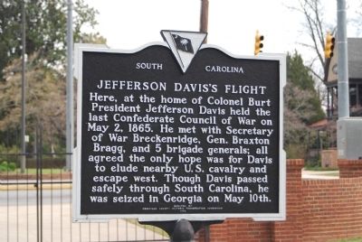
Jefferson Davis's Flight Marker
RANKED BY RELEVANCE
| On North Main Street (State Highway 71) at Greenville Street (State Highway 20) on North Main Street. |
| On Main Street at Greenville Street, in the median on Main Street. |
| On 3rd Street at Main Street, on the left when traveling north on 3rd Street. |
| On Navasota Street north of East 7th Street, on the right when traveling north. |
| On Maysville Road (U.S. 68) at Main Park Road, on the left when traveling north on Maysville Road. |
| On Elm Tree Lane at East Third Street, on the right when traveling south on Elm Tree Lane. |
| Near Wilkinson Boulevard (U.S. 421) north of West Plaza Connector Road (U.S. 127), on the right when traveling south. |
| On Newtown Pike (Kentucky Route 922) 1 mile north of Iron Works Pike ( Route 1973), on the right when traveling north. |
| On Kentucky Route 1 at Laurel Road, on the left when traveling north on Kentucky Route 1. |
| On Clifton Avenue 0.5 miles west of Cheek Street, on the left when traveling west. |
| On Manchester Street at Saint Charles Street, on the left when traveling north on Manchester Street. |
| Near Danville Road Loop 2 0.4 miles south of Fitch Road. |
| On Ghent-Eagle Station Road south of Dividing Ridge Road ( Route 2984), on the left when traveling south. |
| On Coronado Ridge 0.1 miles south of Sprinters Trail, on the right when traveling south. |
| On U.S. 27 at Hutchison Station Road ( Route 1939), on the right when traveling north on U.S. 27. |
| Near Bryan Station Road (Kentucky Route 57) at Brair Hill Road. |
| On West 4th Street at Poplar Street, on the right when traveling east on West 4th Street. |
| On Old Frankfort Pike (Route 1681) at Alexandria Drive, on the right when traveling east on Old Frankfort Pike. |
| On East Main Street at South Martin Luther King Boulevard, on the left when traveling west on East Main Street. |
| On West Short Street at North Upper Street on West Short Street. |
| On Deweese Street south of Elm Tree Lane, on the left when traveling south. |
| On West 3rd Street west of North Mill Street, on the right when traveling west. |
| On State Highway 94 north of Lucille Avenue, on the right when traveling north. |
| Near East Washington Street. |
| On Kentucky Route 1 just north of Route 1496, on the left when traveling south. |
| On Farm to Market Road 2571 at Young School House Road (County Road 280), on the right when traveling west on Road 2571. |
| On State Highway 159 0.3 miles north of Darden Loop, on the right when traveling north. |
| On North Main Street (Business U.S. 27) at West Maple Street, on the right when traveling south on North Main Street. |
| On Chester Street north of Walker Street, on the left when traveling north. |
| On North Main Street at East Poplar Avenue (Tennessee Route 57), on the right when traveling north on North Main Street. |
| Near East Main Street (U.S. 60) at Holley Street. |
| On Princeton Avenue (U.S. 19) at Tony Wagner Avenue, on the right when traveling east on Princeton Avenue. |
| On North Main Street south of First Street, on the left when traveling south. |
| On Old Richmond Road (U.S. 25/421) 0.7 miles south of McCalls Mill Road, on the left when traveling south. |
| Near North Main Street (Business U.S. 27) north of Wardlaw Street East, on the right when traveling north. |
Thin black lines indicate changes in relevance. Between each pair of lines entries are ordered geographically but all have the same relevance.* Inflectional forms of words are their plurals, singulars, and possessives as well as gramatical tenses and similar variations.
Nov. 12, 2026
