226 entries match your criteria. Entries 201 through 226 are listed.⊲ Previous 100
Alabama Historical Commission Historical Markers
The Alabama Historical Commission's historical marker program began in 1975 to help preservationists inform the public about significant buildings, sites, structures, objects, cemeteries, and districts in the state. Most markers are cast with a circular medallion at the top featuring an outline of the state inside. However, there are also rectangular non-cast markers. The Alabama Historical Association has a similar marker program (and separate HMDb series) but its markers feature the Alabama State Flag.
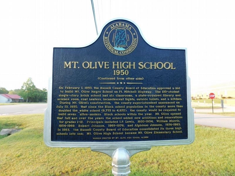
On Alabama Route 165 south of Mt. Olive Drive, on the right when traveling south.
1916. In 1916, Mt. Olive School was built on Ft. Mitchell Highway across the highway from the current location of the school. Philanthropist Julius Rosenwald, in partnership with Booker T. Washington, created matching grants to fund rural . . . — — Map (db m302424) HM
On Alabama Route 169 just west of U.S. 431, on the right when traveling west.
The Old Federal Road that opened the southeastern United States to
settlers once crossed at this location. In 1805, the United States Congress
granted funds to build a post road from Georgia to New Orleans to
cross the sparsely settled wilderness . . . — — Map (db m237220) HM
On County Road 24, on the right when traveling south.
Harless Cemetery was established as a burying ground in the early 1800s. It is on land homesteaded by Henry Harless, Jr., that was later owned and subsequently deeded to the cemetery by members of the Wyatt family. The oldest surviving marker is for . . . — — Map (db m24914) HM
On County Highway 204 south of Epsibeth Road, on the left when traveling north.
Epsibeth Missionary Baptist Church founded 1873, has been designated as a significant African American historic site by the Alabama Historical Commission — — Map (db m295284) HM
On Selma Road (State Highway 119) at Ellis Street, on the right when traveling north on Selma Road.
Shiloh Missionary Baptist Church, Montevallo, organized in 1899, has been designated as a significant African American historic site by the Black Heritage Council of the Alabama Historical Commission. — — Map (db m295183) HM
On Bear Creek Road 0.1 miles west of Argonne Forest Drive, on the right when traveling west.
Gilgal Cemetery is associated with Gilgal Baptist Church and has a history dating to the early 1840s. The cemetery contains over 200 marked and an unknown number of unmarked burials. Church history states that many babies were buried near the road . . . — — Map (db m231528) HM
On Main Avenue north of 5th Street, on the right when traveling south.
James Shirley built this raised cottage in 1838, using Federal and Greek Revival detailing. Constructed of local handmade brick, it was home for him, his wife, Mary Ann Christian Shirley, and his mother, Elizabeth Shirley. James was town surveyor in . . . — — Map (db m35384) HM
On 20th Avenue at 18th Street, on the right when traveling south on 20th Avenue.
This one story brick cottage was built ca. 1837 for the Benjamin S. Wilson family. Its overall form – a gabled main block with the rear slope of the roof extending over shed rooms at the back – is typical of smaller Tuscaloosa and Northport houses . . . — — Map (db m217158) HM
On Judy Bonner Drive 0.1 miles east of Magnolia Drive, on the right when traveling east.
On November 18, 1921, Psi Chapter of Alpha Gamma Delta became the fifth national sorority installed at the University of Alabama. On this date, eight new inductees were initiated to establish Alpha Gamma Delta. These eight women were Annie Mary . . . — — Map (db m235516) HM
On Kirkbride Lane at Harper Court, on the right when traveling west on Kirkbride Lane.
One of four historic cemeteries located on the campus of Bryce Hospital, Alabama's oldest mental health facility, this cemetery features at least thirty-seven marked graves, the earliest of which dates to 1892. There are an undetermined number of . . . — — Map (db m235525) HM
On Jack Warner Parkway Northeast north of 8th Avenue Northeast, on the right when traveling north.
One of four historic cemeteries located on the campus of Bryce Hospital, Alabama's oldest mental health facility, this cemetery was established in 1922 and was closed for burials in 1953. It contains approximately 1550 burials mostly marked with . . . — — Map (db m40449) HM
Near Jack Warner Parkway 0.1 miles south of 8th Avenue Northeast, on the right when traveling east.
One of four historic cemeteries located on the campus of Bryce Hospital, Alabama's oldest mental health facility, this cemetery was established in 1953 and is still in use. It contains approximately 500 burials mostly marked with simple, . . . — — Map (db m235677) HM
On Magnolia Drive 0.1 miles north of Paul W Bryant Drive, on the left when traveling north.
Delta Zeta at the University of Alabama Founded October 24, 1902, Miami University, Oxford, Ohio Alpha Gamma Chapter Installed September 9, 1922
The sixth national sorority at the University of Alabama began in 1920 as local sorority Delta . . . — — Map (db m235508) HM
On Jack Warner Parkway Northeast south of McFarland Blvd East (U.S. 82), on the right when traveling south.
This is the oldest of four historic cemeteries located on the campus of Bryce Hospital, Alabama's oldest mental health facility. The first recorded burial dates to 1861. While only a few graves are currently marked, it is estimated that thousands of . . . — — Map (db m40450) HM
On Loop Road 0.1 miles east of Patton Avenue/Woodland Road, on the right when traveling east.
The Tuscaloosa Veterans Administration (VA) Hospital was constructed in the early 1930's and was dedicated on July 6, 1932. The 272 bed General Medical and Surgical Hospital began admitting patients on July 15, 1932. In 1940, the hospital was . . . — — Map (db m203526) HM
On 19th Street at 3rd Avenue, on the right when traveling west on 19th Street.
The Confederate Monument was erected on November 13, 1907 and dedicated May 2, 1908 by the Jasper Chapter No. 925 United Daughters of the Confederacy under the leadership of Elizabeth Cain Musgrove to honor the 1900 soldiers who served from Walker . . . — — Map (db m37222) HM
First United Methodist Church
Jasper
Methodism came to Jasper with the city's founder, Dr. Edward Gordon Musgrove, who donated land for the courthouse and for most of downtown Jasper. In 1826, he and others constructed a building of large . . . — — Map (db m29981) HM
On Jefferson Davis Highway (U.S. 43) at John Johnston Road (County Road 35), on the right when traveling north on Jefferson Davis Highway.
Andrews Chapel, also known as the McIntosh Log Church, is one of the few remaining log churches in Alabama. In 1860, John C. Rush and his wife donated land for the church to the McIntosh Community. Shortly afterwards, the church was constructed and . . . — — Map (db m70594) HM
On Claiborne Street (Alabama Route 28/41) 0.2 miles west of Firehouse Road, on the right when traveling west.
[side 1 • faces east] In 1886, William Henderson, a Scottish immigrant, former Union Army Officer, and United Presbyterian moved from New York to Wilcox County. He saw the plight of freed slaves and urged his children to begin schools in the . . . — — Map (db m228693) HM
On Broad Street (Alabama Route 28) at Fail Street, on the left when traveling north on Broad Street.
This building was constructed c. 1849 as a Cumberland Presbyterian Church.
The Camden Associate Reformed Presbyterian congregation was organized in September 1890 in the parlor of the William Joel Bonner home. There were twelve charter . . . — — Map (db m68161) HM
On State Highway 28 at McCall Road (Prairie Mission Road), on the right when traveling west on State Highway 28.
Prairie Mission was established in 1894 by the Freedmen’s Board of the United Presbyterian Church of North America to educate the children of ex-slaves. The Mission consisted of a church, school building, dormitories for male and female students, a . . . — — Map (db m38496) HM
On State Highway 10 at Adams Street on State Highway 10.
Founded in 1882 by John Trotwood Moore, who became a famous author, archeologist, and poet laureate of the State of Tennessee, the original two-story wood frame building served the Pine Apple area from 1882 until the present brick structure was . . . — — Map (db m47705) HM
On State Highway 10 at Garret Street, on the right when traveling east on State Highway 10.
Founded in 1825, the town of Pine Apple became a regional commercial center due to its strategic location as the end of the Selma to Pensacola Railroad line from 1871 to the 1890s. The progressive spirit of Pine Apple during the centennial period . . . — — Map (db m47704) HM
On State Road 10 at Ruthuen Cutoff Road, on the left when traveling west on State Road 10.
Founded in 1825, the town of Pine Apple became a regional commercial center due to its strategic location as the end of the Selma to Pensacola Railroad line from 1871 to the 1890s. The progressive spirit of Pine Apple during the centennial period . . . — — Map (db m47799) HM
On 20th Street at 10th Avenue, on the right when traveling east on 20th Street.
Born in Winston County, Alabama in 1918, Frank M. Johnson, Jr. transcended the prejudices of his time and made his mark as one of the great jurists in American history.
He married his Winston County sweetheart, Ruth Jenkins, in 1938. During . . . — — Map (db m80559) HM
On County Road 63 at County Road 61, on the left when traveling south on County Road 63.
The Jail at Houston
The Houston Jail is the only surviving log jail in north Alabama. The jail, constructed around 1868 from hand-hewn hardwood logs, replaced an earlier one destroyed by pro-Union men in the county during the Civil War. The . . . — — Map (db m182919) HM
226 entries matched your criteria. Entries 201 through 226 are listed above. ⊲ Previous 100