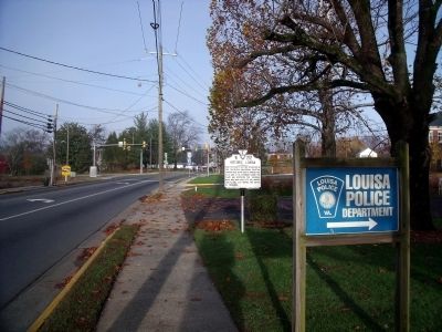
On East Main Street (U.S. 33) 0.1 miles west of Lyde Avenue, on the right when traveling west.
Here the county seat was established in 1742. The British Cavalryman, Tarleton, stopped here on his raid to Charlottesville, June 3, 1781. Stoneman raided the place and destroyed the railroad, May 2, 1863. Near here Fitz Lee camped, June 10, 1864, . . . — — Map (db m24560) HM
On West Main Street (U.S. 33) at Elm Avenue, on the left when traveling west on West Main Street.
Welcome to historic downtown Louisa, known as Louisa Court House during the Civil War, your starting point for a driving tour of the pivotal Battle of Trevilian Station.
In June 1864, the Virginia Central Railroad, which passed through Louisa, . . . — — Map (db m308345) HM
On Ellisville Drive (County Route 669), on the left when traveling north.
Having reached Louisa Court House on June 10, 1864, Confederate Gen. Wade Hampton's cavalry divisions camped around the Virginia Central Railroad and across Union Gen. Philip H. Sheridan's route to Gordonsville. About 3 A.M. on June 11, Confederate . . . — — Map (db m308316) HM
On Ellisville Drive (County Route 669) at Oakland Road (County Route 613), on the right when traveling north on Ellisville Drive.
After riding across Virginia for three days on a raid to destroy parts of the Virginia Central Railroad, Union Gen. Philip H. Sheridan's 9,300 cavalrymen and horse artillerists crossed the North Anna River at Carpenter's Ford and bivouacked in the . . . — — Map (db m308313) HM
On Oakland Road (County Route 613), on the right when traveling north.
A 9,300-man Union cavalry force under Gen. Philip H. Sheridan, on a raid to destroy parts of the Virginia Central Railroad, camped a few miles east on June 10, 1864. The next morning, Gen. Wesley Merritt's brigade, followed by Col. Thomas C. Devin's . . . — — Map (db m4841) HM
On Oakland Road (County Route 613), on the right when traveling north.
Fifty yards east is the site of Netherland Tavern (ca. 1822), which was demolished in the 1950s. The tavern served travelers on the Fredericksburg Stage Road and the Louisa Court House Road to the south. It also served rail passengers after the . . . — — Map (db m4840) HM
On Oakland Road (County Route 613) 0.3 miles east of Louisa Road (U.S. 33), on the right when traveling north.
This tavern is where General Wade Hampton slept the night before the bloodiest cavalry battle was fought and won by the rebel's
This tavern was used as a hospital for the wounded.
The original tavern was built in the 1700's era — — Map (db m308352) HM
On Louisa Road (U.S. 33) at Danne Road (County Route 682), on the right when traveling west on Louisa Road.
Nearby stood Trevilian Station, south of which Confederate Gen. Wade Hampton had parked his wagon train on the evening of June 10, 1864. At daylight the next day, Gen. Matthew C. Butler and Col. Gilbert J. Wright advanced north on the Fredericksburg . . . — — Map (db m193772) HM
On Louisa Road (U.S. 33) at Danne Road (County Route 682), on the right when traveling west on Louisa Road.
By mid-morning on June 11, 1864, Gen. George A. Custer's attack on Confederate Gen. Wade Hampton's wagon train here had gone from success to near disaster as Southern cavalry surrounded Custer's force. A staff officer of Gen. Alfred T.A. Torbert, . . . — — Map (db m193777) HM
On Louisa Road (U.S. 33) at Danne Road (Route 682), on the right when traveling west on Louisa Road. Reported missing.
In June 1864, Maj. Gen. Philip H. Sheridan led a Union cavalry raid against the Virginia Central Railroad here, which Maj. Gen. Wade Hampton and Maj. Gen. Fitzhugh Lee defended during a two-day battle. On 11 June, the first day, Union Brig. Gen. . . . — — Map (db m193819) HM
On Danne Road 0.1 miles north of Louisa Road (U.S. 33), on the left when traveling north.
The rail on the right side is the 1858 rail laid by the Virginia Central Railroad. It remained in place through the war, until the 1870 replacement by the C&O Railroad.
The rail on the left is a section of the rail the C&O Railroad started . . . — — Map (db m308350) HM
On South Spotswood Trail (U.S. 33) 1.4 miles north of Louisa Road (Virginia Route 22), on the right when traveling west.
After breaking off the fighting of June 11, 1864, Confederate Gen. Wade Hampton’s cavalry division withdrew to a position near here. Gen. Matthew C. Butler’s South Carolinians spent the next morning preparing a stout defensive position along the . . . — — Map (db m256957) HM
On Louisa Road (U.S. 33) at Trevilians Square, on the right when traveling east on Louisa Road.
In June 1864, shortly after the bloody battle at Cold Harbor, Union Maj. Gen. Philip H. Sheridan and his cavalry moved westward to disrupt the Virginia Central Railroad and unite with Maj. Gen. David Hunter’s army, then operating in the Shenandoah . . . — — Map (db m271472) HM
On Louisa Road (U.S. 33) at Trevilians Square, on the right when traveling east on Louisa Road.
— Fought here June 11, 12, 1864 —
Confederate Gens. Wade Hampton, Fitzhugh Lee
and Thomas L. Rosser, victors over
Federal Gens. P.H. Sheridan and G.A. Custer
5000 Confederates, 8000 Federal
Casualties Confederate 612, Federal 1,007 . . . — — Map (db m271470) HM
On West Street (County Route 666) at Purcell Drive, on the left when traveling west on West Street.
Confederate Gen. Wade Hampton's victory over Gen. Philip H. Sheridan at Trevilian Station on June 11-12, 1864, prevented Sheridan from joining Gen. David Hunter and destroying the Virginia Central Railroad at Charlottesville. Gen. Jubal A. . . . — — Map (db m156010) HM
On West Street (County Route 666) at Purcell Drive, on the left when traveling west on West Street.
Here in Oakland Cemetery, beneath small, rectangular stone markers, rest as many as 60 Confederate dead from the Battle of Trevilian Station. Most of them were never identified.
Immediately inside the gate are the graves of the three Towles . . . — — Map (db m256955) HM
On West Street 0.1 miles east of West Main Street (U.S. 33), on the right when traveling east.
"Love Makes Memory Eternal"
This monument is dedicated
with affection, reverence
and undying remembrance
to the memory of the men
who gave their lives at
The Battle of Trevilians
June 11-12 1864
And who lie buried here . . . — — Map (db m308279) WM