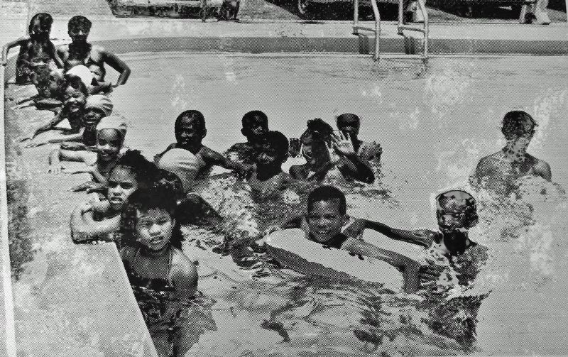
On West Carolina Street west of North Martin Luther King Jr. Boulevard, on the left when traveling west.
Greater Frenchtown Greater Frenchtown is a derivative of the original Frenchtown, in name and geographics. Current and long-time residents who are familiar with the history know the neighborhoods now called Greater Frenchtown as the . . . — — Map (db m229282) HM
James Calvin Tyson's personal story resembles that of many Florida Cracker families. His parents moved to Florida from Georgia just weeks before the Civil War in 1861. James was born in Florida, and by 1885, he had established himself as a farmer . . . — — Map (db m220310) HM
On Turn Around Bay Road at East Irlo Bronson Memorial Highway (U.S. 441), on the right when traveling north on Turn Around Bay Road.
Before the Spanish invaded Florida in the 1500s, Jororo Indians inhabited what are now parts of South Orange, Lake, Polk, and Osceola Counties. In the late 1600s the Spanish established many mission churches across Florida, three of which were . . . — — Map (db m237226) HM
Near Babb Road 0.6 miles north of Old Vineland Road, on the right when traveling north.
Like so many Cracker families, Henry Oscar Partin’s parents moved to Florida from Georgia in the 1870s. Henry, an ambitious teenager, followed in his father's footsteps as a farmer and rancher. He was only 15 when he used his wages as a cowhand to . . . — — Map (db m204514) HM
On West Emmett Street (U.S. 17) east of South Rose Avenue, on the right when traveling east.
Osceola County was created in May, 1887 from portions of Orange and Brevard Counties. One of its sponsors was Senator J. Milton Bryan, who suggested the new county be named for Osceola, the great Seminole warrior. The new county was Florida's . . . — — Map (db m54022) HM
Near Babb Road 0.6 miles north of Old Vineland Road, on the right when traveling north.
Discover
Frontier Communities
The Pioneer Village at Shingle Creek is a composite reconstruction of Osceola County's early history designed to reflect the local heritage and common stories. The buildings and historic environments are . . . — — Map (db m204400) HM
The Seminoles of central Florida built settlements on elevated hammocks or islands along the swampy Kissimmee River Valley. Their shelters, "chickees," were built from local materials, including pine logs and palm thatch. Chickees were well designed . . . — — Map (db m220319) HM
Near Chisholm Park Trail 1 mile west of South Narcoossee Road, on the left when traveling south.
More than 35 years prior to sugarcane being grown commercially in South Florida, northern entrepreneurs came to Central Florida and started planting cane on newly drained, nutrient-rich, land. By 1888, Hamilton Disston, a Philadelphia saw . . . — — Map (db m237884) HM
On Vine Street (Florida Route 192) 0.1 miles west of North Hoagland Boulevard, on the left when traveling east.
Fletcher Park
Donated to the State of Florida
June 15 1935
by Tufts College
Boston Massachusetts
In Memory of Austin B. Fletcher
To perpetuate for future generations these large Cypress Trees.
Fletcher Park . . . — — Map (db m215520) HM
Near Babb Road 0.2 miles north of Princess Lane, on the right when traveling north.
Pioneers grew and produced sugarcane to use as sweetener for cooking and baking. The sugarcane grew in small "cane patches" alongside other crops. This perennial plant was harvested once a year in the fall and often processed in community . . . — — Map (db m205491) HM
Near Babb Road 0.2 miles north of Princess Lane, on the right when traveling north.
Like so many others settlers of the time, John Lanier moved to Florida from Georgia in search of new opportunities. He and his family moved through Florida as John established himself as a cattle rancher, eventually settling in "the Point," an area . . . — — Map (db m220316) HM
On New York Avenue at 12th Street, on the left when traveling north on New York Avenue.
St. Cloud's First National Bank opened in 1910. This narrow, two story Masonry Vernacular structure was built from locally produced sand brick, wood beams, and concrete block. St. Cloud residents subscribed over $100,000 of capital stock, twice as . . . — — Map (db m96945) HM
On New York Avenue just south of 10th Street, on the right when traveling north.
Following World War I, the United States economy was thriving. Florida’s population skyrocketed as cheap land, combined with the improved roads and railways, drew northern tourists and developers to the state. In 1925, Ohio mausoleum builder . . . — — Map (db m137485) HM
Near Babb Road 0.3 miles north of White Oak Road, on the right when traveling north.
When Osceola County was formed in 1887, there were small villages scattered outside of Kissimmee. New settlers in the rural areas built schools for their children, and these one-room buildings accommodated multiple school grades. Students attended . . . — — Map (db m220308) HM
When Lt. Colonel William Cadman purchased an orange grove in Narcoossee in 1888, he was retired and busy with many interests. The grove was likely an investment in his sons' futures, and they handled much of the work along with paid seasonal . . . — — Map (db m220311) HM
Prior to the late 1880s, travel was completed primarily by foot, horse, or wagon. After the expansion of railroad lines through Florida, convenient transportation became affordable to more of the population. Travel time was still slow, but railroads . . . — — Map (db m220309) HM
In 1888, Lt. Col. William Edwin Cadman of Yorkshire, England, came to Narcoossee to investigate a potential investment property, including a home and citrus grove. Several members of the family joined him, including his wife, Jane. Upon their . . . — — Map (db m236257) HM
In the mid to late 1880s, cow camps were a part of the Cracker way of life. Cowmen drove their cattle to market between March and August, and the camps were established along the route - about a day's ride between each. The cowmen hunkered down for . . . — — Map (db m220317) HM
On Kempfer Road at E. Bronson Highway (U.S. 192), on the left when traveling south on Kempfer Road.
In 1895 George Washington Hopkins from Michigan began buying land in eastern Osceola and Brevard County. He founded the Union Cypress Company, operating a saw and planing mill in Hopkins, a small town south of Melbourne. Deer Park was founded to . . . — — Map (db m221629) HM
On South Canoe Creek Road (County Road 523) 0.6 miles west of South Kenansville Road (U.S. 441), on the left when traveling west.
This building was constructed in 1917 on five acres of land with $6,000 donated from the estate of Mrs. Mary Lily Kenan Flagler Bingham, (1867-1917), wife of Henry Flagler, the owner and promoter of the Florida East Coast Railroad. Kenansville . . . — — Map (db m72612) HM
On Jones Road at Fryer Road, on the left when traveling north on Jones Road.
A group of young Black families migrated to Narcoossee from North Carolina in 1886. Jones, Fryar, Wiggins, and Whitted roads and Little Lane are named after some of these original settlers. They came to harvest citrus and sugarcane on land owned . . . — — Map (db m247947) HM
Near Old Vineland Road at Princess Way, on the right when traveling south.
The Shingle Creek community was once a frontier, with the first settlers arriving around 1860.
Henry Overstreet deeded land for a church and cemetery, a permanent church site was established in 1865. The creation of a place of worship became the . . . — — Map (db m245829) HM
Near Babb Road 0.2 miles north of Princess Lane, on the right when traveling north.
In the 1880's, and before, when settlements in Osceola County were just beginning, there were few roads as such, mainly wagon trails and no bridges over Single Creek. The road west, Vine Street led to three Fords named after Jim Yates (also called . . . — — Map (db m204486) HM
Bronson
1900-1975 — 1907-1971
Irlo — Flora Bass
Irlo, 4th generation cattleman, was born in Osceola County. Flora was born in Kissimmee. Married in 1924, Irlo served in the Florida Legislature, 1942-67. Generously gave time, . . . — — Map (db m204497) HM
On Massachusetts Avenue just north of 11th Street, on the left when traveling north.
The Ladies Improvement Club of St. Cloud organized in 1910 for the betterment of the community through civic projects and the advocacy of literacy. The club established a small area in the Sugar Belt Railway depot for books and magazines for . . . — — Map (db m102976) HM
Near Babb Road 0.6 miles north of Old Vineland Road, on the right when traveling north.
For the Florida pioneers, barns were used to protect valuable riding gear, farm equipment, animal food, and at times, the animals themselves. Horses, oxen, and meat cattle were generally kept outdoors. Small or young animals may have been kept . . . — — Map (db m220315) HM
Near Babb Road 0.2 miles north of Princess Lane, on the right when traveling north. Reported permanently removed.
After the conclusion of the Civil War, an influx of pioneers moved to the wilds of central Florida to farm and raise cattle. Kissimmee City began as a trading post, and Shingle was the location of an area post office and shingle mill. The early . . . — — Map (db m219936) HM
Near Babb Road 0.2 miles north of Princess Lane, on the right when traveling north.
Water, a daily necessity for life, is seasonally limited in areas of Osceola County. Pioneers built water towers to store collected rainwater or pumped water from rivers, lakes, and streams. Some settlers used cisterns to store water, while others . . . — — Map (db m205107) HM
Thin black lines indicate changes in relevance. Between each pair of lines entries are ordered geographically but all have the same relevance.
* Inflectional forms of words are their plurals, singulars, and possessives as well as gramatical tenses and similar variations.