The Civilian Conservation Corp (CCC) was created by Congress in response to the Great Depression and signed into law by President Franklin D. Roosevelt on April 5, 1933. The purpose of the CCC was to create thousands of public works jobs for young . . . — — Map (db m272724) HM
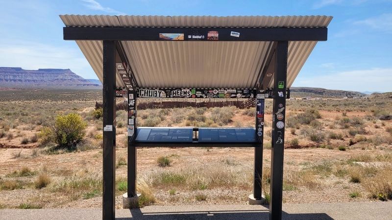
• July 1954. Funding approved for the construction of a U.S. Air Force Rocket Sled Test Track on Hurricane Mesa.
• July 8, 1955. Initial test run completed at "Project Smart" (code name) by Coleman Engineering Co., the contract operator for . . . — — Map (db m272726) HM
The Mormon Pioneer Trail from Nauvoo, Illinois to the Rocky Mountains passed here April 17, 1847. In this vicinity a military-type organization was formed with Brigham Young, Lieutenant General; Stephen Markham, Colonel; John Pack and Shadrach . . . — — Map (db m58566) HM
October 13, 1776:"We set out southward from the small river and campsite of Nuestra Senora del Pilar ("Our Lady of the Pillar" – Kolob Canyon of Zion Canyon National Park)…" and…"We traveled a league and a half to the south, descended to . . . — — Map (db m59468) HM
St. George Social Hall c.1865
The St. George Social Hall was the first community center designed for social and religious events Located on Main Street just south of St. George Boulevard, it was the center of community life. When the Opera . . . — — Map (db m266096) HM
In 1908 the Midland Bridge Company was awarded a contract in the amount of $3,299 to fabricate and erect the Hurricane/LaVerkin Bridge. This structure incorporates distinctive characteristics in its method of construction, is one of the earliest and . . . — — Map (db m59453) HM
Juanita Brooks was born Juanita Leavitt on January 15, 1898 in Bunkerville, Nevada. She married Leonard Ernest Pulsipher in 1919, but was widowed upon his death 18 months later. Despite being widowed with an infant son at the age of 20, Juanita . . . — — Map (db m266911) HM
In 1915 prisoners from the Utah State Prison camped here among these very rocks. They were detailed to build a wagon road up the fault, directly east from here. Remnants of the road can still bee seen with its lava rocks retaining walls. The work . . . — — Map (db m59429) HM
Anthony W. Ivins was a prominent church and civic leader in early St. George. He served twice in the presidency of the St. George Stake and Mayor of the city from 1890-1894. In 1893 he was elected as a Washington County Representative to the Utah . . . — — Map (db m266861) HM
Thomas Sirls Terry was born in Bristol Township, Buicks County, Pennsylvania, on 3 Oct 1825 to Thomas Sirls and Mary Ann Murkins Terry. Thomas went to work at the age of 7 in a local cotton mill. At 17 he was apprenticed to learn the trade of . . . — — Map (db m14342) HM
The Utah-Idaho Sugar Company after determining that sugar beet seed was a good cash crop, bought these grounds and started production that would last for nearly fifty years.
Sugar beets were planted in the fall in the Bloomington and Washington . . . — — Map (db m59221) HM
The history of Harrisburg, Leeds, and Silver Reef is closely intertwined. Historic Harrisburg is a ghost town today, as is Silver Reef, although the homes of New Silver Reef have sprung up close to the historic town. Leeds continues as both a . . . — — Map (db m243213) HM
St. George was designated as the county seat on January 14, 1883. This building was begun in 1866 and completed in 1876. It served the county government as offices. The 18-inch thick walls housed the jail in the basement and school was held upstairs . . . — — Map (db m59226) HM
Early History
It is believed the Paiutes moved in Utah about A.D. 1100-1200. They were hunter-gatherers with some limited agriculture. Their first contact with Europeans was probably with the Escalante-Dominguez party in 1776 and then with . . . — — Map (db m255614) HM
"Once I lived in Cottonwood and owned a little farm / But I was called to Dixie / Which did me much alarm." - From the song "Once I lived in Cottonwood," by George A. Hicks
Explorers
The first Euro-Americans in today's Southern . . . — — Map (db m266841) HM
"The people of St. George were determined to save their college because they knew that in the long run, education would help save them."- Bruce Hafen
Beginnings
In 1911, the Church of Jesus Christ of Latter-day Saints founded St. . . . — — Map (db m266843) HM
During the Utah Council of Land Surveyors (UCLS) 2016 Convention: Daniel W. Webb - BLM, Utah State Office, approached several UCLS Board members and suggested that we collaborate together and re-monument the Tri-State monument located here at . . . — — Map (db m305954) HM
The warm comfortable productive climate in the sheltered valleys along the meandering Rio Virgin and its lower tributaries in Washington County became known as "Utah's Dixie".
The rugged pioneer colonizers and their descendants are known as . . . — — Map (db m59365) HM
Present city officials and citizens of Washington City desired to pay tribute to early prominent pioneers who first settled here in 1857. These pioneers sacrificed their all while improving conditions in this harsh, dry, hot inhospitable, . . . — — Map (db m59315) HM
Between June 9, 1856, and July 6, 1860, ten separate Handcart Companies left Iowa
City, Iowa, or Florence, Nebraska to their land of Zion in the Utah Territory. There were
653 handcarts and 50 wagons.
Nearly 3,000 souls, some with babes in . . . — — Map (db m59369) HM
The Black Ridge .
The toughest, heartbreaking barrier to the colonization of “Utah’s Dixie” was the Black Ridge between New Harmony and Pintura, north of Toquerville, Utah.
A deep, rough, lava flow clogged the valley from the . . . — — Map (db m1427) HM
The Hurricane Canal runs from the dam on the Virgin River at the Narrows, to where it leaves the Hurricane Cliffs and flows through the fields located on the Hurricane Bench (a distance of approximately 6.5 miles), and to the town of Hurricane. . . . — — Map (db m255613) HM
St. George Town Square is central to the story of education in Utah's Dixie-a nickname, a term of endearment and identity - so named because Washington County was considered ideal for growing cotton and other warm-weather crops. Town Square was . . . — — Map (db m266925) HM
This property is one of the earliest developed sites in Hagerstown. St. John's Episcopal Church stood here from the 1780s until around 1830, when a new church was constructed on South Jonathan Street (Summit Avenue). When that church burned in . . . — — Map (db m195378) HM
In the years preceding the war with Mexico, the United States and Mexico were two nations headed in opposite directions.
The United States, inspired by the concept of “Manifest Destiny,” confidently expanded its territories westward. Meanwhile, . . . — — Map (db m231522) HM
Thin black lines indicate changes in relevance. Between each pair of lines entries are ordered geographically but all have the same relevance.
* Inflectional forms of words are their plurals, singulars, and possessives as well as gramatical tenses and similar variations.