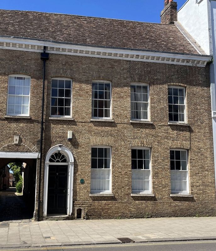
A large C14 Hall House stands behind a C15 front range, altered later; with a brick front c.1830. The warehouses towards the river were typical of a Lynn merchant's yard, and possibly part of the Corpus Christi Gild property until 1548. — — Map (db m316997) HM
An early 17th century house built with a central passage reflecting two medieval hall house plots. The rear crow-stepped gables are rare for King's Lynn. Refronted early in the 18th century the house was divided into two by 1810. In 1988/90 it was . . . — — Map (db m316994) HM
Altered by Dutch merchant families, the limestone house front is 1739 and the finely-detailed rear wing is c1695. After 1814 this property also owned the Guildhall warehouses, and included Everard & Blencowe's Bank from 1826-61. Offices after 1930 . . . — — Map (db m316991) HM
In front of you is the Church of All Saints, it is the oldest Church in Kings Lynn thought to date back to the Saxon period. The Great Storm in 1763 caused the eighty foot high church tower, surmounted by a thirty foot spire to collapse through the . . . — — Map (db m316470) HM
In 1899 a four-storey linseed oil mill and warehouse here was destroyed by fire. Rebuilt for Henry Leake & Son in 1900, making linseed cake for cattle feed. This tower became a granary after 1945, and was retained as part of a courtyard of . . . — — Map (db m317000) HM
To the memory of
Captain George Vancouver RN.
Born King's Lynn 1757, died Petersham 1798
A great navigator & surveyor
from 1791 to 1795
Captain Vancouver precisely charted many thousands
of miles of the northwest Pacific . . . — — Map (db m316999) HM
The Chapel with its Charnel House below was built during the 14th century. The building of the Charnel House is recorded in manuscript rolls of the Trinity Guild.
"On the same day the brethren ordain that the treasurers pay to the custodians . . . — — Map (db m316646) HM
Old School Court is the site of this Guildhall, founded soon after the Black Death (1349). Hall of a guild of wealthy merchants, on an extensive site with warehouses down to its own quay. Dissolved 1548. Late C19 Girls High School, now housing. — — Map (db m316995) HM
This is one of a series of panels explaining the history of the medieval Franciscan friary that once stood on this site.
When the friary was closed in 1538, much of it was demolished in 1577 many cartloads of stone were taken from here to the . . . — — Map (db m316464) HM
West Lynn Ferry
Since at least 1265 come rain, shine, tide and storm, a ferry has carried passengers across the river Great Ouse. The ferry service was vital to save a twelve-mile walk over the only river bridge at Wiggenhall St Germans. In . . . — — Map (db m316651) HM
This building, of 1784, was the town prison until 1866, replacing an earlier one. The entrance design was influenced by the Newgate Prison in London, and 18th century cells still remain here. There was a Borough Police force from 1836-1947, and this . . . — — Map (db m316482) HM
Welcome to Tower Gardens. This is one of a series of panels explaining the history of the Franciscan friary that once stood here.
The Greyfriars came to King's Lynn in the 1230s. By 1250 the building of the friary was well underway. In the . . . — — Map (db m316469) HM
You are standing inside the only surviving above ground remains of the medieval Franciscan friary. It is about 28 metres (93 feet) high. It was built and altered at different stages from the 13th to the 15th century.
It is a lantern tower, with . . . — — Map (db m316466) HM
Revolutionary Artist, early anti-nuclear campaigner, and local activist, who in 1953-59 lived in his studio here. He invented Auto-Destructive Art in response to nuclear weapons' threat to society and the environment, and made demonstration pieces . . . — — Map (db m316657) HM
Granted Lynn a charter in 1204 at the request of the Bishop of Norwich who retained the lordship of the town. Lynn was raised to borough status with the rights of local jurisdiction and government including a merchant gild to oversee commerce and . . . — — Map (db m316483) HM
This illustration shows the layout of the friary just before it was closed down.
It is based on the remains found here during recent archaeological excavations as well as evidence from Franciscan friaries elsewhere in England.
Standing . . . — — Map (db m316468) HM
The Town Hall is one of King's Lynn's most important buildings. [Illegible]
The Gaol House was built in 1784. Its design is typical of the Georgian period. It has the appearance of a grand townhouse, however the chains that hang above . . . — — Map (db m316472) HM
Opposite this plaque, on the old road to London, stood a Chapel of Our Lady from c1329 until 1549; later used as a house. This road bridge was rebuilt by the town's Paving Commissioners in 1806, and Millfleet itself was covered over in 1897. — — Map (db m316480) HM
In 1101 Bishop Herbert de Losinga, the first Bishop of Norwich, founded The Church of St Margaret, St Mary Magdalene and all the Virgin Saints with a Benedictine Priory.
The Church is named after Saint Margaret of Antioch. Legend has it that . . . — — Map (db m316471) HM
The Chapel of St Mary on the Mount has been known as the Red Mount Chapel since the 1700s. It was built between 1483-85 for the use of pilgrims on their way to the shrine of Our Lady at Walsingham. The chapel was built just outside the town's . . . — — Map (db m316460) HM
This large house c.1670, subdivided in late C19 and C20. has many C17 features. The front is later, c.1790, with porch, venetian window and a blind top storey parapet. The site formerly backed onto the river and could be the medieval Bishop's House. . . . — — Map (db m316990) HM
The stone wall 35 metres to the east is a remnant of St. James' Chapel and Workhouse. The Chapel in existence by the 1130's, was converted into a workhouse in 1581 and used as such until partial collapse in 1854. — — Map (db m316481) HM
In front of you is St James' Park.
This ornamental park was opened to the public in 1903, following the removal of tombstones from the St James' cemetery that originally lay here.
To your right, in the garden of the King's Lynn nursery . . . — — Map (db m316463) HM
In front of you is St James' Park.
This ornamental park with formal gardens was opened to the public in 1903, following the removal of tombstones from the St James' cemetery that originally lay here. Surviving plans from the year 1900 describe . . . — — Map (db m316462) HM
The Walks were established in the 1700s. The first Walk was originally designed for use only by Lynn's wealthier inhabitants. Here they could take gentle exercise socialise and promenade, well away from the town's dirty and crowded streets.
St . . . — — Map (db m316461) HM
The Thoresby family of merchants and land owners lived at this site between c.1427-1510. Thomas Clabourne (c.1557-1607), merchant (and Mayor 1592-93) lived here, but moved to Kent; William Claibourne (1600-77), his son, is famous as the first . . . — — Map (db m316479) HM
Tower Gardens
Welcome to Tower Gardens. You are standing in what was the friary orchard When the friary was closed in 1538, the tower and the land around it passed to the Town Council.
Remarkably, part of this land was never permanently . . . — — Map (db m316465) HM
Historic Town
King's Lynn, originally known as 'Lin', is thought to have taken its name from the Celtic
word for lake, and it is recorded that a large tidal lake originally covered this area.
In 1101 Bishop Herbert de Losings of . . . — — Map (db m316650) HM
Welcome to the Saturday Market Place. The surrounding area was the heart of medieval King's Lynn, or Bishop's Lynn as it was then known.
There has been a regular market in Lynn for over 900 years. King's Lynn has two market places, the Tuesday . . . — — Map (db m316643) HM
This is a mid-15th c. merchant's hall-house, on the Woolmarket street. The front door is in a 14th c. style with columns added c.1605. To the right is a 'Tudor' insertion (in 1924) under the surviving first-floor gallery, which once linked into the . . . — — Map (db m316654) HM