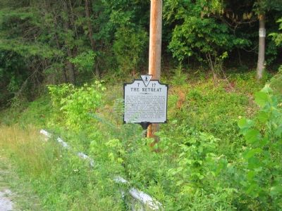
On Parker Lane at Harry Byrd Highway (Virginia Route 7), on the right when traveling west on Parker Lane.
One and a half miles north is The Retreat, home to three distinguished generations of the Parker family. Thomas Parker, a general in the War of 1812, constructed this imposing Federal-style house in 1799. Richard Parker, his nephew, was a U.S. . . . — — Map (db m75497) HM
On Castleman Road (Virginia Route 603) at Harry Byrd Highway (Virginia Route 7), on the right when traveling east on Castleman Road.
To draw Union troops from Petersburg to Washington, Confederate Gen. Jubal A. Early attacked the capital’s defenses on July 11, 1864. He then withdrew to the Shenandoah Valley, where he had left Gen. John C. Breckinridge’s division to hold the . . . — — Map (db m1201) HM
On Harry Byrd Highway (Virginia Route 7) at North Hill Lane, on the right when traveling east on Harry Byrd Highway.
Three miles north in July 1864, General Jubal Early’s army, returning from his raid on Washington, was attacked by Federal units which forced a passage of the river. On July 18, Colonel Joseph Thoburn led his troops against the Confederates but was . . . — — Map (db m138516) HM
On Harry Byrd Highway (Virginia Route 7) at Blueridge Mountain Road (Virginia Route 601), on the right when traveling west on Harry Byrd Highway. Reported missing.
Early, while passing through this gap on his return from his Washington raid, was attacked by Crook’s cavalry, July 16, 1864. Crook destroyed a few wagons, Early captured a cannon. — — Map (db m1204) HM
On Church Street at Academy Street on Church Street.
The year after Clarke County was formed in 1836, construction began on a brick courthouse based on county justice David Meade’s design. The courthouse was remodeled in the Neoclassical style about 1850 when the portico and cupola were added. . . . — — Map (db m1296) HM
On Bishop Meade Highway (Virginia Route 255) at Carter Hall Lane, on the right when traveling north on Bishop Meade Highway.
Col. Nathaniel Burwell, great-grandson of Robert "King" Carter, constructed Carter Hall in the mid-1790s after moving here from Tidewater Virginia. Edmund Randolph Governor of Virginia, U.S. Attorney General, and U.S. Secretary of State, died here . . . — — Map (db m72942) HM
Traveler was tethered on this spot June 21, 1863, as General Robert E. Lee paused on his march to Gettysburg. He attended services here in Grace Episcopal Church. Tablet placed by Sycamore Society 1986 Replaced by E.V. White Chapter, MOSB and . . . — — Map (db m173645) HM
On Stonewall Jackson Highway (U.S. 522) at Lord Fairfax Parkway (Route 340) on Stonewall Jackson Highway.
Early in the 19th century, three important roads crossed here: Nineveh Turnpike leading to Front Royal, Winchester Turnpike leading to the north, and Newton Turnpike connecting Stephens City and the Shenandoah River via the Winchester and Berrys . . . — — Map (db m1751) HM
On Westwood Road at West Main Street (Business U.S. 7), on the right when traveling south on Westwood Road.
As it maneuvered against Lt. Gen. Jubal A. Early’s Army of the Valley, Maj. Gen. Philip H. Sheridan’s U.S. Army of the Shenandoah marched south from Halltown, reaching Berryville on 3 Sept. 1864. Finding part of Brig. Gen. George Crook’s corps . . . — — Map (db m1781) HM
On Lord Fairfax Highway (U.S. 340) 0.1 miles south of Davis Lane, on the right when traveling south.
Just after dawn on 13 Aug. 1864, Col. John Singleton Mosby and 300 of his 43rd Battalion Partisan Rangers attacked the rear section of Maj. Gen. Philip H. Sheridan’s 600-vehicle wagon train here. The train, headed for Winchester, carried supplies . . . — — Map (db m1785) HM
On Lord Fairfax Parkway (U.S. 340) 0.1 miles south of Davies Lane, on the right when traveling south.
Gen. Robert E. Lee bivouacked near here on 18-19 June 1863, as he began his invasion of Maryland and Pennsylvania. Part of his Army of Northern Virginia marched north toward Winchester, while Lt. Gen. James Longstreet’s corps camped here with Lee. . . . — — Map (db m1786) HM
On West Main Street (Business Virginia Route 7), on the right when traveling east.
The town was laid out in 1798 on land of Benjamin Berry and was first known as Battletown. Here at “Audley” lived Nellie Custis, Washington’s adopted daughter. Here at “Soldiers Rest” lived General Daniel Morgan, who built . . . — — Map (db m1788) HM
On South Buckmarsh Street (U.S. 340), on the right when traveling south.
Before 1798 Berryville was known as Battletown, a name that perhaps originated from a local tavern famous for its fistfights. The General assembly incorporated the town of Berryville on 15 Jan. 1798. Located at a major crossroads of the Shenandoah . . . — — Map (db m1811) HM
On South Greenway Avenue (U.S. 340) at West Main Street (Virginia Route 723), on the right when traveling north on South Greenway Avenue.
A half-mile east, Revolutionary War hero Daniel Morgan began this limestone Georgian mansion in 1779 while on furlough. He named it for the Battle of Saratoga in which he had recently distinguished himself. The house was probably constructed by . . . — — Map (db m1813) HM
On Lord Fairfax Highway (U.S. 340) at Pyletown Road (Virginia Route 620), on the right when traveling south on Lord Fairfax Highway.
Two and a half miles to the northwest stands The Briars, as stuccoed stone, two-story, five-bay dwelling that was constructed around 1819 as the home of Dr. Robert Powell Page. His daughter, Mary Francis Page, married John Esten Cooke, noted . . . — — Map (db m192471) HM
On Millwood Road / Old Route 50 (Virginia Route 723) at Bishop Meade Road (Virginia Route 255), on the right when traveling west on Millwood Road / Old Route 50.
This village developed around two late-18th-century gristmills and Nathaniel Burwell’s Carter Hall plantation, one of the preeminent estates in the area. The Burwell-Morgan Mill in the center of the village was a commercial gristmill, while the . . . — — Map (db m172179) HM