By Craig Swain, June 18, 2007
The Retreat Marker
SHOWN IN SOURCE-SPECIFIED ORDER
On Parker Lane at Harry Byrd Highway (Virginia Route 7), on the right when traveling west on Parker Lane.
On Castleman Road (Virginia Route 603) at Harry Byrd Highway (Virginia Route 7), on the right when traveling east on Castleman Road.
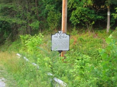
On Harry Byrd Highway (Virginia Route 7) at North Hill Lane, on the right when traveling east on Harry Byrd Highway.
On Harry Byrd Highway (Virginia Route 7) at Blueridge Mountain Road (Virginia Route 601), on the right when traveling west on Harry Byrd Highway. Reported missing.
On Church Street at Academy Street on Church Street.
On John Mosby Highway (U.S. 50). Reported missing.
On Bishop Meade Highway (Virginia Route 255) at Carter Hall Lane, on the right when traveling north on Bishop Meade Highway.
On North Church Street, on the right.
On Stonewall Jackson Highway (U.S. 522) at Lord Fairfax Parkway (Route 340) on Stonewall Jackson Highway.
On Westwood Road at West Main Street (Business U.S. 7), on the right when traveling south on Westwood Road.
On Lord Fairfax Highway (U.S. 340) 0.1 miles south of Davis Lane, on the right when traveling south.
On Lord Fairfax Parkway (U.S. 340) 0.1 miles south of Davies Lane, on the right when traveling south.
On West Main Street (Business Virginia Route 7), on the right when traveling east.
On South Buckmarsh Street (U.S. 340), on the right when traveling south.
On South Greenway Avenue (U.S. 340) at West Main Street (Virginia Route 723), on the right when traveling north on South Greenway Avenue.
Paid Advertisement
On Lord Fairfax Highway (U.S. 340) at Pyletown Road (Virginia Route 620), on the right when traveling south on Lord Fairfax Highway.
On Lord Fairfax Highway (U.S. 340), on the right when traveling south.
On Millwood Road / Old Route 50 (Route 723), on the right when traveling west.
On Lord Fairfax Highway (U.S. 340) at Trapp Hill Road (Virginia Route 729) on Lord Fairfax Highway.
On West Main Street (Business Virginia Route 7) at Westwood Road (Virginia Route 636), on the right when traveling east on West Main Street.
On Harry Byrd Highway (Virginia Route 7) at Blueridge Mountain Road (Virginia Route 601), on the right when traveling west on Harry Byrd Highway.
On Millwood Road / Old Route 50 (Virginia Route 723) at Bishop Meade Road (Virginia Route 255), on the right when traveling west on Millwood Road / Old Route 50.
On Lord Fairfax Highway (U.S. 340) at Highland Corners Road, on the right when traveling east on Lord Fairfax Highway.
On John Mosby Highway (U.S. 17/50) at Mt. Carmel Road (County Route 606), on the right when traveling west on John Mosby Highway.
On Castleman Road (County Route 603), on the right when traveling north.
Near Parshall Lane (County Route 608) at Hill and Dale Lane, on the right when traveling south.