Near Pine Street just south of East 4th Street, on the left when traveling south.
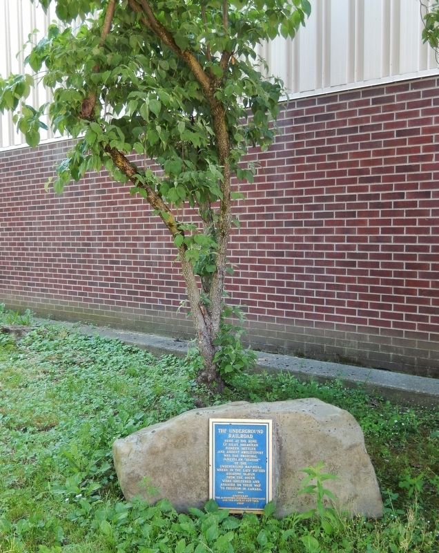
Here at the home of Silas Shearman pioneer settler and ardent abolitionist was the principal Jamestown “station” of the Underground Railroad where in the late fifties escaping slaves from the south were sheltered and assisted on their way to . . . — — Map (db m177999) HM
On Frewsburg Road (U.S. 62) 0.2 miles south of Jamestown Road (New York State Route 394).
First commercial enterprise in southeastern Chautauqua County
Doctor Thomas Ruston Kennedy built first mill October 1805 after purchase of 3000 acres in the area which became the Town of Poland — — Map (db m60146) HM
On East Chautauqua Street (New York State Route 430) at South Erie Street (New York State Route 394), on the right when traveling east on East Chautauqua Street.
Chautauqua Lake, eighteen miles long and one to three miles wide, has as its outlet a branch of Connewango Creek, a tributary of the Allegheny River. This gives Chautauqua an indirect connection with the Gulf of Mexico by way of the Ohio, and . . . — — Map (db m64687) HM
On North Erie Street (New York State Route 394) at East Chautauqua Street (New York State Route 430), on the right when traveling north on North Erie Street.
Here in 1810 William Peacock, local agent of Holland Land Co. built his cabin and office of logs. He served 26 years. — — Map (db m172795) HM
On Main Street (New York State Route 430) at Pleasant Street, on the left when traveling east on Main Street.
Findley Lake, N.Y., Settled by Alexander Findley, Sergeant Revolutionary War & War of 1812 - Built dam in 1815 to power his mill - This created lake from two ponds. — — Map (db m117546) HM
On Howard Street (New York State Route 5 at milepost 8.4) at Buffalo Street, on the right when traveling north on Howard Street.
First Settlers In 1803 Abel Cleveland, David Dickinson and John Howard settled along this creek, erecting a grist and saw mill, and a tavern for westward settlers. — — Map (db m117501) HM
On Wyncoop Creek Road (County Road 3) just south of Main Street (County Road 60), on the right when traveling south.
Generals John Sullivan and James Clinton were appointed by George Washington to lead a punitive expedition against the hostile tribes of the Iroquois Confederacy and to capture the British forts at Oswego and Niagara. The objectives were to . . . — — Map (db m198208) HM
Erected by his fellow citizens to the memory of
a Revolutionary officer, a brave soldier,
a faithful citizen, and an honest man
who died Mar. 15, 1840 Ag'd 82 y'rs, 6 mos, 12 dy's
He was one of the oldest settlers and
the first white man . . . — — Map (db m154284) HM WM
On East Water Street (New York State Route 352) at Harriet St., on the right when traveling west on East Water Street.
The first Methodist sermon in this area was given near this site at Lough’s Tavern, Newton Village, by Rev. William Colbert, Dec. 16 1792.
Text Mathew 5:6 "Blessed are They That Hunger and Thirst After Righteousness." This Circuit rider dressed in . . . — — Map (db m41576) HM
On Main Street at 3rd Street, on the left when traveling north on Main Street.
The Gateway feature, inspired by local architectural landmarks, history, and the natural environment, employs locally-sourced bluestone boulders to represent the iconic flat-top hills that surround the city of Elmira. The boulders are carefully . . . — — Map (db m197200) HM
On Walnut Street, on the left when traveling north.
THE BEGINNING:
The development of Elmira's Woodlawn Cemetery was the result of a need for more burial space and an outgrowth of the "rural cemetery movement" which became increasingly popular after 1830. Elmira's earliest known burial ground . . . — — Map (db m154291) HM
On Hanover Square, on the left when traveling north.
In 1779 near this spot
General John Sullivan
mercifully disposed of his pack horses
worn out by faithful service
in the campaign against the
Six Nations of the Iroquois.
——————
The first white . . . — — Map (db m90382) HM
On South Main Street, on the left when traveling north.
On September 24, 1779, General Sullivan's military park horses, returning through the valley from their 450 mile journey, had reached the end of their endurance. The General was compelled to dispose of these partners in the cause of American . . . — — Map (db m90386) HM
On Wilawana Road (New York State Route 427) 1.3 miles east of Main Street, on the left when traveling east.
• The site of • First Church of any denomination —in— Chemung Valley was one-fourth mile north ———— Organized September 2, 1789 by Roswell Goff, First Pastor —and— William Buck • John Hillman Peter Roberts • John Roberts Jesse . . . — — Map (db m198216) HM
On East Main Street (New York State Route 206) at South Main Street (New York State Route 7), on the right when traveling east on East Main Street.
Settled about 1789 by "Vermont Sufferers."
Originally known as Jericho , in Clinton Township.
Named Bainbridge in 1815 in honor of Captain
William Bainbridge, naval hero of the War of 1812.
Incorporated as a village in 1829.
This park, known . . . — — Map (db m146618) HM
On New York State Route 80 at Columbus Hill Road, on the right when traveling west on State Route 80.
Columbus Memorial
Columbus named by Dr. Tracy Robinson
First settlement by Col. Converse on lot 44 in 1781.
Revolutionary Soldiers buried in Columbus
Church, C.
Church, J.
Dennison, J.P.
Howard, T.
Kinney, N.
Loomis, . . . — — Map (db m168968) WM
Early Settlers included Joseph Juliand, Simond Barnett, and Stephen Ketchum. In 1795 Talleyrand visited early French Settlement here. — — Map (db m230648) HM
On West Main Street (Route 80), on the right when traveling east.
1793 1893
This monument erected to the proprietors & pioneers of Sherburne by their descendants of the one hundredth anniversary of this settlement.
Brave, Patriotic, Freedom • Loving, God • Fearing. Their names are honorable. Their character . . . — — Map (db m226618) HM
Colonel William S. Smith,
aide to Washington, owned
150,000 acres hereabout in
1791; married Abigail Adams.
Buried at rear, due north. — — Map (db m93154) HM
On New York State Route 26 at Clarence Church Road, on the right when traveling north on State Route 26.
South Otselic Historic District has been placed on the National Register of Historic Places in 1983 by the United States Department of the Interior — — Map (db m231801) HM
On Military Turnpike (New York State Route 190) 1.4 miles west of Atwood Road, on the right when traveling west.
1823
Erected here by
Lewis Sage Robinson
Robinson's Tavern
also erected opposite here in 1810
The original log tavern
visited in 1817
by Pres. James Monroe
Until 1857, these sites were part of
the town of Chazy
Lewis G. . . . — — Map (db m204581) HM
In 1789, Revolutionary War veteran Pliny Moore (1759-1822) settled Champlain after being awarded land by the State of New York. In 1801 he built a Federal-style frame house similar to the one standing today. Moore was the first judge and postmaster . . . — — Map (db m177320) HM
On Lake Shore Road, 0.4 miles south of Sheldon Lane, on the left when traveling south.
1763 homestead site of Jean LaFramboise first settler in Clinton County driven out by Burgoyne in 1777-Returned 1783 Estab. 1st North Country apple orchard — — Map (db m105856) HM
On East Street east of Champlain Street (New York State Route 22), on the left when traveling east.
Held in home of John Shedden April 3, 1804. His grandson, Lucien Love Shedden was Regent of The University of the State of New York 1905-1912. — — Map (db m147430) HM
On River Road west of Barney Downs Road, on the right when traveling west.
Site of one of Peru's earliest settlements. Little remains of the mills, shops, & homes that once made up this pioneer community — — Map (db m189560) HM
Jonas Platt (1769 – 1834) 2nd son of Zephaniah Platt and bro. of Robt. Platt. Jonas was Mem. NYS Assembly 1796, NYS Senate 1810 - 1813. — — Map (db m126086) HM
On U.S. 9 at Ausable Point Road, on the right when traveling north on U.S. 9.
( left panel )
Lakes to Locks Passage takes you through
a spectacular landscape laden with history.
Follow this map to find your way through
four story-filled regions that connect the
historic waters of Lake Champlain and . . . — — Map (db m194631) HM
William Hay, a Scotsman,
was Peru's first settler. He built
his house in this vicinity in 1772.
Hay had a friendly relationship with
Benedict Arnold and witnessed
the "Battle of Valcour.” The town's
first marriage was between . . . — — Map (db m136672) HM
On Union Road (County Route 39) north of Brown Road, on the right when traveling north.
Site of Peru's Earliest Settlement Est. by Society of Friends
C. 1790. Homes, taverns, stores, blacksmith shops
and a meeting house comprised this hamlet. — — Map (db m236862) HM
Near City Hall Place (U.S. 9) at Trinity Place, on the right when traveling north.
The Saranac River runs through the heart of the City
of Plattsburgh. The river supported native peoples
long before the arrival of Europeans, and it has been
crucial in the commercial and industrial development
of the region since the first . . . — — Map (db m141172) HM
On City Hall Place (U.S. 9) at Court Street, on the right when traveling north on City Hall Place.
The Village of Plattsburgh
elected its first officers at The
Ark, a popular hotel on May 2 1815.
Le village de Plattsburgh
a elu ses premiers officiers le 2
mai 1815 dans i hotel de renom The Ark. — — Map (db m115254) HM
On New York State Route 9, 0.4 miles south of Lapham Mills Road, on the right when traveling south.
Robt. Platt, Mem. NYS Assembly 1814-15, built this home in 1809 on 700 acres given by his father, Zephaniah, founder of Plattsburgh. — — Map (db m108682) HM
On New York State Route 9 at Old Dock Road, on the left when traveling south on State Route 9.
2000 acres settled in 1766 by William Gilliland (1734-1796) first named Janesborough, later Port Gilliland. A port for lake shipped goods c. 1820-1900. — — Map (db m108643) HM
On New York State Route 9 north of South Junction Road, on the right when traveling south.
Site of first home raised by a European settler in the Town of Plattsburgh and Clinton County. Erected September 10-13, 1766 by William Gilliland (1734-1796). — — Map (db m108645) HM
On New York State Route 9 at South Junction Road, on the right when traveling south on State Route 9.
Erected c. 1820 by Jacob Sax. Sax family home c. 1820-1832, William Gilliland III (1812-1886) family 1845-1880, Day family 1881-1958. — — Map (db m108646) HM
On County Route 8 at County Route 3, in the median on County Route 8.
Ancramdale Hamlet
Historic District
has been placed on the
National Register of
Historic Places in 2019
by the United States
Department of the Interior — — Map (db m245343) HM
On New York State Route 22 at E Hill Road, on the left when traveling south on State Route 22.
Austerlitz Historic District has been placed on the National Register of Historic Places in 2018 by the United States Department of the Interior — — Map (db m205921) HM
On New York State Route 66, 0.1 miles north of Farm Road, on the right when traveling north.
By 1916 Thomas Buckley's
lumber & cider mills, Borden
milk plants, coal yard and
railroad siding operated
in this former hamlet. — — Map (db m236941) HM
On Main Street at New York State Route 66 and, on the right when traveling north on Main Street.
First known as Groats' Corners. Settled about 1811. Incorporated 1869. Earlier renowned as an important terminal on three railraods. — — Map (db m135977) HM
On Iron Hill Road (County Route 9) at Raup Road, on the right when traveling west on Iron Hill Road.
Mary E. Clark, prominent
physician & philanthropist
lived here 1845-1937. Land
owned by early settler
Nehemiah Spencer until 1799. — — Map (db m158656) HM
On County Road 12 (County Route 12) at Junction Road, on the left when traveling west on County Road 12.
Both districts 1772, towns 1788. Livingston included Clermont, Gallatin, Granger. Claverack included Hudson, Hillsdale, part of Ghent. — — Map (db m150825) HM
On Millbrook Road at County Route 12, on the right when traveling north on Millbrook Road.
Both districts 1772, towns
1788. Livingston included
Clermont, Gallatin, Granger.
Claverack included Hudson,
Hillsdale, part of Ghent — — Map (db m166153) HM
On County Route 12 at Millbrook Road, on the right when traveling west on County Route 12.
Both districts 1772, towns
1788. Livingston included
Clermont, Gallatin, Granger.
Claverack included Hudson,
Hillsdale, part of Ghent — — Map (db m166154) HM
On Taghkanic-Churchtown Road at Junction Road, on the left when traveling north on Taghkanic-Churchtown Road.
Taghkanic organized 1803
as Granger, included Copake.
Claverack, a district 1772.
Hillsdale removed 1782, Hudson
1785. Organized as town 1788 — — Map (db m165751) HM
On New York State Route 9H north of Maple Avenue, on the right when traveling north.
Early Columbia County school established here 1779. Later became Claverack College and Hudson River Institute until its closing in 1902. — — Map (db m136449) HM
On New York State Route 23, 0.5 miles east of New York State Route 9H, on the left when traveling east.
Location of manor of Lower
Manor of Van Rensselaer
patroonship. House built by
Hendrick van Rensselaer in
1685. Tenants paid rents here. — — Map (db m158660) HM
On Valley View Road, on the left when traveling east.
This Greek Revival style dwelling appears on maps dating to 1858. The home was likely built in the late 1840s to early 1850s for Isaac Chesbrough, who owned the house until his death in 1893. Chesbrough was the first foreman of the Copake Iron . . . — — Map (db m135845) HM
In 1660 Medad Pomeroy accepted tools, an anvil shaped like this replica, and land in exchange for opening a blacksmith shop in Northampton, Massachusetts. That anvil was passed through many
generations of Pomeroy blacksmiths becoming a symbol of . . . — — Map (db m135717) HM
On Valley View Road, on the right when traveling east.
Maps dating to the mid-19th century indicate that two dwellings once stood in this location. The homes were probably built in the early 1850's. One of the houses belonged to the first owner of the Copake Iron Works, Lemuel Pomeroy II, and later to . . . — — Map (db m135871) HM
On County Route 27 (County Route 27) near County Route 12, on the right when traveling north.
Taghkanic organized 1803
as Granger, included Copake.
Claverack, a district 1772.
Hillsdale removed 1782, Hudson
1785. Organized as town 1788 — — Map (db m150824) HM
On County Route 19 at Petersen Road, on the right when traveling north on County Route 19.
Gallatin organized from
Livingston 1803. Livingston
a manor 1686: a district 1772:
a town 1788, including Gallatin,
Ancram, Taghkanic and Copake — — Map (db m166155) HM
On Jackson Corners Road (County Route 2) at County Route 19, in the median on Jackson Corners Road.
In towns of Gallatin and
Livingston. Settled before
1790. Post office
established 1840. Named from
Union Corners House, a tavern. — — Map (db m165484) HM
Near Clermont Avenue, 0.3 miles Woods Road (County Route 35).
All the land visible from this point was once owned by the Livingston family. Robert Livingston, Sr., "The Founder" (1654-1728), acquired a 160,000-acre land patent in 1686. His property extended 9.5 miles along the eastern shore of the Hudson River . . . — — Map (db m149847) HM