On St. George Street close to Church Street, on the right when traveling north.
The modern-day market in Annapolis Royal sits on land that for much of the town’s history was church property. The earliest Roman Catholic Church, built of stone, was located next to the fort and destroyed following Sir William Phips’ capture of . . . — — Map (db m78720) HM
On Main Street (Route 4) just east of Church Street, on the right when traveling east.
The congregation of St. James was founded in 1804. The present day church was built in 1862. Our ten original memorial windows were installed and dedicated in 1911. They use Christian symbolism to uplift the spirit.
St. James has had three church . . . — — Map (db m139424) HM
Near Charlotte Street north of York Street, on the right when traveling north.
Cossit House was built in 1787 by Reverend Ranna Cossit, the first Anglican Minister in Sydney. It was purchased by the Province of Nova Scotia and the Old Sydney Society in 1976, and opened to the public by the Honourable Vincent J. Maclean, . . . — — Map (db m171097) HM
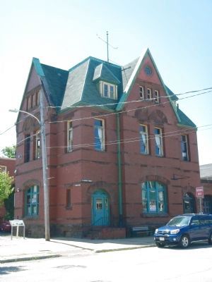
Near Esplanade at Dorchester Street, on the right when traveling north.
Come and explore the Colonial Town of Old Sydney. Few cities in North America can boast eight buildings erected between 1785 and 1802 within a two-block radius. In season, we invite you to visit these historic buildings: St. Patrick's Church Museum . . . — — Map (db m171099) HM
On Nova Scotia Route 311 at Balmoral Road (Nova Scotia Route 256), on the left when traveling north on Provincial Route 311.
The land for the church was
donated by
Mr. John R. Hayman
and was contracted to be
built for the sum of one
thousand, four hundred
thirty two dollars.
The closing service for
St. Andrew's Presbyterian
Church was held
December . . . — — Map (db m108184) HM
On Prince Street just east of Lorne Street, on the left when traveling east.
Legend
This plaque commemorates
The centennial of the formation of the Presbyterian Church in Canada in 1875;
The ministry of the Rev. Daniel Cock (1771-1805) of Greenock, Scotland, and the Rev. David Smith (1771-1795) of St. Andrew's, . . . — — Map (db m108220) HM
This plaque is dedicated to the memory of
Edmund Burke
distinguished scholar, missionary pastor, and prelate, having served for sixteen years, he was elected as Bishop of Sion and first Vicar Apostolic of Nova Scotia on July 4, 1817. He . . . — — Map (db m77747) HM
On Spring Garden Road close to Barrington Street, on the right when traveling west.
This plaque is dedicated to the memory of
Pierre Maillard
who served as missionary to the Micmac Indians in this country for over thirty years, who succeeded in reconciling the Micmac to British rule, who celebrated the first mass and opened . . . — — Map (db m77723) HM
English
St. Mary’s holds a central position in the history of Roman Catholicism in Nova Scotia. Begun in 1820, the church demonstrated the enhanced ecclesiastical status of the province, which acquired its own Bishop in 1818, and witnessed . . . — — Map (db m77721) HM
Near Argyle Street just north of Prince Street, on the left when traveling south.
English:
Completed in 1750, St. Paul’s was the first church outside Great Britain to be designated as an Anglican cathedral. Between 1787 and 1864 it served as the cathedral church of the See of Nova Scotia. For 96 years St. . . . — — Map (db m139686) HM
Near Argyle Street south of Duke Street, on the left when traveling south.
This has been the central gathering place of our people since the founding of Halifax in 1749.
Saint Paul’s Church was established by Royal Charter in our founding year, becoming the first church in the city and the oldest Protestant church in . . . — — Map (db m139593) HM
1790-1990 On September 27, 1790, His Excellency William MacCormick, Governor of the Province of Cape Breton, graciously and generously granted
7 000 acres of land at Chéticamp to our «Quatorze Vieux». By this
historical act, our . . . — — Map (db m140169) HM
Built in 1893, St-Pierre's Church majestically watches over
the Acadian community of Chéticamp. An imposing 212
feet long, 74 feet wide and with a steeple rising to 167 feet,
St-Pierre's lavish Baroque interior and original . . . — — Map (db m139872) HM
On Cabot Trail, 0.2 kilometers north of Viev Moulin, on the left when traveling north.
English:
This monumentErected in memory of the 93 families who founded the parish of Saint Joseph du Moine. Was blessed by Reverend Charles Omer Cormier, and unveiled by Mr. and Mrs. Pat J. AuCoin on July 28, 1979 during the . . . — — Map (db m140308) HM
On Cornwallis Street at Cumberland Street, on the right when traveling north on Cornwallis Street.
Here, in the year 1753, before any church was built, open-air Divine Services were held and Holy Communion administered in English, French, and German, to the first settlers and Garrison of the Town of Lunenburg by the Reverend Jean Baptiste . . . — — Map (db m112431) HM
Prominently sited on the parade square, this church was an important symbol of British authority and Anglican dominance for Lunenburg's early settlers, who were mainly German-speaking Protestants. From construction in 1754 through many alterations . . . — — Map (db m112453) HM
On Cornwallis Street at Cumberland Street, on the right when traveling north on Cornwallis Street.
The first Anglican services in Lunenburg were held outdoors on this site and were conducted by a missionary from England. A two-storey structure in the New England Meeting House style was built between 1754 and 1763. The oak frames were . . . — — Map (db m112486) HM
Beginning in the early hours of November 1, 2001, fire ravaged this historic church, substantially destroying the building. Undaunted by the destruction, the parishioners decided to restore the church. With financial help from friends around the . . . — — Map (db m112454) HM
On Cornwallis Street at Cumberland Street, on the right when traveling north on Cornwallis Street.
This bell hung in the tower of St. John's since 1814 and served as the tolling bell for over 185 years. It was cast at the Whitechapel Foundry in London, England. On November 1, 2001, fire ravished through the Church, destroying the tower and . . . — — Map (db m112432) HM
On Cornwallis Street at Fox Street, on the left when traveling north on Cornwallis Street.
Lunenburg is home to the oldest worshiping Lutheran congregation in Canada. The first Lutherans, mostly Germans from farming districts of the Upper Rhine, settled in the Town in 1753. Initially they worshiped outdoors and later were allowed to . . . — — Map (db m112480) HM
On Glasgow Street just south of Dalhousie Street, on the right when traveling north.
The community that was to become New Glasgow was settled in 1784 by Deacon Thomas Fraser. By 1809 the Town was named after Old Glasgow in Scotland and incorporated in 1875. A strong entrepreneurial spirit was evident even in 1809 when the first . . . — — Map (db m144794) HM
On MacLean Street just east of James Street, on the left when traveling east.
In grateful memory of The Rev James Drummond MacGregor, D.D. Born at Comrie, Perthshire, Scotland, 1759. Died at East River, Pictou, 1830. Pioneer Minister of the Gospel in Eastern Nova Scotia, where he labored with Apostolic zeal for 43 years. . . . — — Map (db m144800) HM
On Stellarton Road (Nova Scotia Route 374) 1 kilometer south of Duff Street, on the left when traveling south.
The First Church in East Pictou was built on this site in 1787. Made of logs, it served the Lower Settlement East River Presbyterian Congregation for 16 years until 1803. From this beginning other Congregations developed in the East Pictou rural and . . . — — Map (db m144791) HM
Before You Step Back in Time...
Though Le Village historique acadien is a created outdoor museum, it speaks to truths about the overall Acadian experience in Nova Scotia, and to the particular life and times of the Pubnicos in the . . . — — Map (db m108272) HM
Near Rocco Point Road, 1.2 kilometers south of the Lighthouse Route (Nova Scotia Route 3).
La chapelle originale fut construite sur le site en 1784. La vue sur la colline est superbe. Vous pouvez facilement imaginer l'arrivée des fidèles à la messe à pied, à cheval, par bateau, ou par attelage de bœufs.
Après son arrivée de France en . . . — — Map (db m108627) HM
Near Rocco Point Road, 1.2 kilometers south of the Lighthouse Route (Nova Scotia Route 3).
Le Site
La Pointe-à-Rocco fut fondée en 1767 par les Acadiens revenus de l'exil. Pierre LeBlanc, Pierre et Louis Muis et Pierre Surette furent les premiers à s'établir dans le village. Ce site était le lieu de la première chapelle. . . . — — Map (db m108641) HM
On the Lighthouse Route (Nova Scotia Route 3) at Rocco Point Road, on the left when traveling west on the Lighthouse Route.
Une chapelle fut construite à la Pointe-à-Rocco en 1784. Elle fut utilisée par des Acadiens et des Mi'kmaq de la région jusqu'à ce qu'une église plus grande soit construite sur le site en 1808. À la suite d'un incendie dévastateur en 1900, . . . — — Map (db m108513) HM