This strategic point on Lake Champlain was occupied by Native Americans for thousands of years. In 1690 Jacobus deWarm build a small stone fort here. The French build a wooden stockade in 1731, erecting Fort St. Frederic across the lake in 1734. . . . — — Map (db m85414) HM
Near this spot
on the shore of the lake was the
Northern Terminal of the
Crown Point Military Road
built by
Gen. Amherst, in 1759 — — Map (db m109079) HM
The Marble Works Memorial Bridge was constructed and generously donated by the Marble Works Partnership to the citizens of the town of Middlebury for their use and enjoyment.
The bridge is dedicated to the memory of the mechanics of Middlebury . . . — — Map (db m144478) HM
“Some of the intrenchments are still visible.” – John Disturnell, 1857 After the American Revolution, numerous visitors curious to see the places that figured so prominently in the war for independence visited Mount . . . — — Map (db m19501) HM
The Wilderness
Shhh. Imagine Otter Creek 300 years ago when it was pristine wilderness. The river teems with fish, herons, ducks and other waterfowl. Deer and moose tracks dot the river's edge. Downed trees, trampled shrubs, and mounds of . . . — — Map (db m89155) HM
State Highway 9 traverses scenic Hogback Mt. to the Connecticut River Valley. Old Bennington, site of the Battle Monument and Historical Museum, was the meeting place of the Green Mountain Boys. It was the first town chartered by Governor Benning . . . — — Map (db m94427) HM
Whereas, the Old First Church of Bennington was
organized December 3, 1762, and is the Oldest Church
within the present limits of Vermont; and
Whereas, our forefathers met in Prayer in the First
Meeting House for assistance against the . . . — — Map (db m28223) HM
On the site at Hagar Brook stood the small clapboarded mint-house in which Reuben Harmon, Jr. coined copper for the Republic of Vermont, 1785-1788. When the Federal Government was instituted in 1789, Vermont abandoned minting. This rare currency of . . . — — Map (db m73639) HM
A Brief History
The Village of North Bennington established McWaters Park in 2007. The Park is named in honor of Rob and Jean McWaters in recognition of local community involvement. Residents are
creating a perma forest consisting of berry . . . — — Map (db m193197) HM
Near this spot in 1761
Captain Samuel Robinson
the pioneer settler of Bennington, the first magistrate in what is now Vermont, and during his lifetime, the acknowledged leader of the settlers of the town
built his first log cabin. . . . — — Map (db m77052) HM
Pownal was the site of one of the state’s oldest white settlement’s when Dutch settlers lived here for a short time after 1724. Up this valley came the pioneers from Connecticut including Ethan Allen, who led the dauntless Green Mountain Boys & . . . — — Map (db m150438) HM
Jonas Galusha, born in Norwich, CT in 1753, moved his family to Shaftsbury in 1775. During the Revolutionary War he served with Seth Warner's Green Mountain Boys and was at the Battle of Hubbardton and a Captain during the Battle of Bennington. A . . . — — Map (db m27799) HM
By 1763, the English had driven the French armies from Canada making the Champlain Valley safe for settlement. In the same year, King George III chartered Colchester Township on the Onion River - now known as the Winooski. In 1773, Ira Allen's . . . — — Map (db m86658) HM
These islands were first seen by a European in 1609, when Samuel De Champlain explored the Lake which bears his name and claimed them for the King of France. Ceded in 1763 to Britain, they became part of the Royal Colony of New York. After 1776, . . . — — Map (db m74516) HM
The Settlers' House is constructed of hand-hewn beech and pine timbers. In the 18th and early 19th centuries, Vermont settlers, loggers, and trappers often built similar temporary log homes. Research suggests that this particular example was . . . — — Map (db m109479) HM
Imagine a time machine taking us back to this spot 500 years ago. We would see a deep, rocky waterfall now hidden under the ponded area behind the Winooski One hydroelectric dam, an extensive forest of small pine trees and small fields of corn, . . . — — Map (db m89141) HM
These islands were first seen by a European in 1609, when Samuel de Champlain explored the Lake which bears his name and claimed them for the King of France. Ceded in 1763 to Britain, they became part of the Royal Colony of New York. After 1776, . . . — — Map (db m75482) HM
Many centuries before Samuel de Champlain's July 1609 landfall, Isle La Mottte had been a meeting place for the lake's neighboring native peoples. The Wonbanakiak on the eastern shore called the land Bitawbagw, or "the waters between," while the . . . — — Map (db m49374) HM
On this shore was the site of Fort Ste. Anne built in 1666 by Capt. Pierre La Motte for defense against the Mohawks. The Jesuits celebrated the first Mass and erected the first Chapel. Though not permanent, this was Vermont's first white . . . — — Map (db m74721) HM
One of the first settlers of Newbury, 1762, Influential in organizing the town and state; Revolutionary officer; Aid to General Lincoln at Ticonderoga, 1777, A prisoner in Canada 1781, Elected representative ten times. This marks the location of . . . — — Map (db m87960) HM
The old court house with jail connected for Gloucester County New York, which became Orange County Vermont. It was used for a meeting house until 1788. The Legislature of 1787 met in this building. A few rods northerly stood the log fort of . . . — — Map (db m48618) HM
James Mead, Rutland's first settler, arrived at these falls on the Otter Creek in 1769. The next year he and his family were given shelter by members of the Caughnawaga tribe while they finished their log cabin. Mead built saw and grist mills on the . . . — — Map (db m77440) HM
A meetinghouse or town hall has existed on this site since about 1800. The land was donated to the town of Ira in 1797 by Thomas and Benoni Collins for the purpose of constructing a meetinghouse and school. Thomas Collins purchased the land after it . . . — — Map (db m150440) HM
Southward appears the summit of Mt. Killington, once called Pisgah, on which Rev. Samuel Peters claimed he christened the wilderness with the name "Verd-mont" in 1763. Most historians give credit to Dr. Thomas Young’s letter "to the inhabitants of . . . — — Map (db m78175) HM
At The Mouth of the Williams River
A Few Rods East of This Place
Rev. John Williams
A Deerfield Captive
On Sunday, March 5, 1704
Preached the First Protestant Sermon
Delivered in the Territory that Later
Became the State of Vermont . . . — — Map (db m98044) HM
Brattleboro
Rich History, Thriving Culture
Chartered in 1753, Brattleboro is one of Vermont's largest towns. Known as the site of Vermont's first Anglo-Saxon settlement (Fort Drummer, 1724), this town holds a commanding position on the . . . — — Map (db m230515) HM
Fort Dummer was established in 1724 by Lt Governor William Dummer of the Massachusetts Bay Colony. The wooden fort was a northern outpost along the Connecticut River and one of the first permanent European settlements in what would become Vermont. . . . — — Map (db m159865) HM WM
In Memory of Jonathan Park Original Settler of Newfane Who Gave to the People of Windham County the Common And All the Land On Which Now Stand The County Buildings Erected by His Great-Granddaughters Martha Osgood Morse . . . — — Map (db m23130) HM
The Rockingham Meeting House is one of the finest remaining examples of New England Colonial architecture. It is the oldest intact public building in Vermont. Built between 1787 and 1801, it served Rockingham as a house of religious worship and . . . — — Map (db m115806) HM
Rockingham Meetinghouse has been designated a National Historic Landmark This site possesses national significance in commemorating the history of the United States of America A rare 18th century New England meetinghouse of the "Second Period," . . . — — Map (db m72023) HM
This rock marks the site of
Fort Bridgman
The first white settlement
In Vernon, Vt. Built in 1737,
The scene of many Indian massacres
Sacked and burned by the Indians
For the third time
June 27, 1755,
After having slain . . . — — Map (db m241035) HM
Famed as the "Fair Captive", her faith and courage survived the slaying of two husbands by Indians and--after an attack on nearby Fort Bridgman in 1755--her own forced hardship march to Canada. One of her seven children perished and the others were . . . — — Map (db m60274) HM
Westminster "Massacre" Northward stood the Cumberland County Courthouse, seat of New York's colonial administration. Opposition to holding a court session led to the "Massacre" of March 13, 1775. Here the New Hampshire Grants on Jan. 16, 1777, . . . — — Map (db m94378) HM
circa late 1700’s, one of the oldest houses left in town, was originally built on Lisle Hill in the first town of Wilmington. It was moved to its present site by ox cart in the 1830’s. — — Map (db m23292) HM
This homestead represents over two centuries of residency by the Hugh Henry family. The main house was built for Thomas Kimball c.1780 during the Federal architectural period with a Georgian plan. In 1803, Hugh Henry (1767-1847) of Acworth, N.H. . . . — — Map (db m183155) HM
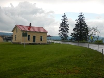
The Eureka Schoolhouse, constructed between 1785 and 1790, is Vermont’s oldest one-room school and one of the few surviving 18th century public buildings in the state. It was originally located in the “Eureka Four Corners,” northeast of . . . — — Map (db m74965) HM
Near this spot stood Windsor’s First Meeting House built in 1773 – 1774 Here July 2 – 1777 assembled for its initial session the convention which six days later in the tavern farther north on Main Street adopted the first constitution of . . . — — Map (db m180563) HM