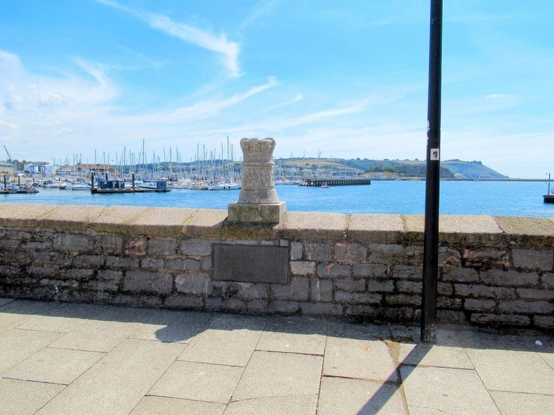
Near Commercial Road at The Barbican, on the right when traveling north.
HM Queen Elizabeth
HRH The Duke of Edinburgh
embarked from this quay on the occcasion
of Their visit to the City of Plymouth on
26th July 1962 — — Map (db m123895) HM
On Osborne Place at Citadel Road, on the left when traveling south on Osborne Place.
( top plaque )
This tablet is erected to the Memory of John Smeaton F.R.S. the distinguished civil engineer who was born in 1724 and died in 1792 at Austhorpe Lodge Leeds in the County of York He designed this lighthouse and erected it on . . . — — Map (db m123783) HM
Near Commercial Road at The Barbican, on the right when traveling north.
This tablet was erected in 1959 by the people of Bermuda to commemorate the 350th anniversary of the wreck on a Bermuda reef of Sea Venture; Captain Christopher Newport, flagship of Admiral Sir George Somers whose fleet sailed from Plymouth Sound . . . — — Map (db m123902) HM
Near Queen Street at Wickham Street, on the left when traveling north.
Lord Nelson’s flagship HMS Victory is the world’s oldest commissioned warship and famous for playing a crucial role at the Battle of Trafalgar in 1805, a naval battle which contributed to the defeat of Napoleon in 1815.
The ship is currently . . . — — Map (db m122726) HM
Near Queen Street at Wickham Street, on the left when traveling north.
After Gallipoli, HMS M.33 supported Allied forces against the Bulgarians at Salonika in 1916. She remained in the Aegean for the rest of the war, a ‘lucky ship’ with no casualties from enemy action, although her sister M.30 was sunk . . . — — Map (db m122930) HM
Near Route B2154 close to Clock Street, on the left when traveling north.
Hulked & Rotten Row
On May 14th 1883 Warrior entered Portsmouth for the last time under her own steam. In her 22 years of service, six of them in full commission and eight as a first line reserve, Warrior had sailed some 90,000 . . . — — Map (db m123160) HM WM
Near Queen Street at Wickham Street, on the left when traveling north.
In the dry dock below is HMS M.33, a coastal bombardment ‘monitor’. Although she seems small and insignificant, she is a unique survivor, one of only three Royal Navy warships from the First World War, and the only ship left from the huge . . . — — Map (db m122926) HM
Near Route B2154 at Clock Street, on the left when traveling north.
Britannia ruled the waves when Queen Victoria came to the throne. Wooden sailing ships were on the decline, making way for new maritime innovations like the paddle steamer, Great Western and the iron-hulled, screw driven SS Great Britain. . . . — — Map (db m123173) HM
Near Route B2154 at Park Road, on the left when traveling north.
British MMK1
Magnetic Moored Mine
The MMKI Mine was designed to be laid by a surface minelayer. It is different from other British moored mines because of its oval shape, rather than the usual sphere. The mine would have been moored at a . . . — — Map (db m123316) HM
Near Anglesea Road (England Route A3) at Bishop Crispin Way, on the right when traveling north.
Charles Napier
Admiral of the Blue K.C.B.
Born 1786
Died 1860
Martinique · Cape St.Vincent · Acre · Ready Aye Ready
To Commemorate The Untiring Efforts Of
A Gallant Officer And True-Hearted Man
In Advancing The Welfare Of The . . . — — Map (db m123195) HM WM
Near Queen Street at Wickham Street, on the left when traveling north.
HMS M.33 stayed in service for almost 70 years and went through many changes. Therefore, the team working on her faced hard choices: which parts of the ship to restore and which to leave alone? Should anything original ever be removed to . . . — — Map (db m122928) HM
Near Queen Street (Route B2154) at Wickham Street, on the left when traveling north.
Figurehead
H.M.S. Benbow
72 Guns Launched at Rotherhithe in 1813
The Figurehead Represents
Vice Admiral John Benbow
Born 1653 and Died 1702 — — Map (db m122581) HM
Near Queen Street at Wickham Street, on the left when traveling north.
Built as a First Rate of 120 guns at Woolwich and completed in 1841, 2694 tons. Took part in the bombardment of Sebastopol in 1854, being towed to her position in line by the Retribution (paddle).
Converted to a two deck screw ship of 90 . . . — — Map (db m122923) HM
Near Queen Street at Wickham Street, on the left when traveling north.
HMS M.33’s low hull and flat bottom made her ideal for bombarding the shore, as well as making her a small target. However, when combined with her lack of a keel these features made her very difficult to navigate at sea. She was also slow, . . . — — Map (db m122927) HM
Near Queen Street at Wickham Street, on the left when traveling north.
We have implemented a historically accurate re-painting of HMS Victory. For the first time, visitors can see the ship in her true colors — exactly as she appeared at the Battle of Trafalgar in 1805.
Several hundred paint samples . . . — — Map (db m122730) HM
Near England Route B2154 at Park Road, on the left when traveling north.
HM Gunwharf, Portsmouth
The Gunwharf was built in 1662 to enable ships’ guns, tested by the Army’s Board of Ordnance, to be fitted into the warships built within Portsmouth’s Royal Dockyard. The site was in continuous military service for over 300 . . . — — Map (db m123275) HM
Near Queen Street at Wickham Street, on the left when traveling north.
In June 1915, five officers and 67 men squeezed into HMS M.33’s tiny hull. Most stayed away from home for 3 ½ years. They were of all ages, and were mostly reservists returning for the war, or volunteers. None had been conscripted. . . . — — Map (db m122925) HM
On Clarence Esplanade at Serpentine Road, on the left when traveling north on Clarence Esplanade.
In Memory of
Forty Eight
Officers & Men Who Died
During the Epidemic of
Yellow Fever On Board
H.M.S. Aboukir
at Jamaica in 1873 – 74 — — Map (db m123468) HM
Near Anglesea Road (England Route A3) at Bishop Crispin Way, on the right when traveling north.
HMS Centurion
Naval Brigade
North China 1900
Peit Sang
Hsiku Peiyang
Tientsin
Erected by
Admiral Sir E.H.Seymour Gcb
The Captain, Officers and Ship's Company
of
H.M.S.Centurion.
( left side )
In Memory of
The . . . — — Map (db m123196) HM WM
Near Queen Street at Wickham Street, on the left when traveling north.
HMS M.33
Last Fighting Ship — Gallipoli 1915
The History of M.33
Belfast-built in 1915, the monitor HMS M.33 served Britain in peace and war. She is now one of the three remaining British fighting ships of the First World War. . . . — — Map (db m123047) HM WM
Near Anglesea Road (England Route A3) at Bishop Crispin Way, on the right when traveling north.
Taku Forts, Tientsin, Defence Of Legations, Pekin.
H.M.S. ORLANDO
NORTH CHINA 1900
Commander P.H. WRIGHT, died of wounds received at Tientsin
W.GINGELL Sergt R.M.L.I. · N.BERRY Ord
Killed Sir E. Seymour's Column
J.W.JOHNSON Lt. SMm. · . . . — — Map (db m123199) HM WM
Near Anglesea Road (England Route A3) at Bishop Crispin Way, on the right when traveling north.
Erected
by
Captain
the Hon. Hedworth Lambton C.C.
Officers
and Ship's Company
of HMS Powerful
( back )
To the Memory of
The Officers and Men Of The
Naval Brigades of H.M.S.Powerful
Who Were Killed In Action or Died . . . — — Map (db m123197) HM WM
Near Anglesea Road (England Route A3) at Bishop Crispin Way, on the right when traveling north.
Erected by the Officers and Men
In Memory of
Those Who Were Killed in
A Gun Accident on Board
H.M.S. Royal Sovereign
Off Platea
November 9th 1901
Whilst Discharging Their
Duty
Capt. H.W. Spurway H.M.A. · C. Primmer Cm. Armp. · F. . . . — — Map (db m123194) HM WM
Near England Route B2154 at Park Road, on the left when traveling north.
HMS Sirius
This sculpture featuring the flagship of the first fleet HMS Sirius commemorates the courageous voyage of the fleet which departed from Portsmouth on 13th May 1787 and arrived in Sydney on Australia’s Foundation Day, 26th January 1788. . . . — — Map (db m123314) HM
Near England Route B2154 at Park Road, on the left when traveling north.
HMS Vernon Figurehead
This figurehead originates from the fourth HMS Vernon, a 50-gun frigate that saw active service in home waters, the Americas and the East Indies between 1832 and 1848. She was then laid up in Chatham Dockyard until emerging in . . . — — Map (db m123313) HM
Near Anglesea Road (England Route A3) at Bishop Crispin Way, on the right when traveling north.
To the Officers and Men
Who Lost Their Lives Onboard H.M.S. “Victoria”
June 22nd 1893.
Erected by the Survivors.
( lower plaque )
This Monument
was removed from
Town Hall Square
at the request of the survivors . . . — — Map (db m123198) HM WM
Near Queen Street at Wickham Street, on the left when traveling north.
On June 16th 1987, 58 years after leaving Portsmouth a forlorn hulk, Warrior made her triumphant return - a magnificent warship once more. As she came slowly towards the entrance to Portsmouth Harbour an armada of small boats greeted her, . . . — — Map (db m123056) HM
On Clarence Esplanade at Pier Road, on the left when traveling north on Clarence Esplanade.
( north side )
Sacred
To the Memory of
Captn. Sir Wm Peel K.C.B.
Captn. Thos. Grey
Mr. M.P. Garvey Mate
Mr. M.A. Daniel Mid
The Seamen and Marines
of the Shannon Naval Brigade
Who Fell Whilst Employed In
N.W. Provinces of . . . — — Map (db m123541) WM
On England Route B2154 at St Georges Square, on the right when traveling north on State Route B2154.
Isambard Kingdom Brunel was born in nearby Britain Street, Portsea, Portsmouth on 9 April 1806. His father, Marc, a French Refugee, and English mother Sophia, were living in Portsmouth while Marc supervised the installation of his machines for . . . — — Map (db m123121) HM
On Route B2154 at St Georges Square, on the right on Route B2154.
Isambard
Kingdom
Brunel
Born Portsea
9th April 1806
Unveiled by the Right Worshipful the
Lord Mayor of Portsmouth
Councillor Robio Sparshatt
on 7th April 2006 to commemorate the
bicentenary of the birth of
Isambard Kingdom . . . — — Map (db m123158) HM
On England Route B2154 at St Georges Square, on the right when traveling north on State Route B2154.
In front of this board is the site of Portsmouth’s first royal dockyard built by King Richard I (1189-99) and extended and inproved by King John (1199-1216).
John, King of England
Born: 24 December 1166
Died: 19 October 1216
Reign: 6 . . . — — Map (db m123120) HM
Near Queen Street at Wickham Street, on the left when traveling north.
In August 1979, the hulk was towed 800 miles to Hartlepool, where the world's largest maritime project ever undertaken would begin.
The intention was to restore the ship as near as possible to her condition during the first commission from . . . — — Map (db m123051) HM
Near Route B2154 at Clock Street, on the left when traveling north.
Second Commission 1867-1871
When her first commission ended in November 1864 Warrior spent two and a half years in harbour undergoing her first major re-fit. On 8th July 1867 she steamed out of Portsmouth to re-join the Channel Squadron . . . — — Map (db m123166) HM
Near Route B2154 at Park Road, on the left when traveling north.
Mark VIII 21 Inch Torpedo
This torpedo was designed for use by 'O' class submarines and motor torpedo boats. First entering service in 1927, they were extensively used during World War II, and were still in use until the mid-1980's. During the . . . — — Map (db m123317) HM
Near England Route B2154 at Park Road, on the left.
‘Ere, Guv, put a penny in the mud,
A penny or two won’t break yer.
We’ll take all your rusty silver,
And I’ll cover my face for a tanner.
The nearby statue commemorates the generations of Portsea children who enjoyed mudlarking here . . . — — Map (db m123319) HM
Near Queen Street at Wickham Street, on the left when traveling north.
HMS M.33’s permanent home is No. 1 Dock, part of the complex of six docks surrounding the Great Ship Basin, one of the great legacies from the golden age of sail. The Great Basin and the ‘Great Stone Dock’ (now No. 5 Dock) were begin in . . . — — Map (db m122924) HM
Near Route B2154 close to Park Road, on the left when traveling north.
The Noon Day Gun was originally fired to allow ships to check the accuracy of their marine chronometers, an instrument necessary for the accurate calculation of longitude. As light travels faster than sound observers would watch for smoke from the . . . — — Map (db m123277) HM
On Clarence Esplanade at Serpentine Road, on the right when traveling north on Clarence Esplanade.
This panel features a selection of ships on which many of the men commemorated on the First World War memorial at Portsmouth were serving when they lost their lives. Until well into the 20th century, when a man, woman or boy joined the Royal Navy . . . — — Map (db m123463) WM
On Clarence Esplanade at Serpentine Road, on the right when traveling north on Clarence Esplanade.
More than 45,000 men and women lost their lives while serving with the Royal Navy during the First World War. Many of these were members of the Royal Naval Division who died while fighting on land, but the majority were lost at sea and have no . . . — — Map (db m123464) WM
On Clarence Esplanade at Serpentine Road, on the right when traveling north on Clarence Esplanade.
This panel features a selection of ships on which many of the men commemorated on the Second World War extension at Portsmouth were serving when they lost their lives. Until well into the 20th century, when a man, woman or boy joined the Royal . . . — — Map (db m123465) WM
On Clarence Esplanade at Serpentine Road, on the right when traveling north on Clarence Esplanade.
In 1946 it was decided that the existing naval memorials should be extended in order to commemorate the naval dead of the Second World War who had no grave but the sea. The architect of the Second World War extension at Portsmouth was Sir Edward . . . — — Map (db m123466) WM
Near Route B2154 at Clock Street, on the left when traveling north.
RAF – HSL 102
“The sea shall not have them”
HSL 102, built by the British Power Boat Company at Hythe in 1936, is one of only 22 100-Class High Speed Launches which were used by the RAF to rescue World War 2 airmen from the sea. . . . — — Map (db m123159) HM WM
Near Grand Parade at Penny Street, on the right when traveling south.
Portsmouth the great waterfront city
From as early as Roman times, Portsmouth Harbour was vulnerable to attack from the sea. The town was burnt down by the French in the 14th century and by the early 1500s its military significance had grown . . . — — Map (db m123543) HM
Near Queen Street (Route B2154) at Wickham Street, on the left when traveling north.
What? The ship-side mock-up is a 3m × 3m snapshot replica of the mid-ship section of HMS Victory.
Who? T. Nielson & Co., traditional wooden ship builders, have constructed the mock-up for the National Museum of the Royal . . . — — Map (db m122725) HM
Near Queen Street at Wickham Street, on the left when traveling north.
You are standing by HMS M.33’s port side. Her distinctive ‘dazzle’ paint scheme was introduced in 1918, to break up her outline, making it harder for submarines to target her. To your left is the bow (front of the ship) and the ‘forecastle . . . — — Map (db m122932) HM
Near Queen Street at Wickham Street, on the left when traveling north.
In 2013 and 2014 we undertook a series of studies to improve our understanding of HMS Victory and her significance to help decide the best ways of preserving the ship for the future.
A highly detailed laser scanning exercise revealed . . . — — Map (db m122727) HM
Near Queen Street close to Wickham Street, on the left when traveling north.
The Figurehead
HMS Warrior was one of the last battleships to carry a figurehead. The original was made in Portsmouth at a cost of E60, but was lost in 1868 when Warrior accidentally collided with HMS Royal Oak. The figurehead's head fell off and . . . — — Map (db m123050) HM
Near Route B2154 at Clock Street, on the left when traveling north.
HMS Warrior was built by The Thames Ironworks and Shipbuilding Company at Blackwall in London.
Throughout 1859 and 1860 thousands of workers were employed on the hull every day. As delays to the ship increased a 24-hour work pattern . . . — — Map (db m123167) HM
On Queen Street (England Route B2154) at Clock Street, on the left when traveling north on Queen Street.
The Hard
Originally called the Common Hard, The Hard is the road that runs along the public waterfront, leading from the Historic Dockyard. It was constructed around 1720 as a landing place for small boats.
To your right is Britain’s first . . . — — Map (db m122577) HM
Near Clarence Esplanade at Serpentine Road, on the right when traveling north.
The Portsmouth Naval Memorial
This memorial commemorates officers, ranks and ratings of this Port who died at
sea during the wars of 1914 to 1918 and 1939 to 1945. Actions in which they
fought are recorded in the registers and on the memorial . . . — — Map (db m123467) HM
Near Queen Street at Wickham Street, on the left when traveling north.
HMS Victory was taken out of service in 1812 and remained in Portsmouth Harbour until 1922, when the ship was moved into the Royal Naval Dockyard amid fears for her deteriorating condition. The Admiralty Board ordered that Victory . . . — — Map (db m122731) HM
Near Route B2154 at Clock Street, on the left when traveling north.
Fitting Out
The morning after her launch, Warrior was towed to the Victoria Dock basin, where Penn's of Greenwich installed the most powerful machinery ever put in a warship. With the engines and boilers in place the masts were then lowered . . . — — Map (db m123169) HM
On Riverbank at Hampton Court Way, on the left when traveling south on Riverbank.
Historic Molesey
Molesey was first mentioned in the mid 7th Century record books when it was transferred to the monastery at Chertsey Abbey. It was referred to as Mulesei or Mul's Island. In the Domesday Book, it became Mulesey when the survey of . . . — — Map (db m118691) HM
The Hythe was already in existence by the late 7th century, established as a port where the curve of the River was favourable to the berthing of the craft. In the medieval period its importance was emphasised by its location opposite the important . . . — — Map (db m231088) HM
On Quayside at Sandhill, on the left when traveling east on Quayside.
This Plaque Was
Erected to Commemorate
The Vist of the
Cutty Sark
Tall Ships Races
Fleet To
Newcastle Quayside
14 – 17 July 1993
Councillor Mrs J. Lamb
The Lord Mayor
Vice Admiral Sir George Vallings
Chairman, S. T. A. . . . — — Map (db m126844) HM
On Quayside close to Sandhill, on the left when traveling east.
Newcastle City Councl
Lort Burn
Originally Dene Burn, it became
Lort Burn (dirty burn) from later
14th century. Rising in Leazes it
follows the line of Dean Street
and enters the river near this spot.
High Bridge and Low Bridge
mark . . . — — Map (db m126838) HM
On Quayside at Lombard Street, on the left when traveling east on Quayside.
Tyne and Wear County Council
1986
Sailing Ship Owners
Throughout the age of sail, this
Quayside area around Exchange
Buildings (c.1861) was home to
Newcastle's ship owners,
including such men as
R. Beckwith, H. Milvain
and T. . . . — — Map (db m126846) HM
Near Front Street at Pier Road, on the right when traveling east.
Tyne and Wear County Council
1986
Site of Tynemouth Lighthouse
A lighthouse was built here in 1664 using stone from the Priory. It is likely that this tower replaced a medieyal light in the Priory buildings. Demolished in 1898 and replaced by . . . — — Map (db m126163) HM
History
Battleton Brook was known as Pedredan in Anglo Saxon times (c5th-c11th), owned by King Aetheled, and was the recorded boundary of Hampton.
When the name of this tributary became known as Battleton Brook has been lost in time -- . . . — — Map (db m246054) HM
Born in Powick, John was the son of a former Mayor of Worcester. He was educated at Kings School, Worcester and studied at Oxford to become a physician Dr. Wall was one of the founders of a charitable hospital the Worcester Infirmary in 1745. . . . — — Map (db m245566) HM
161 entries matched your criteria. Entries 101 through 161 are listed above. ⊲ Previous 100