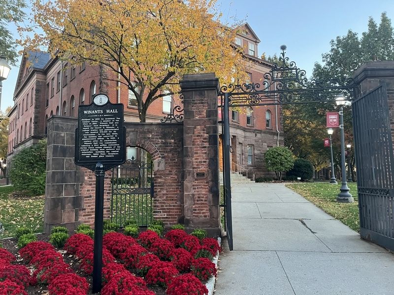
On College Avenue at Somerset Street, on the right when traveling north on College Avenue.
Designed in 1890 by architect Van Campen Taylor, a member of the Class of 1867. Winants Hall was Rutgers' first dormitory. It is named for Garret E. Winants, a college trustee and philanthropist who donated $75,000 for its construction. In the late . . . — — Map (db m208914) HM
Built n 1871, this was the first public school building in Perth Amboy. The original eight-room school, which was doubled in size in 1905, exemplifies the best class of public school building erected in New Jersey in the years after the Civil War. . . . — — Map (db m93943) HM
Plainsboro community leaders petitioned the State Legislature to grant the community incorporation as an independent township in 1919. This was successfully achieved in May of that year. Plainsboro School, the community’s first four-room . . . — — Map (db m93845) HM
On West Avenue (County Route 611) at Marsh Street, on the right when traveling south on West Avenue.
Est. 1913 by Sewaren
History Club and Civic Assoc.
Current location since 1960
Originally built as
Christian Science Church
1920 — — Map (db m192501) HM
On Augusta Street at Stevens Ave. N. on Augusta Street.
St. Mary’s parishioners built the school nearby at great sacrifice and dedicated it to Mary, Mother of God, in 1903. St. Mary’s served ten surrounding parishes during peace-time, wars and other catastrophes.
This marker placed in 2002 calls out . . . — — Map (db m93913) HM
Dedicated to the memory of South River's first and second graduates of the US Naval Academy
Classes of 1953 & 1957
Commander Leo J Cannon USNR Ret
Major Matthew M Cannon USAF Ret
who resided on this site. — — Map (db m95751) HM WM
On Rahway Avenue (County Route 514) at Martin Terrace, on the right when traveling north on Rahway Avenue.
Home of Deacon Joseph Barron,
First Presbyterisn Church.
One of many handsome colonial homes, it
remained in the Barron family, donors
of the money and land to build the
Barron Library
Circa 1803 — — Map (db m191712) HM
On Rahway Avenue at Port Reading Avenue, on the right when traveling north on Rahway Avenue.
First library in Middlesex County on land and money donated by the Barron family. Constructed in Richardsonian Romanesque Revival Style Architecture with massive Belleville stone, floral stained glass, and terra cotta panels. — — Map (db m191713) HM
On N Park Drive at Elmwood Avenue when traveling west on N Park Drive.
Originally called Woodbridge Avenue, Green Street was a popular thoroughfare from the early 1800s and served as the address of many prosperous Woodbridge citizens. Perhaps named for the adjacent green fields and canopy of stately trees, the . . . — — Map (db m126470) HM
On School Street at Brook Street, on the right when traveling south on School Street.
Classes began January 1877.
First high school graduation 1883;
two graduates.
Became Woodbridge Township District
Administration Offices.
Built 1876 — — Map (db m190136) HM
On Amboy Avenue (Route 35) near Main Street, on the left when traveling north.
St. James Roman Catholic Parish
First mass, 1683
School opened, 1890
Church relocated from Upper Main Street, 1924
New church dedicated, 1968 — — Map (db m195829) HM
On this site in September 1890, Mother M. Joseph and Sisters M. Sebastian, M. Baptist and M. Josephus (Sisters of Mercy) founded St. James School. The school was located in the frame building which had formerly been the church. The school was . . . — — Map (db m19890) HM
The Parish Community of St. James
The history of St. James Roman Catholic Church began in the late 17th century, when many French and Irish immigrants were drawn to Woodbridge following the discovery of a fine type of potter’s clay in the area. . . . — — Map (db m125512) HM
On Barron Ave. north of Green St., on the left when traveling north.
Opened September 11, 1911
Last graduating high school class June
1956: became Woodbridge Middle School
John Pierson & Son, Architects
CIRCA 1911 — — Map (db m191208) HM
One of 6 "one room" schoolhouses, originally known as the Barrenton School was moved to its present site, and became the Montrose School. Operation ceased in 1922 with the construction of the Atlantic School on Rt. 537. — — Map (db m15628) HM
On Kearney Road, on the left when traveling south.
This barracks was built for the enlisted men at the Sandy Hook Proving Ground. After the proving ground moved to Aberdeen, Maryland, in 1919, it became the Fort Hancock School and later Headquarters for the 7th Coast Artillery Regiment. Sandy Hook . . . — — Map (db m54534) HM
On Sycamore Avenue (County Road 13A) just east of Broad Street (State Route 35), on the right when traveling east.
On this site
Christopher Reynolds
from 1743 to 1760 conducted the Christ Church School one of the earliest common schools in New Jersey — — Map (db m209048) HM
On Loantaka Way west of Shunpike Road, on the right when traveling west.
The one room red brick school administered by Chatham Township was erected on property privately owned by Republican Academy. Serving as a Sunday and Elementary school, one teacher taught students age 5-18 from parts of Morris and Chatham . . . — — Map (db m198721) HM
On Southern Blvd at Fairmount Avenue, on the left when traveling south on Southern Blvd.
Built around 1860 as one room schoolhouse. Served until 1928 as one of four township schools. Renovated as Chatham Township Hall 1959. — — Map (db m8879) HM
Children attended this school from 1861 until 1908 when the Third Union School opened across the road. The First Union School built on this site in 1816 was destroyed by fire in 1860. The Union School united the villages of Franklin and Ninkey into . . . — — Map (db m91626) HM
Dover's oldest public meeting house built by town forefather Henry McFarlan. Served as school and place of worship for Presbyterian and Episcopalian Congregations. — — Map (db m91191) HM
On Old Mt Pleasant Avenue at Hanover Road, on the left when traveling west on Old Mt Pleasant Avenue.
Site of The Latin School The First School circa 1774 Founded by the Rev. Jacob Green Plaque erected by E. Hanover American Revolution Bicentennial Committee 1776 - 1976 — — Map (db m32285) HM
On Ridgedale Avenue at Columbia Turnpike (County Route 510), on the right when traveling south on Ridgedale Avenue.
Built on site of 1830 wooden school. Present structure predates Florham Park borough by 33 years. Classes held here continuously until 1914. Morris County Heritage Commission New Jersey Register of Historic Places National Register of . . . — — Map (db m36415) HM
On Fairview Road, on the left when traveling east.
Between 1830 and 1886 this bell rang from a belfry on top of this building when it served as a school.
In memory of Kathleen Darter. — — Map (db m58413) HM
On Madison Avenue (New Jersey Route 124), on the right when traveling west.
Florham 1893-1955 Country estate of Hamilton and Florence Vanderbilt Twombly. Grounds designed by Frederick Law Olmsted and Son. Buildings designed by McKim, Mead and White. Acquired by Fairleigh Dickinson University in 1958 — — Map (db m32108) HM
On Greenwod Ave. at Rockwood Rd., on the right when traveling north on Greenwod Ave..
Among the pioneers who came to this area around 1720 were three brothers: Thomas, Ichabod and Jeremiah Genung. The region became known as the Genungtown Settlement.
In 1805, a school was built to provide organized education to meet the needs of . . . — — Map (db m174206) HM
Near Madison Avenue, on the right when traveling east.
Greek Revival mansion, built by William Gibbons, part of estate, "The Forest". Purchased 1868 by Daniel Drew for Drew Theological Seminary. Mansion named for Roxanne Mead Drew.
New Jersey Register of Historic Places — — Map (db m32994) HM
On Union Schoolhouse Road at Mosele Road & Pleasant Valley Road, on the right when traveling south on Union Schoolhouse Road.
Built and operated as a one room school until 1928, when students transferred to Mendham Borough School. Remodelled as private dwelling after acquisition by Schiff Scout Reservation, 1941 — — Map (db m16981) HM
On Wahington Valley Road at Schoolhouse Lane, on the right when traveling east on Wahington Valley Road.
Built on site of original 1813 "Brick School". Educated 30-40 children yearly until 1913. Served as a Sunday School 1875-1937. In continuous use as a community meeting place since 1851. — — Map (db m36859) HM
On East Main Street at Hilltop Road on East Main Street.
Built c.1805 in the classic federal style. It first served as an academy for young ladies. Purchased in 1820 by William Phoenix for use as an inn. It was converted by his daughters to a boarding house in 1857. Since 1938, the borough of Mendham has . . . — — Map (db m229637) HM
On Long Hill Road, on the right when traveling south.
Built in early 19th century as one room school. Classes held continuously until 1926. Addition added 1910. Since 1928 used as Passaic Township Hall. Public school classes discontinued in 1933. — — Map (db m32987) HM
On Mt. Kemble Avenue (U.S. 202), on the right when traveling south.
Oldest schoolhouse still standing in Morris township. Addition built in 1899. School held here continuously from 1810-1914. Morris County Heritage Commission — — Map (db m8595) HM
On Cutler Street, on the right when traveling west.
Home of Silas Condict, colonial patriot, and subsequently home of General Joseph Cutler and his son, Augustus, congressman and father of the Free School System. Morris County Heritage Commission New Jersey Register of Historic Places . . . — — Map (db m42204) HM
On Washington Valley Road, 0.1 miles west of Mendham Road, on the right when traveling west.
World famous center for training dogs to lead blind persons. Founded in 1929 by Dorothy Harrison Eustis as first dog guide school an United States. Present headquarters built 1965. — — Map (db m36858) HM
On Newark Pompton Turnpike, on the right when traveling north.
School District No. 105. 1885 Trustees H. J. Smith • J. R. Evans • M. Card ( Second Marker : ) This stone plaque marks the site of the Pompton Plains School (1885 – 1985). It was part of the original “Brick . . . — — Map (db m62876) HM
On West Bay Avenue, 0.1 miles west of South Main Street (U.S. 9), on the left when traveling west. Reported damaged.
Stafford Township has a long history of patriotism and honoring those who have served our nation. Stafford Township residents have served with honor and distinction from the American Revolution to the deserts of Iraq and the Mountains of . . . — — Map (db m209271) HM
Elizabeth Schulthorp Force (1902-2007) brought national fame to Toms River Schools and community with courses in Family Relationships and Social Behavior, designed and taught by her to local high school students from 1942 to 1957. News of both her . . . — — Map (db m92452) HM
On Washington Street at Courthouse Lane, on the right when traveling east on Washington Street.
Bishop Memorial Library (c. 1941)
101 Washington Street
Writer and traveler Nathaniel Holmes Bishop (1837-1902), born in Medford, Massachusetts, moved to Toms River when he was about 27 years old. His adventurous spirit and . . . — — Map (db m208297) HM
On Washington Street just east of Allen Street, on the right when traveling east.
Ocean County Courthouse (1850)
118 Washington Street
Built from borrowed plans1 used to construct the Hudson County Courthouse, this two-story red brick building was designed in a neo-classical Greek . . . — — Map (db m208310) HM
Near River Drive, on the left when traveling north.
This stone marks the site of the old district school of Acquackanonk dating from 1693 to 1870 also known as Nassau Hall Academy (then two stories in height) where boys prepared for Princeton College many of them becoming well known ministers, . . . — — Map (db m36161) HM
Built and dedicated n 1912 by Fannie Friedman Einstein in memory of her husband. Incorporated as the Free Public Library of Pompton Lakes in 1953; declared a local historic landmark in 1994; an example of English Tudor Revival Style. — — Map (db m94667) HM
The initial structure is an excellent example of a Colonial Revival building from the New Deal era. The school initially received students from Oakland, Wayne and Midland Park as well as Pompton Lakes.
Declared a local historic landmark 2001 — — Map (db m94674) HM
Lenox School built in 1918 is a good example of the stripped classicism construction favored during this period. The separate entrances on each side of the front door identify the original entrances for "girls” and "boys”. An addition was . . . — — Map (db m190664) HM
On Lambert Street, on the right when traveling east.
Construction of the building began in 1856 and it served as a school from 1857-1925. The upper floor housed the high school,
accessible through the door on the front right side of the building and led to the stairway to the second floor. . . . — — Map (db m244298) HM
On East Broadway (Route 49) just east of Market Street (New Jersey Route 45), on the right when traveling west.
Built in 1869 as Union Fire Company No. 1, replacing their previous building named Union Hall, built in 1825. Salem fire companies included Union (est. 1749), Reliance (1825), Liberty (1866), Washington (1867) and North Bend (1904). This fire house . . . — — Map (db m153696) HM
On East Avenue (U.S. 40) at School Lane, on the left when traveling west on East Avenue.
In the late 1800's this school bell is understood to have hung in a small bell tower on top of our public school. At that time, the school was located on South Main Street next to the Baptist Church. — — Map (db m153657) HM
On East Avenue (U.S. 40) at School Lane, on the left when traveling west on East Avenue.
U.S. President Warren Harding 1922
U.S. President Warren G. Harding was traveling by car from Penns Grove to Atlantic City on May 12, 1922 when he stopped briefly in Woodstown and addressed a local crowd at the Woodstown Public School. New . . . — — Map (db m157199) HM
This building was erected in 1809 by Rev. Robert Finley to house a classical school founded by him in 1797. Statesmen, professional men, and business leaders were among its graduates. The academy served as a public school from 1853 to 1903. Owned . . . — — Map (db m18305) HM
On Burnt Mills Road (County Route 620) 0.2 miles west of U.S. Route 206 (U.S. 206), on the right when traveling west.
The Pluckemin School house was constructed in 1912 as a two-story four-room school. It cost approximately $5,000 and was designed by Peter C. Van Nuys of Somerville and was built by John Gulick of Lamington. it was used as a school house until 1958 . . . — — Map (db m117652) HM
On Millstone River Road (County Route 533), on the right when traveling north.
One room school house from 1860 to 1944. One teacher taught all eight grades. Enrollment varied with attendance up to 35 students. Original structure included a belfry. The Board of Education transferred the building to the borough in 1949, at . . . — — Map (db m37166) HM
The people's reading room and library was formally established in 1871. The library had several locations until George W. Post, architect of the New York Stock Exchange, designed this neoclassical building expressly for it. Later incorporated as . . . — — Map (db m76365) HM
On Amity Road (County Route 671) near County Route 605.
The Amity School was built in 1840, and in continuous use until June 1936. When it was built, Byram Township included part of current Sparta Township, and all of Stanhope and Hopatcong Boroughs. Stanhope Road did not reach from Green Road to . . . — — Map (db m26433) HM
On Washington Ave. at School Plaza, on the left when traveling east on Washington Ave..
Franklin has held valuable minerals for over 1 billion years. Mining of iron began in the 1760s and the first school was a log structure near the Baptist Church, replaced by a brick school in 1871 when iron production increased and railroads . . . — — Map (db m167184) HM
On Passaic Avenue at County Route 517 on Passaic Avenue.
Built in 1910 as Ogdensburg's fifth public school, it was adapted for re-use in 1930 as the Borough's first firehouse. In 1989, with the aid of two state grants, the Ogdensburg Historical Society adapted it for re-use and dedicated it as the Old . . . — — Map (db m27303) HM
On Price's Switch Road (County Route 515) at Meadowburn Road on Price's Switch Road.
Built in 1840, Price's Switch School was the last one-room schoolhouse to operate in Sussex County. The building originally stood on Route 94, a quarter mile north of Price's Switch Road, but was moved to its current location in 1883. It is the only . . . — — Map (db m27301) HM
On Broad Street at Caldwell Place, on the right when traveling south on Broad Street.
From 1664 until 1703, the First Presbyterian Church of Elizabeth was the only house of worship serving most of current-day Union, Morris, Somerset and Hunterdon Counties. The oldest stones in the cemetery are from the year 1687 and are located in . . . — — Map (db m144144) HM
On Broad Street (Route 623) at Caldwell Place, on the right when traveling south on Broad Street.
This tablet marks the first site of Princeton University incorporated Oct 22nd 1746 --------------- Erected by the Elizabeth Members of the New Jersey Society of Colonial Dames of America – Oct 22nd 1897 — — Map (db m40708) HM
On Broad Street (New Jersey Route 623) at Caldwell Place, on the right when traveling south on Broad Street.
Site of the Old Academy Attended by Alexander Hamilton and Aaron Burr Col. Francis Barber was Principal at the outbreak of the Revolution. — — Map (db m40608) HM
On Old Academy Drive north of Main Street, on the right when traveling north.
Until 1848, the children in and around Blairstown attended classes in two locations: in a wood frame schoolhouse that was located near the Presbyterian church and, by 1822, in a brick schoolhouse that was built on the south side of the Paulins . . . — — Map (db m150376) HM
On County Route 517, 0.2 miles south of Interstate 80, on the right when traveling north.
Rutherfurd Hall, built in 1903, is a National and NJ State Historic Landmark. A sprawling country home, the hall was designed as a grand country manor by famed architect Whitney Warren, who also designed such landmarks as New York's Grand Central . . . — — Map (db m165879) HM
Mary Catherine Phillips, consumer advocate, author, and editor, joined Consumer’s Research, a New York-based organization, in 1932. She married one of its founders, Frederick Schlink, that same year. One year later, the entire operation relocated to . . . — — Map (db m94693) HM
270 entries matched your criteria. Entries 201 through 270 are listed above. ⊲ Previous 100