On South Front Street north of Walnut Street, on the right when traveling north.
Founded here, 1775, as the Society for the Relief of Free Negroes Unlawfully Held in Bondage. In 1787 it became the Pennsylvania Abolition Society which sought social, educational, and employment opportunities for Blacks. — — Map (db m51110) HM
On Arch Street at N 4th Street, on the left when traveling west on Arch Street.
On February 23-25, 1979, about 300 activists from across the nation met at the Arch Street Meeting House to plan the seminal National March on Washington for Lesbian and Gay Rights. Here, leaders organized a march on October 14, 1979, that with . . . — — Map (db m106212) HM
On Dock Street near Walnut and South 3rd Streets, on the right when traveling north. Reported permanently removed.
The magnificent building in front of you testifies to 19th Century Philadelphia’s importance as a financial hub. The Philadelphia (Merchants’) Exchange opened in 1834, and stood in the commercial heart of the city. Merchants, manufacturers, brokers . . . — — Map (db m137681) HM
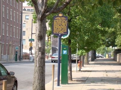
On South Front Street just south of Market Street, on the right when traveling south.
Near here, silversmith Philip Syng, Jr. created the inkstand used to sign the Declaration and Constitution at Independence Hall. With Benjamin Franklin, took part in experiments in electricity; founded institutions like the American Philosophical . . . — — Map (db m51242) HM
On Arch Street at 3rd Street, on the right when traveling west on Arch Street.
Here, in its first General Assembly held May 21-24, 1789, the Presbyterian denomination in America was formally organized on a national basis. This took place in the city's Second Presbyterian Church, which was at this site from 1750 to 1837. — — Map (db m9327) HM
Near South 4th Street, on the right when traveling north.
On this site in the 1790s stood one of Philadelphia's five Quaker meeting houses. Here members of the Society of Friends gathered to worship.
The religious freedom guaranteed to those who settled in Pennsylvania attracted not only Quakers, . . . — — Map (db m9661) HM
In schools like the one that stood here in the 1700s, Quaker teachers educated all children and servants -- male and female, black and white.
Although Quaker influence over city and state politics declined steadily in the 18th century, their . . . — — Map (db m9659) HM
Near Market Street just east of South 4th Street, on the right when traveling east.
This is a remnant of brick flooring in what was Franklin's cellar kitchen. The bricks are laid on edge on a lime mortar bed.
This is a remnant of the south foundation wall of the house.
While Franklin was in London in 1765, he and his . . . — — Map (db m192942) HM
In the Burial Ground of this Church
rest the remains of Seven Signers of the
Declaration of Independence
Benjamin Franklin Benjamin Rush MD Obit 1796Obit . . . — — Map (db m76078) HM
An influential revolutionary-era printer, he operated a shop on this block. In 1782, Aitken printed the nation’s first complete English Bible. It received endorsement from Congress, and was the only new Bible available to colonists due to printing . . . — — Map (db m83386) HM
On Walnut Street (County Road 3006) west of South 3rd Street, on the right when traveling west.
The regularity of Philadelphia is so great, the streets are so much like each other and the houses so nearly the same size (being built of one coloured brick) that I do not think there is anything else worthy of remark about it. . . . — — Map (db m214217) HM
The holder of the first U.S. patent, signed by George Washington, lived here. On July 31, 1790, Hopkins received a patent for an improvement in making potash, a major industrial chemical. In succeeding centuries, the U.S. Government issued millions . . . — — Map (db m82897) HM
Near Arch Street west of North 3rd Street, on the left when traveling west.
Samuel Nicholas (1744-1790) was expelled from this Quaker worship community for founding the Continental Marines, the precursor to the U.S. Marine Corps, during the American Revolutionary War. After the Revolutionary War, Nicholas became a member of . . . — — Map (db m210903) HM
Near Arch Street at North 4th Street, on the left when traveling west.
Sarah Mapps Douglass
Sarah Mapps Douglass (1806-1882) was a Black Quaker, anti-slavery activist, artist, and educator. A free and affluent family, the Douglass' worshiped at Arch Street during a time when seating was racially . . . — — Map (db m210930) HM
On South 3rd Street south of Chestnut Street, on the left when traveling north.
During the 1790s, when Philadelphia was the capital of the United States, a large two-story brick building on this site housed the office of the Secretary of the Treasury. Alexander Hamilton, the first Treasury Secretary, presided over the largest . . . — — Map (db m106745) HM
On Arch Street at North Front Street, on the right when traveling west on Arch Street.
This is the Smythe Stores condominium apartments. The original building was built in 1857. It is one of the many buildings which are being preserved and refurbished in the Old City National Historic District.
You will first notice the . . . — — Map (db m192968) HM
On Front Street south of Ionic Street, on the left when traveling south.
Here, in 1747, at the
Tun Tavern
twenty-five gentlemen
of Philadelphia from that
part of Great Britain called
Scotland formed the . . . .
St. Andrew's Society
of
Philadelphia
Since that time, Scotsmen
of honor . . . — — Map (db m102320) HM
First U.S. foundation, Augustinian Order, 1796. In 1844 the original church here was burned during Nativist riots. This and other violence led to a state law requiring police forces, 1845, and to consolidation of the city and county, 1854. — — Map (db m82983) HM
On North 4th Street at North Marginal Road, on the left when traveling south on North 4th Street.
This is America’s oldest Methodist church edifice, having been in continuous use since 1769. It was the seat of the first three conferences of American Methodism, the first church visited by many of the early British Methodist itinerants, and the . . . — — Map (db m135997) HM
On Chestnut Street at Front Street, on the right when traveling east on Chestnut Street.
The Great Hunger in Ireland led to the greatest loss of life in western Europe in the 100 years between the Napoleonic Wars and World War I. Whole families and villages fell to starvation and accompanying diseases. Cholera, deadly fevers, . . . — — Map (db m102389) HM
On North Front Street at Market Street, on the right when traveling north on North Front Street.
In honor of the contributions of Native American Indians—the ancestors, the elders, this generation, and the generations to come—this sculpture commemorates Tamanend, a Sakima, of the Lenni-Lenape nation who resided in the Delaware . . . — — Map (db m62016) HM
On Chestnut Street at 3rd Street, on the right when traveling east on Chestnut Street.
Imagine this neighborhood filled with the sights, sounds, and smells of war. Philadelphia’s tradesmen and women produced muskets, cannons, ammunition, wagons, ships, uniforms, and flags that helped to win American Independence.
In 1775, hat . . . — — Map (db m106211) HM
On South 2nd Street close to Walnut Street, on the left when traveling north.
The City Tavern in Philadelphia was erected at a great expense by a voluntary subscription of the principal gentlemen of the city or the convenience of the public, and is much the largest and most elegant house occupied in that way . . . — — Map (db m51219) HM
On South 3rd Street at Chestnut Street (County Road 3008), on the left when traveling south on South 3rd Street.
The words above, from the Declaration of Independence, have changed the world.
Written to proclaim America's right to become a separate nation, these sacred truths have led successive generations of Americans to create the most open society . . . — — Map (db m210934) HM
Near Arch Street just east of North 3rd Street, on the right when traveling west.
"[T]he historical value of Betsy Ross need not be a zero-sum game… She is important to our understanding of American history not because she made any one flag, however iconic that moment may have become, but because she was a young craftswoman . . . — — Map (db m212568) HM
In this yard, now known as Franklin Court, formerly stood the home of Benjamin Franklin. In his later years, Franklin also built three Market Street houses and a Print Shop for his printer-publisher grandson, Benjamin Franklin Bache. . . . — — Map (db m9538) HM
On Chestnut Street east of Front Street, on the right when traveling east.
The first wave of Hunger Emigrants faced enormous difficulties, but they found a foothold in what became America's first urban, ethnic ghettos. Often, they lived in overcrowded hovels beset by disease, crime, unemployment, drink, and despair. . . . — — Map (db m102403) HM
On Chestnut Street at Front Street, on the right when traveling east on Chestnut Street.
Erected to commemorate An Gorta Mór -
Ireland's Great Hunger of 1845 - 1850
when more than one million Irish
were starved to death and another million
forced to emigrate. We celebrate the
indefatigable spirit of the Irish that enabled . . . — — Map (db m102407) HM
On Chestnut Street east of Front Street, on the right when traveling east.
This memorial commemorates the struggle and pain of those Irish who fled their homeland in the face of a hunger of catastrophic proportions. It celebrates their courage and honors them for opening the door for others. Their story springs from . . . — — Map (db m102406) HM
On Chestnut Street (County Road 3008) just west of South 2nd Street, on the right when traveling east.
Near this site in 1796, John McAllister Sr. opened America's optical shop and began a family tradition of innovation in optics and eye care. John Sr. was a pioneer of opticianry. His son John Jr. became the first American hospital optician. Third . . . — — Map (db m210933) HM
On Sansom Walk just east of South 2nd Street, on the right when traveling east.
The names of the streets are mostly taken from the things that grow in the country as Vine Street, Mulberry Street, Chestnut Street, and the like. — — Map (db m194440) HM
Brought from England in 1754 Proclaimed our Independence on July 4, 1776. Two bells were added in 1947 in memory of the men from this the oldest business neighborhood in the United States of America who served in World War II. All Now Ring Freedom . . . — — Map (db m9350) HM
On Chestnut Street at Front Street, on the right when traveling east on Chestnut Street.
The fungus that decimated the potato fields of Ireland in the mid-nineteenth century is well named. Phytopthora infestans, literally "infesting plant destroyer," can, under the right conditions, reduce the foliage of a field of potatoes . . . — — Map (db m102367) HM
Near Arch Street at North 4th Street, on the left when traveling west.
Approximately 5,000 Philadelphians — 10% of the city's population — died from yellow fever between August and November 1793. Burial records for Arch Street would list the "American Plague," another name for yellow fever, as the cause of death. . . . — — Map (db m210927) HM
On South 2nd Street south of Chestnut Street, on the left when traveling south.
In 1769, when Dr. Thomas Bond built this house and rented it to his son and namesake, the elder Bond was already a prominent Philadelphia physician and civic leader. Along with Benjamin Franklin, he helped to found the Pennsylvania Hospital and the . . . — — Map (db m32431) HM
On South 3rd Street north of Walnut Street when traveling north.
During the 1790s, in a house on this site, the Treasurer of the United States kept careful records of all moneys received and spent by the new federal government. — — Map (db m214212) HM
On South Front Street at Samson Street, on the right when traveling north on South Front Street.
Near here stood Tun Tavern, 1693–1781, which is regarded as the traditional birthplace of the United States Marine Corps, authorized by a resolution of the Continental Congress, November 10, 1775.
Semper fidelis — — Map (db m51109) HM
This first truly volunteer fire company in the US served as a model for others across the nation. Members, including Ben Franklin, purchased tools stored here in Grindstone Alley, helped provide a fire bell, buckets, and an engine for the city, and . . . — — Map (db m83402) HM
On Chestnut Street at 3rd Street, on the right when traveling east on Chestnut Street.
This bronze sculpture replicates the famous painting, Washington Crossing the Delaware by Emanuel Leutze. It depicts Gen. George Washington leading the Continental Army on a dangerous nighttime crossing of the Delaware River on December 25, . . . — — Map (db m106149) HM
On Sansom Walk just east of South 2nd Street, on the right when traveling east.
William Penn's Farewell
And thous, Philadelphia, the virgin settlement of this province named before thou wert born, what love, what care, what service, what travail have there been to bring thee forth and preserve thee from such as would . . . — — Map (db m194436) HM
Near Arch Street, on the right when traveling west.
Betsy Ross (1752 - 1836) lived and worked here on Arch Street during the American Revolution. The house where she boarded with the elderly Widow Lithgow has been restored to early 1777.
In 1776 Betsy Ross lost her husband John. The young . . . — — Map (db m210906) HM
Near Arch Street just east of North 3rd Street, on the right when traveling west.
Welcome to the Betsy Ross House, the museum that celebrates the legendary maker of the first American Flag. Betsy Ross is one of the most famous women in American history, best known for her role in the creation of the Stars and . . . — — Map (db m212570) HM
Near Arch Street just west of North 4th Street, on the left when traveling west.
In the 1700s, Philadelphia Quakers declared grave markers were "Marks of Superfluity and excess." Grave markers and stones were deemed "inconsistent with the plainness of [Quaker] Principles and Practice," and many were removed or buried in a pit . . . — — Map (db m210923) HM
On Arch Street just west of North 3rd Street, on the left when traveling west.
Quakerism, or the Religious Society of Friends, was founded in England by George Fox as a Protestant Christian faith during the mid-1600s. Quakers, often called "Friends," believe God is present in the hearts of everyone through a power called . . . — — Map (db m210901) HM
On Chestnut Street (County Route 3008) just east of South 4th Street, on the right when traveling east.
National Park Service, state, and local officials have always grappled with questions of preservation. What is worth saving? What gets destroyed?
The creation of Independence National Historical Park ensured the preservation of many sites . . . — — Map (db m227595) HM
Near Market Street (County Road 2004) east of South 4th Street, on the right when traveling east.
No images of Franklin Court in the 1700s exist. After Benjamin Franklin's house was demolished in 181, Orianna Street cut through the property and erased any trace of the Founder's presence.
The National Park Service conducted multiple . . . — — Map (db m227592) HM
On South Second Street, 0 miles north of Walnut Street, on the right when traveling north.
By liberty of conscience we understand not only a mere liberty of the mind, but the exercise of a visible way of worship this day my country was confirmed to me by the name of Pennsylvania. My God will, I believe, bless and make it the seed of . . . — — Map (db m135453) HM
On North Front Street just south of Callowhill Street, on the right when traveling north.
The steps here are the only surviving example of ten passageways along the original Delaware River bank commissioned by William Penn in the early 1700s. Providing public access to the river wharves, the steps promoted transportation, commerce, and . . . — — Map (db m82906) HM
Near Arch Street just east of North 4th Street, on the left when traveling west.
In 1701, William Penn formally deeded this land to the Quakers "for a burying place." However, surviving documents show Quaker burial records as far back as 1687. Arch Street's burial grounds were initially organized by family and community. As . . . — — Map (db m210922) HM
On South Christopher Columbus Boulevard north of Walnut Plaza, on the right when traveling north.
Compass card, end of the 18th century.
View of Philadelphia, 1702. Courtesy of the Historical Society of Philadelphia.
The "new" mariner's quadrant was commonly used on ships for obtaining an estimated position. It came into use as . . . — — Map (db m192820) HM
On South Christopher Columbus Boulevard north of Walnut Plaza, on the right when traveling north.
This early version of the modern marine chronometer resolved the problem in navigation on determining longitude accurately. It increased the efficiency and safety of maritime trade and travel, which directly affected the prosperity of the port of . . . — — Map (db m192831) HM
Near South Christopher Columbus Boulevard north of Walnut Plaza, on the right when traveling north.
The Declaration of Independence, drafted by Thomas Jefferson, is read for the first time in a crowd in front of the State House. — — Map (db m192811) HM
Near South Christopher Columbus Boulevard north of Walnut Plaza, on the right when traveling north.
Orukter Amphibolos, a steam-powered dredge, designed by Philadelphian Oliver Evans in 1834. It was used to dredge the banks of the Delaware River.
G. Matter's Bird's Eye View of Philadelphia, 1840. Courtesy of the Free Library of . . . — — Map (db m192845) HM
On South Christopher Columbus Boulevard near Dock Street, on the right when traveling north.
Charismatic Leader • Navigator
Explorer • Visionary • Naturalist
Mathematician • Cartographer
Columbus, intrepid navitagor, with a sense of the sea unparalleled before or after him. A native son of Genoa, he became through his . . . — — Map (db m192861) HM
On S Columbus Blvd at Dock Street, on the right when traveling north on S Columbus Blvd.
Following the creation of the US Navy in 1794 under President Washington, Barry was appointed first commissioned officer and secretary. He oversaw construction of the nation's first fleet. He won numerous naval victories during the American . . . — — Map (db m77081) HM
Olympia
Cruiser Olympia, launched in 1892, is the oldest steel warship afloat today. Olympia is best known as Commodore George Dewey’s flagship in the Battle of Manila Bay, Philippine Islands during the 1898 Spanish . . . — — Map (db m19242) HM
On Walnut Street Promenade at South Columbus Boulevard on Walnut Street Promenade.
To the memory of the followers of Caspar von Schwenckfeld who fled from Silesia and found in Pennsylvania a haven of religious toleration They landed near this spot 1731-37 Erected by the Society of the Descendants of the Schwenkfeldian Exiles . . . — — Map (db m34781) HM
On South Christopher Columbus Boulevard at Walnut Street, on the right when traveling east on South Christopher Columbus Boulevard.
In a covert CIA plan named the Jennifer Project, this ship was built at Sun Shipbuilding and Dry Dock Company, Chester, in the early 1970s and played a key role in US Cold War espionage. Its mission was to obtain intelligence by recovering a sunken . . . — — Map (db m34483) HM
Near South Chris Columbus Boulevard, 0.3 miles north of Dock Street, on the right when traveling north. Reported damaged.
1644: William Penn born in London, October 14, 1644
1660-62: Attended Oxford University
1675: Became a trustee of Quaker colony in New Jersey
1682: Wrote Pennsylvania constitution, Frame of Government and Laws. . . . — — Map (db m192809) HM
528 entries matched your criteria. Entries 101 through 200 are listed above. ⊲ Previous 100 — Next 100 ⊳