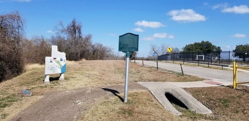
Victoria is the quintessential South Texas city, rich in history and charm. Victoria County is considered to be the place where the history of Texas began, as it is the only place in the Lone Star State where all of the Six Flags Over Texas flew. It . . . — — Map (db m192632) HM
Inhabited briefly by adventurer Cabeza de Vaca in 1530's and French explorer La Salle in 1680's. Site of 1720 Mission Espiritu Santo de Zuniga. Mission friars, sent here to Christianize and civilize the Karankawa Indians, laid foundation for the . . . — — Map (db m192444) HM
Founded 1824 by Martin de Leon as center of his colony, Mexico's buffer against Comanches.
Active in 1836 in support of Texas War for Independence, and in Confederate cause during Civil War.
Historic, trade, cattle, oil and industrial . . . — — Map (db m192446) HM
Son of a Victoria County judge. From boyhood wrote stories and poems. Left college to join Confederate Army in the Civil War. Fought in Ross' Brigade, in many of the hardest battles in history. Was wounded twice and spent many months as a prisoner . . . — — Map (db m192457) HM
Born on the Isle of Guernsey, Great Britain; moved to London at an early age. After marriage, he emigrated to Montreal, Canada, in 1832. Came to Texas in 1834, and settled on the San Jacinto River. Joined the Texas volunteers and fought in Battle . . . — — Map (db m213761) HM
1528 · 1685 Cabeza de Vaca · Cavelier de la Salle Victoria County Under the Mexican Government Victoria was a district in 1832, a Municipality in 1835. Under the Republic of Texas Victoria County was created
March 17, 1836 with Victoria . . . — — Map (db m241014) HM
Country's Defenders from Victoria County who made the supreme sacrifice in the World War. Erected by the citizens of Victoria County. Dedicated by Leon Zear Post No. 166, The American Legion
Overton Asa Abshier •
Raymond A. Allen • . . . — — Map (db m211974) WM
The McFaddin Ranch settlement was renamed Marianna in 1906 by the St. Louis, Brownsville, & Mexico Railroad. A post office, opened in the Marberry and Stubblefield General Store in 1907, moved to the McFaddin Mercantile in 1911, and to this . . . — — Map (db m166431) HM
Traditionally recognized as the first great cattle ranch in Texas, Espíritu Santo Ranch traces its history to the Spanish Mission of Nuestra Senõra del Espíritu Santo de Zúniga, established on Garcitas Creek in present Jackson County in 1722. It . . . — — Map (db m208015) HM
The Hon. Robert A. Kerr, political and civic leader, was born in Louisiana in 1833 and by 1855 had moved to Texas where he served as an election judge for San Patricio, Refugio, Calhoun and Victoria counties. After moving to Bastrop he became the . . . — — Map (db m195976) HM
This site was claimed in 1857 under a Republic of Texas land certificate held by former State representative Darwin Stapp of Victoria County. In 1869 he sold the tract to another absentee owner. By tradition, this house was built in the 1870s by . . . — — Map (db m94549) HM
First founded on Garcitas Creek, near Espiritu Santo Bay in April 1722 moved to Mission Valley, Victoria County, in 1726 and from there. In 1749, moved to this, it's final location - site of the massacre of Fannin's men Palm Sunday, March 27, 1836. . . . — — Map (db m235082) HM
Daniel Webster Wallace, "80 John," was one of Texas' most successful black ranchers. Born the son of slave parents in Victoria County in 1860, he went to work as a cowboy when he was 15, eventually working for C.C. Slaughter, Isaac Ellwood, John . . . — — Map (db m191373) HM
The Nursery community was established in 1883, named for Gilbert Onderdonk's site for growing trees and plants. A post office opened the following year, and the first public school for the community was a two-room building located on the Kyle Ranch . . . — — Map (db m192581) HM
The Prairie Grove Cemetery served residents of the Aleo community from the late 1800s until the middle of the 20th century. The burial ground has ties to the Prairie Grove Baptist Church, which set aside land to be used for burials. The oldest known . . . — — Map (db m264430) HM
Panel 1
The first German settlements in Texas were Industry in Austin County, founded by Friedrich Ernst in 1831, Biegel in Fayette County, founded by Joseph Biegel in 1832, Cat Spring in Austin County, founded by the von Roeder, Kleberg, . . . — — Map (db m210312) HM
Reminder of De Witt County's earliest settlement, Irish Creek, begun in 1826 when Arthur Burns (1780-1856) migrated from Missouri and Iowa to Texas. He joined colony of Green DeWitt and built a 2-story log home near here. Used as a refuge during . . . — — Map (db m205853) HM
The Camino Real (Royal Road), also known as the King’s Highway, was a series of routes linking Spanish missions and presidios in Texas and Louisiana. Beginning in 1725, the Spanish employed one such roadway, the Lower Camino Real, that went . . . — — Map (db m291890) HM
Built 1890 of Florida pine and cypress; typical Victorian style. Home of James A. McFaddin (1840-1916), loyal citizen of Texas Republic and pioneer stockman. He married Margaret Virginia Coward in 1861 and served as an officer in the Confederate . . . — — Map (db m207851) HM
Originally established near present Matagorda Bay, Mission Nuestra Señora del Espíritu Santo de Zuñiga was moved to this San Antonio River location in 1749. Here, for more than 70 years, the Franciscan missionaries taught the native Aranama peoples . . . — — Map (db m235186) HM
In the Spanish colonization system, houses built outside the presidio fort walls by civilians and soldiers' families were intended to become a center of settlement. A diverse population - Spanish, Indian, African and European - flourished around the . . . — — Map (db m235136) HM
The presidio Nuestra Señora de Loreto was originally established near Matagorda Bay (La Bahía del Espíritu Santo) in 1721 to prevent future French landings in the area and to protect the mission Nuestra Señora del Espíritu Santo de Zúñiga. It was . . . — — Map (db m235084) HM
When Don Martín de Leon platted the original townsite of Guadalupe Victoria in 1824, he designated public squares, including one that would later be shared by city and county governments for many years. Victoria County built its first courthouse, a . . . — — Map (db m95356) HM
At the suggestion of Confederate Col. Henry McCullough, an area near this site north of Victoria, known as Nuner's Mott, was selected for the establishment of a military training camp in 1861. Troops from Bell, Bexar, Calhoun, DeWitt, Gonzales, . . . — — Map (db m54305) HM
The St. Louis, Brownsville,and Mexico Railroad built a line thorugh the McFaddin Ranch about 1900. The ranch settlement, temporarily renamed Marianna by the railroad, soon boasted a depot, post office, church, school, and several businesses, . . . — — Map (db m166428) HM
Although the town of Victoria had been established in 1824, it was all but abandoned during the Texas Revolution in 1836, as settlers fled east during the Runaway Scrape. After the Revolution's successful close at the Battle of San Jacinto on April . . . — — Map (db m192583) HM
Education of Victoria's African American schoolchildren began during Reconstruction; a Freedman's School on East Convent Street is referenced in an 1868 deed. By 1875, three of the city's ten schools served African American pupils. Prof. Frederick . . . — — Map (db m192405) HM
Many Victoria pioneers were laid to rest here.
Early Spanish colonization requirements dictated that land be set aside as public burial grounds. However, the tradition of home burial persisted and the "Old Cemetery", now Memorial Square, . . . — — Map (db m192722) HM
Harry G. Woodhouse (1865-1918), a former conductor with Southern Pacific Railway, completed this house for his family in 1910. While living in Victoria, he became a successful farmer and served several terms on the city council. Interesting . . . — — Map (db m211724) HM
A far-sighted businessman who contributed much to the development of South Texas, Preston Rose Austin was born in Harrison County and grew up in Victoria County. After achieving prominence as a stock raiser, Austin became a partner in the Refugio . . . — — Map (db m119457) HM
Built through the generosity of James A. and A.M. McFaddin in 1916, this church began as a mission of St. Mary's Catholic Church in Victoria. It was established to serve Catholics in the Marianna (later McFaddin) community, including workers on . . . — — Map (db m166432) HM
Pioneer horticulturist Gilbert Onderdonk (1829-1920) exhibited early talent in his native New York, developing new varieties of potatoes that earned him recognition when he was still a teenager. After graduating from the New York State Normal School . . . — — Map (db m192582) HM
Mexican Empresario Don Martin de León received permission in 1824 from Mexican authorities to establish a colony bearing his name between the Lavaca and Lower Guadalupe Rivers and Coleto Creek, on the former lands of the Spanish mission, Nuestra . . . — — Map (db m208168) HM
Located along Chocolate Bayou, which empties into Chocolate Bay
dividing Port Lavaca and Indianola, the Chocolate Community
predates the organization of Calhoun County. In 1846, Massachusetts
native and Old 300 family head Sylvanus Hatch . . . — — Map (db m297388) HM
Thin black lines indicate changes in relevance. Between each pair of lines entries are ordered geographically but all have the same relevance.
* Inflectional forms of words are their plurals, singulars, and possessives as well as gramatical tenses and similar variations.