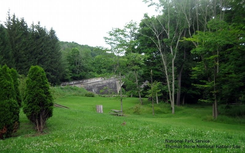
Transportation
Transportation features include Garrett County's Indian Trails, the National Road, and the Casselman Bridge. It also includes railroads and waterways, which all contributed to the cultural landscapes and settlement patterns . . . — — Map (db m168096) HM
Transportation
Transportation features include Garrett County's Indian Trails, the National Road, and the Casselman Bridge. It also includes railroads and waterways, which all contributed to the cultural landscapes and settlement patterns . . . — — Map (db m310831) HM
Transportation
Transportation features include Garrett County's Indian Trails, the National Road, and the Casselman Bridge. It also includes railroads and waterways, which all contributed to the cultural landscapes and settlement patterns . . . — — Map (db m223083) HM
This monument, at the headspring of the Potomac River, marks one of the historic spots of America. Its name is derived from Thomas Lord Fairfax who owned all the land lying between the Potomac and Rappahannock rivers. The first Fairfax Stone, marked . . . — — Map (db m3946) HM
Agriculture in Garrett County has a long broad history and is extremely present in today's society. The farmer-distiller was a familiar figure in nineteenth century Maryland.
Getting a ton of corn to market was expensive and the return . . . — — Map (db m275652) HM
Meshach Browning (1781, Damascus, Montgomery County,
Maryland - 19 November 1859, Garrett County, Maryland) was an early backwoodsman, hunter and explorer of the watersheds of the North Branch Potomac and Youghiogheny Rivers. His memoir is . . . — — Map (db m275619) HM
Maryland has many interesting geological features. This sandstone builder shows an unusual naturally occurring geometric pattern. Years of consolidating, folding and fracturing have resulted in a rock with many crevices filled with deposits of . . . — — Map (db m315518) HM
During the early 20th century, forest fires ravaged Maryland, impacting both people and wildlife, and costing uncalculated dollars worth of damage annually. Not only was marketable timber lost, but so were emerging sprouts and seedlings. Moreover, . . . — — Map (db m98506) HM
Oakland's Main Street Maryland program and its Design Committee spent several years looking for a way to beautify the town's barren walls while informing its residents and visitors about town history. A review of other small towns around the . . . — — Map (db m234244) HM
The Deep Creek Lake Lions Club welcomes you to our park! We operate and maintain this park under a long-term lease from the Board of Commissioners of Garrett County which owns the property. Over the years, we have worked with numerous individuals . . . — — Map (db m276039) HM
The community of Sang Run has a rich history and has been intertwined with the narrative of Garrett County. Sang Run was an active community, supporting a general store, school, church, and water-powered mill that which its remains can still be . . . — — Map (db m275724) HM
Born at Damascus, Maryland. Garrett County's most famous hunter, Browning wrote the book, "Forty-Four Years of the Life of a Hunter". During this time he killed two thousand deer and five hundred bear. — — Map (db m430) HM
Highest point in Maryland. Backbone Mountain, Garrett County, 3360 feet above sea level. Named for Captain Charles E. Hoye, founder of the Garrett County Historical Society. Dedicated September 1, 1952. — — Map (db m154) HM
Hurricane Sandy hit the east coast in late October causing massive damage. Here in Garrett County, Maryland, we received over 30 inches of heavy, wet snow.
Much of the damage you see in the forest is from Hurricane Sandy. Over 3000 hours . . . — — Map (db m233804) HM
The land occupied by Wilderness Voyageurs was once the site of the livery stable for the Riverside Hotel. The house pictured above was the home of Captain Elijah Monroe Friend, grandson of Gabriel Friend, son of John Friend the first white . . . — — Map (db m153156) HM
Spanning the Casselman River and supporting 200 years of hooves, boots, sleigh runners, and wheels of every type and description, the Casselman River Bridge begins its third century on the National Road in Grantsville, Maryland. It is one of the . . . — — Map (db m167079) HM
Frederick County. Named for Frederick 5th and last Lord Baltimore. Erected out of Prince George’s County in 1748. It then included Montgomery County and all of Maryland west to the West Virginia boundary.
Washington County. The first . . . — — Map (db m41770) HM
For nearly 60 years, the Deep Creek Volunteer Fire Company (DCV) has been serving the residents, businesses, and visitors of Garrett County. In 1965, a few local citizens placed a sign-up sheet in Walt's General Store, located across from the . . . — — Map (db m282956) HM
When the B&O railroad finally arrived in Cumberland on November 5, 1842, there was cause for celebration. The railroad would soon reap big rewards from the valuable coal reserve of the Cumberland basin. The ultimate goal at that time was to . . . — — Map (db m256766) HM
"The early settlers, being but few in number, had a hard time to maintain themselves; and had they not used the greatest economy, they could not have lived in the wilderness at all...All the settlers lived in cabins, and fed their children on . . . — — Map (db m276289) HM
The Appalachian Mountains formed approximately 500 million years ago when continental collisions created towering peaks, some reaching up to 20,000 feet. Over time, however, these mountains eroded, creating the rolling hills and forested . . . — — Map (db m275316) HM
Spanning the Cassleman River and supporting 200 years of hooves, boots, sleigh runners, and wheels of every type and description, the Cassleman River Bridge begins its third century on the National Road in Grantsville, Maryland. It is one of the . . . — — Map (db m135702) HM
When the River Road connected Selbysport and Friendsville, the original way into town was past the cemetery, across Bear Creek, at the cement arch bridge location; and down Walnut Street to Morris Avenue. The more daring could cross on foot, . . . — — Map (db m252256) HM
Delaware, Algonquian, and Shawnee migrated spring through fall in camps on paths worn by migrating game Fur traders followed, then settlers. Garrett County, Maryland was officially established in 1872 from Allegany County, with the town of . . . — — Map (db m275654) HM
Deep Creek Lake is the centerpiece of Garrett County’s reputation as an all-season destination. Visitors include “day-trippers”, families and groups of friends that stay for a number of days, and second-home owners that often visit frequently. . . . — — Map (db m275579) HM
Stitched collage of hand-crafted papers by Annie Simcoe, 2023
The artist, Annie Simcoe, created this piece using papers hand-crafted from plants that she grew or gathered such as cornhusks, iris leaves, and rye grass. The vibrant . . . — — Map (db m276448) HM
Whitewater boating on the Upper Youghiogheny River offers a world-class - and exciting - experience. Kayakers began to run the “Upper Yough” in the 1970’s. In 1981, the first commercial company (Precision Rafting, still operating) was formed in . . . — — Map (db m275442) HM
On December 4, 1872, following a public vote by the residents of Western Maryland, Governor William Pinkney Whyte issued a proclamation establishing a new county, created out of the western-most portion of Allegany County. The new county was . . . — — Map (db m252255) HM
"My mind cannot imagine a more beautiful sight than could be obtained from the highest grounds of the Hoop-Pole Ridge, which commanded a view of the valley between that and the great Back-Bone . . . It was a grand sight to watch the tall . . . — — Map (db m276287) HM
Deep Creek Lake is a stunning body of water that offers a paradise for boating enthusiasts. Whether you're an experienced sailor, a casual cruiser, a water sports enthusiast, or someone eager to simply explore, Deep Creek Lake provides endless . . . — — Map (db m275506) HM
A Gentle Hand - The Blind Skier Program at Wisp Resort, sponsored and organized each year by the Deep Creek Lions Club and several auxiliary volunteers, proves again and again to be a true "win-win" for all involved. In operation since 1976, . . . — — Map (db m275787) HM
Deep Creek Lake serves as a focal point for the community, not just as a recreational haven but also as a hub for local non-profit organizations. The lake and its surrounding area provide a unique environment where various non-profits thrive, . . . — — Map (db m275550) HM
The Loar family was a pioneer family in what is now Garrett County, known for their community involvement and philanthropy.
Jacob Loar (d.1827), the German ancestor, came to America in 1774. After the Revolutionary War he bought property around . . . — — Map (db m139059) HM
Thin black lines indicate changes in relevance. Between each pair of lines entries are ordered geographically but all have the same relevance.
* Inflectional forms of words are their plurals, singulars, and possessives as well as gramatical tenses and similar variations.