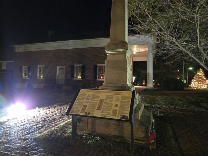
On David Bruce Avenue (Virginia Route 40) east of Legrande Avenue ( Route 47), on the right when traveling east.
(Preface) From 1861 To 1865, Our country was torn apart by a Civil War that pitted North against South, brother against brother, father against son, neighbor against neighbor. The impact of the war and its aftermath are still felt today as . . . — — Map (db m262872) HM
On Legrande Avenue (Virginia Route 47) at David Bruce Avenue ( Route 40) on Legrande Avenue. Reported permanently removed.
Beginning in 1937, Ambassador and Mrs. David K. E. Bruce anonymously gave money to 11 sites in Southside Virginia to build libraries. The Bruce libraries, as they were called, became the first public libraries to allow access to African . . . — — Map (db m31019) HM
On Jeb Stuart Highway (Virginia Route 92) at Godseys Lane, on the right when traveling west on Jeb Stuart Highway.
Charlotte County. Area 496 square miles. Formed in 1764 from Lunenburg, and named for Queen Charlotte, wife of King George III. Patrick Henry and John Randolph of Roanoke lived in this county, and Henry is buried here. . . . — — Map (db m31001) HM
On Cargills Creek Road (County Route 632) at Salem School Road (County Route 608), on the right when traveling west on Cargills Creek Road. Reported permanently removed.
After the Civil War, in the Red Oak area of Charlotte County, many freed slaves were welcomed to worship at Antioch Baptist Church, a traditionally white church. The Antioch congregation helped raise money to build Salem Baptist Church in . . . — — Map (db m30999) HM
On Battle Park Drive 0.6 miles west of Saratoga Drive, on the left when traveling north.
On May 2, 1861, after hearing that their home state of Virginia had seceded from the Union, John Hudson Pettus, his younger cousin John Overton Pettus, and four other cousins from the Eubank family enlisted in the Keysville Guards as privates for . . . — — Map (db m254320) HM
On Studley Road (Virginia Route 606) at Williamsville Road ( Route 615), on the right when traveling west on Studley Road.
Patrick Henry was born at Studley, just southeast of here, on 29 May 1736. The two-story brick manor house burned in 1807. Henry gained fame as a lawyer in the Parson's Cause case of 1763 by challenging British authority to interfere with laws . . . — — Map (db m170043) HM
On Highway Fifty Eight (U.S. 58) 0.1 miles east of Jefferson Street, on the right when traveling east.
This is the original campus of Randolph-Macon College, the oldest Methodist-affiliated college still operating in the United States. Chartered by the Virginia General Assembly in 1830 and named for Congressmen John Randolph of Roanoke, Charlotte . . . — — Map (db m30910) HM
On Otterburn Road (Virginia Route 614) 0.1 miles south of Leidig Street ( Route 634), on the left when traveling south. Reported permanently removed.
Russell Grove Presbyterian Church and the Russell Grove School were established as a result of the efforts of Mrs. Samantha Jane Neil, a Presbyterian missionary and teacher of African-American children after the Civil War. At first the school . . . — — Map (db m28927) HM
Near Campus Drive (County Route 378) near Chritanna Highway ( Route 46). Reported permanently removed.
Southside Virginia Community College has two campuses: the Christanna Campus in Alberta, which opened in 1970, and the John H. Daniel campus in Keysville, which opened in 1971. The college is part of the statewide system of community colleges . . . — — Map (db m30868) HM
On Fort Hill Road 1.1 miles west of Christanna Highway ( Route 46), on the right when traveling west. Reported permanently removed.
In 1714, at Governor Alexander Spotswood’s urging, the Virginia General Assembly funded the Virginia Indian Company, charged with building a fort on the banks of the Meherrin River in what would become Brunswick County. The fort would provide . . . — — Map (db m20197) HM
On College Drive 0.1 miles north of Windsor Avenue ( Route 46), on the right when traveling north. Reported permanently removed.
Saint Paul’s College began as a small parochial school founded by a newly ordained Episcopal deacon, the Rev. James Solomon Russell. Born into slavery, Russell attended seminary school in Petersburg. Within a year of graduation he had managed . . . — — Map (db m30870) HM
Near Lee Wayside Road near Anderson Highway (U.S. 60). Reported permanently removed.
Union Grove School is representative of the many one-room schools for African-American students in Buckingham County and throughout the area. The African-American members of the community built Union Grove around 1925, and like most schools, . . . — — Map (db m21148) HM
On C G Woodson Road (Virginia Route 670) 0.2 miles north of Liberty Road ( Route 759), on the right when traveling north. Reported permanently removed.
North of this sign is the birthplace of Dr. Carter G. Woodson. Dr. Woodson was born December 19, 1875, to former slaves, James Henry and Eliza Ann Riddle Woodson. Young carter left Buckingham to work in West Virginia when he was 17 years old. . . . — — Map (db m31608) HM
On Tech Lane at Lunenburg Highway ( Route 40) on Tech Lane. Reported permanently removed.
Southside Virginia Community College has two campuses: the Christanna Campus in Alberta, which opened in 1970, and the John H. Daniel campus in Keysville, which opened in 1971. The college is part of the statewide system of community colleges . . . — — Map (db m31025) HM
On Matthews Jefferson Drive at East River Road, on the right when traveling south on Matthews Jefferson Drive. Reported permanently removed.
Virginia State University was chartered by the Virginia legislature in 1882 as the Virginia Normal and Collegiate Institute. Delegate Alfred W. Harris, an African-American attorney in Petersburg, championed the charter and supported it . . . — — Map (db m26005) HM
Near Cartersville Road (Virginia Route 45) at Columbia Road ( Route 690), on the right when traveling south.
Parents in the Cartersville area of Cumberland County met in 1909 to discuss the need for a centralized high school to replace the one-room schools serving white children in the area at that time. The county Superintendent of Schools led the . . . — — Map (db m31609) HM
Near Cartersville Road (Virginia Route 45) 0.1 miles north of Ampthill Road, on the right when traveling north.
Julius Rosenwald, a former president of Sears, Roebuck & Co., continued the efforts made by numerous philanthropists to bring education to African Americans in the South. During the early 1900s, funding for schools was scarce; the South had half . . . — — Map (db m21159) HM
On Foster Road at Anderson Highway (U.S. 60), on the left when traveling north on Foster Road. Reported permanently removed.
Jackson Davis, an educational reformer and amateur photographer, was born in Cumberland County, VA, to William Anderson and Sally Wyatt (Guy) Davis on September 25, 1882. He attended the public schools of Richmond, VA, and received his B.A. . . . — — Map (db m21150) HM
Near Sycamore Drive at Boydton Plank Road (U.S. 1). Reported permanently removed.
Prior to the Civil War, Dinwiddie County was home to several private academies for those who could afford to pay for their education. While it was mostly affluent males who were educated, Pegram’s Academy, Female Academy, Girard Heartwell . . . — — Map (db m26834) HM
Near 7th Avenue 0.5 miles north of Albermarle Street. Reported permanently removed.
In 1938 the Virginia Assembly chartered a residential care facility for mentally retarded African-American males between 8 and 21 years of age. The Petersburg State Colony for the Negro Insane, as it was named, was located on the present site . . . — — Map (db m23455) HM
On Rocky Branch Road (Virginia Route 636) 0.3 miles south of New Cox Road (U.S. 460), on the left when traveling south. Reported permanently removed.
In 1911 a group of Dinwiddie County’s African-American residents established the Rocky Branch School in Sutherland. The school was a typical two-room schoolhouse. It had been moved from original location across from Ocran Methodist Church on . . . — — Map (db m26833) HM
Near Cowford Road (Virginia Route 651) near Mary Bethune Street. Reported permanently removed.
In 1872 the Banister Baptist Association built a private African-American training school in Halifax County. Originally the campus consisted of four wooden buildings and a dormitory. The school year was six months, and the grades went only as . . . — — Map (db m30988) HM
On Ragland Street at Watkins Avenue, on the left when traveling east on Ragland Street. Reported permanently removed.
Many churches in the second half of the 19th century and early part of the 20th century helped fill African Americans’ need for schooling. Frequently the church would raise funds to build the school, with county governments occasionally . . . — — Map (db m30961) HM
On Jeffress Boulevard 0.1 miles east of Penick Avenue, on the right when traveling north. Reported permanently removed.
Determined to provide elementary education for young African Americans, the Rev. Parham B. Ragland started a school in his backyard some time around 1875. Though the "Backyard School" was private, Rev. Ragland was able to garner financial . . . — — Map (db m30970) HM
On Free State Road (County Route 630) 0.4 miles east of Payne Lane, on the right when traveling east. Reported permanently removed.
In 1880 a German Lutheran minister, the Rev. W. R. Buehler, a well-educated man who had worked for five years as a missionary in Africa, moved with his family to Green Bay, Virginia. He had not been in Green Bay long when the black community, . . . — — Map (db m31035) HM
On Tidewater Avenue at West 7th Street, on the right when traveling east on Tidewater Avenue. Reported permanently removed.
On May 13, 1947, several African-American leaders in Lunenburg County met at First Baptist Church in Victoria to discuss the need for a centrally located building large enough to accommodate countywide gatherings and educational activities . . . — — Map (db m31856) HM
On Highway Fifty Eight (U.S. 58) 0.1 miles east of Jefferson Street, on the right when traveling east. Reported permanently removed.
Boydton Academic and Bible Institute was opened in 1879 in building that had been abandoned by Randolph-Macon College when it moved to Ashland in 1868. Dr. Charles Cullis, a humanitarian from Boston, purchased the property in 1878 and opened . . . — — Map (db m30917) HM
On Highway Forty Seven (Virginia Route 47) at Village Road ( Route 874), on the left when traveling west on Highway Forty Seven. Reported permanently removed.
Thyne Institute was established by Rev. J.Y. Ashenhurst, United Presbyterian Church, and a group of local citizens to provide an opportunity for African Americans (known as “freedmen” in the late 1800s) to obtain an education. In 1876 73 . . . — — Map (db m31003) HM
On 4th Street at South Amelia Avenue, on the left when traveling west on 4th Street. Reported permanently removed.
The Blackstone Female Institute was conceived in 1891 by George Pierce Adams, a Blackstone merchant, and Joshua Soule Hunter, a Methodist minister. Originally designed as a school to prepare young female students to enter Randolph-Macon . . . — — Map (db m31045) HM
On Mt. Nebo Road 0.4 miles Walnut Hill Road, on the left when traveling north. Reported permanently removed.
Mt. Nebo Church was founded shortly after the Civil War in 1867. A northerner named Mr. Rickets bought the place called Oak Hill and began preaching to a group of African Americans at this place in the woods. The audience increased as people . . . — — Map (db m20242) HM
On Miller Street at 5th Street SE ( Route 9694), on the right when traveling south on Miller Street. Reported permanently removed.
When the Russell Grove School in Amelia County grew too big for its building, land was found in Nottoway County near Burkeville for a new school. Built in 1892 to educate African-American girls, the new school was named Ingleside Seminary. It . . . — — Map (db m31042) HM
On Harrison Street at Maple Lane, on the left when traveling south on Harrison Street. Reported permanently removed.
Petersburg established a public school system in 1868, two years before the state’s mandate. Colored Elementary School #1 was conducted in the old church building of the African Baptist Church, which stood to your left. The building had been . . . — — Map (db m26011) HM
On South Jones Street 0.1 miles south of Lee Avenue, on the left when traveling south. Reported permanently removed.
Disrupted by the convulsions of the First World War, efforts to replace the increasingly inadequate Peabody School on Fillmore Street stretched out from 1913 until 1920, when the new Peabody-Williams School opened on Jones Street. Charles . . . — — Map (db m26012) HM
On South Main Street (U.S. 15) at 4th Street, on the right when traveling south on South Main Street. Reported permanently removed.
Beulah African Methodist Episcopal (AME) Church was founded in 1868. Originally, it was known as The Colored Methodist Church of Farmville. The original wooden-framed building was destroyed, by fire in 1898. The cornerstone on the present . . . — — Map (db m31318) HM
Near High Street (County Route 643) south of St George Street. Reported permanently removed.
Founded on March 5, 1839 as the Farmville Female Seminary Association, Longwood is one of the oldest colleges originally for women in the country. In 1842 the cornerstone was laid for the first true college building, which is today known as . . . — — Map (db m31316) HM
On South Main Street (U.S. 15) at 4th Street, on the right when traveling north on South Main Street. Reported permanently removed.
The First Baptist Church was organized in 1866 as an outgrowth of the predominantly white Farmville Baptist Church. In 1949, following the death of the Rev. C. H. Griffin, the Church voted unanimously to call his son, L. Francis Griffin, as . . . — — Map (db m31310) HM
On College Road (County Route 692) 0.3 miles south of Five Forks Road (County Route 658), on the right when traveling south. Reported permanently removed.
Hampden-Sydney College, in continuous operation since November 10, 1775, was established “to form good men and good citizens.” One of the few remaining all-male colleges, it was named for John Hampden (1594-1643) and Algernon Sydney . . . — — Map (db m31324) HM
Near Zion Hill Road (County Route 628) 0.1 miles east of McClendon Drive. Reported permanently removed.
In 1954, after the Supreme Court ruled in Brown vs. the Board of Education of Topeka, that United States schools must integrate, Senator Harry S. Byrd and several Virginia governors followed the policy of “massive resistance.” Integration was . . . — — Map (db m31321) HM
Near Griffin Boulevard at Barrow Street. Reported permanently removed.
On this site of the former R.R. Moton High School, the actions of some brave African-American students to achieve equal educational opportunities for blacks eventually led to the end of legal segregation in American public schools.
Moton . . . — — Map (db m31319) HM
Near Red Hill Road (County Route 677) 1 mile Staunton Hill Road (County Route 619).
After three decades of public service, Patrick Henry retired in 1794 to Red Hill plantation in Charlotte County, which he regarded as "one of the garden spots of the world." He purchased the 700-acre estate and simple story-and-half house in 1794 . . . — — Map (db m128698) HM
Near Chiswell Lane (Virginia Route 740) 0.1 miles north of Scotchtown Road ( Route 685). Reported permanently removed.
Scotchtown is best known as the site from which Patrick Henry rode to Richmond in March of 1775 to deliver his infamous “Liberty or Death” speech. . Some have even suggested that the house, where he had been forced to confine his wife Sarah due to . . . — — Map (db m281425) HM
Near Hanover Courthouse Road (U.S. 301) at County Complex Road.
Hanover County was organized in 1720 and named for George I, King of England and former elector of Hanover in Germany. Seventeen years later (between 1737 and 1738), construction of the courthouse structure began and was completed in 1743. The . . . — — Map (db m32691) HM
Near Hanover Courthouse Road (U.S. 301) at County Complex Road.
In December 1763, the Historic Hanover Courthouse was the site of the famous Parsons’ Cause, an opening salvo of the American Revolution. During the Parsons’ Cause trial, Patrick Henry voiced one of the first American objections to denial of the . . . — — Map (db m32692) HM
Near Hanover Courthouse Road (U.S. 301) at Library Drive.
Hanover Tavern was an essential part of the county courthouse complex during the 18th and 19th centuries, serving as the center of social life. For people living on large farms and plantations, whose closest neighbors could live miles away, taverns . . . — — Map (db m32693) HM
On Rural Point Road (Virginia Route 643) at Pine Slash Road, on the right when traveling north on Rural Point Road.
Upon Patrick Henry’s marriage to Sarah Shelton in 1754, he received for her dowry a 300-acre tract of land and six slaves. Like many Virginians with small farms, Henry labored in the fields with his slaves. Much of the soil at Pine Slash had been . . . — — Map (db m46754) HM
Near Rural Point Road (County Route 643) at Heatherwood Drive ( Route 1750).
For more than a century the Polegreen Church stood as a monument to the Hanover Dissenters and Samuel Davies in the struggle for religious liberty. Though Davies died fifteen years before the American Revolution, his influence and revolutionary . . . — — Map (db m32674) HM
Near Rural Point Road (County Route 643) at Heatherwood Drive ( Route 1750).
From Virginia’s founding until the American Revolution 170 years later, the Anglican Church was the only state recognized religion. The government built the churches and the parsonages and paid the clergy with tax money. All other religious groups . . . — — Map (db m32679) HM
Near Studley Road (Virginia Route 606) 0.1 miles west of Shelton Pointe Drive, on the left when traveling west.
Rural Plains, home of the Shelton family for nearly three centuries, stands on the northern bank of Totopotomoy Creek. Eighteen-year-old Patrick Henry married Sarah Shelton in 1754. Family tradition places the wedding ceremony in the first floor . . . — — Map (db m35014) HM
On Studley Farms Drive (Virginia Route 700) 0.4 miles south of Studley Road ( Route 606), on the left when traveling south.
Only archaeological remnants of Studley survive today, but in the 18th century this was the site of an impressive two-story brick house. Studley was built by John Syme in the 1720s for his wife Sarah Winston. After his death, she married John Henry. . . . — — Map (db m46775) HM
On College Road (County Route 692) 0.3 miles south of Five Forks Road (County Route 658), on the right when traveling south.
When Samuel Stanhope Smith, our first president, named the College after English anti-Royalists, he clearly agreed with Patrick Henry’s revolutionary vision. Thus it was logical that Henry should be elected a Founding Trustee in November 1775, . . . — — Map (db m54480) HM
St. John’s Church symbolizes the foundations of our republic and the founding ideal of liberty. Here, Patrick Henry’s masterful argument summoned Americans toward independence with the immortal words, “Give me liberty or give me death” . . . — — Map (db m32695) HM
On Bedford Lane east of Kenney Drive, on the left when traveling north.
The land that is now Bedford Plantation subdivision was once part of 640 acres owned by Julian Bedford (1825-1879), and Virginia R. Kenney
Bedford (1830-1916), who settled in 1851 at what was
to be known as the Bailey Station community.
They . . . — — Map (db m149053) HM
On David Bruce Avenue (Virginia Route 40) east of Legrande Avenue ( Route 47), on the right when traveling east.
Joseph R. Holmes, formerly enslaved in Charlotte County, campaigned for civil rights and education after emancipation. He served as a delegate to the Virginia Republican Party conventions in 1867 and 1869 and was elected to represent Charlotte and . . . — — Map (db m262856) HM
On East Broad Street at North 24th Street, on the right when traveling west on East Broad Street.
Patrick Henry Memorial Park
Made possible by the generosity of
Dr. J. Fulmer Bright
Brigadier General, National Guard
Mayor of the City of Richmond, 1924 to 1940
and by
The City of Richmond
in . . . — — Map (db m235977) HM
On Patrick Henry Highway (Virginia Route 40) 0.3 miles east of Owl Road, on the left when traveling west.
Campbell County
Campbell County was created from Bedford County by the Virginia General Assembly in 1781 and named for Gen. William Campbell, one of the heroes of the Battle of King's Mountain in 1780. The county seat is Rustburg. British Lt. . . . — — Map (db m306964) HM
On Cole Ferry Road (Virginia Route 624) at Morton's Ferry Road ( Route 623), on the right when traveling north on Cole Ferry Road.
Halifax Church is the oldest Presbyterian church in Halifax County. The Congregation was formed in June, 1830, from Cub Creek Church in Charlotte County. The organizational group included the Reverend Clement Read of Cub Creek and twenty-six local . . . — — Map (db m66027) HM
On Red Hill Road at Staunton Hill Road (County Route 619) on Red Hill Road.
One mile to the south is Red Hill, Patrick Henry’s last home and burial place. The marble stone covering his grave carries the simple inscription, “His fame his best epitaph.”
Henry came here in 1794 and died at his beloved Red Hill . . . — — Map (db m65398) HM
On State Highway 72 at Mt. Carmel Road (State Highway 823), on the left when traveling south on State Highway 72.
5.5 miles southeast is the burial ground of Patrick and Martha Caldwell Calhoun, Parents of John C. Calhoun; Deputy Surveyor 1756; First Representative from Up Country to Commons House of Assembly, 1769-1772; Member of First Provincial Congress, . . . — — Map (db m10627) HM
Near West James Anderson Highway (U.S. 60) at Courthouse Road, on the right when traveling west.
“When buildings are of durable materials, every new edifice is an actual and permanent acquisition to the state, adding to its value as well as to its ornament…” Source: Thomas Jefferson, Notes on Virginia
8
The . . . — — Map (db m67322) HM
On David Bruce Avenue (Virginia Route 40) at Legrande Avenue ( Route 47), on the right when traveling east on David Bruce Avenue. Reported permanently removed.
In June 1864, to deny Gen. Robert E. Lee the use of the South Side R.R. and the Richmond and Danville R.R., Gen. Ulysses S. Grant sent Gen. James H. Wilson and Gen. August V. Kautz south of Petersburg on a cavalry raid to destroy track and . . . — — Map (db m262877) HM
On Virginia Route 40/47 at Legrande Avenue ( Route 47), on the right when traveling east on Virginia Route 40/47.
Early in 1799, at the urging of George Washington, Patrick Henry emerged from retirement to run for Charlotte County's seat in the Virginia House of Delegates. He gave a speech here in March in front of a large crowd. Although Henry had opposed the . . . — — Map (db m182497) HM
On Cargills Creek Road (County Road 632) just west of Tobacco Hill Road (County Road 608), on the right when traveling west.
After the Civil War, in the Red Oak area of Charlotte County, many freed slaves were welcomed to worship at Antioch Baptist Church, a traditionally white church. The Antioch congregation helped raise money to build Salem Baptist Church in . . . — — Map (db m182464) HM
Near Courtland Farm Road (Virginia Route 820) 0.2 miles east of Hanover Courthouse Road (U.S. 301), on the right when traveling east.
(side 1)
The Colonial River Road
After centuries of use by native people and the colonists of New Kent County, the road along the Pamunkey River was extended past the tobacco ports of Newcastle and Page’s Warehouse (later . . . — — Map (db m53801) HM
On Indian Springs Cemetery Road at Ferncroft Avenue, on the left when traveling south on Indian Springs Cemetery Road.
Indian Spring Cemetery, also called Indian Springs, was created in 1886 on land donated by James L. Sandlin (1858-1903), who settled on Alligator Creek in 1884. Additions were recorded in 1891, 1931, 1974 and 1975. The name "Indian Spring" came from . . . — — Map (db m189588) HM
On Legrande Avenue (Virginia Route 47) just south of David Bruce Avenue ( Route 40), on the right when traveling south.
Beginning in 1937, Ambassador and Mrs. David K.E. Bruce anonymously gave money to 11 sites in Southside Virginia to build libraries. The Bruce libraries, as they were called, became the first public libraries to allow access to African . . . — — Map (db m182496) HM
On Thomas Jefferson Highway (Route 47) north of Union Cemetery Road ( Route 709), on the left when traveling north.
Central High School opened in 1939 as Charlotte County's first African American high school. Before its construction, African American students attended the Charlotte Training School, which had been built between 1928 and 1929 with . . . — — Map (db m182502) HM
On Lemon Bay Road just east of Riverside Drive, on the left when traveling west.
1891: Colonel James M. Lewis built a hunting lodge near here on Deer Creek and named it "New Point Comfort" after his boyhood home, Old Point Comfort. in Virginia.
1893: The Gottfried family from Milwaukee settled on Deer Creek, now named . . . — — Map (db m255693) HM
On Laurens Street SW near The Alley, on the right when traveling north.
Aiken, chartered in 1835 and the county seat of Aiken County since its creation in 1871, was an early stop on the railroad line from Charleston to Hamburg. It was named for William Aiken (1779–1831), the first president of the S.C. Canal and . . . — — Map (db m9640) HM
Near Red Hill Road (County Route 677) 1.2 miles south of Patrick Henry Road, on the right when traveling south.
Long Island Plantation
A 600-acre island and 1,906-acre adjoining estate on the Staunton River. Purchased by Patrick Henry from Richard Henry Lee in 1792 and worked by 31 enslaved persons.
Green Hill Ferry
Samuel Pannell, a neighbor . . . — — Map (db m306913) HM
Near Dr Martin Luther King Jr Boulevard at East Virginia Avenue, on the left when traveling north.
The Bailey Brothers served the United States of America honorably World War II, the Korean War and the Vietnam War
Archie and Josephine Bailey were married in 1905 and made Punta Gorda their home. They raised their large family in their . . . — — Map (db m249137) HM
Thin black lines indicate changes in relevance. Between each pair of lines entries are ordered geographically but all have the same relevance.
* Inflectional forms of words are their plurals, singulars, and possessives as well as gramatical tenses and similar variations.