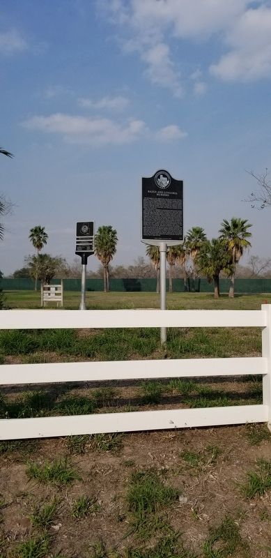
On State Highway 186 at U.S. 281, on the left when traveling east on State Highway 186.
On September 27, 1915, Jesus Bazán and his son-in-law, Antonio Longoria – both recognized Tejano community leaders and the latter a Hidalgo County Commissioner – traveled to a local Texas Ranger camp on the Sam Lane ranch to report a . . . — — Map (db m166335) HM
Officer who rose from Ranger to Adjutant General. Ranching, law enforcement were his life's work. Six feet four inches tall, he was expert shot and horseman.
Scout for U.S. Army in 1914-1917 border troubles; served in two world wars, a colonel . . . — — Map (db m182916) HM
Near Interstate 20 at milepost 538, on the right when traveling west.
Pioneer nickname appropriate to this area’s many freedoms–particularly from want and fear. (Food was obtained with little effort; and although the Indians fought white men here as late as 1842, the settlers by 1847 slept in the open with no . . . — — Map (db m84510) HM
On South Cage Boulevard 0.2 miles south of Military Highway (U.S. 281), on the right when traveling south.
Wisconsin native John Closner established the first steampowered irrigation system in the Lower Rio Grande Valley in 1895. Closner successfully grew sugar cane and entered a sample for judging at the St. Louis World's Fair of 1904. The award-winning . . . — — Map (db m223731) HM
On North Sugar Road, on the right when traveling north.
Hidalgo County native Emilia Schunior (1902-1960) graduated from Edinburg High in 1919 and married Rafael Ramirez in 1921; the couple had four children. Emilia attended college and earned a B.A. in 1940, becoming a teacher and principal at several . . . — — Map (db m269538) HM
On North 3rd Street at East Brazil Avenue, on the right when traveling south on North 3rd Street.
Born in New York City in 1806, Elder Barton was a formative figure in Hidalgo County history. Barton joined the Republic of Texas Army on March 13, 1836, and fought at the Battle of San Jacinto under Capt. Robert J. Calder. He married Santitos Balli . . . — — Map (db m223837) HM
On U.S. 83 at Stadium Street, on the right when traveling west on U.S. 83.
This school's roots lie in the former town of Havana (2 Mi.S), where between 1890 and 1944 area children, most of whom lived on, nearby ranches, attended classes in a one-room schoolhouse. Nellie Leo Schunior (1878- 1920), who later became the first . . . — — Map (db m224227) HM
On South Cage Boulevard 0.1 miles south of Business U.S. 83, on the right when traveling south.
Located on lands originally known in the 1600's as the Seno Mejicana, the City of Pharr was founded 1909, during a period of great social and economic transition in the Rio Grande Valley.
Amidst the explosive growth caused by the . . . — — Map (db m166044) HM
On Colorado Avenue (County Highway 106) at North Arroyo Boulevard, on the right when traveling west on Colorado Avenue.
The Arroyo Colorado is the Lower Rio Grande Valley’s only natural waterway besides the Rio Grande. The 89-mile stream extends from mission in Hidalgo County to the lower Laguna Madre in Cameron County. From early colonization in the late 1700s, the . . . — — Map (db m195622) HM
On East Saint Peters Avenue at S Mier Street, on the left when traveling west on East Saint Peters Avenue.
On January 6, 1915, nine men of Mexican descent met in San Diego, seat of Duval County, and signed El Plan de San Diego, a manifesto calling for political insurrection in response to contemporary social and political events. The proposed . . . — — Map (db m288996) HM
On Military Highway 0.1 miles west of International Blvd (Farm to Market Road 498), on the right when traveling west.
The present school system for the town of Donna can be traced to a 1904 school in the Run community (6 Mi.S). Classes were first held in the home of A.F. Hester, a founder of Donna. The earliest school for the new town opened in 1908. Teachers held . . . — — Map (db m223668) HM
On North Jasman Road at U.S. 281 Bypass Service Rd, on the right when traveling north on North Jasman Road.
This property is believed to be the only graveyard in Hidalgo County dedicated for African American burials. Prior to its founding in 1928, blacks were allowed burial space only in private ranch cemeteries. In the 1920s, Edinburg had a growing . . . — — Map (db m292474) HM
On East Flora Avenue west of South 1st Street, on the right when traveling west.
This building served as the Hidalgo County Courthouse from its construction in 1886 until the County Seat was moved to Chapin (later name Edinburg) in 1908. Made of brick from nearby Reynosa, Mexico, it originally was a two-story structure. Its . . . — — Map (db m195639) HM
On East Esperanza Avenue at South 1st Street, on the right when traveling east on East Esperanza Avenue.
Built in 1886 by S. W. Brooks, who also constructed the nearby courthouse, this jail served Hidalgo County during a turbulent period in its history, when outlaw raids were still occurring. The city's first newspaper, "The Hidalgo Advance," was . . . — — Map (db m195647) HM
On South 15th Street at Chicago Avenue, on the right when traveling south on South 15th Street.
Priests from La Lomita Chapel in nearby Mission ministered to Catholics at McAllen from 1908 until 1911, when a mission was begun here and a wood frame chapel was built. The congregation remained under the guidance of the Rev. J.M.F. Guenneugues, . . . — — Map (db m166222) HM
On Military Highway (U.S. 281), on the right when traveling east.
Originally part of a Spanish land grant, Relampago (lightning) Ranch community lay along the stage and military route from Rio Grande City to Brownsville. In 1852 Thaddeus Rhodes (1828-1904) acquired acreage here when he came as Hidalgo County . . . — — Map (db m164461) HM
On West 5th Street (Business U.S. 83) at Lincoln Street, on the left when traveling west on West 5th Street.
Tom Mayfield left the Gonzales County farm of his parents, John and Maggie Mayfield, in 1898 to help buy horses for Teddy Roosevelt's Rough Riders. Between 1910-1921 Tom served as Pharr City Marshal, Texas Ranger, and Hidalgo County Deputy Sheriff. . . . — — Map (db m224536) HM
On South Tarnava Street at Railroad Street, on the left when traveling north on South Tarnava Street.
The son of Joseph Champion, an Italian immigrant who settled in Texas in 1855, Charles Champion was born on February 2, 1870, in Old Point Isabel. He served as district clerk in Hidalgo County before purchasing the Hess General Store in Old Point . . . — — Map (db m165642) HM
On Sunshine Strip (Business U.S. 77) at North Sam Houston Boulevard (State Highway 345), on the right when traveling west on Sunshine Strip.
Col. Sam A. Robertson, who founded the town of San Benito in 1907, promoted and built the San Benito & Rio Grande Valley Railway. It was designed to provide a more accessible and efficient transportation system for the shipping of area farm . . . — — Map (db m221101) HM
On Military Highway (U.S. 281) 0.5 miles west of International Blvd (Farm to Market Road 493), on the left when traveling west.
Thomas J. Handy (1843-1927) first came to the Rio Grande Valley from Wisconsin as a Union solider during the Civil War. While stationed with Co. F, 4th Wisconsin Cavalry, Handy met Angelita Cavazos (ca. 1844-1925). The two were married on April 25, . . . — — Map (db m223673) HM
On South Ohio Street at West 4th Street, on the right when traveling south on South Ohio Street.
Constructed in 1928 to house the town's municipal offices and fire station, this building was designed by architect R. Newell Waters of Weslaco. The two story Gothic style building, constructed of red brick, features a copper cupola designed to . . . — — Map (db m165814) HM
On West Hidalgo Avenue (State Highway 186) at North 4th Street, on the right when traveling west on West Hidalgo Avenue.
Formed from Cameron and Hidalgo counties
Created March 11, 1911
Organized August 12, 1911
Recreated April 20, 1921
Reorganized August 3, 1921
Named in honor of
John G. Willacy
November 10, 1859 • September 19, 1913
Member of the . . . — — Map (db m118039) HM
On Military Highway 0.5 miles west of International Blvd (Farm to Market Road 493), on the left when traveling west.
This area in the mid-1800's was part of the Asadores Ranch owned by Salvador and San Juana Cavazos. In 1898, east Texas rice farmers A.F. Hester, Sr. and T.J. Hooks bought land in the vicinity. They and others began La Blanca Agricultural Company . . . — — Map (db m223671) HM
The Capilla de la Lomita was built on the ranch of Mr. Rene Guyard in 1865 by the Oblate fathers. In addition to being a place of worship, it acted as a way station for Oblates traveling on horseback between Brownsville and Roma. It was rebuilt in . . . — — Map (db m239812) HM
Site of the guest house at La Lomita. Built of adobe at the same time as the Cook House, it housed transient visitors to the Mission and Oblates in route to other destinations in the valley. Like the other outbuildings of the chapel, it was torn . . . — — Map (db m239811) HM
The original chapel at Rancho La Lomita in 1865 was built of adobe by the fathers and ranch workers. Upon the death of Mr. Guyard in 1871, the ranch was willed to the Oblates. This first chapel was torn down in 1885, and it was not until four years . . . — — Map (db m239813) HM
Site of the fathers' residence and, after 1871, also the La Lomita Ranch Headquarters. The first building which stood here was constructed of adobe shortly after the original chapel in 1865. A newer five room residence replaced it in 1899. This . . . — — Map (db m239807) HM
The small shrine to the Virgin Mary is not an original part of the Capilla de la Lomita grounds. It was erected in 1956 during the "World year in honor of Mary Immaculate" by the Oblates, whose patroness she is. The statue honored the fathers who . . . — — Map (db m239810) HM
On South Cage Boulevard at Business U.S. 83, on the right when traveling south on South Cage Boulevard.
For many centuries, nomadic Coahuiltecans lived in the Lower Rio Grande area. In the 1500s, Spanish explorers came through the region, and the Spanish government began to colonize both sides of the river by the late 1700s. At the close of the . . . — — Map (db m165872) HM
On Business Farm to Market Road 1015 0.1 miles north of Johnny Vela Street, on the left when traveling south.
The agricultural boom that marked the early development of this area was due in large part to the San Benito & Rio Grande Valley Railroad. Begun in 1912 by Missouri native Sam A. Robertson (1867-1938), it was called the Spiderweb Railroad because . . . — — Map (db m165727) HM
On East 5th Street at South Kansas Avenue, on the right when traveling east on East 5th Street.
Located on part of a Spanish land grant known as Llano Grande, Weslaco was founded in 1919 by a partnership composed of R.C., Dan, and Ed Couch and Robert L. Reeves. The city's name is take from the initials of the W.E. Stewart Land Co., which . . . — — Map (db m165748) HM
On East 5th Street at South Kansas Avenue, on the right when traveling east on East 5th Street.
Erected in 1928, this structure replaced a frame community building at this site. City founder Ed Couch (1879-1944) and Mayor David E. Kirgan (1877-1936) led ceremonies marking the building's completion. Prominent Weslaco architect R. Newell . . . — — Map (db m165747) HM
On East Chimney Road at Mayberry Road, on the right when traveling south on East Chimney Road.
Lands for La Lomita ("The Little Hill") Mission came from the 1767 Spanish grant of Joseph A. Cantu, and were donated in 1861. Used as farms and ranches, the lands supported the priests and their charities. The original chapel, built in 1865 at a . . . — — Map (db m224224) HM
Thin black lines indicate changes in relevance. Between each pair of lines entries are ordered geographically but all have the same relevance.
* Inflectional forms of words are their plurals, singulars, and possessives as well as gramatical tenses and similar variations.