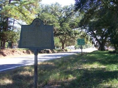
On Effingham Hwy (State Highway 17) at Oliver Highway (State Highway 24), on the right when traveling south on Effingham Hwy.
On Nov. 28, 1864, Maj. Gen. H.C. Wayne, Adj. Gen. of Georgia, with a small force (CS) composed of the Corps of Cadets, Georgia Military Institute, Warthen`s Washington County militia company and Pruden`s battery, fell back from Millen and entrenched . . . — — Map (db m13093) HM
Near South Railroad Avenue (U.S. 221) just south of Broad Street, on the left when traveling south.
Montgomery County was cut from Washington County in 1793 First Court held in William Neal’s House 1794 (now in Emanuel Co.)Later sites • Arthur Lott’s Plantation on Ohoopee 1797-1801; • Near Ebenezer Church (now Emanuel Co.) 1802-1812; • . . . — — Map (db m185264) HM
On Bartow Road (Georgia Route 242) 0 miles west of Riddleville-Davisboro Road ( Route 231), on the right when traveling east.
In this locality was one of the four academies of Washington County authorized by the State of Georgia and known as the Riddleville Academy. Mr. Anderson Riddle, a prominent citizen of the community and an ardent advocate of education, learning of . . . — — Map (db m21256) HM
On Georgia Route 15 S at Montgomery Road, on the right when traveling south on Georgia Route 15 S.
Colby Smith, a Revolutionary War soldier who was prominent in America’s War of Independence settled in the 89th District in 1798 and was granted property by the Governor of Georgia in Honor of his service to America. He, his children, and his . . . — — Map (db m21300) HM
On North Main Street (Florida Route 77) just north of Old Bonifay Road, on the right when traveling north.
This house was built in 1906 by Edward Jacob and Georgia Ophelia Stokes. This one-story frame structure with Queen Anne Cottage architectural elements embodies a residential building style popular in northern Florida between 1880 and 1910. Its . . . — — Map (db m244289) HM
On North Harris Street (Georgia Route 15) at West Haynes Street, on the right when traveling south on North Harris Street.
The present site of the building, which stands on the corner of South Harris Street and West Haynes Street, was the location of Mr. Mark Sander’s store at the crossing of roads. On December 19, 1793, the Legislature of Georgia authorized that a . . . — — Map (db m24756) HM
Near North Harris Street (Georgia Route 15) south of East McCarty Street, on the right when traveling north.
The Brown House was built about 1850 by Nathan Haynes. It was purchased by merchant and planter William Gainer Brown about 1851. During the 1850s portraits of William and Miriah Brown were painted by an itinerant artist for $75 plus room and board. . . . — — Map (db m103238) HM
On Smith Street at West North Central Avenue on Smith Street.
Tennille was founded in 1837 as Franklinville for Sam O. Franklin who gave land for the railroad's right-of-way and the town's creation. Its name was changed in 1842 after a prominent local citizen, Francis Tennille. The following year Tennille also . . . — — Map (db m103239) HM
On Georgia Avenue Northwest (U.S. 29) at Missouri Avenue Northwest, on the right when traveling south on Georgia Avenue Northwest.
The Grand, Neo-classical Revival style building that you see across Georgia Avenue north of Missouri opened in 1925 as the Bank of Brightwood, thanks to efforts of the Brightwood Citizens Association. Designed by Treasury Department architect . . . — — Map (db m72818) HM
On Ebenezer Cemetery Rd (County Road 714) 1 mile south of State Highway 7, on the right when traveling south.
James A. Head was a Texas Ranger, veteran of the War for Independence, and Republic of Texas legislator. Born in Georgia in 1797, he moved to Texas in 1835, enlisting at San Felipe de Austin in Silas Parker's ranging company and securing a land . . . — — Map (db m293422) HM
On West Haynes Street 0 miles east of Jones Street, on the left when traveling east.
Governor Thomas William Hardwick, lawyer and statesman, spent most of his life in this city. Born in Thomasville, Dec. 9, 1872, he graduated from Mercer in 1892 and from Lumpkin Law School, U. of Ga., in ‘93, in which year he was admitted to the . . . — — Map (db m24746) HM
On 124 near County Road 248, on the left when traveling north.
Panola County pioneer Isaac R. Youngblood was born about 1793. Не and his wife, Elizabeth, moved to Texas from Washington County, Georgia, before 1846. In 1847 the county commissioners named him overseer of Grand Bluff Road and part of a . . . — — Map (db m268526) HM
On Mud Road 0.1 miles west of Black Creek Church Road, on the right when traveling west.
(Side 1):
Upper Black Creek met each month on the third Sunday and Saturday before from the time she was organized in 1802 until the Church elected to meet every Sunday in 1957. Conference was every month on those Saturdays, and Upper . . . — — Map (db m38614) HM
On East Washington Street, on the right when traveling east.
The oldest remaining colonial settlement in East Alabama from Florida to the Tennessee line and older than the county of Henry and the state of Alabama. An active trading post was located here in the Alabama Territory on “The Hill” early in 1819. . . . — — Map (db m83757) HM
On Chipola Street (County Route 274) 1.3 miles west of North Main Street (Florida Route 71), on the right when traveling west. Reported missing.
On this site are the remains of early area settlers, the Richards family. As a prominent Virginia Colonial family, George Richards (1727-1818) was with Washington at Braddocks Defeat (1755), and with his sons in the Revolutionary War (1776). The . . . — — Map (db m186749) HM
On New Hope Church Road at Heards Bridge Road on New Hope Church Road.
New Hope is the oldest Methodist Church still in existence in Washington County. Its early written church records are lost, but oral history relates that New Hope's original structure was built in the late 1700s. It was a one-room building with a . . . — — Map (db m103249) HM
On West Haynes Street at Stacer Avenue, on the right when traveling west on West Haynes Street.
On Thursday, November 24, 1864, the 14th and 20th Corps of Union Major General William T. Sherman's army began entering Washington County. By November
26th the 28,000 soldiers of the two corps arrived in Sandersville, marching on separate roads . . . — — Map (db m103235) HM
On East 3rd Court at Park Street, on the right when traveling west on East 3rd Court.
(Front Side): The McKenzie House is a large two-story clapboard frame dwelling built in the Dutch Colonial style typical of the turn of the century houses still standing in Northern Michigan. It was built 1909 by Belle Booth who married R. . . . — — Map (db m8155) HM
On North Harris Street (Georgia Route 15) at Malone Street, on the right when traveling south on North Harris Street.
Washington, Georgia’s ninth county and first in the nation to be named for George Washington, was created in 1784 for granting land to soldiers for Revolutionary War services.
Court House Square, located on the old stage coach road from . . . — — Map (db m24690) HM
On Farm to Market Road 1363 0.1 miles east of Front Street (County Highway 315), on the right when traveling west.
A leader in Texas colonization, Alexander Thomson, Jr., was born in St. Matthew's Parish, South Carolina, the only son of Alexander and Lucy (Fontaine) Thomson. He later lived in Georgia before moving to Tennessee. There, in 1830, he became a . . . — — Map (db m210613) HM
On Farm to Market Road 390 south of Longpoint Road, on the right when traveling west.
As a boy Gideon Lincecum moved with his father to various frontier sites in his native Georgia and in Mississippi. It was during this time that he developed insights about natural habitats and cultivated an understanding of Indian culture which . . . — — Map (db m93501) HM
On County Road 28 2.5 miles east of State Route 95, on the right when traveling east.
Side 1
Reuben Hicklin Hall Log Home
Reuben Hicklin Hall (1812-1890) and Mary Ann Strange (1814-1872) moved to Henry County by ox wagon from Washington County, Georgia, in 1845. They built a log home just south of here with slave . . . — — Map (db m71821) HM
Near Navasota Street near East 7th Street, on the right when traveling north.
A veteran of the War of 1812
Internationally famous botanist
Friend of Darwin
Born in Georgia
Died at Long Point
Washington County, Texas
November 28, 1873 — — Map (db m74930) HM
Near Dwight D. Eisenhower Highway (Interstate 70) south of Baltimore National Pike (U.S. 40), on the right when traveling east.
Maryland's Appalachian Region Offers Visitors Natural Splendor And Outdoor Adventure, Plus Countless Opportunities To Explore The Region's Rich Heritage—all Just A Few Miles Off Interstate 70.
Maryland Byways, like the Historic National . . . — — Map (db m116525) HM
Maryland's Appalachian Region Offers Visitors Natural Splendor And Outdoor Adventure, Plus Countless Opportunities To Explore The Region's Rich Heritage—all Just A Few Miles Off Interstate 70.
Maryland Byways, like the Historic National . . . — — Map (db m196240) HM
On outh Potomac Street (Maryland Route 65), on the right when traveling north.
Immediately after the Civil War, Union casualties in the Frederick-Washington County areas were re-interred at a new National Cemetery at Sharpsburg. Yet no provisions were made to provide decent burial for thousands of hastily-buried . . . — — Map (db m153412) HM
On East Baltimore Street (U.S. Alt 40) at King Street, on the right when traveling west on East Baltimore Street.
The Hagerstown Female seminary, a women’s college founded by the Evangelical Lutheran Church, opened its doors in 1853. Its name was changed in the 1890s to Kee Mar College, and operated at this location until 1911 when the campus was sold to the . . . — — Map (db m129316) HM
On 6th Avenue North, on the left when traveling north.
Ridge and Valley
The Ridge and Valley physiographic province is an area between the Cumberland Plateau on the west and the Mountains on the east. This 9,000 square mile great valley extends diagonally across east Tennessee from Virginia to . . . — — Map (db m206495) HM
On Old Baylor College Road at Waters Lane on Old Baylor College Road.
The Independence Historical Society moved the Coles Cabin and Independence Log House buildings to this site to ensure their preservation.
"Walking through the house, we can visualize Coles (with his spectacles on his forehead) conducting . . . — — Map (db m157275) HM
On Colonial Road SW east of Reedy Creek Road, on the left when traveling east.
To the south at Craig’s (Dunn’s) Meadow, is the
likely site of the Washington County militia’s
muster ground for the Revolutionary War’s Kings
Mountain Campaign. In Sept. 1780, under the com-
mand of Col. William Campbell the militiamen . . . — — Map (db m46264) HM
On Omussee Creek Road 0.5 miles north of Picnic Road, on the right when traveling north.
The original builders of the Omussee Creek mound
had abandoned the site by around 1550, but the
area continued to be occupied by Native American
groups well into the early nineteenth century. As early as
the 1630s, Spanish missionaries from . . . — — Map (db m115037) HM
Near Capitol Avenue Southwest south of M.L.K. Junior Drive Southeast, on the left when traveling north.
Expelled Because of Color” is dedicated to the memory of the 33 Black state legislators who were elected, yet expelled from the Georgia House because of their color in 1868.
The cinder block forms at the base of the sculpture symbolize the . . . — — Map (db m130191) HM
Thin black lines indicate changes in relevance. Between each pair of lines entries are ordered geographically but all have the same relevance.
* Inflectional forms of words are their plurals, singulars, and possessives as well as gramatical tenses and similar variations.