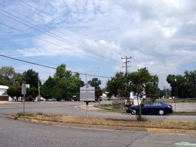
On Warwick Boulevard (U.S. 60) at Franklin Road, on the right when traveling south on Warwick Boulevard. Reported missing.
Camp Alexander was created from a portion of Camp Hill between Warwick and Jefferson Avenues on Aug. 15, 1918. Part of the Hampton Roads Port of Embarkation, it quartered Black stevedore regiments and labor battalions. Named for 2nd Lt. John Hawks . . . — — Map (db m266824) HM
On Warwick Boulevard just south of University Place.
Born as Oak Grove Baptist Church under the pastoral leadership of the Rev. John Corbin in 1882, First Baptist Church Morrison moved to this site in 1933 and for over seven decades served faithful members of this community and offered a sacred place . . . — — Map (db m86238) HM
Near Hiden Boulevard 0.1 miles south of Warwick Boulevard (U.S. 60), in the median. Reported permanently removed.
This historic acreage, formerly an extensive tract of Warwick County timberland known in colonial days as Nutmeg Quarter, was developed by the Hiden family, 1951 - 1957. The name honors Philip Wallace Hiden (1872-1936), successful businessman, civic . . . — — Map (db m266823) HM
On Warwick Boulevard (U.S. 60) at Main Street (Virginia Route 152), on the right when traveling east on Warwick Boulevard.
The nation's first Federal war-housing project, this planned community was sponsored by the U. S. Shipping Board and the Newport News Shipyard on the site of J. Pembroke Jones' Warwick County farm "Hilton". It was opened July 7, 1918, and sold to . . . — — Map (db m33986) HM
On Deer Park Drive just west of Jefferson Avenue (U.S. 17), on the right when traveling west.
This 100-acre tract, then in Warwick County, was acquired in 1930 for the Mariners Museum by Archer Huntington. Encompassing the upper reaches of Lake Maury, it was used as a state game sanctuary for Virginia whitetail deer and other wildlife from . . . — — Map (db m167539) HM
On Monroe Avenue just north of Dillon Circle, on the right when traveling south.
In conjunction with a brick church of the Anglican faith, which stood near this spot in 1660, Glebe lands were set aside for the clergy during their incumbency. The congregation worked the lands, raised cattle and hogs, and stocked the necessary . . . — — Map (db m92327) HM
The earliest prominent settler on Mulberry Island was John Rolfe, who with others owned a 1700-acre plantation there. Rolfe's introduction of a new type of tobacco was the economic salvation of the Jamestown Colony. After the death of his 2nd wife, . . . — — Map (db m92101) HM
On Harrison Road at Taylor Avenue on Harrison Road.
Said to have been called 'Bourbon.' This fine example of medieval-style architecture was built in the early 1700's as a story-and-a-half brick house. In 1893 it was remodeled to a full two stories. With its arched doorway, massive chimneys, and a . . . — — Map (db m92100) HM
On Old Grist Mill Lane at Warwick Blvd (U.S. 60), on the left when traveling west on Old Grist Mill Lane.
Earthworks on the hillside above mark the southernmost of three fortified cross-peninsula defense lines built by Confederate Gen. John B. Magruder in the spring of 1862 and extending three miles from Deep Creek here at Young’s Mill, to the Poquoson . . . — — Map (db m10175) HM
On Old Grist Mill Lane at Warwick Blvd (U.S. 60), on the right when traveling west on Old Grist Mill Lane.
Since early colonial days Deep Creek has had a dam and pond here with a mill, owned by the Matthews, Digges and Young families, grinding corn well into the 20th century. In the Peninsula Campaign, Federal forces of Gen. McClellan encountered strong . . . — — Map (db m10209) HM
On Condon Road at Mulberry Island Road on Condon Road.
The world's first military heliport, Felker Army Airfield was dedicated on 7 December 1954 at ceremonies attended by aviation pioneer Igor Sikorsky and MGs Rush B. Lincoln and Paul F. Yount. The basic plan of the unique circular landing pad for . . . — — Map (db m92102) HM
On Dozier Road 0.5 miles south of Warwick Boulevard (U.S. 60), on the right when traveling south.
Camp Abraham Eustis was established March 1918 as a U.S. Coast Artillery training center and was redesignated Fort Eustis in 1928. During the Depression it was a Civilian Camp. In World War II it served again for Coast Artillery, Anti-Aircraft and . . . — — Map (db m167541) HM
On Dozier Road 0.5 miles south of Warwick Boulevard (U.S. 60), on the left when traveling south.
Born at Petersburg, VA., and a Harvard graduate, he led a light artillery battalion at the capture of Toronto in the War of 1812. He later commanded Fort Monroe, VA. and began there the first army service school. He led army units in the Black Hawk . . . — — Map (db m193630) HM
Off this point in early June 1610 anchored the small ships of the starving colonists who had abandoned Jamestown and started down the river to return to England. It was here they were apprised of the timely arrival of Sir Thomas West, (Lord de la . . . — — Map (db m79394) HM
On Denbigh Boulevard (Virginia Route 173) at Garrow Road, on the left when traveling south on Denbigh Boulevard.
This plantation was homesite of Miles Cary, Sr. who came from England in 1645 at the age of 22. He was killed defending Old Point Comfort against the Dutch June 10, 1667. His grave nearby is said to be the oldest in Newport News. Father of Miles . . . — — Map (db m33993) HM
On Campsite Drive at Jefferson Avenue ( Route 143), on the right when traveling north on Campsite Drive.
U.S. Military Academy graduate, 1830, Virginia-born 'Prince John' Magruder served with distinction in the Mexican War. In 1861 he resigned as Colonel, USA and joined the Confederacy. In the Civil War's first planned battle, his forces were . . . — — Map (db m33996) HM
On Elmhurst Street at Yorktown Road ( Route 238), on the right when traveling west on Elmhurst Street.
The village of Lee Hall, built after the arrival of the C & O Railway in the 1880’s, took its name from the fine residence begun in 1848 by Richard Decatur Lee overlooking his extensive Warwick County Plantation. Lee Hall became the headquarters of . . . — — Map (db m293507) HM
Near Richneck Road 0.1 miles south of Jefferson Avenue ( Route 143), on the right when traveling south.
In 1667 Miles Cary Jr. inherited land lying between the forks of Stoney Run which he named Richneck. The plantation was home to four generations of Carys and stood until 1865. Charter Elm, commemorated on the Newport News City Seal, grew at Richneck . . . — — Map (db m165304) HM
On Old Courthouse Way, on the left when traveling north.
By tradition, early Warwick County court sessions were held under a large elm tree at nearby Richneck Plantation, home of Col. Miles Cary, Jr. In 1810, Warwick’s first brick courthouse was built on this Denbigh site. It also served as clerk’s office . . . — — Map (db m11274) HM
On Chestnut Avenue, on the right when traveling south.
Madam Annie B. Daniels is known for her untiring humanitarian service and her contributions to the general welfare of the city. Her persuasiveness in working with people of various backgrounds has created greater understanding among diverse . . . — — Map (db m94348) HM
On Warwick Boulevard (U.S. 60) at Huntington Avenue, in the median on Warwick Boulevard. Reported missing.
Operated by the Hampton Roads Port of Embarkation on land leased from the Old Dominion Land Co. In both World Wars I and II, Camp Hill was named for Confederate Lt. Gen. Ambrose P. Hill, C.S.A. During World War I, its over 200 buildings could house . . . — — Map (db m33966) HM
On Roanoke Avenue at 16th Street, in the median on Roanoke Avenue.
In World War 1, Camp Stuart, named for Confederate General 'JEB' Stuart (1833-1864), was America's largest troop handling facility. It was run by Hampton Roads Port of Embarkation July 1917 to Sept. 1919 on 300 acres leased from the Old Dominion . . . — — Map (db m33951) HM
On Huntington Avenue (U.S. 60) at 64th Street, on the right when traveling south on Huntington Avenue.
Near this site on July 1, 1958, Mrs. Philip W. Hiden and Mrs. Homer L. Ferguson, assisted by Shipyard Board Chairman J. B. Woodward, Jr., cut the ribbon marking the consolidation of the cities of Warwick and Newport News into the greater city of . . . — — Map (db m110254) HM
To provide emergency housing for war workers and their families during World War II, the U.S. government constructed a combined 5,200 unit project at Copeland and Newsome Park in 1943 on 1,174 acres between Briarfield Road and 39th Street. This . . . — — Map (db m94335) HM
On Jefferson Avenue 0.3 miles south of 6th Street, on the left when traveling south.
Aviation pioneer Glenn H. Curtiss sponsored the Atlantic Coast Aeronautical Station on a 20-acre tract east of Newport News Boat Harbor in the fall of 1915 with Capt. Thomas Scott Baldwin as head. Many civilian students, including Canadians, later . . . — — Map (db m33952) HM
On Wickham Avenue at 24th Street, on the right when traveling north on Wickham Avenue.
Ella Fitzgerald was born in Newport News on April 25, 1917. She later moved to New York where her singing talent was discovered at the legendary Apollo Theater in Harlem. Ella was the most popular singer in the world for more than half a century, . . . — — Map (db m167538) HM
Near Biggins Circle 0.1 miles west of Hornet Circle.
To provide emergency accommodation for shipbuilders on the eve of World War II, the U. S. Navy set up a 5,000 person housing development in 1940 on 68 acres between Warwick Road and James River. The first tenants moved into 100 prefab buildings in . . . — — Map (db m33968) HM
On Hornet Circle 0.1 miles south of Warwick Boulevard (U.S. 60), on the right when traveling south.
To provide emergency accommodation for shipbuilders on the eve of World War II, the U. S. Navy set up a 5,000 person housing development in 1940 on 68 acres between Warwick Road and James River. The first tenants moved into 100 prefab buildings in . . . — — Map (db m33969) HM
Gregory Cherry was a man whose love for Newport News and the Southeast Community expressed itself in many ways. He served in the United States Army as an NCO Congressional Escort and in the prestigious Old Guard Fife and Drum Corps. He returned to . . . — — Map (db m98281) HM
On West Avenue at 25th Street, on the left when traveling west on West Avenue.
The splendid natural harbor of Hampton Roads served the nation as a military port of embarkation in the Spanish American War and two World Wars. In World War 1, headquarters were set up at Newport News on July 11, 1917, and vast shipments of troops . . . — — Map (db m33953) HM
On 16th Street (Virginia Route 167), on the left when traveling west.
From this spot March 9, 1862, observers anxiously awaited the outcome of one of the most famous naval battles of all time – between the Confederate ironclad Virginia (formerly USS Merrimack) and the Union ironclad Monitor. After four hours . . . — — Map (db m180514) HM
In 1906 this house became the home of J. Thomas Newsome (1872-1942) and his wife Mary. A lawyer, churchman and newspaper editor, Newsome was an early advocate for Huntington High School and also formed the Colored Voters League of Warwick County. He . . . — — Map (db m98334) HM
A Native of Newport News - born March 29, 1918. Served as United States Delegate to the United Nations. Awarded First Order of Arts by President of Egypt. Appointed Ambassador of Love by President Nixon. Received the highest civilian . . . — — Map (db m94334) HM
On West Avenue at 25th Street, on the right when traveling east on West Avenue.
"Greetings with love to those who return
A triumph with tears to those who sleep"
Newport News' Victory Arch provides a continuing memorial to American servicemen and women. Grateful Peninsula citizens built a temporary Arch, . . . — — Map (db m33954) HM
On West Avenue at 24th Street, on the right when traveling west on West Avenue.
Erected by the Old Dominion Land Co. as the city’s largest residential structure and opened April 11, 1883, the Hotel Warwick fronting on West Ave. and 24th St. long served as the ‘Hub’ of city activities. It housed the county seat of government, . . . — — Map (db m33958) HM
On West Avenue at 30th Street, on the right when traveling east on West Avenue.
Established in 1891 as a private library for Newport News, its books were housed at various sites until a permanenet public facility opened on Oct. 14, 1929, on West Avenue. The library was built with funds from the city and library board on . . . — — Map (db m94349) HM
On Museum Drive at Museum parkway, on the left when traveling west on Museum Drive.
The 'Patriot', 60-ton Virginia Navy armed schooner commanded by Lieut. James Watkins, was charged with the defense of Warwick Co. inhabitants then harassed by British plundering expeditions. In April 1781, in the James River offshore, the 'Patriot" . . . — — Map (db m33989) HM
On Harpersville Road at Gatewood Road, on the left when traveling east on Harpersville Road.
A station named for Col. J. S. Morrison, Construction Engineer of the Peninsula Division, Chesapeake & Ohio Railway, was built in the Warwick County Hamlet of Gum Grove on completion of the line between Richmond and Newport News on Oct. 16, 1881. . . . — — Map (db m77586) HM
On Museum Drive 0.3 miles west of Boundary Road, in the median. Reported missing.
Capt. Edward Waters gave his name to Waters Creek when patented land here in 1624. In the spring of 1781 a force of 30 mounted militia led by Capt. Edward Mallory repulsed a British foraging party loaded with plunder near the mouth of the creek. . . . — — Map (db m293492) HM
On Parish Avenue just north of 28th Street ( Route 143), on the left when traveling north.
Developed by the Newport News Cemetery Corporation in 1888. 50 acres were laid out at the convergence of Mill Dam Creek and Salters Creek to serve as the new town's first public cemetery. Its landscape with five miles of serpentine roads reflects . . . — — Map (db m166455) HM