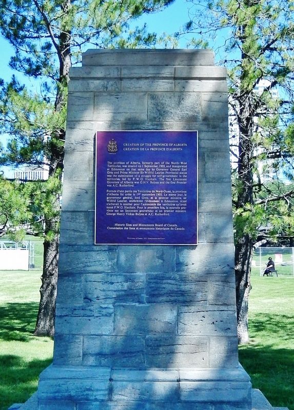
On Legislature Building Road Northwest just west of 107 Street Northwest, on the right when traveling west.
[English] The Province of Alberta, formerly part of the North-West Territories, was created on 1 September, 1905, and inaugurated at Edmonton on that same day by Governor General Earl Grey and Prime Minister Sir Wilfred Laurier. . . . — — Map (db m206184) HM
On 83 Avenue Northwest just west of Gateway Boulevard, on the right when traveling west.
The 1909 Strathcona City Council had to make a decision. Where do they house the volunteer fire department? After much spirited debate they decided that the old fire hall was not worth repairing and a new one should be built. The citizens agreed. . . . — — Map (db m197048) HM
On 83 Avenue Northwest just west of Gateway Boulevard, on the right when traveling west.
Originally known as Strathcona Fire Hall Number 1, this structure is the last remaining example of a pre First World War fire hall in Edmonton. Designed by Arthur G. Wilson and David E. Herrald, the hall was built by contractor James M. Eaton at a . . . — — Map (db m197047) HM
On 104 Street Northwest at 84 Ave Northwest, on the right when traveling north on 104 Street Northwest.
This was the first public library building in Edmonton. The Carnegie Foundation offered to build a library of a specified size and shape; this did not meet the requirements of the citizens of Strathcona, who refused the offer and instead financed . . . — — Map (db m197046) HM
On 109 Street Northwest 0.2 kilometers south of 97 Avenue Northwest, on the left when traveling south.
[English] Construction of a bridge across the North Saskatchewan River was first proposed by the Canadian Pacific Railway in 1905. After extended negotiations with the government and the cities of Edmonton and Strathcona, . . . — — Map (db m197052) HM
Near Fortway Drive Northwest just east of Legislature Building Road Northwest, on the left when traveling east.
[English] Partner in the North West Company, Chief Factor of the Hudson's Bay Company, Rowand of Fort Edmonton was reputed to be "the most influential white man among the wild tribes of the plains". Admired for his courage and . . . — — Map (db m220698) HM
On 30 Street Northwest at 30 Street and 111 Avenue, on the right when traveling north on 30 Street Northwest.
Humberstone Coal Mine
Mine No. 43. North half. Sec 7-53-23-W4, west of river and part of River Lot 40. Entrance along northeast bank of North Saskatchewan (30th Street), north of 111th Avenue and south of 115th Avenue. Recorded production . . . — — Map (db m275458) HM
Near Rooney Crescent Northwest west of Romaniuk Place Northwest, on the right when traveling west.
[English]
Amisk Wacîw Mêskanaw Trail - Beaver Hill Road Trail
Amisk Wacîw Mêskanaw is a 100-km pedestrian trail connecting six municipalities
through the North Saskatchewan River Valley: Parkland County, Devon, Edmonton, . . . — — Map (db m294328) HM
On 95 Avenue Northwest at 85 Street Northwest, on the right when traveling west on 95 Avenue Northwest.
The edifice of St. Luke's Anglican Church is a distinctive example of modernist church architecture. Built in 1958, in the postwar period, new construction materials and techniques ushered in novel, bold, and expressive forms of church design. St. . . . — — Map (db m289171) HM
Near 101 Street 0.1 kilometers north of 100 Avenue, on the left when traveling north.
Fort Saskatchewan, constructed in 1875, was the first North West Mounted Police Post built in northern Alberta. As a center of law enforcement in the area it was, from 1885 until 1913, the headquarters of “G” Division. This cairn was erected in . . . — — Map (db m212479) HM
Near 101 Street at 100 Avenue, on the right when traveling south.
Constructed in 1974as an Alberta-R.C.M.P. Centennial project by the Knights of Columbus and the Catholic Women’s League of Fort Saskatchewan to commemorate the part that the North West Mounted Police, the native peoples, the first settlers and the . . . — — Map (db m212495) HM
Near 101 Street at 100 Avenue, on the right when traveling south.
The first missionaries to arrive in this area were the Oblate Fathers from St. Albert who began a mission at Lamoureux in 1875. This mission became a formal parish in 1891 and was later administered by the Franciscan Fathers who established a . . . — — Map (db m212497) HM
Near 101 Street at 100 Avenue, on the right when traveling south.
Arriving in the Fall of 1872, Joseph and François Lamoureux spent the winter sheltered on the north side of the river across from what is now the City of Fort Saskatchewan. This was the beginning of the first settlement in this area which was later . . . — — Map (db m212498) HM
Near 101 Street at 100 Avenue, on the right when traveling south.
Centuries ago the many Indian tribes using the North Saskatchewan waterway established a boatbuilding encampment at the mouth of the Sturgeon River. This encampment was commonly known as “Birch Hills” due to the availability of Birch trees for the . . . — — Map (db m212496) HM
Near Yellowhead Highway (Provincial Highway 16) 6.3 kilometers east of Range Road 190 (Provincial Highway 834), on the right when traveling east.
Ukrainian Settlement The first Ukrainian immigrants to Canada came to this part of Alberta in the early 1890s, fleeing poverty and oppression in their homeland. Taking out homesteads, they gradually cleared the forest to create . . . — — Map (db m204235) HM
The development of this field in 1947 marked a turning point in the history of the Alberta petroleum industry. After the drilling of Leduc No. 1, the geographical focus of the industry shifted from Turner Valley northward to the central plains area, . . . — — Map (db m8856) HM
Near 47 Street just north of 47 Avenue, on the left when traveling north.
George Ambrose Liggins was Leduc's first Canadian Pacific Railway stationmaster. In 1891 his family was the second to settle in Telford Place, now known as Leduc. He was instrumental in the development of Leduc's first school, served as a school . . . — — Map (db m213003) HM
On 49 Avenue at 48 Street, on the right when traveling east on 49 Avenue.
On this site in December, 1902, the first bank in Leduc was opened by the Merchants Bank of Canada which later merged with the Bank of Montreal. This plaque commemorates that event and was installed by the Bank to . . . — — Map (db m213002) HM
On 51 Avenue just west of 51 Street, on the left when traveling west.
The coming of the railway to Wabamun initiated many changes. Old Wabamun was moved across the lake to its present location. The rails ran through Wabamun in 1909 and a railway station was built. It consisted of office, waiting room, freight and . . . — — Map (db m212500) HM