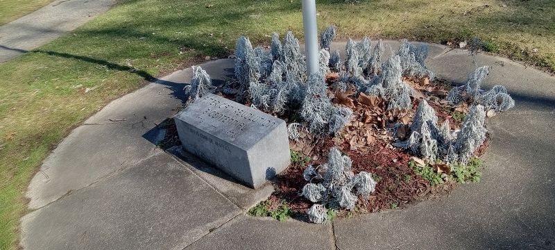
On North Broadway (Michigan Route 43) at West Thorn Street, on the right when traveling south on North Broadway.
Gettysburg
Wilderness
The Union
One and Inseparable.
Mission Ridge
To
Our Nation's Defenders
1861-1865
Vicksburg
Dedicated to those who
offered up their lives
that the government of
the people by the people . . . — — Map (db m216395) WM
On Hastings Riverwalk, on the right when traveling south.
Dedicated to those who served from Barry County during World War I 1917-1918
Dedicated to those who served from Barry County during World War II 1941-1946 Dedicated to those who served from Barry County during the Korean War 1950-1953 . . . — — Map (db m216397) WM
On Hastings Riverwalk north of North Broadway ( Route 43), on the right when traveling north.
Dedicated to those who served from Barry County during the Revolutionary War 1775 - 1783
War of 1812 1812-1815
Mexican War 1846 - 1848
and all others from Barry County who served in the military in any other conflicts
Dedicated to . . . — — Map (db m216400) WM
On South Broadway Street at West Walnut Street on South Broadway Street.
Central School Hastings built the first school on this site in 1852. It burned in 1871, and the second school was constructed. Hailed as a "landmark of progress," the new building served until 1930 when it was razed. Bucks from that structure . . . — — Map (db m216612) HM
On West State Street just east of South Broadway Street (State Highway 37), on the right when traveling east.
Barry County, organized in 1839, was named after U.S. Postmaster General William Barry. Hastings, the county seat, was platted in 1836 and chartered as a village in 1855. The present courthouse was completed in 1892. A newspaper was published here . . . — — Map (db m150276) HM
On South Broadway Street, on the left when traveling north.
Oakland County physician
George W. Lowry (1850-1922)
purchased this lot and a
medical practice from Dr.
William A. Upjohn in 1887.
In 1892-1894 he built one of
Hasting's finest residences,
which also housed his medical office. The . . . — — Map (db m216360) HM
On West State Street just west of South Church Street, on the left when traveling west.
Kim Sigler (1894-1953), a native of Schuyler, Nebraska, received his law degree from the University of Detroit in 1918. While attending law school, Sigler worked at Henry Ford’s Highland Park plant. He first practiced law in Detroit, where he . . . — — Map (db m150275) HM
On South Church Street, on the right when traveling north.
Hastings City Bank began its corporate existence on October 26, 1886, when
state bank charter number eleven was granted by the State of Michigan. The
bank's first quarters were above a hardware store on State Street. In 1890, a
new bank building . . . — — Map (db m216358) HM
On West Court Street at South Church Street, on the right when traveling east on West Court Street.
Hastings City Bank began its corporate existence on October 26, 1886, when
state bank charter number eleven was granted by the State of Michigan. The
bank's first quarters were above a hardware store on State Street. In 1890, a
new bank . . . — — Map (db m216609) HM
On West Grand Street at South Broadway Street, on the right when traveling east on West Grand Street.
Center Panel:
To honor the Hastings High School boys who made the supreme sacrifice in the World War
Left Panel:
Laurence J. Bauer '13
1894-1918
1st Lieut. 11th Squadron Air Service
fell at Bar Le Doc France
Right Panel:
Reuben . . . — — Map (db m216614) WM
On East Woodlawn Avenue, on the right when traveling east.
On April 5, 1885, the Michigan Mutual Tornado, Cyclone, and Windstorm Insurance Company became the first mutual windstorm company incorporated by the state of Michigan. Starting in a one-room office above Grant's store, the company occupied and . . . — — Map (db m33250) HM
On Cedar Creek Road at West Brogan Road, on the right when traveling south on Cedar Creek Road.
From 1872 to 1963 Hope Township children attended school in this building, known as the Hinds School because of its location at the crossroads community of Hinds Corners. The school had stood vacant for almost twenty years when Robert Casey, a Hinds . . . — — Map (db m191509) HM
In the early nineteenth century the Thornapple band of Ottawa Indians established a village a short distance from Thornapple Lake. It was served in the 1840s by a Methodist mission and school conducted by the Reverend Mannaseh Hickey. Trails leading . . . — — Map (db m191511) HM
On Nashville Road near McKeown Road, on the right when traveling north.
This steel Pratt through truss bridge was erected for Hastings Township in 1903. The township contracted with the Massillon Bridge Company of Massillon, Ohio, for $2,090, to fabricate and erect the steel bridge. In operation from 1869 to the 1930s, . . . — — Map (db m191510) HM
On Jefferson Street at Green Street, on the right when traveling south on Jefferson Street.
The first Methodist Episcopal Society, the oldest congregation in Hastings, erected this Greek Revival structure in 1860. In 1911 the Methodists built a new church on the northwest corner of Green and Church Streets. The following year it sold the . . . — — Map (db m199125) HM
Near West Apple Street, on the right when traveling east.
Hastings was first linked
with Jackson and Grand
Rapids by the Grand River
Valley Railroad in 1870.
The Michigan Central Railroad leased the line that
same year. At first located
elsewhere, a passenger
station was built on this
site in . . . — — Map (db m216359) HM
On Jefferson Street at Green Street, on the right when traveling north on Jefferson Street.
Built in the 1880s by Daniel Striker, this Queen Anne-style building was once considered the "handsomest residence in Hastings." Born in New York State in 1835, Striker moved as a child with his family to Michigan. He was elected to several . . . — — Map (db m216572) HM
On Hastings Riverwalk near North Broadway ( Route 43), on the right when traveling south.
We proudly stand for our family,
That served and have now died.
Memories are all we have,
A tear in all our eyes.
They knew what they signed on to do.
They answered duty's call.
The honor of the uniform,
They fought for one and all. . . . — — Map (db m216398) WM
On North Church Street, on the left when traveling north.
This block of brick paving
is the only extant portion
of Hastings' first major
street improvement project
completed in 1907 as the
result of the initiative of
Dr. George W. Lowery, elected
mayor in 1906. The fine
condition of this . . . — — Map (db m216361) HM
On South M-43 Highway (State Highway 43) near Bendere Road, on the right when traveling east.
In 1850 George Thomas operated a sawmill here, and in the next decade as settlers began to arrive he built a gristmill. The new village, also known as Gull Lake, was a few miles south of the Reverend Leonard Slater’s Baptist Indian mission. Thomas . . . — — Map (db m191508) HM
On Ellis Street at Park Street, on the right when traveling north on Ellis Street.
Calvin G. (Squire) Hill, founder of the village of Middleville, came from New York state to Michigan in the autumn of 1834. He purchased four hundred acres on both banks of the Thornapple River where the village now stands. In 1854 he donated this . . . — — Map (db m216913) HM
On West Main Street near Lem Paul Street, on the right when traveling west.
In 1867 Ionia County native John Carveth (1841-1910) settled in Middleville to read law. In 1868, after the completion of his studies, he was admitted to the bar and established a practice in Middleville. Carveth served one term as state senator . . . — — Map (db m216346) HM
On River Street near Railroad Street, on the right when traveling north.
WWI
Arthur Finkbeiner, Pvt. Army Oct 29 1918
WWII
Robert Corson, RT3, USN Nov 13 1942
Melbourne Donovan, PFC, Army Dec 21 1944
Bernard Fighter, CPL, Army Jan 1 1943
Steve Hula, SSGT, Army Jan 10 1945
Patrick Reynolds, CPL, . . . — — Map (db m216910) HM
In 1878 twelve persons organized the Parmelee Methodist Church. The small congregation met at various locations until 1884, when this church was built on land given to the Methodist Trustee Board by Oliver and Bernice Carpenter. On September 15, . . . — — Map (db m215391) HM
On Adams Road at Norris Road, on the right when traveling east on Adams Road.
In 1834 Louis Moran, member
of a French family prominent
in Detroit since the mid-1700s, purchased land here
and opened a log tavern and
trading post. An Indian settlement called Middle Village was nearby, on the
trail from Gull Prairie . . . — — Map (db m258137) HM
On Old Mill Road 0.2 miles south of Bowens Mill Road.
Settlement began here in the mid-1830s, and in 1850 a post office known as Gun Lake was established. The village, never over 100 population, contained a sawmill, general store, blacksmith shop, and several other businesses. E. H. Bowen constructed . . . — — Map (db m216624) HM
On Scott Road (Michigan Route 79) near Barryville Road, on the right when traveling west.
This village was settled in the mid-nineteenth century, and in 1857 a post office was opened. By 1860 a town of several blocks was established, and the businesses included a gristmill, hotel, and sash factory. The gristmill, run by Melatiah J. . . . — — Map (db m216525) HM
On Main Street (State Highway 66) north of Maple Street, on the right when traveling north.
Emory Parady was born in New York in 1844. On April 24, 1865, he was one of twenty-seven men from the 16th New York Cavalry Regiment who rode with the two detectives tracking John Wilkes Booth after the assassination of President Abraham Lincoln. On . . . — — Map (db m191499) HM
On Main Street (State Highway 66) 0.1 miles north of Washington Street, on the right when traveling south.
Built in 1884/85, this red-bricked Italianate structure was the home of Charles W. and Agnes Putnam. Mr. Putnam was a hardware merchant and banker; Mrs. Putnam taught music and was the first public school teacher in Nashville. Around the turn of the . . . — — Map (db m191514) HM
On Main Street (State Highway 66) near Maple Street, on the right when traveling north.
This plaque is issued by the Historical Society of Michigan in recognition of
Village of Nashville
Founded in 1869
For more than 150 years of continuous operation in service to the people of Michigan and for contributing to the growth and . . . — — Map (db m191542) HM
Near South Yankee Springs Road 0.2 miles north of Duffy Road.
Near here once stood one of the most famous inns west of Detroit. It was run by “Yankee Bill” Lewis, a New Yorker who came here in 1836. His establishment, located on the main road from Grand Rapids to Battle Creek and Kalamazoo, was an unimposing . . . — — Map (db m216617) HM
On East Broadway Street (Michigan Route 43) at South State Street, on the right when traveling east on East Broadway Street.
The area now known as Woodland Township was first settled in 1837 by Charles Galloway and Jonathan and Samuel Haight. In 1842, the state legislature set aside the township, which by then had several hundred residents. The area’s level surface and . . . — — Map (db m216646) HM
On East Main Street at Hanover Street, on the right when traveling west on East Main Street.
Alvah N. Belding
Memorial Library
has been placed on the
National Register of
Historic Places
by the United States
Department of Interior
May 21, 1993 — — Map (db m216061) HM
On East Main Street at Hanover Street, on the left when traveling east on East Main Street.
Alvah N. Belding erected this library in 1917/18 as a memorial to his parents, Hiram and Mary Wilson Belding. Alvah and his brother Hiram began peddling silk around Belding (then Patterson's Mills) in 1858. With the help of their brother Milo they . . . — — Map (db m216178) HM
On East Congress Street at North Bridge Street, on the left when traveling east on East Congress Street.
On April 1, 1912, the citizens of Belding voted to issue a $15,000 bond to build a new city hall. At the time, the city jail was housed in an old barn and the dilapidated building rented by the city as a firehouse was called a “burning shame.” . . . — — Map (db m216068) HM
On Depot Street west of North Bridge Street, on the right when traveling west.
In memory of the boys of 1861-1865 who offered their services for the integrity and unity of our Grand Republic during the War of the Rebellion
Dan S. Root Post 126
Department of Michigan
Grand Army of the Republic
Organized April . . . — — Map (db m216677) WM
On Depot Street near North Broas Street, on the right when traveling west.
Desert Shield
We stood behind the men & women who stood behind the line in the sand
Persian Gulf War
August 1990 - February 1991
Desert Storm
To honor our men & women who served 1991 — — Map (db m216680) WM
On Depot Street near North Bridge Street, on the right when traveling west.
Korean War
June 25th, 1950
July 27th, 1953
And still occupied to this day
The Forgotten War
The first soldier from Ionia County to be killed in action was Pvt. Clayton D. Adams US Army. Adams left for Korea on July 20, 1950 . . . — — Map (db m216683) WM
On Depot Street near North Broas Street, on the right when traveling west.
Afghanistan
Operation Enduring Freedom
All gave some, some gave all!
This memorial is dedicated to all those who served in Afghanistan and to the heroes we lost. — — Map (db m216681) WM
On Depot Street near North Broas Street, on the right when traveling west.
★★★ Chair of Honor ★★★
For
Prisoners of War - Missing in Action
★★★
This unoccupied chair is in honor of those that are still Prisoners of War (POW)or Missing in Action (MIA), and . . . — — Map (db m216682) WM
On Depot Street near North Bridge Street, on the right when traveling west.
This memorial was erected to commemorate those who dedicated their lives to serve in the First World War
April 6, 1917 - November 11, 1918 — — Map (db m216678) WM
On Hanover Street at East Main Street, on the right when traveling north on Hanover Street.
Built in 1906, the Belrockton is the last remaining boardinghouse of the three provided by the Belding Brothers and Company for its single female workers. A major silk manufacturer in the late nineteenth and early twentieth centuries, the company . . . — — Map (db m55242) HM
On Depot Street at North Bridge Street, on the right when traveling west on Depot Street.
Pere Marquette Depot
built in 1921
has been placed on the
National Register
of Historic Places
by the United States
Department of the Interior — — Map (db m216064) HM
On Depot Street at North Bridge Street, on the right when traveling west on Depot Street.
Completed in 1923 for the Pere Marquette Railway, this depot is typical of the railroad stations that served Michigan towns during the early decades of the twentieth century. The depot replaced an earlier, wood frame station built during the 1880s . . . — — Map (db m216177) HM
On Depot Street near North Bridge Street, on the right when traveling west.
Belding Varsity Football jersey #61 was worn by Warren Lane, a graduate from
Belding High School with the class of "63". He married Marcia, moved to
Grand Rapids and entered the Army in 1966, but he will always remain a
Belding son. Warren was . . . — — Map (db m217244) WM
On North Whites Bridge Road 1 mile north of Richmond Road, on the right when traveling north.
This picturesque covered bridge, one of the last of its kind in Michigan, was built in 1867 by Jared N. Brazee and J.N. Walker, builders of several covered bridges in this area. The name of the bridge derives from the White family, a prominent . . . — — Map (db m55246) HM
St.John the Baptist Church
Organized in 1855 to serve Irish Catholic immigrants, the parish of St.John the Baptist worshipped in a simple church on the Cowman farm until 1868. That year, the parish of seventy families built this church, which . . . — — Map (db m217492) HM
This block was used as a stepping stone to
get into and out of carriages. The side
facing the street is inscribed with the name
John C. Welch. The block originally stood
in front of Welch's residence in the 500
block of West Main Street. One of . . . — — Map (db m216316) HM
On West Main Street, on the right when traveling east.
Alfred Cornell, Sr., and his family came to Ionia during November,
1833. His son, Dr. Alanson Cornell, was a physician and druggist
who operated a drug store at the southwest corner of Main Street
and Cornell Alley. Dr. Cornell's home was on the . . . — — Map (db m216319) HM
On West Main Street, on the left when traveling east.
The first store opened in 1834 in a
rented portion of Samuel Dexter's barn. By
1845, the downtown included a hotel,
tavern, wagon repair shop, drug store and
the Ionia Land Office, where land purchases
were made for all areas of Michigan to . . . — — Map (db m216307) HM
On West Main Street, on the right when traveling east.
Jonathan Hale and Son was a mill formerly
located at 227 South Steele Street. Hale
operated flour and feed mills in several
other Michigan cities, including Lyons and
Stanton, before opening the Ionia mill in
1901. By 1907, the Ionia mill had . . . — — Map (db m216310) HM
On West Main Street at North Dexter Street, on the right when traveling east on West Main Street.
This tablet is dedicated to the memory of
Samuel Dexter · Erastus Yeomans · Oliver Arnold · Joel Guild · Edward Guild · Darius Winsor · and their families
and
Dr. William B. Lincoln · Winsor Dexter · Warner Dexter · Patrick M. Fox · Abram . . . — — Map (db m215982) HM
On West Main Street, on the right when traveling east.
- Owner of the Ypsilanti Reed
Furniture Company in Ionia, the
world's largest reed furniture factory
and one of Ionia's largest employers
- Investor in many business
ventures in Michigan and beyond
- Graduate of the University of Michigan, . . . — — Map (db m216322) HM
On Union Street at High Street, on the right on Union Street.
Governor of Michigan, 1927-1931, Fred W. Green was born in Manistee in 1872 and grew up in Cadillac. A partner in the Ypsilanti Reed Furniture Co., he moved the business to Ionia in 1904. Attracted to politics, he served twelve terms as mayor of . . . — — Map (db m215975) HM
On East Main Street at Library Court, on the right when traveling west on East Main Street.
Captain Lucius Mills, a local builder, constructed this house for Frederick and Ann Hall in 1869-70. Built of variegated Ionia sandstone, the house is an outstanding example of the Italian Villa style. Frederick Hall came to Ionia County in 1837 . . . — — Map (db m215970) HM
On West Main Street at Hudson Street, on the left when traveling east on West Main Street.
In memory of Wm. H. Borden Post No. 211 Dept. of Mich. G.A.R.
In memory of Wm. H. Borden W.R.C. No. 28
Though we die
We shall live again — — Map (db m216313) WM
On East Washington Street near Library Court, on the right when traveling west.
In Merritt’s Hall on January 24, 1859, the Reverend Isaac Errett and forty-three members signed the original charter of the Ionia Church of Christ (First Christian Church). The first church of this denomination had been founded in nearby Muir in . . . — — Map (db m215974) HM
On East Main Street at Hudson Street, on the right when traveling west on East Main Street.
Completed in 1885, the Ionia County Courthouse is the largest structure ever built of Ionia sandstone. The handsome three-and-a-half story courthouse replaced an 1840s hall of justice, which had become inadequate for the county’s needs. David W. . . . — — Map (db m215952) HM
On East Main Street, on the left when traveling east.
Dedicated to the
Korean and Vietnam
veterans of Ionia
County who honorably
served and gave
their all for our
great country.
Korean Conflict 1950 - 1957
Clayton D. Adams - Ionia County •
Clifford C. Castle - Ionia County •
Robert L. . . . — — Map (db m216312) WM
On North Dexter Street, on the right when traveling north.
Ionia was established in 1833 by Samuel Dexter. Originally, Dexter named the settlement Washington Center. The name was later changed to Ionia County Seat and then shortened to Ionia. In the mid-1800's, Dexter's home and sawmill stood near this site. — — Map (db m216326) HM
Near West Main Street west of South Depot Street, on the right when traveling east.
- Born in Ionia County in 1840
- Authorized to raise a company of the 6th Michigan Cavalry in 1862, and quickly rose to the rank of Colonel
- Succeeded Gen. George Armstrong Custer to command his Michigan Cavalry Brigade, then served under . . . — — Map (db m216321) HM
On East Main Street near South Jackson Street, on the right when traveling east.
John C. Blanchard
John Celsus Blanchard (1822-1905) epitomizes the American “self-made man.” He left his home in Cayuga County, New York, at age fourteen, bound for the western frontier. Blanchard worked as a laborer in Detroit, Livingston . . . — — Map (db m215933) HM
Near West Main Street west of South Depot Street, on the right when traveling east.
• Julia Wheelock
(top center)
- One of the area's early school teachers
- Pioneering nurse during the Civil War
- Early advocate for nursing education
• Bertha Brock
(lower left)
- Ionia's premier historian
- Namesake of . . . — — Map (db m216323) HM
On West Main Street, on the right when traveling east.
This artifact reflects the industrial past of
Ionia. A wide variety of industries,
including furniture manufacturing, a button
factory and industrial and automotive
suppliers, have operated in Ionia
throughout its history. — — Map (db m216325) HM
On West Main Street, on the left when traveling east.
This one horse plow represents Ionia
County's agricultural past, an important
industry throughout local history. Farming
became especially profitable after the
railroads were built through Ionia, as it gave
the farmers a quicker and more . . . — — Map (db m216306) HM
On West Main Street, on the right when traveling east.
• Samuel & Anna Dexter
(top center)
- Leader of the Dexter Colony that first
settled the village of Ionia in 1833
- A leading businessman in Ionia
• Erastus & Phoebe Yeomans
(lower left)
- Original settlers of the village
- . . . — — Map (db m216320) HM
On West Washington Street near North Kidd Street, on the right when traveling east.
The St. John’s Episcopal parish was established on February 4, 1841. Under the leadership of the Reverend Melancthon Hoyt, the parish constructed its first church, now the parish house, that same year. Built on land donated by Ionia’s founder, . . . — — Map (db m215973) HM
On West Washington Street near North Kidd Street, on the right when traveling east.
St. Johns Parish House
-Erected in 1841-
The first church in Ionia
moved from corner to
present site in 1881
-lot presented by-
Hon. Samuel Dexter
The founder of Ionia — — Map (db m215972) HM
On West Main Street, on the right when traveling east.
This artifact recalls the importance of the
railroads to Ionia's growth. The first
railroad reached Ionia in 1857, and a
second was built in 1869. In 1871-72, the
Pere Marquette Railroad constructed a
roundhouse and shop in Ionia to . . . — — Map (db m216317) HM
On West Main Street, on the left when traveling east.
Used for sharpening knives and other edge
tools, this whetstone reflects Ionia's
historical agricultural and meat processing
industries. The trough would have been
filled with water to keep the stone wet
while in use. — — Map (db m216309) HM
On West Garden Street at Liberty Street, on the right when traveling west on West Garden Street.
In 1856 the Reverend Isaac Errett organized Disciples of Christ congregations in Montrose- (present-day Muir) and Lyons. Membership grew quickly, and in 1861 this church was built to serve Muir. The board-and-batten Gothic Revival exterior masks a . . . — — Map (db m215375) HM
Near East Stoney Creek Road at North Hubbardston Road.
Dedicated to all men and women of the armed forces who honorably served their country. May wherever their shadows fall be in peaceful surroundings. — — Map (db m215917) WM
On East Main Street at Higham Street, on the right when traveling west on East Main Street.
Dedicated to the men and women of Pewamo and vicinity who served in the armed forces in both World Wars
1917 - 1918
1941 - 1945 — — Map (db m215932) WM
On Kent Street near East Bridge Street, on the right when traveling north.
City of Portland In 1833, Elisha Newman filed a federal land grant for extensive land around the Looking Glass and Grand Rivers that would later become the village of Portland. Early Ionia County histories state that Philo Bogue built a . . . — — Map (db m182786) HM
This steel beam recovered from the World Trade Center is dedicated to all of the people who lost their lives in the terrorist attacks on September 11, 2001 and to all of those who aided in the rescue and recovery efforts.
We Will Never . . . — — Map (db m189571) WM
In Honor Of All Who Have Served In
Operation Iraqi Freedom
Operation Enduring Freedom
Never Forget Those Who Have Made
The Ultimate Sacrifice
In Memory Of
LCPL David A Huhn, USMC — — Map (db m189572) WM
Lest we forget
Dedicated to all the men and women in the Portland area, past, present and future, who served or gave their lives in time of war to defend our great nation. — — Map (db m189573) WM
On Portland Riverwalk south of Morse Drive, on the right when traveling south.
Railroads were vital to early residents for receiving goods and moving local produce to market. The first train into Portland arrived in November 1869. In 1881, in addition to freight trains, there were six passenger trains daily, three in each . . . — — Map (db m198483) HM
On East Main Street 0.1 miles east of Fuller Street, on the left when traveling east.
In 1836, when Saranac was settled, the upper Grand River Valley was a promising but undeveloped area. The soil was fertile; Lake Creek provided water power; and the river was navigable to Grand Rapids. The town grew slowly until 1857, when the . . . — — Map (db m55248) HM
On West Grand River Avenue 0.1 miles east of Morrison Lake Road, on the right when traveling east.
Here on old U.S. 16 in Boston Township, Ionia County, the first picnic table along a highway right-of-way was placed in 1929 through the initiative of Allan Williams, county engineer. The table was built of salvage planks formerly used as . . . — — Map (db m55249) HM
On West Riverside Drive, on the right when traveling east.
Doubtless the oldest
cobble-stone school house
now standing in Michigan
Restored by
the board of supervisors
of Ionia County
in 1918 — — Map (db m216328) HM
On North Whites Bridge Road at Button Road (State Highway 91), on the left when traveling south on North Whites Bridge Road.
In 1843 Calvin Smith became the first white settler in the area. N.G. Chase opened a store here the following year. When Dr. Wilbur Fisher, the area's pioneer physician, began operating a rural post office in 1848, he named the community Smyrna . . . — — Map (db m55244) HM
On Thornapple River Drive Southeast at Fase Street Southeast, on the right when traveling south on Thornapple River Drive Southeast.
An act of the legislature in 1867 authorized Ada Township to borrow up to $3000 for the purpose of building or repairing bridges in the township. This bridge was built about that time, apparently by William Holmes. The design for the trusses was . . . — — Map (db m182789) HM
On Belmont Avenue Northeast at Jupiter Avenue Northeast, on the left when traveling north on Belmont Avenue Northeast.
Dedicated To All The
Men And Women Of This
Community Who Helped
To Preserve The Freedom
Of This Great Nation
Plainfield Charter Township
2003 — — Map (db m176432) WM
On West River Drive Northeast at Mall Avenue Northeast, on the right when traveling east on West River Drive Northeast.
William Hyser
William Hyser (1826-1909), pioneer surgeon and Civil War captain, came to Plainfield Township in 1850, when it was a lumber center. In 1852 he built this Greek Revival house as a home and an office for his medical and civic . . . — — Map (db m176433) HM
451 entries matched your criteria. The first 100 are listed above. Next 100 ⊳