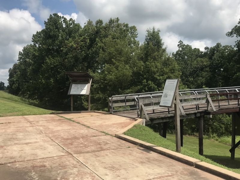
On Highway 451 at Iron Bridge Crossing (Sarto Lane) on Highway 451.
Sarto Old Iron Bridge is the first bridge in Louisiana to be placed on the National Register of Historic Places. The State Review Committee for the National Register of Historic Places in Baton Rouge first considered the bridge on November 21, 1989 . . . — — Map (db m105643) HM
On State Highway 451 near Iron Bridge Crossing, on the right when traveling north.
Bayou Des Glaises' French name likely refers to the kind of loamy, clay soil that settlers found along its banks. Bayous are typically found in flat, low-lying areas and can be slow-moving streams, rivers, marshes or wetlands. They are . . . — — Map (db m116249) HM
On State Highway 451 near Iron Bridge Crossing (Sarto Lane).
Big Bend is located along Louisiana State Highway 451, adjacent to Bayou des Glaises in a loop through northeastern Avoyelles Parish, between Hamburg and Moreauville. The community was settled in the 19th century by people of both French and . . . — — Map (db m105604) HM
On State Highway 451 at Iron Bridge Crossing, on the right when traveling north on State Highway 451.
Prior to 1913, floodwaters from the nearby Mississippi, Atchafalaya, and Red Rivers frequently forced the evacuation of people, livestock and property in the Big Bend area. The Avoyelles Parish Police Jury in 1915 authorized the . . . — — Map (db m105571) HM
On State Highway 451 at Iron Bridge Crossing (Sarto Lane) on State Highway 451.
The Sarto Old Iron Bridge, built in 1916, is a steel truss bridge traversing Bayou des Glaises in the rural community of Big Bend. The Sarto Bridge is a pedestrian and vehicular bridge, one lane wide with a three part centered span mounted on a . . . — — Map (db m105786) HM
On Highway 451 at Iron Bridge Crossing, on the right when traveling north on Highway 451.
The Sarto Old Iron Bridge was built in response to flood problems in northeast Avoyelles Parish during the early part of the twentieth century. Frequent flooding between Bayou des Glaises and the Red River resulted in the need to evacuate people, . . . — — Map (db m105599) HM
Near Lock Dam Road 0.7 miles Preston Street (State Highway 452).
Located on Red River 11 miles upstream from Marksville, Lock & Dam #1 is the first of five locks used to manage transportation from Shreveport to the Mississippi and Atchafalaya Rivers.The Red River is 1,360 miles long and originates in the . . . — — Map (db m116089) HM
On Southwest Main Street (U.S. 71) near Church Street (State Highway 115), on the right when traveling south.
Louisiana Ice & Electric Company
was established in 1935. The plant (located in Bunkie, La.)
Generated and supplied Ice and Electricity for Bunkie,
Mansura, Simmesport, Villeplatte and other
small communities. This was the beginning of
the . . . — — Map (db m283101) HM
Built by Josephine Ernest between 1907 and 1909
and originally known as the Hostel Ernest, R. Lee
Bailey purchased the hotel and renamed it in 1918.
It was listed on the National Register of Historic
Places in 1999. The hotel served as the . . . — — Map (db m284195) HM
On Southwest Main Street (U.S. 71) near Willow Street.
A "state of the art" Bottling facility began its operation
in 1936, repeatedly winning awards for highest per
capita sales. It was one of two independent Coca-Cola
bottlers in Louisiana and one of the larger employers
in Avoyelles Parish. In . . . — — Map (db m284200) HM
On Northwest Main Street (U.S. 71) north of Oak Street, on the right when traveling north.
The Texas and Pacific Railway established a
station on the main line at Bunkie in 1882. The
current depot, built in 1911 and listed on the
National Register of Historic Places, is the only
existing reminder of the importance of the
railway to . . . — — Map (db m208821) HM
The Bunkie Post Office was established on January 26,
1883, originally located on Main Street, relocated here
in 1937. First postmaster Thomas B. Kimbro was
succeeded by Louis W. Anderson, then John D. Earnest,
Levi West, Ewell West and . . . — — Map (db m283156) HM
On Southwest Main Street (U.S. 71) 0.3 miles south of Orange Street, on the left when traveling south.
The 20-year-old Louisiana Hoop Company
relocated to Bunkie in 1930. It had a priority
status to supply highly demanded barrels during
WWII. In 1952 the business transitioned to
manufacturing hardwood furniture. In 1962 LHC
was the last . . . — — Map (db m283098) HM
On Southwest Main Street (U.S. 71) near West Church Street (State Highway 115/29).
Built in 1904 in the heart of Bunkie first as
R.H. Lester Department Store, then as an
antique store, Griffins Antiques continues to
be a hub for local and visitor shopping
experiences and comfort stop along the
Jefferson Highway. — — Map (db m284197) HM
On Southwest Main Street (U.S. 71) near Church Street (State Highway 115), on the right when traveling south.
In 1878 Captain Alexander Haas (not his brother,
Samuel) purchased much of the land in this part of
Avoyelles Parish, which was then called Irion. In 1882 the
Texas and Pacific Railway sought the right of way across
Haas land. In exchange for . . . — — Map (db m283100) HM
On Southwest Main Street (U.S. 71) near West Magnolia Street.
Constructed in 1900, the oldest bank building in Bunkie
was in existence from 1900 until 1934 when the bank
dissolved from financial hardships of the Great Depression.
Damaged by fire in 1910, Bunkie Brick Company was
used for the restoration . . . — — Map (db m284199) HM
On Louisiana Route 115 3 miles east of Interstate 49, on the right when traveling east.
Near this site on the main road from Opelousas to Avoyelles, Reuben Ray operated a ferry service across Bayou Boeuf. A surety bond granted by the State of Louisiana is dated 19 Sep 1816. In the early 19th Century before the advent of bridges and . . . — — Map (db m229930) HM
On Northwest Main Street (U.S. 71) near East Oak Street, on the right when traveling north.
What part does Avoyelles play in the Jefferson Highway corridor?
Highway 71 passing through Bunkie is on the
Jefferson Highway. Originally, it entered into
Avoyelles from Rapides Parish on the northside at
Shirley Road leading into . . . — — Map (db m284070) HM
On NW Main Street (U.S. 71) north of East Oak Street, on the right when traveling north.
"Freedom Is Not Free, We Paid An Awful Price For It..." Ray Davis, Lt. Col. USMC. Medal Of Honor, Korea
The Revolutionary War Era Boies David · Boies Joel · Merrill Stephen · Robert Peter · Soileau Jr Noel Etienne · Townsend Samuel The . . . — — Map (db m97457) WM
On Whites Chapel Road 0.3 miles south of State Highway 29, on the right when traveling west.
Gothic Revival church built in 1894 by Hugh and Lee Evans on land donated by Wilson A. O'Quin, Sr. It was named in honor of Rev. Frederick White who organized it in 1870. Listed on the National Register of Historic Places. — — Map (db m107478) HM
This building is the
site of the original
Cottonport Drugstore,
Owned and Operated,
by Gano Lemoine, Sr.
and Gano Lemoine, Jr.
from 1923 until 1983. — — Map (db m283097) HM
Freedom Dedicated In Honor of the Men and Women of Cottonport who served their country in the cause of Freedom. WWI Lamar P. Ducote • Donat S. Ducote WWII Reece Chenevert • Barton J. Jeansonne, Sr. • . . . — — Map (db m214701) WM
On Cottonport Avenue near North Main Street, on the right when traveling north.
A regional Easter tradition,
competitors knock decorated
hard-boiled eggs together &
cracked egg loses. Name from
"Pâques", French for Easter.
Jeu traditionnel de Pâques.
Les joueurs "Pâquent” ou
cognent ensemble des
œfs durs décorés. . . . — — Map (db m283066) HM
On Front Street (State Highway 29) south of Cappel Lane, on the right when traveling north.
The history of Cottonport began about 1823 when Joseph Ducote II married Marguerite Bordelon. On the bank of Bayou Rouge he cleared a cane brake, built a house, & planted these oak trees. About 1835 he donated some of his property for a road & a one . . . — — Map (db m97459) HM
In 1856 the home & property
were owned by
Zepherine Poincy de Generes
& inherited by her daughter,
Coralie de Generes Dulany.
In 1875 Theophile & Rosalie
Lemoine purchased the home
and property. Other homeowners
were the Bordelon, . . . — — Map (db m283046) HM
On Highway 107 at Effie Highway (State Highway 115), on the left when traveling south on Highway 107.
Centerpoint, Louisiana was first settled in the early 1800's. It derives its name from being the center of Ward One in Avoyelles Parish. Many of the descendants of the early settlers of Centerpoint would come to settle in Effie. — — Map (db m110627) HM
On Highway 107 at Effie Highway (State Highway 115), on the left when traveling south on Highway 107.
Effie, Louisiana was established around 1898. The area was known as "Point Maigre" by early settlers. Benjamin F. Garlington became postmaster and renamed the area, "Effie", after his daughter. He ran the post office out of his house near this . . . — — Map (db m110602) HM
On Highway 107 at Effie Highway (State Highway 115), on the left when traveling south on Highway 107.
Born 4-23-1914 to William Archie & Cedonia (Sayes) McCann Served his country 1940-1944 World War II Pacific Theater AAC Reconnaissance Pilot Active State & Local politics State Representative 1944-1948 LA. State Senator 1952-1956 Owner Avoyelles . . . — — Map (db m110657) HM
On State Highway 107 at Effie Highway (State Highway 107), on the left when traveling south on State Highway 107.
On May 11, 1985, Lafargue High School's baseball team became the Louisiana State Champion of Class B. Other highlights were a District 9-B Championship and an undefeated season. It was the greatest athletic accomplishment of Lafargue High School in . . . — — Map (db m110934) HM
On State Highway 107 at Effie Highway (State Highway 115), on the left when traveling south on State Highway 107.
Vick, Louisiana was established around 1896. The postmaster was Joe Berlin, the son of the first settler of Vick, George Berlin. Joe would name the area "Vick" after his wife Victoria. Vick is well known for its rich farm land. — — Map (db m110610) HM
On State Highway 1176 north of Youngs Crossing, on the left when traveling north.
John Fogleman, a native of Virginia, was in this area in 1816, a witness to his sister's wedding in the St. Landry Courthouse. He married Polly Sandefur there Jan. 1, 1819. On Nov. 28, 1853, the estate of the deceased John Fogleman was sold in a . . . — — Map (db m107482) HM
On Main Street (State Highway 29) at College Street, on the right when traveling north on Main Street.
Site of Evergreen Home Institute (1856); Henry Clay Kemper, 1st headmaster. Later became Evergreen College; then Evergreen High School in 1904. These schools had a note-worthy influence on education in Avoyelles and Louisiana. — — Map (db m97455) HM
On Louisiana 361 near Dufour Road, on the right when traveling north.
The Goudeau School was built in the 1930s by the
Avoyelles Parish school authorities to educate
African American children. It evolved out of the
Antioch Baptist Church, started on this location
in 1905. This school served the Goudeau . . . — — Map (db m283043) HM
On State Highway 1 at Cocoville Road (State Highway 107), on the right when traveling north on State Highway 1.
This Section of highway is dedicated to honor the Avoyelles Parish Veterans of the Armed Forces of the United States, who served in Vietnam War. Those killed in action are listed in the order they were taken from us.Marine CPL Brian Gauthier-July . . . — — Map (db m120960) WM
On L ��Église Street (State Highway 114) north of Drouin Street, on the right when traveling north.
English: Confederate forces under General Dick Taylor here formed battle line May 16, 1864, barring passage of General Banks' retreating Union Army. The Battle of Mansura ended in withdrawal of Confederates. French: Bataille De . . . — — Map (db m97558) HM
On L'Eglise Street (State Highway 107) south of Coco Street, on the right when traveling south.
Desfossé House Dr. Jules Charles Desfossé, second mayor of Mansura, acquired this c. 1790 house and rebuilt it c. 1850. This Louisiana French Colonial style dwelling was the 1st structure in Avoyelles Parish listed on the National . . . — — Map (db m97774) HM
On L'Eglise Street (State Highway 107) north of Porterie Street, on the left when traveling north.
Incorporated 1860. Long recognized for its culinary artistry in the preparation of Cochon de Lait. The 1960 Louisiana Legislature officially designated Mansura "La Capitale de Cochon de Lait" in honor of its Centennial year. — — Map (db m97596) HM
On Tunica Drive East (State Highway 1/107) south of Airport Drive, on the right when traveling south.
Site of first Catholic school in Avoyelles Parish - 1855. Founded by Daughters of the Cross of Treguier, France, under Mother Mary Hyacinth Le Conniat on request of Bishop Martin. Battle of Mansura, May 16, 1864, began on Convent grounds. — — Map (db m110431) HM
On Spring Bayou Road (State Road 1190) east of Andrus Street, on the right when traveling east.
Large story and a half Acadian style residence built by Alfred Greenhouse and his wife Cecilia Bontempt. Greenhouse was a farmer, cattleman, landowner and hunter who often cared for cattle kept in the lowlands during the winter months. Indian . . . — — Map (db m117693) HM
On South Washington Street near East Odgen Street, on the right when traveling north.
Oldest commercial building site remaining in city. Built by Voinche, native of Paris, France. Later Victorian upper structure on only underground basement in city. Basement used to hide cotton from Union troops during Civil War. — — Map (db m98022) HM
On East Odgen Street near North Main Street ( Highway 107/115), on the right when traveling west.
Movie theater built in the Arts and Crafts style by the Mayer family. First known as the "Palace Theater". Home to "silent" movies and later "speaking" films until about 1975. High school commencements were held here prior to 1927. — — Map (db m98270) HM
On South Main Street (State Highway 115) south of West Barbin Street, on the right when traveling south.
Turn of the century Victorian home featuring Colonial influence. Wrap around porch with complete central hallway. Built by Dr. Aristide Barbin. Restored by Tucker Couvillon family in the 1950's and the Leon Satterthwaite family in the 1990's. — — Map (db m120982) HM
On North Washington Street north of Laurel Lane, on the right when traveling north.
Raised Greek Revival dwelling with Victorian influence built in 1872 by Alfred and Elizka Bordelon. Occupied by direct descendants. Listed on the National Register of Historic Places. — — Map (db m122655) HM
On North Monroe Street south of Tarleton Street, on the left when traveling south.
Full two story Arts and Crafts dwelling with Colonial Revival facade. Built by Michel Bettevy, prominent local banker. Later home to Leroy Havard family and the family of Dr. Alton DeNux, former Mayor and State Representative. — — Map (db m120955) HM
On South Washington Street north of Acton Street, on the right when traveling north.
Victorian dwelling Colonial influence. Built by Alfred Bordelon who practiced dentistry and law in Cottonport and Marksville. Built along northern edge of Spanish land grant of Francois Bordelon. — — Map (db m120984) HM
On South Main Street at West Barbin Street, on the right when traveling south on South Main Street.
Arts and Crafts style house built by Judge Lester Bordelon. Features a large central hallway flanked by gracious rooms and beveled glass entrance. — — Map (db m120973) HM
On North Monroe Street 0.2 miles south of Tarleton Street, on the right when traveling south.
Part of home built by Marksville's first mayor, Charles Brashear. Located originally at corner of Cappel and Monroe Sts. Later housed Bell's Tavern. In 1856, Adolph Lafargue opened a boys' school in building and published "The Villager" newspaper . . . — — Map (db m120887) HM
On West Bon Temps Street at Monroe Street on West Bon Temps Street.
Arts and Crafts style house
Circa 1920. Built as a spec
House by T. James and
Zepher Newton Brouillette.
Purchased as rental property
in May 1934 by Ceran R.
and Eliza Zimmer Guillot.
Similar to the house next
door, but smaller in size. — — Map (db m121174) HM
On West Bon Temps Street near North Monroe Street, on the right when traveling north.
Full two story dwelling built in classic Arts and Crafts style. Features tile roof, stained glass and original Arts and Crafts interior. Designed by Favrot and Livaudais of New Orleans for L. Jules Coco, prominent local merchant. — — Map (db m121066) HM
On North Monroe Street south of West Cappel Street, on the right when traveling south.
A Confederate military hospital was maintained in this area during the Red River campaign of the Civil War. Patients were housed in a Mr. Richaud's buildings on Monroe Street according to an 1864 newspaper account. — — Map (db m121012) HM
On Legion Drive near North Preston Street (State Highway 452), on the left when traveling east.
Organized in 1889 under the leadership of Rev. J.W. Womack of Beggs, Oklahoma. Rev. and Mrs. Womack opened the first private "colored" school in Avoyelles Parish. Rev. A.L. Holmes was pastor of this church for 37 years. — — Map (db m138654) HM
On West Bon Temps Street north of North Monroe Street, on the right when traveling north.
Author of History of Avoyelles Parish, Louisiana published in 1943. Was an Asst. Professor of Spanish and French at Louisiana State Normal College, Natchitoches, Louisiana. — — Map (db m121237) HM
On Tarelton Street 0.1 miles west of North Monroe Street, on the right when traveling west.
The two story plantation home of Judge Ralph Cushman was near this site. Cushman died of yellow fever in 1855, and is buried in this cemetery which bears his name. Other family cemeteries which were founded during this period include the Cannon . . . — — Map (db m120388) HM
On South Main Street (State Highway 115) at Decuir Street, on the left when traveling south on South Main Street.
Modified Victorian and Arts and Crafts style home built by Albert Decuir, dairyman and farmer on Spanish land grant property of his ancestor, Francois Bordelon. Presently owned by Decuir's grandson. — — Map (db m120983) HM
On North Main Street (State Highway 107) 0.3 miles north of Andrus Street, on the right when traveling north.
Mule driven tramway. Flat cars on rails from Marksville to Red River, a distance of six miles. Carried supplies and produce to and from Ware's Landing on the river to a warehouse on this site. — — Map (db m120927) HM
On State Highway 1192 at North Main Street (State Highway 115), on the right when traveling north on State Highway 1192.
Arts and Crafts style home built by Forest Dupuis, merchant and undertaker. Located on the grounds were a mortuary, "filling station", dance hall, and garages to house a horse-drawn hearse and family vehicle. — — Map (db m97845) HM
On North Main Street (State Highway 107/115) near Havard Avenue.
In 1972, at the age of thirty, Eddie Knoll was elected as the 32nd District Attorney of Avoyelles Parish, and the youngest D.A. in Louisiana. After serving five consecutive terms, Eddie retired in 2003 as the longest tenured D.A. in Louisiana. In . . . — — Map (db m98908) HM
On North Main Street (State Highway 107/115) at East Mark Street, on the right when traveling north on North Main Street.
Fort De Russy, four miles north, potent Confederate stronghold defending lower Red River valley, yielded to land attack of General A. J. Smith's Union Army on March 14, 1864. — — Map (db m97846) HM
On North Main Street (State Highway 107/115) near East Ogden Street, on the right when traveling north.
Marcos Litche, a native of Venice, Italy and a traveling peddler, migrated to the Avoyelles Post c. 1794. Because of a broken wagon wheel, the pleasant environment, and friendliness of the Indians and local residents, he decided to stay in this . . . — — Map (db m99098) HM
On North Washington Street 0.2 miles north of East Ogden Street, on the right when traveling north.
A large Eastlake Victorian
one and a half story structure
with heavy Victorian ornamentation
stood on this site. Built by
Adolph Frank, German native.
Local folklore states that
Andrew Jackson stayed at an
earlier inn on this site. — — Map (db m122504) HM
On South Washington Street west of Tucker Street, on the right when traveling west.
Built by Alfred Dupuy for J. R. Smith. Later home to the Gardiner and Benjamin Laborde families. Full two story Victorian dwelling with upper and lower galleries. Strong Eastlake influence of both interior and exterior. — — Map (db m103560) HM
On Philo Street north of Elmo Street, on the right when traveling north.
German prisoners of war were housed in tents in a barbed wire enclosure during the last years of World War II. They assisted in the maintaining of levees and harvesting of crops, and were expatriated after the war. — — Map (db m97649) HM
On West Bon Temps Street at North Monroe Street, on the right when traveling north on West Bon Temps Street.
Arts and Crafts style house
Circa 1948. Rufus and Enola
Dupuy Guillory purchased the
property in April 1948 from
Tillman and Mabel Graham.
Perma Stone (faux stone) was
Placed on the exterior walls
and posts of the chain fence.
One of the . . . — — Map (db m121176) HM
On Waddil Street east of South Lee Street, on the right when traveling west.
Arts and Crafts style home built by Judge Phidias Gremillion. Is unique because it features a gabled roof. The wainscoted dining room is highlighted by a plate rail. — — Map (db m103700) HM
On South Preston Street (State Highway 452) near East Mark Street, on the right when traveling south.
Frame structure with Greek Revival influence was built for the Black Catholic families of Marksville and staffed by the Holy Ghost Fathers. Rev. Fr. T.J. Nolan was the first pastor and this church was built by Rev. Fr. John Cooney. — — Map (db m117651) HM
On South Preston Street (Louisiana Route 452) south of East Mark Street, on the right when traveling south.
Established September 1919, In Marksville, Louisiana by the Diocese of Alexandria, LA primarily for Black Catholics, a common practice of that era. Originally staffed by Holy Ghost Fathers. Currently, serves a congregation of 90% plus Black . . . — — Map (db m214333) HM
On East Mark Street west of South Preston Street, on the left when traveling west.
Founded by
Rev. Fr. Nicholas Juderman
as a school for Black Catholic
children. Land donated by
Daughters of the Cross.
Funding obtained from
Mother Katherine Drexel,
founder of the Sisters of
the Blessed Sacrament.
Opened in 1917. First . . . — — Map (db m122502) HM
On Tunica Drive West (State Highway 1) at Cottage Street, on the right when traveling west on Tunica Drive West.
This c. 1820 Creole house is typical of the dwellings of early Avoyelles Parish families. The Bordelon family, who built the house, was one of the parish's pioneer families. Listed on the National Register of Historic Places in 1980. — — Map (db m97631) HM
On East Odgen Street near South Washington Street, on the right when traveling north.
Ducote, a local attorney and former Mayor, practiced law from this Victorian brick and frame building at the turn of the century. — — Map (db m103692) HM
On South Main Street at Bon Temps Street, on the right when traveling north on South Main Street.
Two story brick mercantile store with Victorian embellishments features business quarters downstairs and living quarters upstairs. Mr. Printz, an Italian immigrant, began his career as a fruit peddler in Avoyelles Parish. — — Map (db m174211) HM
On North Monroe Street south of Tarleton Street, on the left when traveling south.
Classic Greek Revival home with heavy Colonial influence built by attorney, J.W."Buddy" Joffrion. Features a tile roof and spacious gardens. Designed by Favrot and Livaudais of New Orleans.Lower plaque: Joffrion House Has been placed on . . . — — Map (db m120928) HM
On North Main Street near West Bon Temps Street, on the left when traveling north.
Left section of this building was built in 1899 and the right section was added in 1918 by Jules Coco, a local merchant. This building has housed general merchandize (sic) stores, a Ford dealership, photo studio, hat shop, record shop, . . . — — Map (db m122079) HM
On North Main Street (State Highway 107/115) west of East Odgen Street, on the right when traveling west.
Arts and Crafts two story brick building built by Dr. E. M. Laborde and Cliffe E. Laborde for commercial use downstairs and dental and legal offices upstairs. Tidewater Marine, Inc., founded here in 1956. — — Map (db m103567) HM
On East Mark Street at South Washington Street, on the left when traveling east on East Mark Street.
Victorian mercantile store built by Lewis P. Roy, Sr. Restored in 1984-85 by attorneys Tucker Melancon and Rodney Rabalais and certified public accountants Aloysia C. Ducote and Van P. Major. — — Map (db m103699) HM
On North Main Street (State Highway 107) at East Mark Street, on the right when traveling north on North Main Street.
Louisiana's Atchafalaya Basin
Our Mission is to conserve, restore, and enhance the natural habitat and give all people the opportunity to enjoy the Atchafalaya experience.
The Atchafalaya Basin is, simply put, an asset to the southeastern . . . — — Map (db m97848) HM
On Tunica Drive East (State Highway 1) 0.1 miles north of Medic Avenue, on the right when traveling north.
Traveling through the prairie that is now Avoyelles, had a breakdown on his wagon. He stayed, the trading post he established became the city of
Marksville — — Map (db m97469) HM
On North Main Street (State Highway 115) north of Joffrion Street, on the right when traveling north.
First organized in 1896 at the corner of Waddil and Lee Sts. by Rev. C. R. Dellapine. Later moved to corner of Monroe and Ogden Sts., and to this location in 1947. — — Map (db m98179) HM
On North Washington Street at East Cappel Street, on the right when traveling north on North Washington Street.
The Masonic Lodge was first organized in 1900 and chartered on February 12, 1901. The lodge moved to this two story frame Arts and Crafts style building in 1925. — — Map (db m122417) HM
On Martin Luther King Drive at Taensas Street, on the left when traveling east on Martin Luther King Drive.
Marksville is a ceremonial center with two earthen ridges enclosing seven mounds. Indians built these earthworks between 100 BC and AD 400. During that time, the site covered 200 acres and included other earthworks that are now destroyed. The . . . — — Map (db m97726) HM
On Chester Street at Benjamin Drive, on the right when traveling south on Chester Street.
Marksvillians enjoyed horse racing on a hard earth track located on this site. A wood grandstand existed for visitor seating. Begun by Dr. Aristide Barbin who also organized a baseball field and golf course in this area. Dr. Barbin played on the . . . — — Map (db m117463) HM
On West Mark Street at North Monroe Street, on the left when traveling south on West Mark Street.
Small brick edifice with
Victorian influence built
by William Peterman,
native of Pennsylvania
and a railroad attorney.
He married Belle Bordelorn
and later moved his practice
to Alexandria. — — Map (db m121177) HM
On North Main Street (State Highway 107/115) north of East Ogden Street, on the right when traveling north.
A two and one half story Eastlake Victorian structure with twin turrets stood on this site. Built by Alfred Mayer. Served for many years as the city's main hotel and renowned throughout state for its French cuisine. — — Map (db m99100) HM
On North Washington Street north of Edith Avenue, on the right when traveling north.
H. Molenar and J.A. Dalsuet photographed much of early Marksville and its early inhabitants. Most of the photographs that have survived were made by Molenar who had a studio on this site. — — Map (db m122654) HM
On North Main Street south of Joffrion Avenue, on the right when traveling south.
The Marksville Church of the
Nazarene was organized on
October 26, 1926 in the home
of Mrs. L.J. Coco. Rev. L.L.
Latham was the first minister.
This "New England” style
building has outstanding twelve
over twelve windows. . . . — — Map (db m122524) HM
On West Capell Street west of North Main Street, on the right when traveling west.
Full two story frame structure housing a business and hotel. Property originally owned by Madame Marc Eliché. Purchased in the 1940's by Jules Moreau for a "pressing shop". Also housed a tractor dealership at one time. — — Map (db m121367) HM
On North Main Street (State Highway 107/115) at State Highway 1192, on the right when traveling north on North Main Street.
A Spanish military post was established c.1780 in Marksville by Carlos de Grandpré, Civil Lieutenant Governor of the Red and Ouachita River Settlements to protect the Avoyel Indians from the encroachment of white settlers on Indian lands and to . . . — — Map (db m97870) HM
On South Washington Street north of East Wadill Street, on the right when traveling north.
Founded by the Daughters of the Cross of Treguier, France in 1854 at Hydropolis (Cocoville), and relocated to this site after the Civil War. First Catholic girls' school in Avoyelles Parish. Later became co-educational. — — Map (db m122415) HM
On East Waddil Street 0.1 miles east of South Washington Street, on the right when traveling east.
Originally located in Hydropolis (Cocoville). Served as the chapel for the Daughters of the Cross and students at Presentation Academy. Later moved after the Civil War to Marksville and attached to the first St. Joseph Church. Moved to the grounds . . . — — Map (db m97771) HM
On South Monroe Street south of West Bon Temps Street, on the right when traveling south.
Built by L. P. Roy, Sr., prominent bank president, State Representative and local entrepreneur. Designed by Favrot and Livaudais of New Orleans in the Arts and Crafts style. Features a tile roof and much use of beveled glass throughout. "Sister" . . . — — Map (db m121196) HM
On North Main Street north of West Bon Temps Street, on the left when traveling north.
Site of general store and post office where Sam Bass mailed Solomon Northup's letter to obtain his freedom from being kidnapped into slavery. Northup was a free man of color living in Saratoga, New York and was hired to play violin in Washington, . . . — — Map (db m122414) HM
On North Main Street (State Highway 115) north of Mark Street, on the right when traveling north.
Solomon Northup, a free man of color from New York, was lured
to Washington, D.C. in 1841 and kidnapped into slavery.
Brought to New Orleans, he was sold to spend 12 years as a
slave in Central Louisiana arriving on the Red River in
Alexandria. . . . — — Map (db m120959) HM
On Spring Bayou Road 1 mile south of Dr. Michel Road.
Spring Bayou in located within the Spring Bayou Wildlife Management Area, which spans more than 12,000 acres in the low-lying , poorly drained Red River backwater system.Spring Bayou is located within Spring Bayou Wildlife Management Area, . . . — — Map (db m117592) HM
603 entries matched your criteria. The first 100 are listed above. Next 100 ⊳