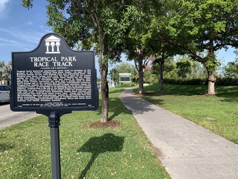
On Southwest 40th Street (Florida Route 976) just west of Southwest 79th Avenue, on the right when traveling east.
Tropical Park’s historical significance stems from its location on the grounds of the former Tropical Park Race Track. As part of the Southern Florida circuit with Hialeah Park and Gulfstream Park, the Tropical Park horse racing track held the first . . . — — Map (db m228600) HM
Near Brickell Avenue (U.S. 1/41) north of Southeast 5th Street, on the right when traveling north.
The Miami Circle at Brickell Point has been designated a National Historic Landmark This site possesses national significance in commemorating the history of the United States of America. The Miami Circle is a 38-foot diameter ring of post . . . — — Map (db m65646) HM
Near Southwest 328th Street 2.8 miles east of Southwest 117th Avenue (Colonial Road) when traveling east.
On Monday August 24, 1992, at 4:30 am, the eye wall of Hurricane Andrew passed over this point before striking Homestead and Southern Miami-Dade County. Andrew was one of the most powerful hurricanes in US history with wind gusts exceeding 175 mph . . . — — Map (db m131777) HM
On Southwest 100th Street at Southwest 82nd Avenue, on the right when traveling east on Southwest 100th Street.
In 1916, David Brantley Dice and Jessie Van May Dice moved to the Kendall area from Little River in northern Miami. The couple purchased a tract of land from J.J. Hinson and established a farm. Later, they opened a small general store and lived . . . — — Map (db m228607) HM
On North Miami Avenue near Northwest 39th Street, on the right when traveling south. Reported damaged.
On December 17, 1979, Arthur Lee McDuffie, a 33-year-old Black man and former Marine, was killed by a group of white Metro-Dade police officers at this location. McDuffie was a father to three young children, the associate manager of an insurance . . . — — Map (db m251245) HM
On SW 72nd Avenue at SW 167th Street, on the right when traveling north on SW 72nd Avenue.
Listed on the National Register of Historic Places since 1986, the Deering Estate at Cutler is a 444 acre environmental, archaeological, historical and architectural preserve owned by the State of Florida and managed by the Miami-Dade County Park . . . — — Map (db m187289) HM
Near Southeast 4th Street 0.1 miles east of South Miami Avenue.
Julia Tuttle arrived from Cleveland, Ohio, in 1891, a widow with two grown children. She bought 644 acres on the north bank of the Miami River, which included Fort Dallas. Her neighbors across the river were fellow early pioneers William and . . . — — Map (db m250418) HM
Near West Flagler Street (Florida Route 968) 0.1 miles west of Northwest 69th Avenue.
The Florida East Coast (FEC) Railway, established by Henry Morrison Flagler, was constructed along Florida’s east coast in the late 19th century. The FEC main line arrived in Miami by 1896, and extended farther south in 1926. The Little River Spur . . . — — Map (db m251048) HM
On Northeast 172nd Street at Northeast 23rd Avenue, in the median on Northeast 172nd Street.
This fountain was built in 1925 during the Florida Land Boom, and marked the entrance to the Fulford-by-the-Sea subdivision, now the city of North Miami Beach. Constructed at a cost of $15,000, it was intended to be the first of five fountains that . . . — — Map (db m146481) HM
On Washington Road, on the right when traveling north.
To commemorate the Battle of the 28th, Dec. 1835 between a detachment of 108 U.S. Troops and the Seminole Indians of Florida, in which all of the detachment save three fell without an attempt to retreat. --------------- The remains of the dead . . . — — Map (db m22814) HM
Near Cape Florida Park Boulevard when traveling south.
Dade Heritage Trust’s Cape Florida Lighthouse Brick Program Dade Heritage Trust is the leading voice for historic preservation in Miami-Dade County. Founded as a nonprofit in 1972, Dade Heritage Trust works to preserve the architectural, . . . — — Map (db m134814) HM
Near North Holmes Boulevard at West King Street, on the right when traveling south.
The move to its present location in northwest Miami-Dade County proved successful for Florida Memorial College. In 1972, the college graduated the first class at the site.
The College celebrated its 100th anniversary in 1979 and . . . — — Map (db m264566) HM
On McFarlane Road just north of South Bayshore Drive, on the right when traveling west.
Born February 7, 1856, Eva Amelia Hewitt Munroe, was the first wife of Commodore Ralph M. Munroe. In the fall of 1881, the young couple traveled from Staten Island, New York to Miami, Florida hoping the mild winter weather would cure Eva's . . . — — Map (db m278268) HM
Located one mile east of this point on the south bank of the Withlacoochee River at the crossing of the Fort King Road. The Fort, built in 1837, named for Major Francis Langhorne Dade, served for many years as a depot and observation post in the . . . — — Map (db m41170) HM
Near Battlefield Parkway (County Road 603) 0.2 miles south of County Road 605.
Major Francis L. Dade and his command consisting of detachments of the Fourth Infantry, Second and Third Artillery United States Army, while marching from Tampa Bay to Fort King was attacked by a superior force of Seminole Indians commanded by Mico . . . — — Map (db m20024) HM
On Hibiscus Avenue 0.1 miles west of State Road A1A, on the right when traveling north.
Side One:
The Pompano Beach Indian Mound is a prehistoric sand burial mound that was used by the Tequesta tribe and their ancestors for burial of their dead. Located nearby was their associated village and midden dating as far back as AD . . . — — Map (db m100403) HM
On Northwest 9th Street at Northwest 2nd Avenue, on the right when traveling west on Northwest 9th Street.
The Lyric Theater was built in 1913 by Geder Walker, an enterprising African American businessman from Georgia who also owned and operated the theater. It quickly became the center of a thriving entertainment district of hotels, restaurants, and . . . — — Map (db m278168) HM
On Main Highway just south of Fuller Street, on the right when traveling south.
Coconut Grove began as a small settlement on the cliffs of Biscayne Bay, surrounded by a vast tropical wilderness. In the mid-1800s, the first known permanent residents, Edmund “Ned” and Ann Beasley, settled near what became Barnacle Historic State . . . — — Map (db m273452) HM
On Overseas Highway (U.S. 1) 0.1 miles south of Osprey Bay Road, on the right when traveling south.
Indian Key is an 11-acre island located in the ocean at MM 78 directly offshore of the Indian Key Irving R. Eyster Bridge. Once home to Calusa Indians, the island was frequently used by Spanish explorers as a port to obtain freshwater from the . . . — — Map (db m292932) HM
On Charles Avenue west of Main Highway, on the left when traveling west.
(Side 1)
Bahamian immigrants played an integral role in the development of Coconut Grove. African-Bahamian immigrant Ebenezer Woodbury Franklin Stirrup was born in 1873, and emigrated from the Bahamas in 1888. Stirrup worked as a . . . — — Map (db m150795) HM
Near North Holmes Boulevard at West King Stree, on the right when traveling south.
The institution's faculty and students actively participated in the civil rights struggle since its early origins in Live Oak, where violence was often directed against the school. Across the country, racial tensions continued to escalate during . . . — — Map (db m264437) HM
Near Northwest North River Drive at Northwest 3rd Street, on the right when traveling north.
The United States of America took possession of Florida from Spain under the terms of the 1821 Treaty of Paris. In 1830, the U.S. implemented the Indian Removal Act, forcing Seminole Indians south into the Miami and Everglades area. The Second . . . — — Map (db m78126) HM
Near Cape Florida Park Boulevard at South Crandon Boulevard, on the left when traveling south.
The Cape Florida Lighthouse stands today as a reminder of perseverance in the face of hardship.
The Cape Florida Lighthouse was built to alert ships as they sailed near the dangerous reefs of the Florida Keys.
Constructed in December . . . — — Map (db m79720) HM
Near Brickell Avenue (U.S. 1/41) north of Southeast 5th Street, on the right when traveling north.
The Miami Circle site would not exist today if it were not for the support of the community. Public outcry over the impending destruction of the Miami Circle led to additional archaeological research and preservation of the 2.2 acre parcel of . . . — — Map (db m65471) HM
On Northeast 4th Court at Northeast 61st Street, on the right when traveling south on Northeast 4th Court.
Lemon City’s first library started in the 1890s, in the local school, under the leadership of teacher Ada Merritt. She organized the Busy Bees of the Everglades, a club for young ladies focused on fundraising for the school library. Under . . . — — Map (db m150770) HM
Near Northwest North River Drive at Northwest 3rd Street, on the right when traveling north.
This 1850s structure is the oldest standing house in Miami-Dade County. It was built by William Wagner, a German immigrant and U.S. Army veteran. After being wounded in the Mexican-American War in 1847, Wagner returned to Fort Moultrie, Georgia to . . . — — Map (db m78192) HM
Thin black lines indicate changes in relevance. Between each pair of lines entries are ordered geographically but all have the same relevance.
* Inflectional forms of words are their plurals, singulars, and possessives as well as gramatical tenses and similar variations.