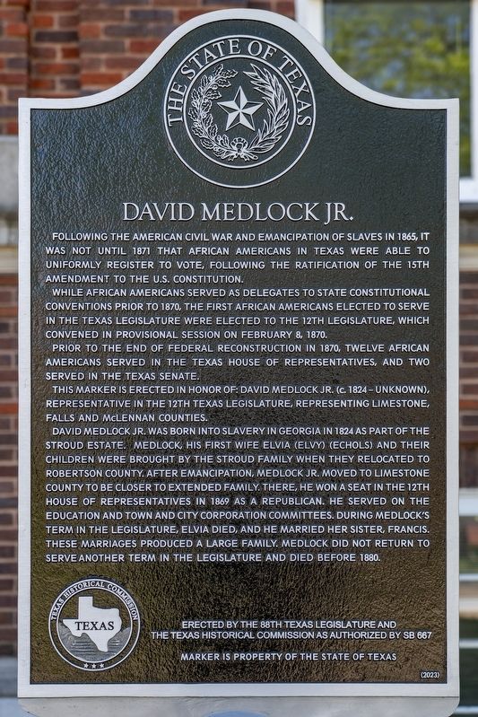
On West State Street at Ellis Street, on the right when traveling east on West State Street.
Following the American Civil War and emancipation of slaves in 1865, it was not until 1871 that African Americans in Texas were able to uniformly register to vote, following the ratification of the 15th Amendment to the U.S. Constitution. . . . — — Map (db m304441) HM
Near Boonville Road 0.1 miles east of Austins Colony Parkway.
Eli Seale 1793-1857
Elias (Eli) Seale was born in North Carolina in 1793. He served as a fifer in the War of 1812 in Mississippi, and in 1835 moved with his three brothers and his family from Alabama to Texas. He received his Mexican . . . — — Map (db m170484) HM
On East Water Street at North Rusk Street on East Water Street.
A native of England, Thomas C. Snailum came to Texas in 1834, settling in Bastrop. He enlisted in the Texas Army in 1836, served during the Texas Revolution, and settled in Nacogdoches after the war. In 1840 Snailum married Mary Ann Rogers . . . — — Map (db m224179) HM
On U.S. 79 at Alley Street, on the right when traveling north on U.S. 79.
This community was established in 1872 and named Morgan for a railroad official. Located on the right-of-way of the International Railway Company, the town contained a depot and three stores in its first year. By 1879, the town had 200 residents and . . . — — Map (db m129299) HM
On U.S. 79 1.3 miles east of Farm to Market Road 46, on the right when traveling west.
Settled by people from Tennessee under an 1822 contract held by Sterling Clack Robertson (1785-1842), who later signed the Texas Declaration of Independence. Colony and county were named for him. County was created Dec. 14, 1837, organized March . . . — — Map (db m119604) HM
On U.S. 79 2.4 miles south of Wheelock Street (Farm to Market Road 46), on the right when traveling south.
After the Texas Revolution, Robertson County covered a vast area of 12.8 million acres from the Brazos River eastward to the Trinity River and northwest to the Cross Timbers. Situated at the southern edge of Robertson County, Franklin (later Old . . . — — Map (db m129298) HM
On Ebenezer Cemetery Rd (County Road 714) 1 mile south of State Highway 7, on the right when traveling south.
James A. Head was a Texas Ranger, veteran of the War for Independence, and Republic of Texas legislator. Born in Georgia in 1797, he moved to Texas in 1835, enlisting at San Felipe de Austin in Silas Parker's ranging company and securing a land . . . — — Map (db m293422) HM
On Calvert Farm Road (County Highway 116) 0.3 miles north of Black Bridge Road (Farm to Market Road 979), on the right when traveling north.
Burial place of some 400 Texas pioneers and descendants. On land granted (1835) to A.J. Webb; bought in 1850 by Judge Robert Calvert, a civic leader in Sterling, a town named for Empresario Sterling C. Robertson. Calvert dedicated 11.1-acre . . . — — Map (db m168331) HM
On Main Street (State Highway 6) at Burnett Street, on the right when traveling north on Main Street.
Swarming ox-carts and cotton wagons, busy stores and saloons, casino tables stacked with gold: this was early Calvert, a major cotton export and trade center. Community began as "Sterling," in Sterling C. Robertson colony of the 1820s. It was . . . — — Map (db m168112) HM
On West 2nd Street (State Highway 22) near North 24th Street, on the right when traveling east.
Born in 1790 in North Carolina, James Clinton Neill came to Texas in 1831 with Stephen F. Austin's third colony. He settled in Milam County, and represented his neighbors at the Convention of 1833. On September 28, 1835, Neill entered the Texas Army . . . — — Map (db m63149) HM
On Woodhead Street at Harold Street, on the left when traveling north on Woodhead Street.
Obedience Smith was a pioneer of three American frontiers: Kentucky, Mississippi, and Texas. Newly widowed, she arrived in the Mexican state of Coahuila y Texas from Jackson, Mississippi just weeks before the Texas Declaration of Independence on . . . — — Map (db m269167) HM
On West 2nd Avenue, on the right when traveling east.
Thomas Ingles Smith was born in 1800 in Virginia and was a soldier in the War of 1812 in a company commanded by his father, General Bird B. Smith.
Smith arrived in Texas late in 1836, and soon enlisted in the Republic of Texas army under Gen . . . — — Map (db m60599) HM
On Lamar Street (Farm to Market Road 2954) 0.1 miles east of North Main Street, on the left when traveling east.
Born in Poland, Joseph (1840-1919) and Catherine (1841-1907) Bartula overcame many hardships after migrating to Texas in 1873. They became the first Polish settlers in Robertson County in 1875. Assisted by J.C. and Mary Roberts, on whose farm he . . . — — Map (db m208718) HM
On Farm to Market Road 391 at Bremond Street (Farm to Market Road 46), on the right when traveling west on Road 391.
Eleazar Louis Ripley Wheelock (1793-1847) came to Texas from Illinois in 1830. A surveyor for Robertson's Colony, he established a town on his land along the Old San Antonio Road. Named Wheelock in 1837, the town boasted twenty businesses by the . . . — — Map (db m129297) HM
On Navasota Street at Inks Avenue, on the right when traveling north on Navasota Street.
Born in Montgomery County, Texas April, 1839 Died in Austin April 15, 1902 Served in the Confederacy 10th and 15th Texas Infantry Elected District Judge in Robertson County, On Civil Appeals Court 1887 - 1902
Reverse William E. . . . — — Map (db m167157) HM
Near Boonville Road 0.1 miles east of Austins Colony Parkway.
"Welcome to My Town"
Father of Brazos County
Harvey Mitchell was born in 1821 in Tennessee. Because his parents could not afford to send him to college, the ambitious 18 year old came to Texas in 1838. From 1839 to 1842, . . . — — Map (db m170405) HM
On Interstate 30 Frontage Road 0.2 miles west of Division Street, on the right when traveling west.
"Gone to Texas" was the popular slogan for settlers during the 1830s who immigrated from numerous countries and states to the newly formed Republic of Texas (1836-1846). Although the Republic of Texas struggled, the desire for vast amounts of cheap . . . — — Map (db m285487) HM
On South Main Street at West Denton Street, on the right when traveling south on South Main Street.
Part of the 1841 Mary Peterson Grant, the land on this site was sold to William Baker and a group of investors in 1869. The investors immediately granted right-of-way to the Houston and Texas Central Railway. The first train pulled into Bremond . . . — — Map (db m208722) HM
On State Highway 6 at Farm to Market Road 1373, on the right when traveling north on State Highway 6.
Famous early health spa and resort. First well was dug 1878 by landowner Francis Wootan. Water tasted good, but turned dishes yellow and clothes red. Even so, it seemed to possess amazing curative properties.
Wootan soon built a hotel and in . . . — — Map (db m208709) HM
On Historic Town Square at E Main Street, on the right when traveling west on Historic Town Square.
The first white settler on Ten Mile Creek, then called Pleasant Run, in what later became Dallas County, then in Robertson County was Elder Roderick Rawlins (1776 1844) who led a party of approximately thirty persons from Greene County, Illinois, . . . — — Map (db m300512) HM
On Elm Street at Hanna Street (Farm to Market Road 1644), on the right when traveling north on Elm Street.
Most imposing public building in early Robertson County. After becoming County Seat in 1870, Calvert lost many leaders in 1873 yellow fever epidemic. As planned, this Courthouse was begun in 1875; but before its completion, Franklin was named . . . — — Map (db m168209) HM
Near Cox Cemetery Road 0.2 miles south of Farm to Market Road 589.
William Driscol Cox (1839-97) and his wife Amanda (Shugart) moved with their family from Tennessee to Texas in 1872. Cox taught in Robertson County then (1876) bought and moved to a 300-acre ranch at this site. He taught the first school in Sidney . . . — — Map (db m162130) HM
On North 15th Street, on the left when traveling north.
David Reed Mitchell, born in 1797 in North Carolina, arrived in Robertson County, Texas, in 1845. He was a surveyor
by trade, and had surveyed the upper Trinity and Brazos River areas in 1844. He became surveyor of the Robertson
County Land . . . — — Map (db m62464) HM
On Business Interstate 45 2 miles south of Interstate 45, on the right when traveling north.
Formed from Robertson County
Created April 25, 1846 Organized July 13, 1846
Named in honor of
Jose Antonio Navarro
1795-1871
Soldier, patriot and statesman,
Signer of the Texas
Declaration of Independence,
Member of the Texas . . . — — Map (db m152966) HM
On North Center Street at West Decherd Street, on the left when traveling north on North Center Street.
Erected in 1882 at a cost of $30,000, this white limestone building is the fourth to serve as Robertson County Courthouse.
In 1879 the county seat had been moved for the fifth time, to Morgan, on the International & Great Northern Railroad. But . . . — — Map (db m119606) HM
On West Texas Street (County Road 1644) at Project Road, on the right when traveling west on West Texas Street.
Built in 1929 with aid from the Rosenwald School Fund, Calvert County Training School, later renamed Calvert Colored High School, was one of the largest Rosenwald schools built in Texas. Up until this point, what little African American education . . . — — Map (db m292103) HM
On North Hughes Street at NW 20th Ave, on the right when traveling north on North Hughes Street.
Born in Robertson County to formerly enslaved persons Alex and Annie
Hooks, Mathew "Bones" Hooks (1867-1951) was a famed black cowboy, Texas
panhandle pioneer and Amarillo community leader. He began ranch
work at age seven and developed a . . . — — Map (db m248433) HM
Thin black lines indicate changes in relevance. Between each pair of lines entries are ordered geographically but all have the same relevance.
* Inflectional forms of words are their plurals, singulars, and possessives as well as gramatical tenses and similar variations.