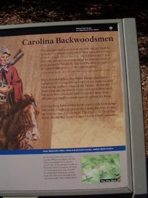
Near Kings Mountain Park Road, on the right when traveling east.
This distinguished race of men are more savage than the Indians,and possess every one of their vices, but not one of their virtues. I have known...these fellows (to) travel 200 miles through the woods never keeping any road or path, guided by the . . . — — Map (db m252535) HM
Near Gilboa Church Road 0.2 miles north of Gilmer Edwards Road (North Carolina Road 1526), on the right when traveling north.
Making Millions: The Bechtler Mint Site It was on this site from 1831 to 1840 that Christopher Bechtler operated the nation's most successful private mint, turning raw gold into nearly $3 million in coins and ingots.
A talented inventor, . . . — — Map (db m240860) HM
On North Main Street (U.S. 221) south of Trade Street, on the right when traveling north.
On March 24, 1865, Union Gen. George Stoneman led 6,000 cavalrymen from Tennessee into southwestern Virginia and western North Carolina to disrupt the Confederate supply line by destroying sections of the Virginia and Tennessee Railroad, . . . — — Map (db m253441) HM
Near Sidney Street south of Virginia Drive, on the left when traveling south.
Elisha Baxter (1827-1899), 10th Governor of Arkansas, was born in Rutherford County, North Carolina. He came to Batesville in 1852, opened a mercantile business and was elected mayor in 1853. Baxter served two terms as state representative . . . — — Map (db m221210) HM
Near Matter Park Circle 0.2 miles north of North Matter Park Road, on the right when traveling north.
2nd Battalion, 1st Regiment, 1st Marine Division, 1st Marine Expeditionary Force. CPL Ebert was killed when the vehicle he was riding in was attacked by the enemy with an improvised explosive device while he was on patrol in Anbar Province, Iraq — — Map (db m241671) HM WM
On Old Main Street (State Road 2018) 0.1 miles north of Drug Store Street, on the left when traveling north.
In 1902 Raleigh Rutherford Haynes, one of the South’s leading textile pioneers, and the founder of Cliffside, built his home on this site. After Haynes’ death on February 6, 1917, his son Charles lived here for the next 40 years. The house was . . . — — Map (db m227395) HM
Near Northwest Broad Street (U.S. 41) at Memorial Boulevard (Tennessee Route 96), on the right when traveling south.
Rutherford County was established on October 25, 1803 from portions of Davidson, Williamson and Wilson counties. The county originally extended to Alabama on its southern boundary. The county was named for Revolutionary War
General Griffith . . . — — Map (db m146773) HM WM
On E. Court Square, on the right when traveling south.
This great country music star was born 300 yds. East of Hickory Creek on the Lawson Mill Road, 6.6 miles SW of here. David Harrison Macon was the son of John and Martha Ann Ramsey Macon. His grandfather, Harrison H. Macon, settled in Warren county . . . — — Map (db m37592) HM
1783 North Carolina Legislature creates Davidson County, which includes parts
of present-day Rutherford County.
1786 North Carolina Legislature makes initial land grants in Stones River area.
1788 Last elk in county is killed . . . — — Map (db m207990) HM
On Old Airport Road (State Highway 1547) east of Henderson Road (U.S. 25), on the left when traveling east.
Soldier, Planter,
Author, Statesman
Born June 3, 1808
Fairview Kentucky
Died December 6, 1889
New Orleans, Louisiana
"He was a Statesman with clean hands and pure heart who served his people faithfully and well from budding manhood to . . . — — Map (db m17800) HM
On Main Street (Alternate U.S. 221) at Spindale Street (State Road 1546), on the left when traveling south on Main Street.
In Spindale, North Carolina history is preserved in the small-town charm of the eclectic shops and restaurants that line Main Street and the brick buildings that have stood strong and tall for generations. A manufacturing hub of mills and . . . — — Map (db m262091) HM
On March 24, 1865, Union Gen. George Stoneman led 6,000 cavalrymen from Tennessee into southwestern Virginia and western North Carolina to disrupt the Confederate supply line by destroying sections of the Virginia and Tennessee Railroad, the . . . — — Map (db m12890) HM
On East Warren Street at South Washington Street, on the right when traveling east on East Warren Street.
Confederate captain; legislator; member of conventions of 1868, '75; conservative leader in Reconstruction period. His home was 100 ft. S. — — Map (db m23535) HM
In Honor of
Dr. Columbus Mills
Planter and Physician
"Father of Polk County"
After a ten-year effort to create a new county from parts of Henderson and Rutherford Counties, the
North Carolina General Assembly passed . . . — — Map (db m11236) HM
On Richmond Street at West Main Street, on the left when traveling north on Richmond Street.
Mount Vernon is unique - it's the only modern town in the "wilderness" that emerged from a frontier outpost. Originally called Langford's Station, it was the creation of Stephen Langford, his son Benjamin (with wife Nancy Peyton), Elizabeth Brown, . . . — — Map (db m244603) HM
On Coxe Road (County Route 1005) 0.4 miles east of River Crest Parkway, on the left when traveling east. Reported missing.
On March 24, 1865, Union Gen. George Stoneman led 6,000 cavalrymen from Tennessee into southwestern Virginia and western North Carolina to disrupt the Confederate supply line by destroying sections of the Virginia and Tennessee Railroad, . . . — — Map (db m266614) HM
On Court Plaza at College Street (Alternate U.S. 74), on the right when traveling south on Court Plaza.
Buncombe County was named for Edward Buncombe (1742-1778), a North Carolina plantation owner who served in the Revolutionary War and died of injuries sustained in the Battle of Germantown.
The county was formed in 1792 from vast tracts of . . . — — Map (db m229427) HM
On Greenlee Ford Road 0.3 miles north of Carbon City Road (U.S. 70), on the right when traveling north.
During the America n Revolution, at this ford of the Catawba River, around 1390 men from Western North Carolina and Southwestern Virginia crossed here on their way to the Battle Of Kings Mountain. The men who crossed the river here were all . . . — — Map (db m285957) HM WM
On Hickory Lincolnton Highway south of Grace Church Road, on the right when traveling south.
Juror, soldier, and patriot in the cause of American independence during the Revolutionary War. Served under Colonel Frederick Hambright in the history making
Battle of King's Mountain on Oct. 7, 1780. — — Map (db m261718) HM WM
On Jeb Seagle Drive at Linwood Drive, on the left when traveling west on Jeb Seagle Drive.
After two hours, fighting ceased. As the fog lifted, the scene revealed the dead and wounded scattered on the ridge and flanks. About 100 men on each side were wounded and 50 Tories were taken prisoner. Casualties were heavy among officers. By . . . — — Map (db m231959) HM
The Cherokees
Greenville County was Cherokee Territory before the Revolution. European settlers were forbidden to live here until 1777, when Native Americans were forced to cede this land to the new state. Most of modern day Greenville was . . . — — Map (db m14535) HM
Vardry McBee purchased more than 11,000 acres around the Reedy River from Lemuel Alston in 1815. Although McBee lived in Lincolnton, North Carolina, he wished to develop his Greenville property, and in 1819 he build a "superior" brick corn mill on . . . — — Map (db m28093) HM
On West Broad Street at West McBee Avenue, on the left when traveling north on West Broad Street.
[East Face - Top Inscription]:
Prospect
Hill
Park
[East Face - Bottom Inscription]:
Established by
Greenville County
Historic Preservation
Commission
[North Face - Top Inscription]:
Site of . . . — — Map (db m11584) HM
On East Castle Street at South University Street, on the right when traveling east on East Castle Street.
Born in North Carolina, Dr. Patterson was a
World War I veteran who came to Murfreesboro
after graduating from Meharry Medical College's
School of Dentistry in 1924. Married to Buena V.
Eaton (1887-1972) Patterson, a Bradley School
teacher, Dr. . . . — — Map (db m226607) HM
Near Gilboa Church Road 0.2 miles north of Gilmer Edwards Road (North Carolina Road 1526), on the right when traveling north.
Christopher Bechtler: A Fascination with Gold Christopher Bechtler was a brilliant man
of seemingly boundless energy.
At the technical college in his home town of Pforzheim, he learned jewelry and clockmaking and became a skilled . . . — — Map (db m240804) HM
Near Gilboa Church Road 0.2 miles north of Gilmer Edwards Road (North Carolina Road 1526), on the right when traveling north.
Drawn by the gold to be found in our rivers, thousands of fortune
seekers kindled a North Carolina Gold Rush to these foothills in the
1820s. Among them was the German jeweler Christopher Bechtler who
bought this land in 1830 and began his own – . . . — — Map (db m240796) HM
Near North Maney Avenue north of Roberts Street, on the left when traveling north.
With a family fortune built upon agriculture, land speculation, slavery, medicine, textiles, and other ventures, the Maneys were heavily involved in the economic, religious, and educational development of Murfreesboro. Like many wealthy Southern . . . — — Map (db m90996) HM
The mortal remains of
James Knox Polk
are resting in the vault beneath.
He was born in MecKlenburg County
North Carolina
and emigrated with his father
Samuel Polk to Tennessee
in 1806.
The beauty of virtue
was illustrated in . . . — — Map (db m85552) HM
Thin black lines indicate changes in relevance. Between each pair of lines entries are ordered geographically but all have the same relevance.
* Inflectional forms of words are their plurals, singulars, and possessives as well as gramatical tenses and similar variations.